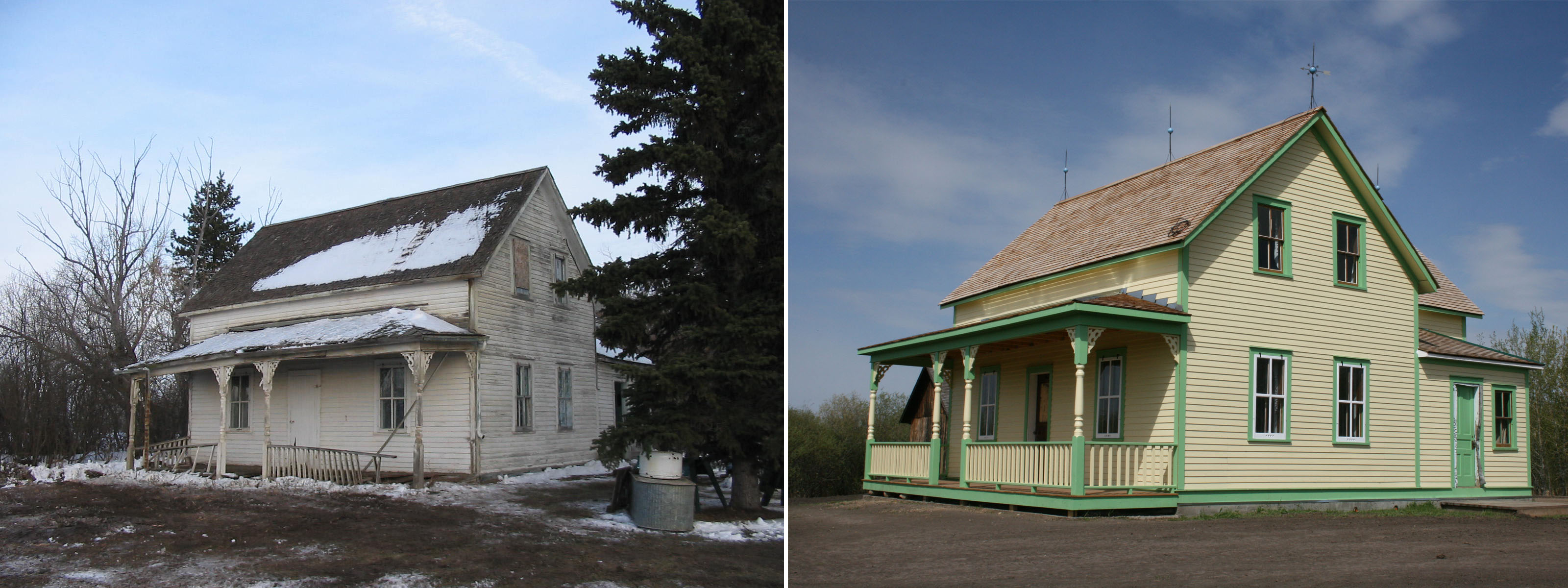
Nine in a line – a vanished skyline

Prairie Sentinels

The tall silhouette of a wooden grain elevator on the horizon once symbolized rural landscape across the prairies. “Against open space,” in the words of distinguished American photographer Frank Gohlke, “grain elevators were the presence against which that emptiness could be measured.”

A long row of eight elevators had been built at Vulcan by 1924 and provided a backdrop for this harvest scene at Vulcan. (Glenbow Archives, ND-8-218).

Early Elevator Row

In 1891, the Calgary and Edmonton Railway built Siding 19, soon to be named Leduc, on the west side of its mainline. The length of the siding—long enough to build a row of six elevators—showed the railway’s faith in the district’s grain growing potential. By 1905 a row of three elevators lent a vertical silhouette across the tracks from the station. The first grain company to build at a new siding tried to choose the best position for attracting customers, and for loading cars with the greatest ease. Each elevator had sufficient space on the siding to load two grain cars. Elevator construction along the Calgary and Edmonton railway set a pattern followed across Alberta as main lines and branch lines slowly spread their reach.

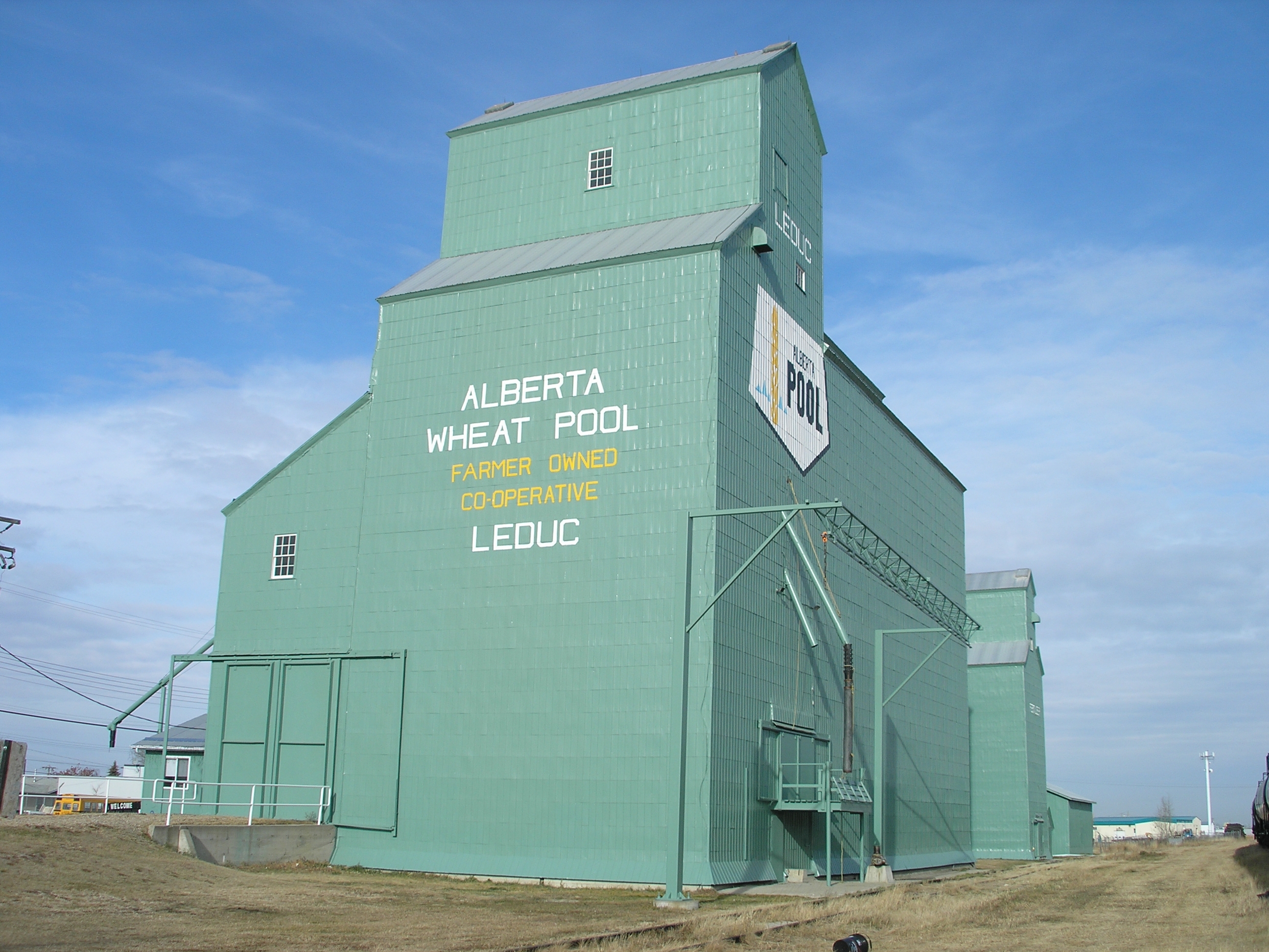
As elevator rows developed they created a varied sky line: there was considerable difference in size and shape of elevators built from the 1890s to the 1920s. After 1920 many of the early variants were replaced and grain companies built traditional elevators with a gable roof and a gable roofed cupola on top. Wood clad elevators were almost always painted CPR red, and what differentiated each company’s elevator was its name (and its logo, if it had one) painted high up on the walls, emblazoned in white along with the name of the town. In contrast, metal clad elevators were galvanized or painted white.

Elevators Everywhere

Competition between the grain companies resulted in the rapid emergence of rows of elevators at the most significant grain delivery points. By 1911 there were 142 sidings with grain elevators, and 43 of them had three or more elevators. Carstairs, High River and Nanton, along with Edmonton and Calgary, had five elevators, while Westaskiwin had six. Eight years later, in 1919, the total number of elevator delivery points in the province totalled 334, of which 150 had three or more elevators. Barons had emerged as the point with the longest row of elevators, with eight, followed by Nanton with seven. A number of towns had six: Blackie, Bow Island, Carmangay, Chinook, Claresholm, Cluny, Gleichen, Granum, Magrath, Oyen, Provost, Vulcan, and Youngstown. Edmonton and Calgary also had six. The points with the largest elevator capacities were mainly in the wheat-growing area of the southern part of the province, but by the 1940s as farming thrived in the Peace River country, impressive rows evolved at Sexsmith and Grimshaw.  Vulcan in southern Alberta however, holds the record for the longest row—12 elevators in 1956.

The elevator row became a towering beacon for Alberta’s growing hamlets, villages, and towns with bustling commercial main streets and residential areas. Through the 1950s into the 1960s a long unbroken row symbolized prosperity. A town with five elevators rather than three had a more lucrative tax base and better services, all of which could be traced back to its life line—the railway.

Barons, 1913. (Glenbow Archives, NA-2059-27)

Elevator Consolidation Begins

From the 1960s, as paved highways increasingly linked Alberta’s major towns with hamlets and rural districts, and one railway station after another closed in smaller centres and on branch lines that were being abandoned, farmers chose to take their business to larger centres. Farmers benefitted from the competition between elevators at larger centres, and grain companies closed more isolated grain buying points due to loss of business, the threat of further branch line closure and changes in car allocation rules. Grain companies consolidated their elevators making for longer rows at fewer points. Towns that had secured multiple elevators flourished; the more elevators in a town, the greater its prestige and the better its prospects for business and further development seemed to be.

All the Colours of the Rainbow

It was in the 1960s that elevator row began to take on the appearance that many of us remember. The grain companies repainted their elevators when the CPR red began to fade. First came white, adopted by the United Grain Growers. A splash of colour marked the beginning of modern company branding. First came white, adopted by the United Grain Growers. Pioneer Grain Company first painted the shingled roofs of their elevators yellow, and then in 1962 went for bright orange on the elevator walls, complemented by yellow roofs. The story goes that on the Victoria Day weekend in 1962 as a Pioneer engineer and his wife toured the countryside, she suggested orange (the colour of her pants that day) would cheer up the appearance of the elevators on the landscape. The company agreed to the experiment and the first dazzling orange elevators on prairie rows surprised everyone. Federal Grain adopted white by the time it took over Alberta Pacific Grain (1943) Ltd. in 1968. The Alberta Wheat Pool adopted a turquoise green colour, which slowly dominated the rows after 1972 as AWP took over Federal Grain in 1972, painting all the white Federal elevators turquoise-green as well. Parrish and Heimbecker adopted a mustard colour in 1976.

The Fall of the Sentinel

More change came to elevator row as the grain companies began to replace ageing elevators with larger single and double composite elevator designs in the 1970s. The sky line began to transform as holes began to appear in the great Alberta rows. By the 1980s elevator row was gap-toothed. Grain companies rapidly consolidated business on sidings where there was enough room to fill more grain cars at one time. Then in 1995 the federal government ended the Crow Rate that subsidized freight rates to the port terminals, and deregulated the railways in 1996. The economy of scale changed. In 1997 there were still major rows of elevator complexes that sometimes included an older elevator as an annex: six at Hussar, six at McGrath, six at Sexsmith, five at Standard, four at Arrowood, and four at Champion and finally seven at Warner. The same year, scores of unwanted elevators, many remnants of once proud rows began to fall. Finally, at the turn of the 21st century, operating grain elevator rows were completely replaced by large inland concrete terminal silo-style structures. Warner is an aberration: with six of its original traditional elevators (forming four elevator complex facilities) still standing and used to handle the local mustard crop, it is a significant legacy of a vanished skyline.

Written by: Judy Larmour.

Thoughts on Detroit

You have no doubt heard of the trials and tribulations of the City of Detroit: the near death of the auto industry, massive population loss, infrastructure woes and high crime rates. The negative connotations have led to a public image of a city abandoned and in upheaval whereas the best-case-scenario associations portray it as a playground of urban decay and rock-bottom housing prices. When I learned that the National Main Street Conference was being held in Detroit this year, I was pleased that I would be able to see it for myself, albeit in the cocoon of a programmed conference setting.

IMG_0136

Having now been there I can make a few comments. First, it is a stunning city. There are architectural marvels (both in use and abandoned), striking parks and trail networks and an eclectic mix of things to do. Second, the city is hard at work. Travelling in and around the downtown core, there is evidence of a community working to rebuild and repair. Third, the city seems to be acutely aware of the volunteerism and resources required to improve its image. Bike patrols and on-foot clean-up crews strive to ensure the downtown core is safe and clean. Residents are cheerful and exceptionally welcoming.

This said, did I really see Detroit? Visiting as part of a conference I no doubt had a curated experience of the city and limited time for exploration. It is important to remember that there are layers that we do not understand: a history of labour and race disputes, urban renewal programs and community activism. There is a long-standing population who is probably growing weary from being under the microscope. I would encourage everyone to visit and appreciate the people, public spaces and community spirit, along with the many restaurants, sports events, markets, museums, and music that make up Detroit. However, visit with an appreciation of the modern urban realities facing the city. Acknowledge and be aware of the complex layers of economic, social and political issues (past and present) that continue to inform the fabric of the city. Detroit is a fascinating and many-faceted city and I would encourage you to make the trip.

This slideshow requires JavaScript.

Stay tuned for upcoming posts about the content of the National Main Streets Conference!

Written by: Rebecca Goodenough, Municipal Heritage Services Officer


Municipal Heritage Forum 2014 – Request for Presenters

As previously announced, the 2014 Municipal Heritage Forum will be held on October 16th and 17th at the Lacombe Memorial Centre with sessions to be held in and around their award winning Main Street. The theme of this year’s forum is “New Ideas for Historic Places: Conservation through Technology and Innovation”. We are planning some exciting sessions to get you thinking about social media, mapping and documentation as well as workshops on using technology for building conservation. We hope to see you there! Registration will open and keynote speakers will be announced in June.

Image
(Note: social media graffiti not actually real!)

For those of you who have attended past Forum’s you will be familiar with the Municipal Show and Tell sessions. Show and Tell is an opportunity for municipalities and volunteer groups to present projects they have been working on to their peers. It is a great way to learn about different heritage initiatives and to make valuable contacts for the future. The challenge we always have organizing Municipal Show and Tell is that you heritage conservationists are a humble group – many of you don’t realize how interesting your projects are and how much others can learn from you. Year after year we get feedback telling us how valuable the Show and Tell is to participants so we strongly encourage you to send us your ideas or recommendations! Presentations are approximately 15 minutes long, with time for questions included. If you would like to forward an idea for the Municipal Show and Tell e-mail us at albertahistoricplaces@gov.ab.ca. 

This slideshow requires JavaScript.

Written by: Rebecca Goodenough, Municipal Heritage Services Officer

Manager of Historic Places Research and Designation Program Leads Diverse Identification, Research, and Protection Efforts

As Manager of the Historic Places Research and Designation Program, Brenda Manweiler heads what may be the unit with the greatest variety of responsibilities within the Historic Resources Management Branch. Brenda joined the branch as a Municipal Heritage Services Officer in 2009, after working for museums, British Columbia’s Heritage Branch, and Parks Canada. She has been in her current position since April 2013.

Brenda Manweiler, pausing for a moment during a busy day.

She now heads a six-member team of historians and heritage specialists. The unit’s primary role is administering the Provincial Historic Resources Designation Program (described below). But there’s much more!

In addition, her group provides ongoing advice on how best to address the impact on historic structures (that are not designated) in cases where they may be affected by development in Alberta. This is part of an integrated regulatory function that Alberta Culture administers for the preservation of historic resources.

Members of her staff provide research services to many of the historic sites operated by the Historic Sites and Museums Branch of Alberta Culture. Their services help, for example, to develop exhibits at these sites.

The Historic Places Research and Designation Program also works closely with the Alberta Historical Resources Foundation. The unit’s staff evaluates applications for Heritage Awareness, Research, and Publication grants submitted to the Foundation’s Heritage Preservation Partnership Program.

Creating Heritage Markers

As well, this unit is responsible for the Foundation’s Heritage Markers Program. This program supports the development of heritage markers that promote awareness of the historic people, places, events, and themes that have defined the character of the province. The markers are ideally sized for placement within parks, along trails or sidewalks, and in other community locales. Once the topic of a new marker has been selected, unit staff members develop the text, select photographs, and are responsible for coordinating the design, fabrication, and installation of the markers.

The unit includes the coordinators for two other programs, as well:

What kind of historic places are “out there” in Alberta?

The Coordinator of the Alberta Heritage Survey Program oversees a database of information about non-archaeological historic resources across the province. The Alberta Heritage Survey was established in the mid-1970s, has information dating back to 1971, and is being continually updated. Entries about individual resources include photographs, details of architectural characteristics, history, designation status, and location. This information comes from heritage surveys of neighbourhoods or building types, many of which have been commissioned by municipal governments and conducted by consultants and heritage groups. Today there are almost 100,000 individual resources documented on a searchable online database.

How do Geographical Features Get Names?

The Coordinator of the Geographical Names Program manages the process to formally name geographical features in Alberta. Names are chosen in accordance with international standards and guidelines, with preference usually given to names that have a demonstrated local and/or historical usage. The coordinator’s work includes communicating with governmental organizations from the municipal to international level, disseminating geographical names information from both popular and scholarly sources, maintaining records, and conducting related field and archival research. All this leads to making a recommendation on a name to the Alberta Historical Resources Foundation board and the Minister of Alberta Culture.

How do places get designated?

The Historic Places Research and Designation Program’s largest responsibility, however, is the Provincial Historic Resources Designation Program, which identifies, evaluates, and designates those historic resources that are most significant to the province as a whole. Resources eligible for consideration include structures, archaeological sites, palaeontological resources, and other works of humans or nature that are of value for their historic, cultural, natural, scientific, or aesthetic interest.

Once a resource is designated, its owner cannot destroy, disturb, alter, restore, or repair it without written approval from the provincial government. But the owner gains tangible benefits, including access to conservation grants and technical advice, and the intangible benefit of knowing that a valued property will be preserved and protected into the future. Currently there are some 360 sites protected as Provincial Historic Resources in Alberta.

Owners or advocates interested in obtaining heritage designation for a property often start by contacting Brenda for advice. She’ll ask questions to determine if the property is eligible for consideration, and to gauge whether designation should be pursued at the provincial or municipal level, or both. Occasionally one of the branch’s Heritage Conservation Advisers will make a site visit to answer property owners’ questions and assess the potential eligibility of their property for designation.

Once an application is received, Brenda administers the evaluation process. The Designation Committee, made up of her staff plus staff of the Heritage Conservation Advisory Services unit, meets about every six weeks to confirm the eligibility of new applications and to monitor the progress for sites currently under study. The Designation Committee works to determine if the site has heritage significance (according to five specific evaluation criteria), and a Heritage Conservation Adviser studies the site to determine if it retains enough integrity to communicate that significance. Much archival and onsite research is required to complete an in-depth evaluation. If the committee recommends designation and that is approved at a higher level, the owner is informed and his or her support is obtained, a designation order is signed, and the site is listed on the Alberta Register of Historic Places, an online database of all designated historic resources in Alberta.

Benefits of Designation

Why would owners want their properties designated? Brenda explains: “They believe that they have a property that’s of significance. They want to keep it around so that future generations can enjoy it and benefit from it, so that it can continue to be a part of the communities that they live in. Also, the Alberta Historical Resources Foundation provides conservation grants to property owners of designated resources, which serves as a fantastic incentive for people to conserve their property for the long term.”

There have been about five new applications since Brenda started in her position nearly a year ago, so she estimates that five to ten per year would be the norm. Her team is currently working through the evaluation process for approximately twenty sites.

So Brenda’s job involves lots of paperwork and administrative management. But she never loses sight of what it’s all for: “So many people work in this field because they feel passionately about the buildings, and I’m certainly no different there,” she says. “But for me, so much of it comes down to the people: the applicants, the owners, the community members. The public is so passionate about the sites that they so want to see conserved. I love being able to work with the public to help them reach their goals of contributing to a legacy for Alberta.”

Written by: Kerri Rubman.

Fort Saskatchewan Approves Historic Precinct Site Master Plan

The City of Fort Saskatchewan is one step closer to realizing their vision for the development and interpretation of a significant community amenity through Council’s recent approval of the Historic Precinct Site Master Plan Guiding Document. Located adjacent to the City’s downtown and along the edge of the North Saskatchewan River, the Historic Precinct provides a unique opportunity to showcase the cultural history of Fort Saskatchewan and to develop a space for public learning and enjoyment.

Historic Precinct Area

The Approach

The Historic Precinct contains an array of man-made and natural elements that contribute to the telling of the story of Fort Saskatchewan. Project consultants EIDOS Consultants Inc. and Marshall Tittemore Architects approached the conceptualization of the space as a cultural landscape, wherein:

“An important part of the Precinct’s heritage value is found in the relics of law and order and public works, including buildings, structures, sightlines, earth mounds, plant materials and features that remain in situ. These relics constitute part of the heritage value of the area by providing tangible evidence of how it was transformed and used by the NWMP, Canadian Northern Railway, the Province and the City.” (Historic Precinct Site Master Plan, page 9).

The planning process sought to integrate local values into the final plan and therefore included public and stakeholder consultation through surveys, open houses and workshop sessions.

The City of Fort Saskatchewan’s Diane Yanch, Culture & Historic Precinct Supervisor and Richard Gagnon, Director of Culture Services display a copy of the completed Historic Precinct Master Plan

The Master Plan

The Master Plan involved considering the long-term development and interpretation of the historic precinct, including integration of existing Provincial Historic Resources, recommendations for pedestrian circulation and way-finding, interpretation opportunities and development of a conceptual design for a new Interpretive Centre. A detailed phasing plan was also provided to allow the City to structure implementation in a coordinated and cost-effective manner.

Historic Precinct Site Master Plan

The uniqueness of the site is exemplified by the existence of three Provincial Historic Resources within its boundaries including the North West Mounted Police Post, the Fort Saskatchewan Museum (Courthouse), and the Canadian Northern Railway Station. These three historic resources are proposed to be key elements in the interpretation and programming of the Historic Precinct and are considered as Historic Precinct Nodes in the Master Plan.

  • Original 1875 Fort Site Node – This Provincial Historic Resource is presently an open native grass field and will remain untouched during development, with the long term goal of undertaking small scale research and public archaeology programs in partnership with interested academic institutions, archaeological societies and the Province of Alberta.
  •  Fort Saskatchewan Museum and Cultural Village Node – The Fort Saskatchewan Museum (Courthouse) is a designated Provincial Historic Resource. The Master Plan calls for the land surrounding the Courthouse to be utilized as a ‘cultural village’ in which historic buildings and artifacts will be displayed.
  •  Railway Node – The CNR Station will continue to be space for use by community groups. The area around the Station will be enhanced to include an opportunity to showcase other rail infrastructure, landscaping and opportunity to enhance access to the adjacent Legacy Park and farmer’s market plaza.

Other Historic Precinct Nodes proposed within the plan include a Gaol Node, Religion Node, MétisNode and First Nations Node.

Next Steps

The City will continue with planning the programming for the future Interpretive Centre with hopes of breaking ground by the end of 2014. Conservation Plans have been prepared for the Courthouse/Museum and CNR Railway Station to ensure that on-going improvements and maintenance are consistent with accepted conservation practices. In accordance with the terms of designation, approvals will be obtained for any projects within the site that will affect the Provincial Historic Resources as well as work in the vicinity of the NWMP Police Post due to the high archaeological potential of the site.

Proposed General Concept Design of the Interpretive Centre

The Historic Precinct Master Plan was partially funded by the Alberta Historical Resources Foundation under the Heritage Management Plan grant category of the Municipal Heritage Partnership Program. Though Heritage Management Plans typically take the form of a document that outlines policy and a process for municipal designation, the grant category is flexible and can apply to projects that involve planning and policy development for the stewardship of historic resources more broadly. The Historic Precinct Site Master Plan is an example of how the program can be tailored to meet the unique needs of municipalities.

Written by: Rebecca Goodenough, Municipal Heritage Services Officer

Crowsnest Pass Phase 2 Heritage Inventory Underway

The Municipality of Crowsnest Pass contains the communities of Coleman, Blairmore, Frank, Hillcrest and Bellevue. Crowsnest Pass has a rich history in coal mining and trade unionism, and therefore, has much to offer in the way of historic resources.

20th Avenue, Blairmore

As a result of this rich and varied history, the Municipality has acknowledged the importance of identifying places of significance in the community. Given the breadth of possible historic resources within the municipality’s boundaries, Crowsnest Pass determined that a three-phase heritage inventory would be required to comprehensively assess potential sites. The first phase was completed in 2013 and inventoried 31 sites in the Coleman area. The second phase is being completed in 2014 and is looking at historic resources in Blairmore and Frank. The third and final phase will look at historic sites in the Hillcrest and Bellevue area and is proposed to be undertaken in 2015.

55 residents attended a public open house held on April 23rd at the Blairmore Elks Hall to provide feedback on possible sites to be included in the second phase of the heritage inventory. Consultants Community Design Strategies Inc. presented 65 possible historic resources for residents to provide feedback on in terms of historical information and opinions regarding the significance of each site. The results of the open house will be reviewed by the Crowsnest Pass Municipal Historic Resource Board and refined to a list of 45 sites for further evaluation. These 45 sites will have Statements of Significance prepared for them and will be presented back to the community for further review and comment at a second open house to be scheduled later this year.

Ken Bourdeau, Development Officer with the Municipality of the Crowsnest Pass and Merinda Conley, Principal with Community Design Strategies Inc. ready to speak with residents at the open house.

The event provided residents and property owners the opportunity to comment on the 65 places of interest and to speak with representatives of the Municipality of Crowsnest Pass, the Municipal Historic Resources Board and Alberta Culture about the heritage inventory project and municipal historic resource designation in general.

Heritage inventory projects are supported by the Municipal Heritage Partnership Program and provide municipalities with the process and tools to assess possible historic sites within their boundaries for future municipal historic resource designation.

Written by: Rebecca Goodenough, Municipal Heritage Services Officer

Lonely Lookouts

Perched high above the tree tops, braced to mountain peaks or balanced on steel towers, fire lookouts have a magnificent view. And that is the idea—they provide a place to watch for the first wisps of smoke that may signal the beginning of a wild fire. Detection, identification and then communication of the whereabouts of fires has been the job of the seasonal fire lookout observer in Alberta for over a hundred years.

The abandoned Black Rock Lookout, near Banff, August 2009. (Photo courtesy of Alberta Sustainable Resource Development.)

By the 1890s forest fires were increasingly a cause for concern, not only because of economic opportunity lost when marketable timber burned, but because of a long term threat to water conservation. (Forests increase precipitation, prevent erosion and slow the evaporation of ground water.) In response the Dominion Forestry Branch developed trails for their patrol routes, and then began building a system of fire lookouts in Alberta’s extensive area of Forest Reserves and Parks. When jurisdiction over crown lands was transferred to Alberta in 1930, the Albert Forest Service expanded the system further, particularly during the 1950s.

The first tower lookouts were temporary, improvised from building materials the forest rangers found while on patrol. They were often no more than “crawl” tree structures—trees with their branches removed serving as supports for bush ladders, steps between poles attached to two trees. A pre-requisite for a permanent staffed lookout was a phone line. Available after 1910, the phone allowed the man in the tower to talk to someone in the nearest ranger station. Seasonal employees were hired to man lookouts during fire season and their job included maintaining the trails and telephone lines, as well as making weather observations.

A photograph of a person atop a simple lookout in 1912.
Tree crawl lookout, Brazeau Forest, 1912. (Photo courtesy of Alberta Sustainable Resource Development.)

After 1912 there were two types of lookouts: summit lookouts, built on the ground or on short stilts, which provided a vantage point from high alpine peaks, and towers, built on high hills in the boreal forest, which elevated the observer over any obstacles to vision.

On mountaintops the earliest summit lookouts were single, square wood frame 12 by 12 foot structures with a pyramidal roof. Later designs featured a 14 by 14 foot structure with a cabin at ground level and a second story for observation. At these locations everything was constructed from planed boards, the easiest and lightest material for horses to haul. The lookouts were held down by steel cable that ran from a post on the roof to wherever they could be secured in earth. Open windows with hinged wood shutters that pulled upwards gave a 360 degree view.

Burke Lookout (later renamed Cameron Lookout) built in 1929 on the summit of Mount Burke in the Livingstone Range is one example. At a staggering elevation of 8,330 feet (2,540 meters), it was the highest in Canada. It was hard work getting supplies up there each summer. The observer had to find his own wood supply for the stove to cook and keep warm; at Cameron this meant a long walk down the mountain to get below the tree line. Cameron was closed in 1953 and replaced by two lookouts positioned at lower altitudes that were easier to get to. Cameron is still visible with binoculars from Highway 2.

Packing in supplies to Cameron Lookout, 1929. Note the rain barrel for catching rain water. (Photo courtesy of Alberta Sustainable Resource Development.)

In the boreal forest area, a variety of tower types evolved. A smaller version of square lookouts, such as that built at House Mountain, near Whitecourt, was placed on broad-based wooden towers. Other towers were narrower, up to 60 feet high, with a small cupola lookout on top. They were constructed from either timber or steel. Introduced in the 1920s, steel increasingly replaced wood for tower construction. The later version of these steel towers replaced the wooden octagonal cupola with a fiberglass design in the 1960s.

Inside the lookout observers used binoculars to scan the forest then locate the fire with a rudimentary fire finder. Then in 1945, lookouts adopted the Osborne, an instrument used to help determine the precise location of a fire in relation to the tower. Mounted on a stand in the middle of the cupola, it measures the azimuth between true north and the location of a fire. Alberta is the only agency in the world that added a telescopic sight to the Osborne. Promoted by a couple of lookout observers in the 1960s, it was developed for use by the province to locate fires with precision over great distances.

The new steel tower at House Mountain, 1953. (Photo courtesy of Alberta Sustainable Resource Development.)

In the early days, the real challenge was to communicate the location of a fire to the nearest ranger stations; the telephone system, a tree-line or tripod system in the mountains, employed cable strung between trees and held on with insulators. It was susceptible to lightning, sometimes with frightening results when a bolt hit the line and the charge travelled along it and up into the lookout. The telephone also went down when trees fell across the line in summer and snow load would take it down prior to the fire season. In 1938, the first two-way radios, run on a generator, were installed in lookouts for communications.

The importance of fire lookouts has not diminished. Many of Alberta’s 127 operational fire lookouts are rebuilt on the location of the first generation of lookouts. Although working conditions are more comfortable, the job requirements for lookout observers—strong physical and mental health to withstand the rigors of climbing the lookout tower, loneliness and often monotonous routines—have changed little. “You have to like yourself to take the job;” that’s what the old hands say about life on the lone lookout.

Written by: Judy Larmour.

New Uses for Old Places – King Edward School, Calgary

New Uses for Old Places is a RETROactive series in which we are looking at examples from around Alberta of historic sites that have found interesting new uses for spaces that were originally designed for other purposes. In this last installment we will be looking at King Edward School in the neighbourhood of South Calgary as an example of adaptive reuse project underway to repurpose the building as a mixed-use arts incubator (a place that nurtures the growth and development of artists and arts organizations).

King Edward SchoolThe King Edward School was constructed in 1912 as a four-storey building that features a symmetrical design, rock-faced sandstone walls and a dressed sandstone front entrance. During its time as an institution of learning, the School also functioned as a community hub, hosting dances and other events. The school operated as versions of both King Edward Elementary/Junior High School and South Calgary High School. The school closed in 2001 and sat empty…until now.

In 2011, cSPACE Projects was established by the Calgary Arts Development Authority and the Calgary Foundation for the purpose of promoting opportunities for artist and non-profit arts/community groups. cSPACE became the new owners of the property and is now embarking on an ambitious rehabilitation effort.

Credit: www.cspaceprojects.com
Credit: http://www.cspaceprojects.com

The project involved the removal of a 1960s addition that was deemed to be non-character-defining to the historic value of the place as well as the construction of a new addition and two adjacent art studio pavilions. Modelled around the concept of providing a ‘creative commons’, ‘learning commons’ and ‘community commons’, the finished product will include facilities for artistic production, exhibition and rehearsal and will serve as home to a range of arts organizations and independent artists.

To learn more about this project, watch this video:

As part of the project the owner and the City of Calgary have entered into an agreement to ensure that the King Edward School will be designated a Municipal Historic Resource.

(A related example is that of the Hudson’s Bay Company Stables / Ortona Armoury in Edmonton’s Rossdale Neighbourhood that is operated by the Ortona Armoury Tenants Association, a group established to coordinate the involvement of the wide range of artists and related groups currently utilizing the space. The property was designated as a municipal historic resource in 2004.)

Written by: Rebecca Goodenough, Municipal Heritage Services Officer.

Coming in Low

The story of the Alberta Wheat Pool Elevator at Leduc.

A photograph of the former Alberta Wheat Pool Grain Elevator at Leduc, taken in 2007.
Leduc Grain Elevator in 2007. Photo by Judy Larmour, Courtesy of Alberta Legacy Development Society.

Have any elevator enthusiasts out there ever noticed that the former Alberta Wheat Pool Elevator at Leduc looks a little different? It is a unique low-profile version of the Pool’s single composite 130,000 bushel elevator built on a standard plan during the 1960s and 1970s. It’s also unique as the only grain elevator that lies directly under the flight path to the main runway of an international airport and therein lies a story.

In 1976 the Alberta Wheat Pool revealed its intent to build a new elevator at the siding in Leduc. It wanted an elevator that would have a large enough capacity to replace all their aging elevators on the row, allowing for easier and more efficient grain handling. A single composite elevator built to the standard design stood normally over 27 meters hight (approximately 90 feet). This was considered a navigational hazard for airplanes approaching the airport—too high to get clearance from Transport Canada. So the Alberta Wheat Pool engineers went back to the drawing board to adjust the design, reducing its height. Transport Canada was satisfied with the new design, gave the green light and Leduc issued a building permit. Work began under AWP construction foreman Jim Pearson in spring 1978.

All elevators were basically built the same way. First a hole was excavated, cement foundation pads were poured and the steel pan set flush in the pit. The crew began construction of the sturdy cribbed walls, built to withstand the weight of the grain. The cribbing timbers were laid flat and spiked together. The cribbing of the exterior walls continued in rounds, in step with the cribbing of the inside bins, so that the elevator rose at an even height. As the cribbing progressed the crew installed the leg to elevate the grain, the distribution spout or gerber, the hopper and scales on the work floor, and the loading spout to the track below. The cupola on top was put together with pre-cut wood studs and shiplap or plywood walls. Finally the driveway was added, and the whole structure was clad with wood siding.

At Leduc, as Pearson later explained, changes had to be made to the standard plan. Instead of the standard 67 foot walls, the walls and bins were cribbed up only 59 feet, and the cribbing strength was reduced proportionately to the overall height of the building. The standard rounds of 2 by 6 cribbing were reduced by 5 feet and the higher 2 by 4 cribbing by 3 feet. To partially compensate for the lost volume, the design incorporated an annex 10 feet longer than was standard, giving the structure a footprint of 38 feet by 100 feet.

Lowering the walls 8 feet was still not enough to meet the required height restrictions. Another factor came into play. Elevators compress when they are filled with grain. The term telescope is used to describe a number of ways to allow the building to move in response to changing loads without causing damage to the structure. Normally, the leg is in one piece, so the cupola must be high enough to clear it as the elevator compresses. The Pool, wishing to install two metal legs—one for receiving grain and one for shipping, as was common by the 1970s—had to devise special legs at Leduc. They were telescoped in the middle and moved with the elevator to allow a lower profile than the standard one piece leg. A floating pulley in the pit took up the slack in the belt inside the leg. This one-of-a-kind system designed by Pool engineers allowed them to construct the cupola thirty inches below the regular height. When the new elevator was complete it was about the same height as the three 1920s elevators that it replaced.

The flight path-friendly elevator, with a capacity of 121, 000 bushels, was more expensive than a standard elevator. It cost $592,752 to build and opened in December 1978—the official ribbon cutting deferred until April 1979. It proudly served the farmers of Leduc until July 2000. When its days were clearly numbered and it, too, was faced with demolition the newly formed Alberta Legacy Development Society sprang into action to ensure its survival. Designated as a Provincial Historic Resource in 2003 and with fresh coat of paint in September 2007, it flaunts the once familiar and omnipresent Alberta Wheat Pool crest and logo.

So the next time you fly over Leduc into Edmonton, just before landing, look down to spot Alberta’s special stubby, one of the last Alberta Wheat Pool single-composite elevators standing and still the tallest building in downtown Leduc.

This slideshow requires JavaScript.

Written by: Judy Larmour.

Creative Problem Solving Delights Head of Conservation and Construction Services

Alireza Farrokhi at the Head-Smashed-In Buffalo Jump during the 25th anniversary celebration in July 2012.

Alireza Farrokhi, Head of Conservation and Construction Services in the Historic Resources Management Branch, describes his work this way: “My unit is the operational arm of our branch. Other program areas protect historic resources and promote heritage conservation by designation, research, and advisory services to municipalities and private property owners; they tell how heritage conservation should be done. We are the group that does it.” Like other program areas, Conservation and Construction Services follows Standards and Guidelines for the Conservation of Historic Places in Canada closely.

Stewards of Provincially Owned Historic Resources

Conservation and Construction Services is responsible for “the heritage conservation, maintenance, and environmental management at all designated Provincial Historic Resources that are owned by the province.” That includes more than 50 restored historic structures, 14 operating historic sites, and 70 “mothballed” (vacant but stabilized) historic structures located at five sites not currently in use. The unit also collaborates with other government ministries—such as Alberta Environment and Sustainable Resources Development; Alberta Tourism, Parks and Recreation; and Alberta Infrastructure (the property manager for all government-owned buildings)—if heritage conservation work is required as part of a larger project.

The seven-member unit (which includes three Heritage Conservation Technologists, a Restoration Foreman, and two Restoration Craftsmen) is currently working on numerous projects throughout the province. Staff members once covered specific geographic areas, but are now more likely to be assigned projects based on their expertise. Members of the unit make up the crew for smaller projects. Larger ones are contracted out, with unit staff overseeing the project planning and management.

Restoring and Conserving

The unit’s ongoing workload ranges from conducting multiyear, multistructure restoration projects to addressing specific conservation problems, including some “that come out of the blue.” One staff member works full time at the Ukrainian Cultural Heritage Village, east of Edmonton, restoring buildings one by one. Another has been restoring the log structures at the Perrenoud Homestead near Cochrane. Members of the unit have also worked recently at the Rutherford House in Edmonton, the Stephansson House near Markerville, and Victoria Settlement near Smokey Lake.

Two images contrasting the Hewko House at the Ukrainian Cultural Heritage Village before and after its restoration.
Hewko House restoration at Ukrainian Cultural Heritage Village: before (2008) and, after (2009)
Images showing different aspects of the St. Charles Mission re-roofing at Historic Dunvegan.
St. Charles Mission re-roofing at Historic Dunvegan

Heritage and Environmental Conservation

Alireza’s current projects involve restoring “environmentally challenged” industrial sites. He and a colleague are currently working at three that were critical to Alberta’s history: Turner Valley Gas Works, Alberta’s first natural gas plant and a key player in the creation of the province’s oil and gas industry; Greenhill Mine Complex, a historic coal-mining operation in the Crowsnest Pass; and the Bitumount Site north of Fort McMurray, the birthplace of oil sands extraction technology.

an image contrasting a scale model of the sulphur plant with the plant itself
Scale model of the sulphur plant at Turner Valley Gas Plant (top) and the genuine article (bottom)

“Back then, their focus was solely on energy extraction. They were not really concerned about the environment,” he says. “But now these are areas that we need to clean up with heritage conservation considerations, so we can’t just dig out the dirt and take it away.” Older structures and equipment must be rescued and stabilized; working in sections, contaminated soil and water must be removed, contained, and treated; nearby waterways must be monitored to verify that groundwater and surface run-off is now clean.

Other historic sites under the unit’s care often require environmental remediation as well, especially removal of asbestos and lead paint.

Regular Maintenance: Conservation at its Best

Conservation and Construction Services is also responsible for regular maintenance (as part of the heritage conservation process) at the sites under its care. To help with that, the unit is developing a maintenance manual for each historic structure. The manual will compile, for easy reference, all records of previous work conducted, related reports, cyclical maintenance requirements, and specific concerns to monitor “so we’re not caught off-guard.”

Alireza loves the challenge and creativity of heritage conservation work. “If a job is not challenging, it’s not interesting,” he says.

Modern buildings tend to develop predictable problems that have known solutions, he explains. But with heritage buildings, “the problems that we deal with don’t necessarily have known solutions. You have to come up with innovative ways of dealing with problems. I love that! It opens up the discussion. There are no right or wrong answers.” For every project, “you always consider the construction technology, what kinds of materials are used, why this is happening, and how you can resolve the issue without impacting the heritage fabric and values.”

An example is recent work at the Rutherford House, an interpreted site on the University of Alberta campus. The sun porch is used as part of the restaurant. Air leaked in through its windows, making the space hard to heat, and water condensation was rotting the wooden window frames and sashes. It was decided to add unobtrusive storm windows where none had existed before. That involved “coming up with different details, experimenting, discussing with our contractor what’s possible and what’s not, and monitoring the work along the way, experimenting to see if it works.” Now the heating and condensation problems are solved and the staff is “very happy,” Alireza says. And, “it would be very hard for you to pick out where the storm window is because it blends into the historic window as if it’s not there.”Images Showing the Rutherford House Sunporch before and after storm windows were added.

From Iran to Canada

Alireza started his career as a civil engineer in his home country of Iran, doing project management for the construction of large-scale industrial and high-rise buildings. His eyes were opened to heritage conservation work when the firm that employed him was building the subway system in historic areas of Tehran. The discussions about the heritage fabric encountered there were like “poetry,” he recalls.

Alireza earned a master’s degree in heritage conservation in Tehran, then he cofounded a private company specializing in heritage conservation—a risky business venture in a country where almost all conservation work is done by the government. The company grew into one of the largest of its kind in Iran.

His company helped with stabilization of heritage structures of the 2500-year-old Bam Citadel, which was damaged in a devastating earthquake in 2003 in which some 43,000 people lost their lives. While doing that work, Alireza questioned why, at the same time that thousands of displaced people lacked basic necessities, conservation professionals were routinely advocating the use of the most advanced and expensive documentation techniques instead of less costly ones (laser scanning rather than study of years of existing aerial photographs.

That led him to the University of Calgary’s doctoral program in Environmental Design, to explore how and why professionals in heritage conservation (and potentially in other fields as well) choose which documentation technology to use. Alireza joined the Historic Resources Management Branch as a Restoration Officer in October 2011, and has been in his current position since July 2013, while also completing his dissertation.

After working on ancient monuments and sites in Iran, doesn’t Alberta’s heritage seem rather modest by comparison? Not at all, Alireza insists! “It comes down to a question of values—what you value. Heritage is heritage, regardless of how old a particular structure is. It brings people together, it creates a sense of community, and those are the important factors.

“And the conservation approaches are similar all across the board. For sure, some techniques are different, but the overall approaches are the same, so whatever you do in one part of the world could be adapted for anywhere else.”

Written by: Kerri Rubman.