
Perched high above the tree tops, braced to mountain peaks or balanced on steel towers, fire lookouts have a magnificent view. And that is the idea—they provide a place to watch for the first wisps of smoke that may signal the beginning of a wild fire. Detection, identification and then communication of the whereabouts of fires has been the job of the seasonal fire lookout observer in Alberta for over a hundred years.
By the 1890s forest fires were increasingly a cause for concern, not only because of economic opportunity lost when marketable timber burned, but because of a long term threat to water conservation. (Forests increase precipitation, prevent erosion and slow the evaporation of ground water.) In response the Dominion Forestry Branch developed trails for their patrol routes, and then began building a system of fire lookouts in Alberta’s extensive area of Forest Reserves and Parks. When jurisdiction over crown lands was transferred to Alberta in 1930, the Albert Forest Service expanded the system further, particularly during the 1950s.
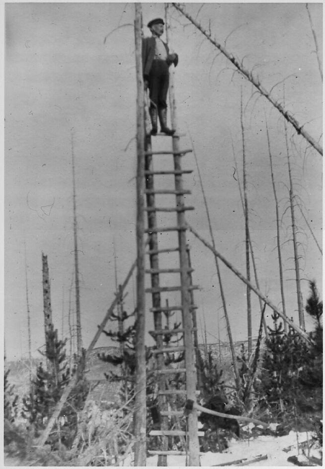
The first tower lookouts were temporary, improvised from building materials the forest rangers found while on patrol. They were often no more than “crawl” tree structures—trees with their branches removed serving as supports for bush ladders, steps between poles attached to two trees. A pre-requisite for a permanent staffed lookout was a phone line. Available after 1910, the phone allowed the man in the tower to talk to someone in the nearest ranger station. Seasonal employees were hired to man lookouts during fire season and their job included maintaining the trails and telephone lines, as well as making weather observations.
After 1912 there were two types of lookouts: summit lookouts, built on the ground or on short stilts, which provided a vantage point from high alpine peaks, and towers, built on high hills in the boreal forest, which elevated the observer over any obstacles to vision.
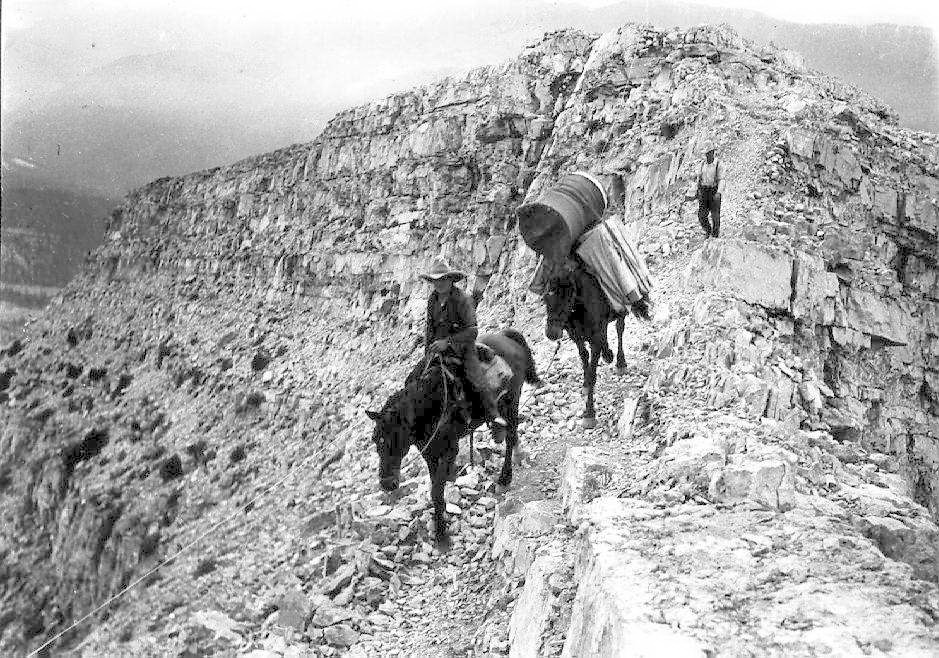
On mountaintops the earliest summit lookouts were single, square wood frame 12 by 12 foot structures with a pyramidal roof. Later designs featured a 14 by 14 foot structure with a cabin at ground level and a second story for observation. At these locations everything was constructed from planed boards, the easiest and lightest material for horses to haul. The lookouts were held down by steel cable that ran from a post on the roof to wherever they could be secured in earth. Open windows with hinged wood shutters that pulled upwards gave a 360 degree view.
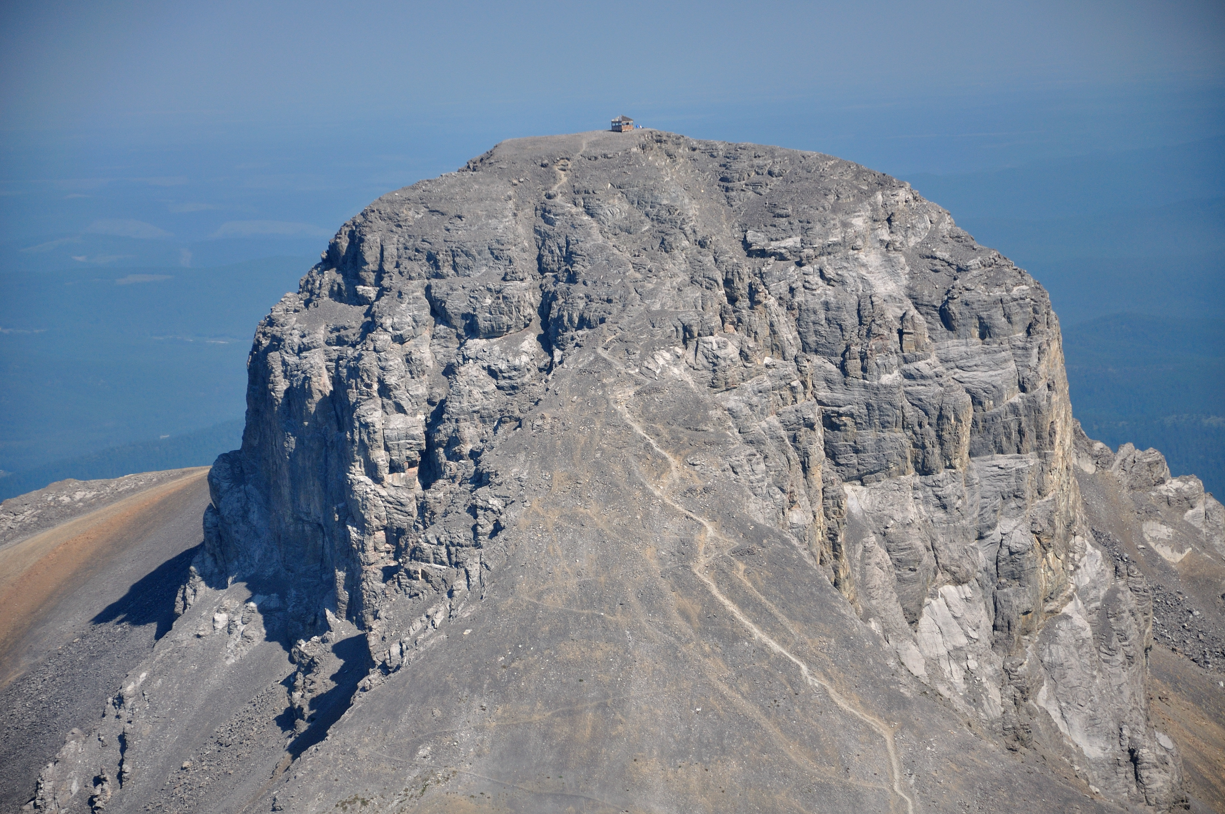
Burke Lookout (later renamed Cameron Lookout) built in 1929 on the summit of Mount Burke in the Livingstone Range is one example. At a staggering elevation of 8,330 feet (2,540 meters), it was the highest in Canada. It was hard work getting supplies up there each summer. The observer had to find his own wood supply for the stove to cook and keep warm; at Cameron this meant a long walk down the mountain to get below the tree line. Cameron was closed in 1953 and replaced by two lookouts positioned at lower altitudes that were easier to get to. Cameron is still visible with binoculars from Highway 2.
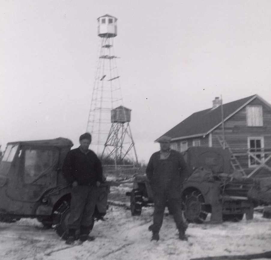
In the boreal forest area, a variety of tower types evolved. A smaller version of square lookouts, such as that built at House Mountain, near Whitecourt, was placed on broad-based wooden towers. Other towers were narrower, up to 60 feet high, with a small cupola lookout on top. They were constructed from either timber or steel. Introduced in the 1920s, steel increasingly replaced wood for tower construction. The later version of these steel towers replaced the wooden octagonal cupola with a fiberglass design in the 1960s.
Inside the lookout observers used binoculars to scan the forest then locate the fire with a rudimentary fire finder. Then in 1945, lookouts adopted the Osborne, an instrument used to help determine the precise location of a fire in relation to the tower. Mounted on a stand in the middle of the cupola, it measures the azimuth between true north and the location of a fire. Alberta is the only agency in the world that added a telescopic sight to the Osborne. Promoted by a couple of lookout observers in the 1960s, it was developed for use by the province to locate fires with precision over great distances.
In the early days, the real challenge was to communicate the location of a fire to the nearest ranger stations; the telephone system, a tree-line or tripod system in the mountains, employed cable strung between trees and held on with insulators. It was susceptible to lightning, sometimes with frightening results when a bolt hit the line and the charge travelled along it and up into the lookout. The telephone also went down when trees fell across the line in summer and snow load would take it down prior to the fire season. In 1938, the first two-way radios, run on a generator, were installed in lookouts for communications.
The importance of fire lookouts has not diminished. Many of Alberta’s 127 operational fire lookouts are rebuilt on the location of the first generation of lookouts. Although working conditions are more comfortable, the job requirements for lookout observers—strong physical and mental health to withstand the rigors of climbing the lookout tower, loneliness and often monotonous routines—have changed little. “You have to like yourself to take the job;” that’s what the old hands say about life on the lone lookout.
Written by: Judy Larmour.

Great article. Having climbed to the old lookout on Mount Burke a couple of different times, I have to admit these are some of my favorite locations. Is there a definitive list of abandoned lookouts in Alberta?
Thanks for your comment, Dan. I’m glad you found the post interesting.
I’ve asked my colleagues with the Ministry of Culture and a contact over at the Ministry of Environment and Sustainable Resource Development. The Government does not have a list of abandoned lookouts, as far as I can determine.
A few people have asked exactly where to find the Black Rock and Cameron lookouts. I’ve obtained some additional information from the Ministry of Environment and Sustainable Resource Development.
The Black Rock Lookout is located at 51° 20′ 30″ north and 115° 11′ 34″ west, near Cochrane Alberta. To get to hiking trail, you can take Highway 40 Forestry Trunk Road to the Ghost River/Waiparous area. A 4X4 vehicle is required to access the trail-head.
The Cameron lookout is located at 50° 17′ 23″ north and 114° 31′ 29″ west, south west of Calgary. Take Highway 940 south from the Highwood (Highway 40) to cataract creek to find a trail-head.
Be sure to wear appropriate clothing and be aware of the physical conditions for hiking alpine areas.There are several websites that can provide detailed trail information (such as Trail Peaks) and others with excellent hiking trail information (such as Outdoor Escapade).
I am looking for any information about the Cameron lookout as my late grandfather was the Ranger posted there in 1935.
I’m not sure, Keith. Alberta Environment and Sustainable Resource Development may still have records pertaining to the lookout. The Alberta Forestry Service Museum (in Hinton) may also have information.
What exactly are you hoping to learn? I might be able to give more specific advice.