Curling at the Straw Pile

Curling rinks, long low windowless buildings popped up in towns and hamlets, as each community grew. Inside were sheets of natural ice, 146 feet long and between 14 and 15 feet wide, marked out with lines and the target (called the house) for the rocks or stones as they are also known. Old curling rinks were cold places, but that was exactly the point—they had to be. In 1953 avid curlers in the small farming community of Conjuring Creek, south of Calmar, built a natural ice rink using straw bales for insulation. When someone unsuccessfully tried to buy the stack of bales, the rink became known thereafter as The Straw Pile!

The straw pile, date unknown. (Photo is courtesy of the Conjuring Lake Curling Club.)

Albertans were already avid curlers by the late 1880s with clubs in Edmonton, Fort McLeod, Banff and the mining town of Anthracite. By 1902, Edmonton had a club with a three sheet indoor rink and 100 members. Vegreville curlers began on a pond in 1907; a year later they builit a three sheet indoor rink.

The introduction of mechanical ice plants to make artificial ice for curling rinks was a major change for the sport. Ice could be kept at the ideal temperature -5° (Celsius) to -3° with an ambient temperature of 4° at chest height. Artificial ice came to city centres first, although Claresholm, plagued by chinooks, installed an artificial ice plant in their rink in 1952. Vegreville opened a new professionally engineered and constructed a six-sheet artificial ice rink in 1955 at a cost of $80,000.

Just as artificial ice was gaining momentum, the Conjuring Creek Curling Club was formed. Lumber was pricey, so Club members decided to build with straw bales, a tried and tested construction method for curling rinks. Square straw bales made thick walls which provided good insulation to control rink temperature. The bales were lined up, and spruce posts were spaced along their length to keep the bales together. The exterior walls were covered in wood slabs, and the rink was wired and lit by a generator. The first Straw Pile proved to be temporary, and in 1956 a new building was erected. Straw bales were used again, but this time the Club sprang for exterior siding and also lined the interior walls. The rink was bigger, with 2 sheets of ice. Further improvements in 1973 included fluorescent lighting and comfy red bench car seats in the viewing area.

The mural painted in the Calmar Curling rink to commemorate the Conjuring Lake curling Club. (Photo courtesy of the Conjuring Lake Curling Club.)

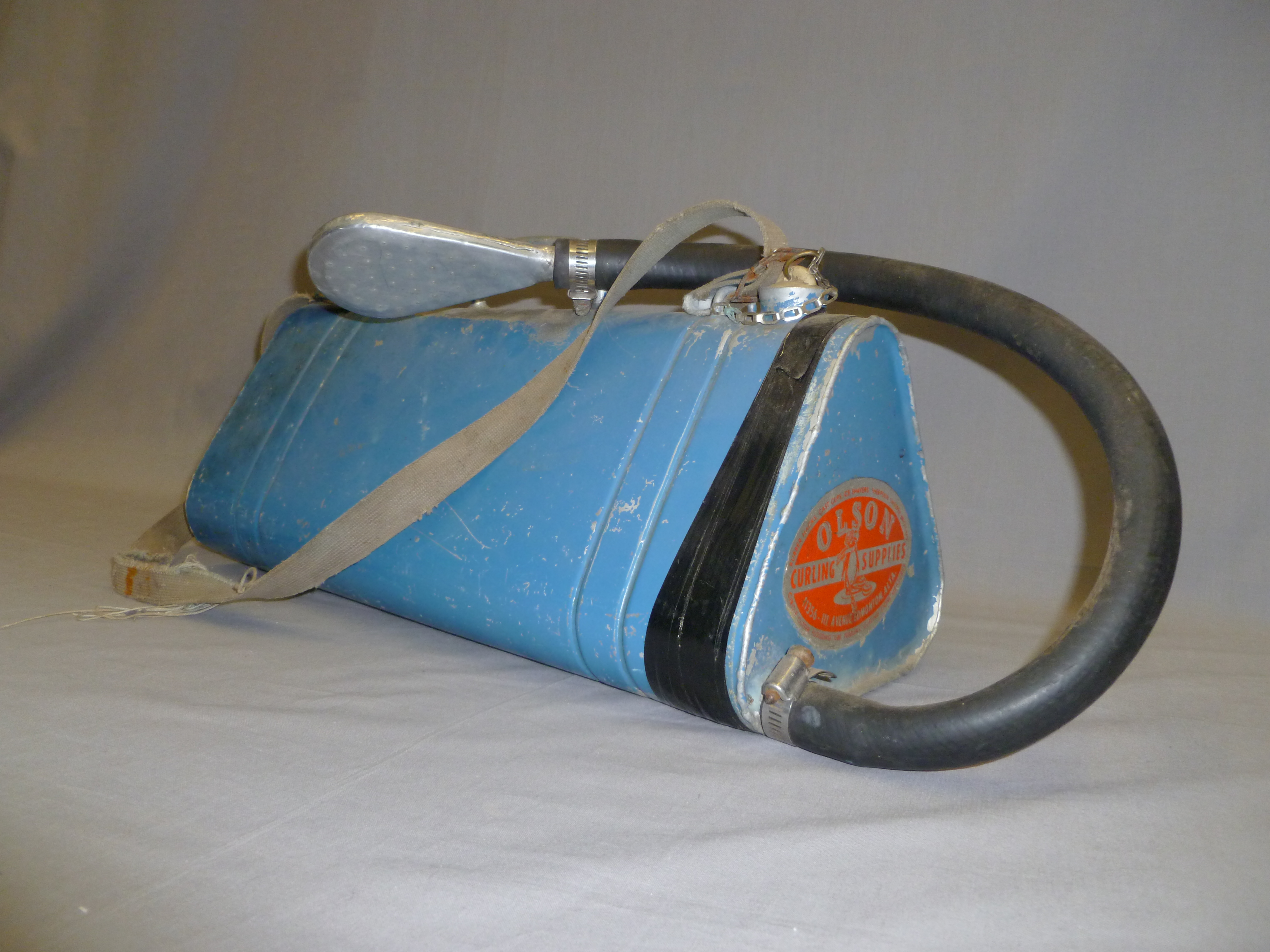
Preparing the ice took time. Sawdust was spread to the edges of the bale walls against the advice of B.E Olson, whose 1929 pamphlet The Art of Making True Curling Ice noted it was not a good conductor of cold and was inclined to go mouldy in spring. The rink was flooded in layers slowly and evenly; if it was too cold during flooding the ice would crack and peel off. At the right level the surface was planed with a homemade scraper, and then a scriber, a board with saw-teeth spaced to mark the rings of the house, was used to etch the ice. A hole made in the centre of the house to anchor a measuring stick for use during play. The water pumped from nearby Conjuring Creek was a little yellow so powered milk was added to whiten the ice, until it was decided to tank water in. The hacks for placing a player’s feet were frozen into the ice as the flooding progressed. The coloured lines and rings were painted on using paint mixed with oil and then frozen over, and finally the ice surface was pebbled. Closing the doors and turning off the lights in between games kept the rink cold.

An ice pebbler, one of the Conjuring Lake Curling Club artifacts donated to the Alberta Sports Hall of Fame. It was invented by E.B. Olson, who founded Olson Curling Supplies, in Edmonton in 1933. Pebbling involves sprinkling warm water on the surface of the ice to give some grip for the rocks; if the ice was completely smooth it would not be possible to “curl” the stones.  (Photo by Judy Larmour, Courtesy of the Alberta Sports Hall of Fame.)
An ice pebbler, one of the Conjuring Lake Curling Club artifacts donated to the Alberta Sports Hall of Fame. It was invented by E.B. Olson, who founded Olson Curling Supplies, in Edmonton in 1933. Pebbling involves sprinkling warm water on the surface of the ice to give some grip for the rocks; if the ice was completely smooth it would not be possible to “curl” the stones. (Photo by Judy Larmour, Courtesy of the Alberta Sports Hall of Fame.)

The Conjuring Lake curling rink was a community gathering place. Part of the fun was preparing the ice and the social aspect of curling included cheering from the viewing area, which eventually hosted 5 generations of eager spectators. The first prizes included jam, cigarettes, eggs and chocolate! Trophies came later. By 2010, however, it was no longer viable to keep the rink going and it was demolished, the straw pile burned in 2011. It’s not known how many natural ice rinks were built using straw bales in Alberta, but Conjuring Lake rink was probably the last one in use. We hope to be proved wrong—is there yet one more quintessentially prairie ice rink out there somewhere?

Written by: Judy Larmour.

Manager of Historic Places Research and Designation Program Leads Diverse Identification, Research, and Protection Efforts

As Manager of the Historic Places Research and Designation Program, Brenda Manweiler heads what may be the unit with the greatest variety of responsibilities within the Historic Resources Management Branch. Brenda joined the branch as a Municipal Heritage Services Officer in 2009, after working for museums, British Columbia’s Heritage Branch, and Parks Canada. She has been in her current position since April 2013.

Brenda Manweiler, pausing for a moment during a busy day.

She now heads a six-member team of historians and heritage specialists. The unit’s primary role is administering the Provincial Historic Resources Designation Program (described below). But there’s much more!

In addition, her group provides ongoing advice on how best to address the impact on historic structures (that are not designated) in cases where they may be affected by development in Alberta. This is part of an integrated regulatory function that Alberta Culture administers for the preservation of historic resources.

Members of her staff provide research services to many of the historic sites operated by the Historic Sites and Museums Branch of Alberta Culture. Their services help, for example, to develop exhibits at these sites.

The Historic Places Research and Designation Program also works closely with the Alberta Historical Resources Foundation. The unit’s staff evaluates applications for Heritage Awareness, Research, and Publication grants submitted to the Foundation’s Heritage Preservation Partnership Program.

Creating Heritage Markers

As well, this unit is responsible for the Foundation’s Heritage Markers Program. This program supports the development of heritage markers that promote awareness of the historic people, places, events, and themes that have defined the character of the province. The markers are ideally sized for placement within parks, along trails or sidewalks, and in other community locales. Once the topic of a new marker has been selected, unit staff members develop the text, select photographs, and are responsible for coordinating the design, fabrication, and installation of the markers.

The unit includes the coordinators for two other programs, as well:

What kind of historic places are “out there” in Alberta?

The Coordinator of the Alberta Heritage Survey Program oversees a database of information about non-archaeological historic resources across the province. The Alberta Heritage Survey was established in the mid-1970s, has information dating back to 1971, and is being continually updated. Entries about individual resources include photographs, details of architectural characteristics, history, designation status, and location. This information comes from heritage surveys of neighbourhoods or building types, many of which have been commissioned by municipal governments and conducted by consultants and heritage groups. Today there are almost 100,000 individual resources documented on a searchable online database.

How do Geographical Features Get Names?

The Coordinator of the Geographical Names Program manages the process to formally name geographical features in Alberta. Names are chosen in accordance with international standards and guidelines, with preference usually given to names that have a demonstrated local and/or historical usage. The coordinator’s work includes communicating with governmental organizations from the municipal to international level, disseminating geographical names information from both popular and scholarly sources, maintaining records, and conducting related field and archival research. All this leads to making a recommendation on a name to the Alberta Historical Resources Foundation board and the Minister of Alberta Culture.

How do places get designated?

The Historic Places Research and Designation Program’s largest responsibility, however, is the Provincial Historic Resources Designation Program, which identifies, evaluates, and designates those historic resources that are most significant to the province as a whole. Resources eligible for consideration include structures, archaeological sites, palaeontological resources, and other works of humans or nature that are of value for their historic, cultural, natural, scientific, or aesthetic interest.

Once a resource is designated, its owner cannot destroy, disturb, alter, restore, or repair it without written approval from the provincial government. But the owner gains tangible benefits, including access to conservation grants and technical advice, and the intangible benefit of knowing that a valued property will be preserved and protected into the future. Currently there are some 360 sites protected as Provincial Historic Resources in Alberta.

Owners or advocates interested in obtaining heritage designation for a property often start by contacting Brenda for advice. She’ll ask questions to determine if the property is eligible for consideration, and to gauge whether designation should be pursued at the provincial or municipal level, or both. Occasionally one of the branch’s Heritage Conservation Advisers will make a site visit to answer property owners’ questions and assess the potential eligibility of their property for designation.

Once an application is received, Brenda administers the evaluation process. The Designation Committee, made up of her staff plus staff of the Heritage Conservation Advisory Services unit, meets about every six weeks to confirm the eligibility of new applications and to monitor the progress for sites currently under study. The Designation Committee works to determine if the site has heritage significance (according to five specific evaluation criteria), and a Heritage Conservation Adviser studies the site to determine if it retains enough integrity to communicate that significance. Much archival and onsite research is required to complete an in-depth evaluation. If the committee recommends designation and that is approved at a higher level, the owner is informed and his or her support is obtained, a designation order is signed, and the site is listed on the Alberta Register of Historic Places, an online database of all designated historic resources in Alberta.

Benefits of Designation

Why would owners want their properties designated? Brenda explains: “They believe that they have a property that’s of significance. They want to keep it around so that future generations can enjoy it and benefit from it, so that it can continue to be a part of the communities that they live in. Also, the Alberta Historical Resources Foundation provides conservation grants to property owners of designated resources, which serves as a fantastic incentive for people to conserve their property for the long term.”

There have been about five new applications since Brenda started in her position nearly a year ago, so she estimates that five to ten per year would be the norm. Her team is currently working through the evaluation process for approximately twenty sites.

So Brenda’s job involves lots of paperwork and administrative management. But she never loses sight of what it’s all for: “So many people work in this field because they feel passionately about the buildings, and I’m certainly no different there,” she says. “But for me, so much of it comes down to the people: the applicants, the owners, the community members. The public is so passionate about the sites that they so want to see conserved. I love being able to work with the public to help them reach their goals of contributing to a legacy for Alberta.”

Written by: Kerri Rubman.

Fort Saskatchewan Approves Historic Precinct Site Master Plan

The City of Fort Saskatchewan is one step closer to realizing their vision for the development and interpretation of a significant community amenity through Council’s recent approval of the Historic Precinct Site Master Plan Guiding Document. Located adjacent to the City’s downtown and along the edge of the North Saskatchewan River, the Historic Precinct provides a unique opportunity to showcase the cultural history of Fort Saskatchewan and to develop a space for public learning and enjoyment.

Historic Precinct Area

The Approach

The Historic Precinct contains an array of man-made and natural elements that contribute to the telling of the story of Fort Saskatchewan. Project consultants EIDOS Consultants Inc. and Marshall Tittemore Architects approached the conceptualization of the space as a cultural landscape, wherein:

“An important part of the Precinct’s heritage value is found in the relics of law and order and public works, including buildings, structures, sightlines, earth mounds, plant materials and features that remain in situ. These relics constitute part of the heritage value of the area by providing tangible evidence of how it was transformed and used by the NWMP, Canadian Northern Railway, the Province and the City.” (Historic Precinct Site Master Plan, page 9).

The planning process sought to integrate local values into the final plan and therefore included public and stakeholder consultation through surveys, open houses and workshop sessions.

The City of Fort Saskatchewan’s Diane Yanch, Culture & Historic Precinct Supervisor and Richard Gagnon, Director of Culture Services display a copy of the completed Historic Precinct Master Plan

The Master Plan

The Master Plan involved considering the long-term development and interpretation of the historic precinct, including integration of existing Provincial Historic Resources, recommendations for pedestrian circulation and way-finding, interpretation opportunities and development of a conceptual design for a new Interpretive Centre. A detailed phasing plan was also provided to allow the City to structure implementation in a coordinated and cost-effective manner.

Historic Precinct Site Master Plan

The uniqueness of the site is exemplified by the existence of three Provincial Historic Resources within its boundaries including the North West Mounted Police Post, the Fort Saskatchewan Museum (Courthouse), and the Canadian Northern Railway Station. These three historic resources are proposed to be key elements in the interpretation and programming of the Historic Precinct and are considered as Historic Precinct Nodes in the Master Plan.

  • Original 1875 Fort Site Node – This Provincial Historic Resource is presently an open native grass field and will remain untouched during development, with the long term goal of undertaking small scale research and public archaeology programs in partnership with interested academic institutions, archaeological societies and the Province of Alberta.
  •  Fort Saskatchewan Museum and Cultural Village Node – The Fort Saskatchewan Museum (Courthouse) is a designated Provincial Historic Resource. The Master Plan calls for the land surrounding the Courthouse to be utilized as a ‘cultural village’ in which historic buildings and artifacts will be displayed.
  •  Railway Node – The CNR Station will continue to be space for use by community groups. The area around the Station will be enhanced to include an opportunity to showcase other rail infrastructure, landscaping and opportunity to enhance access to the adjacent Legacy Park and farmer’s market plaza.

Other Historic Precinct Nodes proposed within the plan include a Gaol Node, Religion Node, MétisNode and First Nations Node.

Next Steps

The City will continue with planning the programming for the future Interpretive Centre with hopes of breaking ground by the end of 2014. Conservation Plans have been prepared for the Courthouse/Museum and CNR Railway Station to ensure that on-going improvements and maintenance are consistent with accepted conservation practices. In accordance with the terms of designation, approvals will be obtained for any projects within the site that will affect the Provincial Historic Resources as well as work in the vicinity of the NWMP Police Post due to the high archaeological potential of the site.

Proposed General Concept Design of the Interpretive Centre

The Historic Precinct Master Plan was partially funded by the Alberta Historical Resources Foundation under the Heritage Management Plan grant category of the Municipal Heritage Partnership Program. Though Heritage Management Plans typically take the form of a document that outlines policy and a process for municipal designation, the grant category is flexible and can apply to projects that involve planning and policy development for the stewardship of historic resources more broadly. The Historic Precinct Site Master Plan is an example of how the program can be tailored to meet the unique needs of municipalities.

Written by: Rebecca Goodenough, Municipal Heritage Services Officer

Head of Land Use Planning Is on the “Front Line” of Resource Protection

Anna Curtis heads up the Historic Resource Management Branch’s Land Use Planning Section. If proposed development projects in the province could potentially impact historic resources, the Historical Resources Act allows the Minister of Alberta Culture to require the project proponent to perform studies or other work before their projects can proceed. “What we do is coordinate [the regulatory approval process],” Anna explains.

A photograph of Anna Curtis, Head of Land Use Planning, working at a site in the Cypress Hills.
Anna Curtis, Head of Land Use Planning, working at a site in the Cypress Hills.

As Anna puts it, the Land Use Planning Section is on the “front line” of the Historic Resources Management Branch when it comes to communicating these requirements to the proponents of development. Land Use Planning receives plans from proponents and determines which part of Alberta Culture—Archaeological Survey, Aboriginal Heritage, Royal Tyrrell Museum of Palaeontology, or Historic Places Stewardship—might need to review the plans to assess if approval should be conditional, requiring that the proponent first complete a study or undertake some action to mitigate the potential impact to a historic resource. If so, Land Use Planning then “translates” the technical language into a regulatory order for the proponent. As Anna puts it: “We aren’t the authorities, we don’t make those decisions [about how best to mitigate or offset the effects of development]—what we do is coordinate what everybody else says, and put it into a format that is both an order to the proponent and [something] the proponent will understand.”

Coordinating the Protection of Historic Resources

Because Land Use Planning acts as a central coordinator, the different sections of the branch can concentrate on their specialties without needing to worry about presenting a comprehensive requirement for the proponent to follow: Land Use Planning synthesizes the different sections’ points of view. Anna explains, “Managing the project is what we’re all about. We’re the central point. The archaeologists don’t necessarily have to know what the palaeontologists want—that’s our job.” She has been the Head for not quite two years. Previously, she worked at the Royal Tyrrell Museum, doing land use planning in palaeontology. For the last ten years, she worked with the federal government in an Aboriginal relations and consultation capacity. All four areas that Land Use Planning covers (archaeology, palaeontology, Aboriginal traditional use, and historic use [structures]), Anna has covered in her personal background—meaning that she’s well-equipped to head up her section’s mandate to synthesize and communicate the different sections’ requirements.

Heritage Conservation and Development are (usually) Compatible

Because Land Use Planning is on the front line, the section also handles many of the questions that come in from the public about the branch’s work. Sometimes citizens call because they want a particular project in their area stopped. “There’s a lot of concern with certain types of developments, such as gravel pits” says Anna, giving an example, “…and a lot of people don’t want those developments near them in their area. So a lot of times we’ll get calls, with people wanting to know if we can stop developments. That is not the Historic Resources Management Branch’s role, Anna remarks. “That’s not what the [Historical Resources] Act is for. It’s not to stop development. It’s [about] how do we preserve and protect [historic] resources while allowing development to happen.”

Occasionally, though, a particular historic resource is deemed far too valuable to allow development to impact it. This was the case with the Quarry of the Ancestors, a significant stone-quarrying and tool-making site for pre-contact native peoples, situated in the middle of the oil sands. “It’s a big deal when you remove part of an oil sands lease out of production,” Anna notes.

But most of the time, rather than putting a halt to development, the Historic Resources Management Branch makes sure that studies are done so that information can be obtained about the site before development that may damage the historic resource is allowed to move forward. With all the development happening in the province, the branch is busy. The Land Use Planning Section helps the branch to stay ahead in several ways.

Anna’s section works with municipalities, so that their administrations understand what kinds of developments need to be reviewed. They also work closely with other Government of Alberta regulatory ministries and, of course, with different industry sectors, to identify projects with significant potential to impact historic resources. “We’re looking for those developments that are going to have a big impact,” Anna says. “For instance, we do a lot of work with…Alberta Transportation; they are big on gravel pits, roads, bridges—those are big projects in the province.”

Every Project is Unique

Land Use Planning also must keep informed about how different types of development affect historic resources differently. A pipeline that goes for hundreds of kilometres, Anna points out, causes a disturbance that is “long and linear. That’s a whole different thing than when you look at something like a gravel pit, which is more constrained in terms of area, but its impact can be quite extensive in terms of historic resources.”

Changing technologies also lead to different types of concerns. For example, open pit mining in the oil sands is now joined by the in situ process—using a series of wells placed in a row that inject steam into the earth and force the oil out of the sand. The impact of these wells on historic resources is wholly different.

The branch also sees “ebbs and flows in these kinds of developments with the commodity markets,” Anna says. When the demand for a particular commodity comes back strong after a downturn, often the technology for extracting that commodity has advanced. Consequently, Land Use Planning needs learn what kind of impact that these new technologies might have on historic resources. “We have to be flexible” in order to keep ahead of those changes, Anna says. “It’s a challenge because it’s a constantly moving target,” Anna remarks, “but it’s an interesting challenge.”

It’s not just heavy industry that the Land Use Planning Section has to take into account. The branch is currently seeing a great “increase in urban areas and the loss of native prairie, and a lot of that native prairie can have good potential [for containing historic resources].”

The Listing of Historic Resources

The Land Use Planning Section also assists to ensure that the Listing of Historic Resources is an up-to-date and effective tool for the branch. The listing is the provincial government’s database, identifying lands that contain or are believed to contain historic sites, including archaeological and paleontological sites, Aboriginal traditional use sites, and historic structures. “The HRMB updates [the list] every six months according to the work that’s been done,” Anna explains. If an excavated site is found not to be as significant as previously supposed, it may be given a lower priority ranking. This gives the branch a heads-up that other proponents in the same area might not need to perform extensive excavations. As new sites are discovered in the process of doing studies in an area, they are added to the list (and if research makes it clear that a site is of greater significance than previously thought, it can be given a higher ranking), so the branch will be aware that any development in the area is likely to require more in-depth studies before it can proceed. “The various sections use these studies to inform the branch’s decision-making process,” Anna says, and to be “conscious and mindful of the status of resources in the provinces. We don’t ask for studies for the sake of asking for studies.”

Alberta’s Historic Resources are Well Protected

“There is such good, strong regulatory oversight for historic resources in Alberta. It’s some of the strongest legislation in the country,” Anna concludes. “History is something that people always think of as an abstract, and this is tangible history. It’s satisfying to me to know that tangible history is not being lost—that we are making every effort to ensure that the most important sites are being protected and that we are extracting information.”

Plus, Anna reminds us, technology changes not only for extractive industries but also for those who unlock the secrets of our past. “Maybe ten years from now people will have different technology” with which to study historic resources, Anna says. “Suddenly we’ll have a whole other level of information that we didn’t have before.”

Written by: Gretchen A. Albers.

Crowsnest Pass Phase 2 Heritage Inventory Underway

The Municipality of Crowsnest Pass contains the communities of Coleman, Blairmore, Frank, Hillcrest and Bellevue. Crowsnest Pass has a rich history in coal mining and trade unionism, and therefore, has much to offer in the way of historic resources.

20th Avenue, Blairmore

As a result of this rich and varied history, the Municipality has acknowledged the importance of identifying places of significance in the community. Given the breadth of possible historic resources within the municipality’s boundaries, Crowsnest Pass determined that a three-phase heritage inventory would be required to comprehensively assess potential sites. The first phase was completed in 2013 and inventoried 31 sites in the Coleman area. The second phase is being completed in 2014 and is looking at historic resources in Blairmore and Frank. The third and final phase will look at historic sites in the Hillcrest and Bellevue area and is proposed to be undertaken in 2015.

55 residents attended a public open house held on April 23rd at the Blairmore Elks Hall to provide feedback on possible sites to be included in the second phase of the heritage inventory. Consultants Community Design Strategies Inc. presented 65 possible historic resources for residents to provide feedback on in terms of historical information and opinions regarding the significance of each site. The results of the open house will be reviewed by the Crowsnest Pass Municipal Historic Resource Board and refined to a list of 45 sites for further evaluation. These 45 sites will have Statements of Significance prepared for them and will be presented back to the community for further review and comment at a second open house to be scheduled later this year.

Ken Bourdeau, Development Officer with the Municipality of the Crowsnest Pass and Merinda Conley, Principal with Community Design Strategies Inc. ready to speak with residents at the open house.

The event provided residents and property owners the opportunity to comment on the 65 places of interest and to speak with representatives of the Municipality of Crowsnest Pass, the Municipal Historic Resources Board and Alberta Culture about the heritage inventory project and municipal historic resource designation in general.

Heritage inventory projects are supported by the Municipal Heritage Partnership Program and provide municipalities with the process and tools to assess possible historic sites within their boundaries for future municipal historic resource designation.

Written by: Rebecca Goodenough, Municipal Heritage Services Officer

Raymond works on a context paper

On April 16th I had the pleasure of attending an open house hosted by the Town of Raymond. They presented the penultimate draft of their historical context paper, drafted with the assistance of consulting firm Donald Luxton & Associates. The open house is the culmination of a process Raymond began with MHPP over two years. Several dozen people attended the event over the course of the evening and all were excited by the result of all this work.

Image of people attending the open house in Raymond discussing the context paper.
Attendees discussing Raymond’s heritage.

The context paper outlines 16 themes (people or groups, or economic or social forces) that shaped the community and, by extension, the physical environment of the town. The context paper will help Raymond identify historic places: a place is locally significant, and therefore worth preserving, if it somehow reflects the influence of one or more of these themes.

While context papers do not explain the full history of a community, each one can provide a visitor (like me) with a glimpse of how a community evolved over time and Raymond’s is no exception. The town was formed by Jessie Knight who financed the purchase of land in the area, helped establish sugar beets as an important crop, and helped start a sugar refinery in Raymond. The community was settled by Jessie’s son Raymond Knight (the town’s namesake) and other members of the Church of Jesus Christ of Latter-day Saints. The town quickly grew to include members of a variety of faiths, including Japanese Buddhists as early as 1902.

I was particularity fascinated to learn about the towns plan of survey, completed in 1901. It’s a unique combination of the urban planning ideas of the Church of Jesus Christ of Latter-day Saints and Georges-Eugène Haussmann, who redeveloped much of Paris in the 19th century. Haussmann’s plan for Paris—emphasising boulevards radiating out from central plazas—can be seen in the design of the central square and the radiating boulevards. Joseph Smith’s Plat of Zion—which emphasises large residential lots—is visible in the residential areas. The plan is unique, as far I know. Although it was never followed exactly, you can still see its influence in the width of the streets, the orientations of several buildings and the location of public buildings (like schools, the town hall and churches)

An image of the original plan of survey laying out Raymond.
The original plan of survey for what would become Raymond

This project is scheduled to conclude shortly. We look forward to seeing what transpires as Raymond moves to begin identifying historic resources.

Written by: Michael Thome Municipal Heritage Services Officer.

Old Strathcona joins the Alberta Main Street Program

AMSP LogoAfter several years of planning, and preparing a thorough application, Edmonton’s Old Strathcona district has joined the Alberta Main Street Program. Previously designated as a Provincial Historic Area in 2007, Old Strathcona is well known as one of Alberta’s most significant, historic commercial areas. The application was approved in late February by the Alberta Historical Resources Foundation,  but was announced publicly for the first time last night, April 28th, at the Annual General Meeting of the Old Strathcona Foundation. This means that Old Strathcona joins a network of other dynamic, historic communities, like:

The Alberta Main Street Program uses the well established Four-Point Approach to foster excellence in historic commercial areas.

The announcement was made by Matthew Wangler, Executive Director of the Alberta Historical Resources Foundation, on behalf of the Honourable Heather Klimchuk, Minister of Culture.

Alberta Historical Resources Foundation Executive Director Matthew Wangler presents the Alberta Main Street Program Membership to Angie McDow, President of the Old Strathcona Foundation.

While unable to attend in person due to commitments in Southern Alberta, Minister Klimchuk commented that Old Strathcona’s “cherished landmarks are a boon to the social, cultural and economic sustainability of the community. This is one of the reasons the Alberta Main Street Program was initiated – to help communities achieve their conservation goals for the long-term benefit of Albertans.”

2014 marks the 40th Anniversary of the Old Strathcona Foundation, which will serve as the primary sponsoring organization for the Old Strathcona Main Street Program. The “OSF” has a tremendous legacy of heritage conservation and community engagement, and the Alberta Main Street Program is looking forward to partnering with them as together we look to create a meaningful future for this already vibrant historic urban landscape.

Lonely Lookouts

Perched high above the tree tops, braced to mountain peaks or balanced on steel towers, fire lookouts have a magnificent view. And that is the idea—they provide a place to watch for the first wisps of smoke that may signal the beginning of a wild fire. Detection, identification and then communication of the whereabouts of fires has been the job of the seasonal fire lookout observer in Alberta for over a hundred years.

The abandoned Black Rock Lookout, near Banff, August 2009. (Photo courtesy of Alberta Sustainable Resource Development.)

By the 1890s forest fires were increasingly a cause for concern, not only because of economic opportunity lost when marketable timber burned, but because of a long term threat to water conservation. (Forests increase precipitation, prevent erosion and slow the evaporation of ground water.) In response the Dominion Forestry Branch developed trails for their patrol routes, and then began building a system of fire lookouts in Alberta’s extensive area of Forest Reserves and Parks. When jurisdiction over crown lands was transferred to Alberta in 1930, the Albert Forest Service expanded the system further, particularly during the 1950s.

The first tower lookouts were temporary, improvised from building materials the forest rangers found while on patrol. They were often no more than “crawl” tree structures—trees with their branches removed serving as supports for bush ladders, steps between poles attached to two trees. A pre-requisite for a permanent staffed lookout was a phone line. Available after 1910, the phone allowed the man in the tower to talk to someone in the nearest ranger station. Seasonal employees were hired to man lookouts during fire season and their job included maintaining the trails and telephone lines, as well as making weather observations.

A photograph of a person atop a simple lookout in 1912.
Tree crawl lookout, Brazeau Forest, 1912. (Photo courtesy of Alberta Sustainable Resource Development.)

After 1912 there were two types of lookouts: summit lookouts, built on the ground or on short stilts, which provided a vantage point from high alpine peaks, and towers, built on high hills in the boreal forest, which elevated the observer over any obstacles to vision.

On mountaintops the earliest summit lookouts were single, square wood frame 12 by 12 foot structures with a pyramidal roof. Later designs featured a 14 by 14 foot structure with a cabin at ground level and a second story for observation. At these locations everything was constructed from planed boards, the easiest and lightest material for horses to haul. The lookouts were held down by steel cable that ran from a post on the roof to wherever they could be secured in earth. Open windows with hinged wood shutters that pulled upwards gave a 360 degree view.

Burke Lookout (later renamed Cameron Lookout) built in 1929 on the summit of Mount Burke in the Livingstone Range is one example. At a staggering elevation of 8,330 feet (2,540 meters), it was the highest in Canada. It was hard work getting supplies up there each summer. The observer had to find his own wood supply for the stove to cook and keep warm; at Cameron this meant a long walk down the mountain to get below the tree line. Cameron was closed in 1953 and replaced by two lookouts positioned at lower altitudes that were easier to get to. Cameron is still visible with binoculars from Highway 2.

Packing in supplies to Cameron Lookout, 1929. Note the rain barrel for catching rain water. (Photo courtesy of Alberta Sustainable Resource Development.)

In the boreal forest area, a variety of tower types evolved. A smaller version of square lookouts, such as that built at House Mountain, near Whitecourt, was placed on broad-based wooden towers. Other towers were narrower, up to 60 feet high, with a small cupola lookout on top. They were constructed from either timber or steel. Introduced in the 1920s, steel increasingly replaced wood for tower construction. The later version of these steel towers replaced the wooden octagonal cupola with a fiberglass design in the 1960s.

Inside the lookout observers used binoculars to scan the forest then locate the fire with a rudimentary fire finder. Then in 1945, lookouts adopted the Osborne, an instrument used to help determine the precise location of a fire in relation to the tower. Mounted on a stand in the middle of the cupola, it measures the azimuth between true north and the location of a fire. Alberta is the only agency in the world that added a telescopic sight to the Osborne. Promoted by a couple of lookout observers in the 1960s, it was developed for use by the province to locate fires with precision over great distances.

The new steel tower at House Mountain, 1953. (Photo courtesy of Alberta Sustainable Resource Development.)

In the early days, the real challenge was to communicate the location of a fire to the nearest ranger stations; the telephone system, a tree-line or tripod system in the mountains, employed cable strung between trees and held on with insulators. It was susceptible to lightning, sometimes with frightening results when a bolt hit the line and the charge travelled along it and up into the lookout. The telephone also went down when trees fell across the line in summer and snow load would take it down prior to the fire season. In 1938, the first two-way radios, run on a generator, were installed in lookouts for communications.

The importance of fire lookouts has not diminished. Many of Alberta’s 127 operational fire lookouts are rebuilt on the location of the first generation of lookouts. Although working conditions are more comfortable, the job requirements for lookout observers—strong physical and mental health to withstand the rigors of climbing the lookout tower, loneliness and often monotonous routines—have changed little. “You have to like yourself to take the job;” that’s what the old hands say about life on the lone lookout.

Written by: Judy Larmour.

Collaboration Is the fun part of Grant Program Coordinator’s Job

The Heritage Preservation Partnership Program of the Alberta Historical Resources Foundation is the provincial funding program focused on helping individuals and organizations fund heritage initiatives. As Grant Program Coordinator, Carina Naranjilla keeps that program on track.

a photograph of Carina Naranjilla, Grant Program Coordinator, A.H.R.F.
Carina Naranjilla, Grant Program Coordinator, A.H.R.F.

The Alberta Historical Resources Foundation is a lottery-funded agency within Alberta Culture. The Heritage Preservation Partnership Program is one of the Foundation’s three grant programs. Heritage Preservation Partnership grants are awarded in five categories: Historic Resources Conservation, Transportation/Industrial Artifact Conservation, Heritage Awareness, Publications, and Research. There are also two scholarships: the Roger Soderstrom Scholarship and the Bob Etherington Heritage Trades Scholarship.

At the close of the twice-yearly application deadlines, Carina logs the applications, then distributes them to the appropriate subject experts within the Historic Resources Management Branch to develop informed recommendations to the Foundation’s Board of Directors.

“I’m not an archaeologist, a historian or conservation expert … so I rely on these people surrounding me in the branch for their technical expertise,” she explains. “My job is to coordinate with them, really putting all their expertise together. I set the timelines. We meet before they submit the technical evaluations to me. Then I edit [their evaluations], ensure the recommendations align with the funding policies and grants budget, check the accuracy of the financial information—a lot of detailed stuff.”

She emphasizes how important these evaluations are: “There are a lot a good projects, but you only have so much funds to distribute, so the challenge is to make sure that we are being fair and…when we deny an application or give reduced funding … we are able to provide the rationale” to explain that decision.

She consults with the Executive Director of the Alberta Historical Resources Foundation on the evaluations and recommendations, and finalises the recommendations that go to the Alberta Historical Resources Foundation’s board for review. She also assists “in the overall operation of the Foundation … administrative, financial, stuff like that.”

The Foundation’s board meets four times a year, and decisions about these awards are made at two of those meetings. Carina organizes the board meetings, along with managing other board interaction: “I look after drafting the agenda, coordinating the logistics, coordinating the materials and making sure they’re distributed on time—everything pertaining to the board meeting.” The two-day meetings, held in different locations around the province, always include a tour of the host community and opportunities for board members to meet with local heritage stakeholders. Carina particularly enjoys this outreach and the chance to see the local impact of grant-funded projects.

The recently announced conservation grants for owners of flood-impacted historic properties will mean more administrative responsibility for Carina. This special funding program will be run in the same way as the Heritage Preservation Partnership Program, but with different deadlines and a separate funding pot of $4.5 million. Carina is eager to see the applications that will come in at the first deadline, April 1.

She also manages two other programs of the Alberta Historical Resources Foundation:

There are the Heritage Awards, presented every two years in the categories of Heritage Conservation, Heritage Awareness, Municipal Heritage Preservation, and Outstanding Achievement. Carina oversees the application and review process, and plans the awards ceremony. “It’s really fun to organize,” she says. She also collaborates with the Communications Branch, which generates media coverage to encourage nominations and publicize the award decisions. The next ceremony, scheduled for October 16, 2014, will be held in conjunction with the annual Municipal Heritage Forum for the first time. Carina anticipates that this will bring even greater attendance and attention.

In addition, the Alberta Historical Resources Foundation provides annual funding to five other provincial heritage organizations—the Alberta Museums Association, the Archives Society of Alberta, the Historical Society of Alberta, the Alberta Genealogical Society and the Archaeological Society of Alberta—and Carina administers that too.

“So, you’ve got to be organized,” Carina concludes about her multifaceted position. She has been with the Historic Resources Management Branch since 2000, and in her present position since 2009, after earning a master’s degree in industrial engineering and working as a Business Analyst in her home country, the Philippines, then holding diverse administrative positions in private industry and government in Edmonton.

While not a heritage specialist herself, Carina says she’s continually learning from her colleagues. For example, when she has time, she likes to “tag along” with the Heritage Conservation Advisers on site visits to view the buildings and projects they’re working on. “It’s great because you collaborate with all these people,” she says. “That’s the fun part of my job.”

Written by: Kerri Rubman.

New Uses for Old Places – King Edward School, Calgary

New Uses for Old Places is a RETROactive series in which we are looking at examples from around Alberta of historic sites that have found interesting new uses for spaces that were originally designed for other purposes. In this last installment we will be looking at King Edward School in the neighbourhood of South Calgary as an example of adaptive reuse project underway to repurpose the building as a mixed-use arts incubator (a place that nurtures the growth and development of artists and arts organizations).

King Edward SchoolThe King Edward School was constructed in 1912 as a four-storey building that features a symmetrical design, rock-faced sandstone walls and a dressed sandstone front entrance. During its time as an institution of learning, the School also functioned as a community hub, hosting dances and other events. The school operated as versions of both King Edward Elementary/Junior High School and South Calgary High School. The school closed in 2001 and sat empty…until now.

In 2011, cSPACE Projects was established by the Calgary Arts Development Authority and the Calgary Foundation for the purpose of promoting opportunities for artist and non-profit arts/community groups. cSPACE became the new owners of the property and is now embarking on an ambitious rehabilitation effort.

Credit: www.cspaceprojects.com
Credit: http://www.cspaceprojects.com

The project involved the removal of a 1960s addition that was deemed to be non-character-defining to the historic value of the place as well as the construction of a new addition and two adjacent art studio pavilions. Modelled around the concept of providing a ‘creative commons’, ‘learning commons’ and ‘community commons’, the finished product will include facilities for artistic production, exhibition and rehearsal and will serve as home to a range of arts organizations and independent artists.

To learn more about this project, watch this video:

As part of the project the owner and the City of Calgary have entered into an agreement to ensure that the King Edward School will be designated a Municipal Historic Resource.

(A related example is that of the Hudson’s Bay Company Stables / Ortona Armoury in Edmonton’s Rossdale Neighbourhood that is operated by the Ortona Armoury Tenants Association, a group established to coordinate the involvement of the wide range of artists and related groups currently utilizing the space. The property was designated as a municipal historic resource in 2004.)

Written by: Rebecca Goodenough, Municipal Heritage Services Officer.