
Written by: Michael Gourlie, Government Records Archivist, Provincial Archives of Alberta
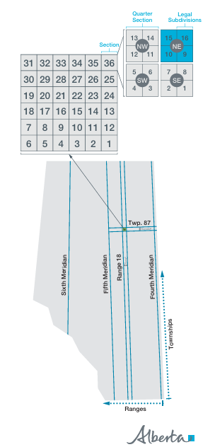
Township maps are a popular research source at the Provincial Archives of Alberta (PAA). An outcome of the Dominion Lands Surveys beginning in 1881 that captured most of what is now Alberta, the township maps document a grid system using meridians, ranges, townships and sections established by federal surveyors. Known as the Alberta Township System (ATS), this grid forms the basis of legal land descriptions used for Alberta land titles to the present day.
The original township maps were subsequently published in several editions, with the published maps used for a variety of operational purposes. They acted as a template or index for various offices to identify land uses for programs such as grazing leases, timber berths, mineral leases, land grants and homestead applicants. They also provided a standardized perspective to administer and oversee land use.
Read more