
“Putting dots on paper maps”—that’s how Eric Damkjar, Head of Archaeology at the Archaeological Survey Section of the Historic Resources Management Branch, describes his section’s old methods of recording archaeological site locations. In his words, “We have on record approximately 40,000 archaeological sites … We used to manage that information with hand-drawn dots on paper maps, and that’s a very arduous system.” But about ten years ago the branch obtained funding to create a geographic information system (or GIS) for the information—basically a computerised map”. Damkjar, a former consulting archaeologist who says he’s always had a technical bent, “jumped at the chance” to work on this new initiative.
Embracing technology, particularly GIS mapping, has dramatically changed the way that the Archaeological Survey Section regulates development. Indicating the proposed footprint of the development on a computerised map is much easier and more accurate than the old system of pulling out the relevant paper map and laboriously drawing in the footprint by hand. Also, the electronic footprint provides instant access to a variety of related electronic records that formerly had to be retrieved by hand and reviewed on paper.
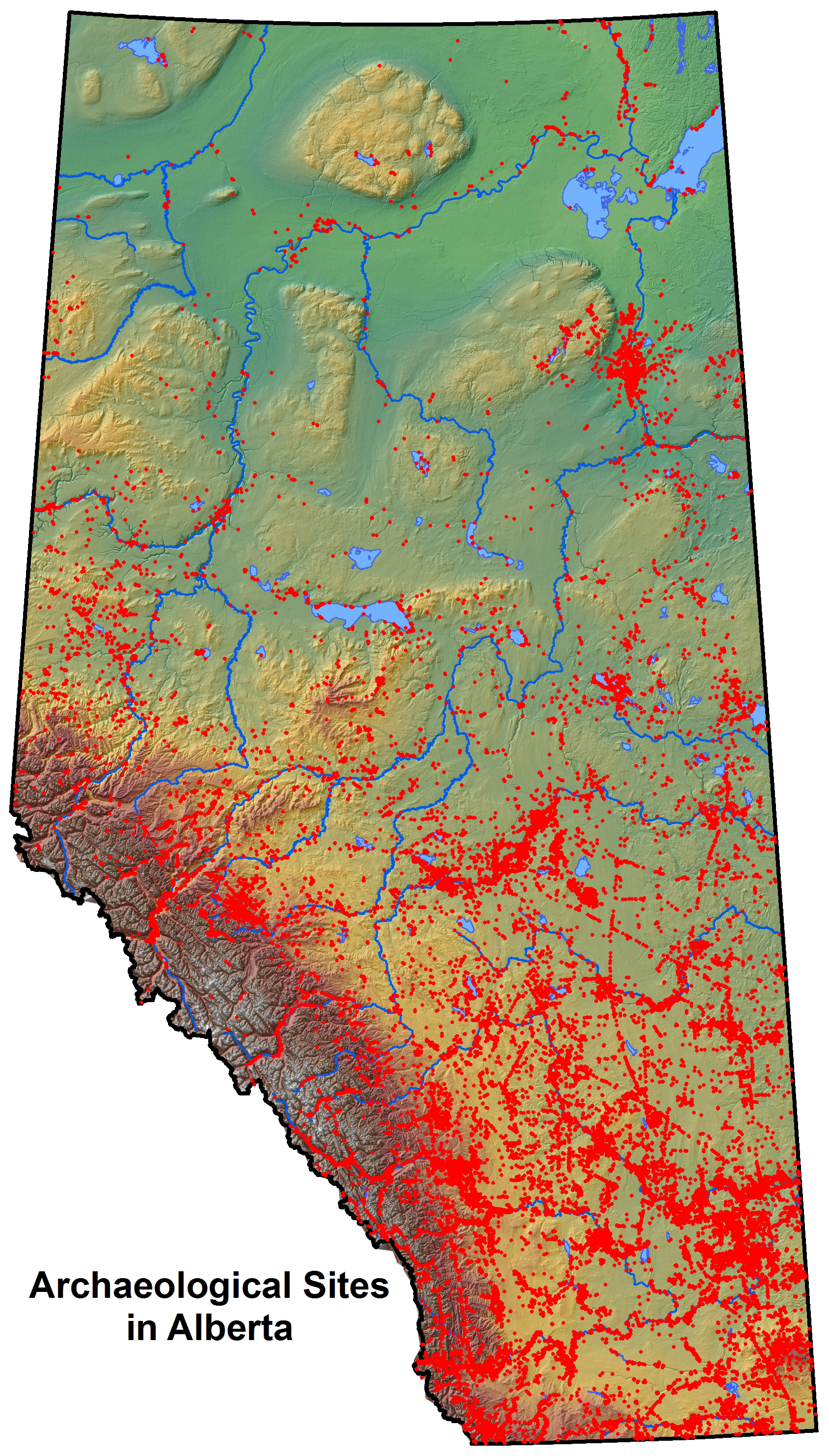
The potential of electronic mapping and electronic databases of information go far beyond improving the section’s abilities to regulate development. Paper maps indicating the location of 40,000 historic resources—along with archaeological reports numbering in the thousands—were, as one might expect, extremely difficult to access. When reports only existed in paper form, an individual who wanted to do research had to physically go into the basement and pull a report off the shelf. “Our unit,” says Damkjar, “was basically trying to unlock the vault of archaeological information that was sitting there, tied up in paper, and to make it more accessible [not only for] our … regulatory actions, but also for research.” One goal for 2014 is to create a web portal consisting of a mapping viewer that the public can use to access and view information about archaeological sites.
Damkjar is also eager to make the information that has resulted from the regulation of development more readily available. Every year millions of dollars are spent by industry on archaeological studies, because the Historic Resources Management Branch frequently requires industry to do excavations of sites slated for potential development. Since 1973, there have been approximately 7,000 archaeology projects undertaken in the province. “There’s a valid point in wondering what is the point of excavating these sites if you’re not going to learn anything from it”—in other words, if that information is not going to be made more accessible to the public and to scholars, says Damkjar.
Synthesizing work that has been done by digitizing reports and building databases and electronic maps will help Albertans improve their understanding of the “big picture” of the province’s historic resources. “We can now study the distribution of ancient land use across the province,” says Damkjar. “We can look at where in Alberta different sites are distributed—that used to be very daunting when it was in paper.” The ultimate goal, in Damkjar’s view, is to translate, digest, and synthetize the existing information that the province holds on all its historic resources and in so doing, create a “higher level of understanding” of Alberta archaeology as a whole. Significant progress has been made by staff at the section, who have published books and articles aimed at both amateur and professional archaeologists.
The vision Damkjar has is to “create an environment where we can have dynamic links between archaeological site location information [in GIS] … artifact information, and photographs that are submitted in reports and so on, and create a kind of unified electronic environment where researchers, regulatory people like ourselves, and consultants can work from their desktops and look at the full spectrum of information.” Damkjar notes that “there’s still a lot of work to be done on that front”—but that goal is vastly more achievable now thanks to the evolving technology.
Written by: Gretchen A. Albers.

One thought on “Unlocking the Vault: How New Technology Can Enhance Understanding of Alberta’s Archaeological Resources”