

Editor’s note: Welcome to the third post in a series of blog posts developed with municipalities in mind who either have or are considering undertaking Municipal Historic Resource designation. In this post, we will introduce Statements of Significance as the primary tool for summarizing the significance of designated historic places. You can read the previous post here.
For more information, please review the “Creating a Future” manuals available here or contact Rebecca Goodenough, Manager, Historic Places Research and Designation at rebecca.goodenough@gov.ab.ca or 780-431-2309.
Written by: Peter Melnycky, Historian and Gary Chen, Heritage Conservation Adviser, Historic Resources Management Branch
A Statement of Significance (SOS) is a one or two page summary document written as a clear, concise and brief narrative of a historic resource. It is written for a broad audience that is not familiar with the resource.
The SOS is comprised of three sections:
- Description of Historic Place – concisely describes the resource
- Heritage Values – explains the reasons why the resource is valued
- Character-Defining Elements – lists the physical elements of the resource that are central to the site`s significance, features which would be essential for preservation upon designation
An SOS is central to understanding a resource and any of its elements that might be protected and why.
If a historic resource is designated, the SOS will be an important planning and property management tool, and essential for developing a conservation plan for ongoing management of the resource.
Description of Historic Place
The introductory component of an SOS provides a two or three sentence, “Description of Historic Place” which is a description of the resource, and any associated features. It explains the physical character and principal resources of the place that has been identified and or protected.
This description may also situate the resource within its broader context or setting. It might identify the location of a significant event, a prehistoric or historic occupation or activity, or a building or structure whether standing, ruined or vanished, where the location itself possesses historic, cultural or archaeological value regardless of the value of any existing structure.
The description should also briefly describe what exists in the present time at a given site. It conveys the principal contributing resources and situates the place within its broader geographic context. It answers four main questions:
- What is it? Describing the type of historic place or resource and its main era of origin or construction and possibly its size or scale.
- Where is it? Describing the surrounding environment of the resource, giving a sense of geographic context.
- What is in it? Briefly indicating the principal resources of the place or resource that contribute to its heritage value (structures, landscape features, archaeological sites).
- What are its boundaries? Indicating the extent of the formal identification of the place or resource to give a clear sense of what is included and what is not.
While not a chronology of the sites evolution, the description should indicate the main period of construction and refer briefly to historical and current uses of the site. The description might focus on a single place or resource or on multiple resources within a grouping.
The following examples will help show these different components (resource, location, contents, boundaries) of the Description of Historic Place.
Alberta Government Telephones Exchange Building, Mannville
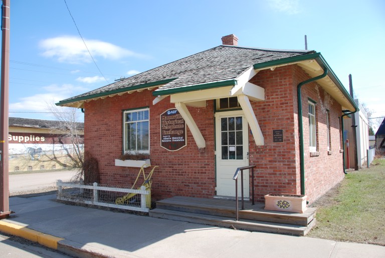

Description of Historic Place: The Alberta Government Telephones Exchange Building in Mannville is a one-storey, brick-clad building with a hipped roof, wide eaves, and exposed rafters. The main part of the building was constructed in 1917. The hipped roof and rear kitchen extension were added in the 1920s and modern bathroom facilities were added in 1954. In 1965, a modern telephone exchange building was constructed behind the 1917 structure. This newer building is not included in the designation. The Alberta Government Telephones Exchange Building occupies the western portion of a subdivided lot on the corner of 50th Street and 51st Avenue in the Village of Mannville’s main commercial district.
Annandale Residence, Lethbridge
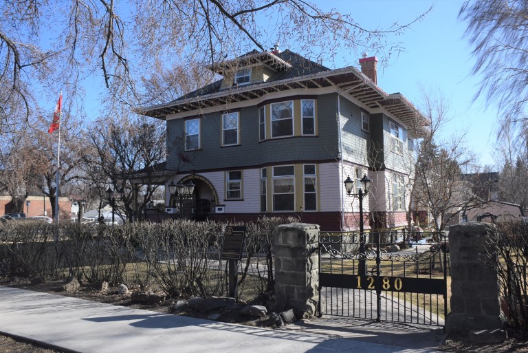
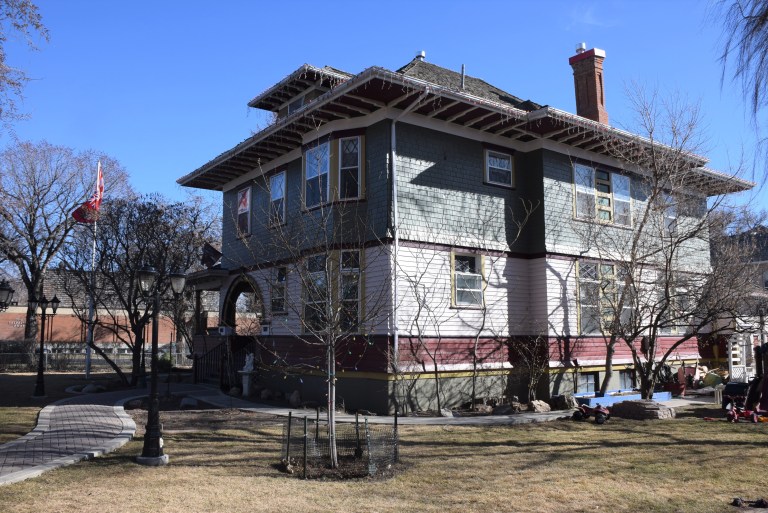
Description of Historic Place: Annandale is a two and one-half storey, wood-frame residence. It is clad in wood siding and shingles and has a hipped roof with north and east facing hipped-roof dormers, two large brick chimneys and a hipped-roofed main entry porch with a recessed entry and half-circle arched openings. The house is situated on a large, landscaped corner lot and is located in the City of Lethbridge at 1280 – 4th Avenue South.
Quarry of the Ancestors, near Fort MacKay
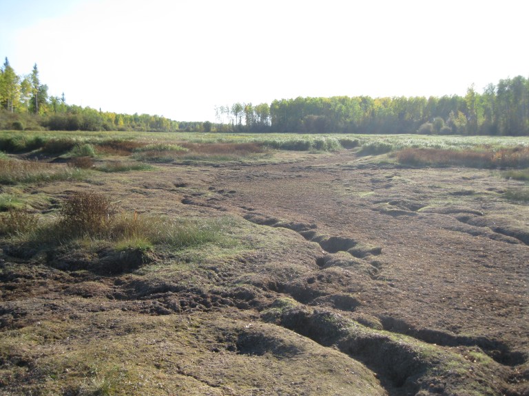
Description of Historic Place: This complex of archaeological sites and natural features is located east of the Athabasca River in the Muskeg River valley, approximately six kilometres northeast of Fort MacKay. It consists of a series of surface and near surface outcrops of bedrock, along with a vast array of associated artifacts representing extraction and processing of Beaver River Silicified Sandstone, the principal tool stone found in archaeological sites throughout Alberta’s Oil Sands region. The site complex includes a series of related habitation and task-specific use locales. The designation area occupies 198.55 hectares and encompasses portions of Sections 27, 28, 33, 34-94-10-W4M. It comprises a number of archaeological sites, including two outcrops of fine-grained Beaver River Silicified Sandstone and associated quarrying and workshop locales, areas of potential for additional deeply buried archaeological deposits, and a portion of the surrounding terrain to maintain a sense of place.
Legislature Building and South Grounds, Edmonton
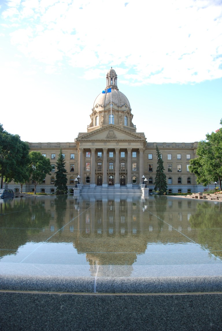

Description of Historic Place: The Alberta Legislature Building in Edmonton was built between 1907 and 1913. It is a monumental, five-storey, steel frame sandstone and granite building designed in the Beaux-Arts style. It is characterized by symmetrical elevations and a high level of ornamentation, notably on the front portico, with its six columns and monumental pediment, and the large, central dome with cupola. The South Grounds comprise an area of approximately nine hectares (20 acres) to the rear of the building and features a large landscaped, public green space with numerous memorials, statues, gardens and walking paths as well as practical, non-public elements, such as the brick power plant building. The Legislature Building and South Grounds are situated between 107th and 109th Street and south of 97th Avenue, near Edmonton’s downtown core, and are prominently located on a bluff above the north bank of the North Saskatchewan River.
The next blog in this series will explain how to write the heritage value section of the Statement of Significance.

3 thoughts on “Municipal Historic Resource designation refresher series: Statements of Significance”