
Written by: Colleen Haukaas, Archaeological Survey
Join the Historic Resources Management Branch as we celebrate GIS Day 2020. GIS, or geographic information science, is a scientific framework for gathering, analyzing and visualizing geographic data to help us make better decisions. At the Historic Resources Management Branch, we have been using GIS since the early 2000s to better understand our historic resources.
GIS at the Historic Resources Management Branch
Alberta is home to tens of thousands of historic resources, and our Branch needs to be able to analyze where those resources are, if there are concerns about the resources, and the best way to address those concerns. At the Branch, we maintain several geospatial databases for our program areas: archaeology, palaeontology, Aboriginal heritage and historic structures. Each database is modified throughout the year as new information is made available (e.g. when new sites are recorded).
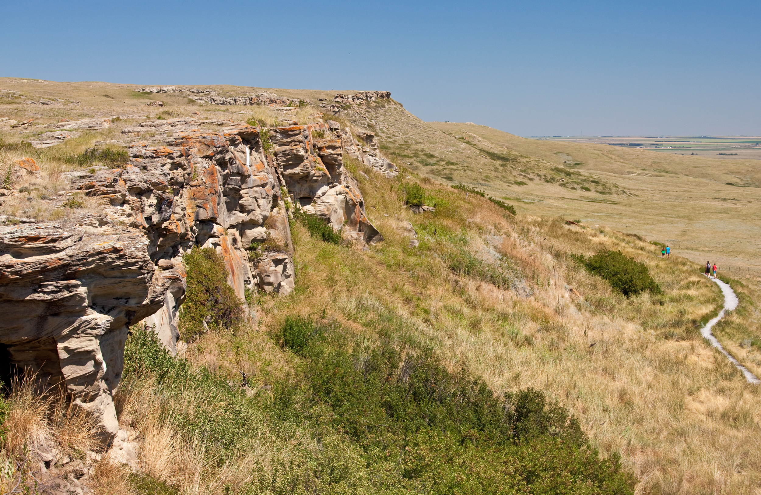
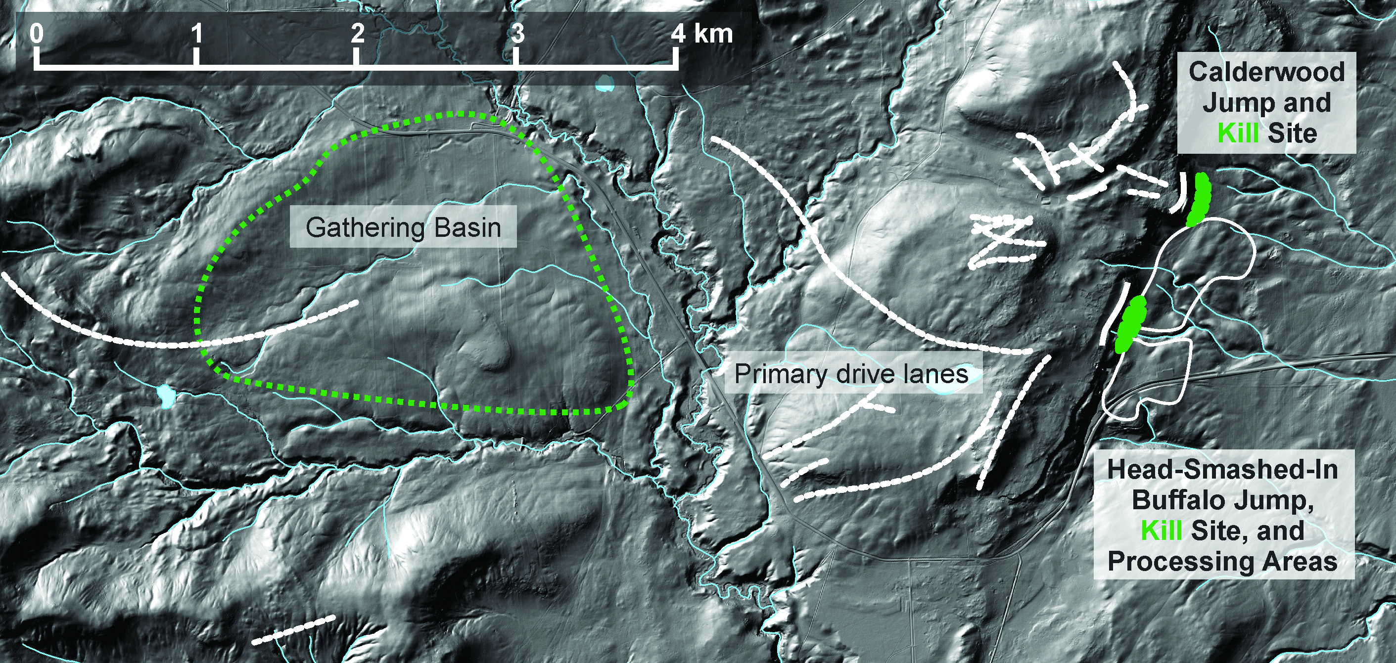
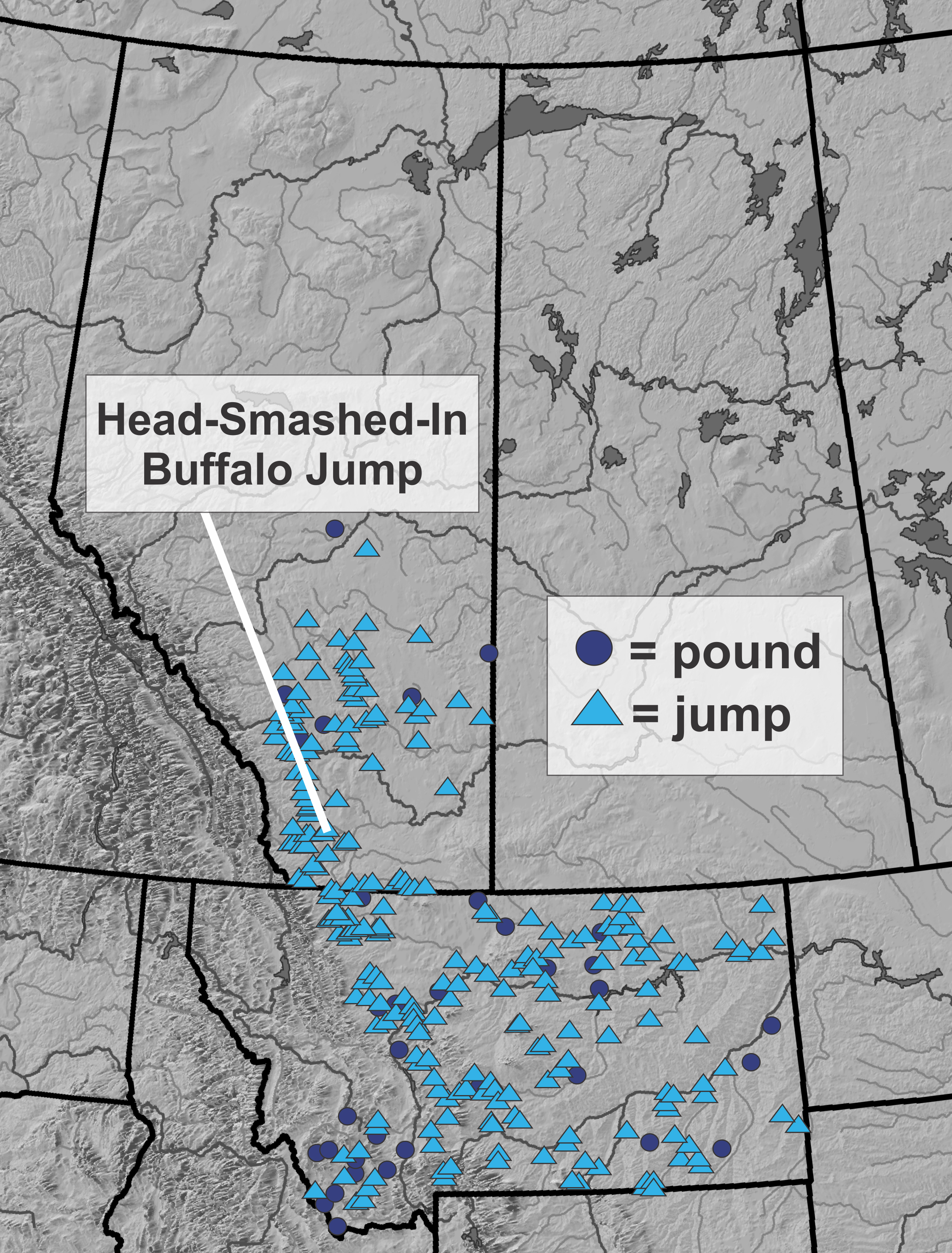
We investigate archaeological sites individually in research, but we also need to understand how sites relate to each other and to broader cultural and natural landscapes. GIS helps archaeologists understand these broader questions. The images below show how we use GIS to understand the broader context of archaeological sites Head-Smashed-In Buffalo Jump and Calderwood Buffalo Jump, courtesy of Todd Kristensen. Archaeologists have investigated the sites through methods such as survey, excavation and artifact analysis. Through GIS, we can then begin to understand the context of the sites within their local topography and see the gathering area, drive lanes and kill areas. We can also see how the sites fit into the broader tradition of bison jumps, pounds, and kill sites on the Great Plains.
The Listing of Historic Resources
Using GIS also lets us communicate historic resources with stakeholders in Alberta. One of our tools for communicating the locations of historic resources has been the Listing of Historic Resources (Listing). This resource identifies lands in Alberta that contain or have a high potential to contain historic resources. Developers, landowners and other stakeholders use the Listing, among other resources, to help determine if a proposed development needs approval under the Historical Resources Act (HRA). The Listing is not an exclusive list of Alberta’s lands with historic potential; as lands with historic resources are identified, they are added to the Listing. We update the Listing twice annually with new lands and remove records as necessary.
Format of the Listing
The Listing includes a list of land parcels their legal land location and their assigned Historic Resource values ranging from 1-5 and categories of concern:
| Value | Definition |
| 1 | designated under the HRA as a Provincial Historic Resource |
| 2 | designated under the HRA as a Registered Historic Resource |
| 3 | contains a significant historic resource that will likely require avoidance |
| 4 | contains a significant historic resource that may require avoidance |
| 5 | high potential to contain a historic resource |
| Category | Definition |
| a | archaeological |
| c | cultural (Aboriginal traditional use |
| gl | geological |
| h | historical |
| n | natural |
| p | palaeontological |
Further information about Listing values and categories is available here and here.
In previous years, the Branch released the Listing in a few formats: an excel table, a PDF, and shapefiles that were available for download for a user’s computer. New in 2020, the Branch developed a web application in order to make the Listing more accessible and user-friendly. Users can query, scroll, draw objects, load their own shapefiles and make their own reports and maps with the Listing in this new application.
The new Listing web application is available at this link. Or by copying and pasting the link below into your browser’s address bar:
https://geoculture.maps.arcgis.com/apps/webappviewer/index.html?id=068e8b3b073d477caffdfcd7a9a52a92
A video walkthrough of the web application and widget tools is available here.

At the time of writing, we are already gearing up for the release of the next Listing of Historic Resources in Spring 2021. The new releases and special developments are announced on our Listing website.

very interesting!