Written by: Colleen Haukaas, Archaeological Survey
Join the Historic Resources Management Branch as we celebrate GIS Day 2020. GIS, or geographic information science, is a scientific framework for gathering, analyzing and visualizing geographic data to help us make better decisions. At the Historic Resources Management Branch, we have been using GIS since the early 2000s to better understand our historic resources.
GIS at the Historic Resources Management Branch
Alberta is home to tens of thousands of historic resources, and our Branch needs to be able to analyze where those resources are, if there are concerns about the resources, and the best way to address those concerns. At the Branch, we maintain several geospatial databases for our program areas: archaeology, palaeontology, Aboriginal heritage and historic structures. Each database is modified throughout the year as new information is made available (e.g. when new sites are recorded).
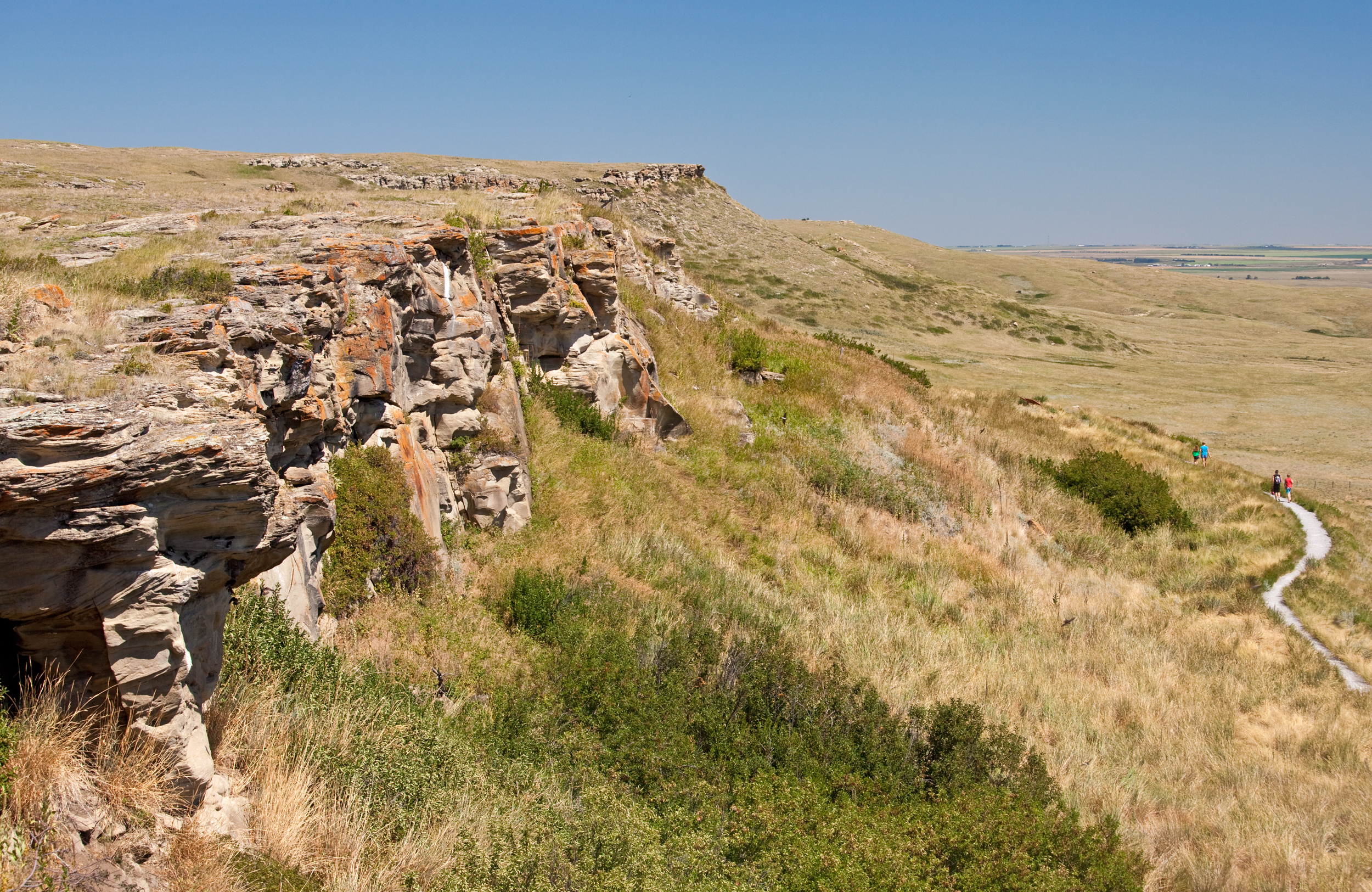
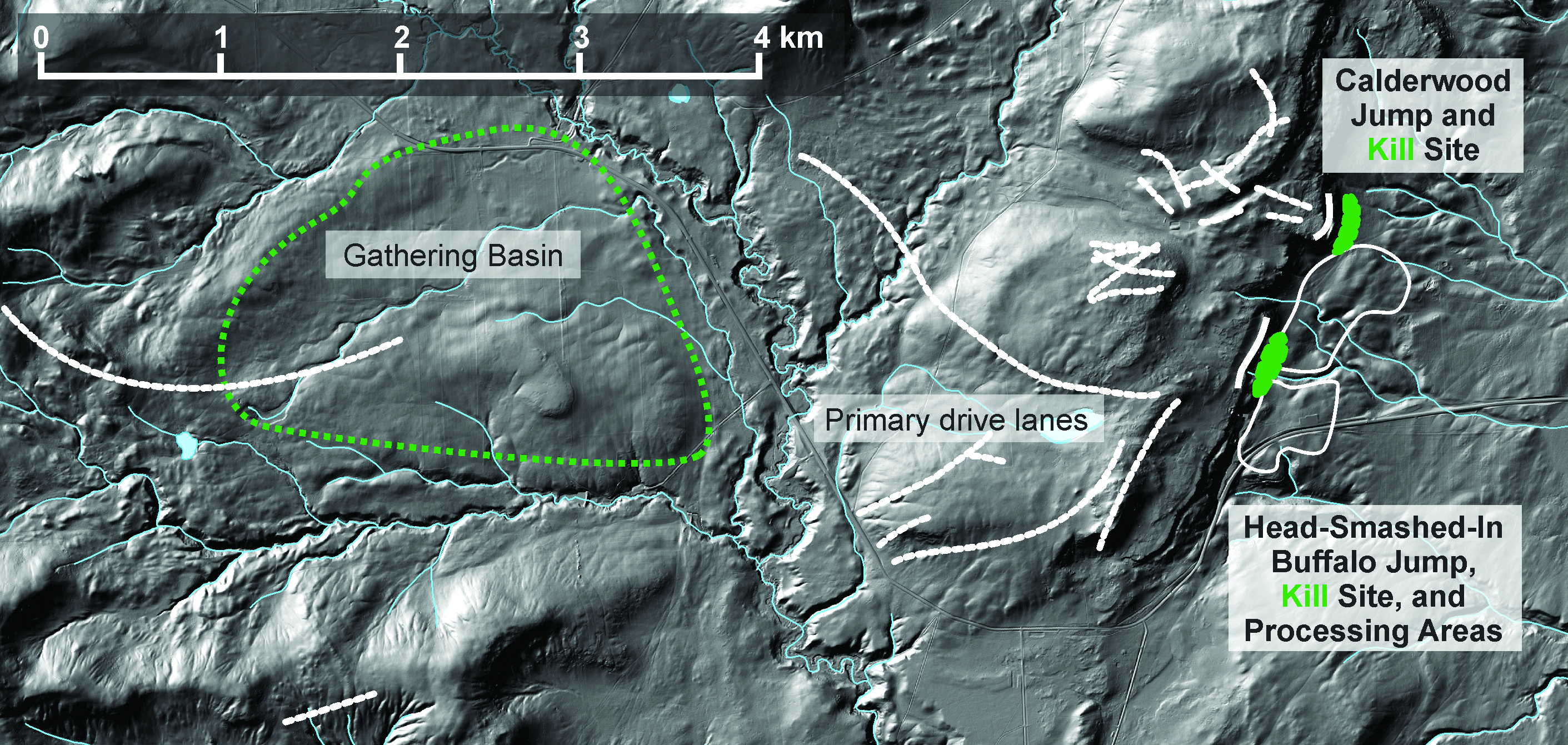
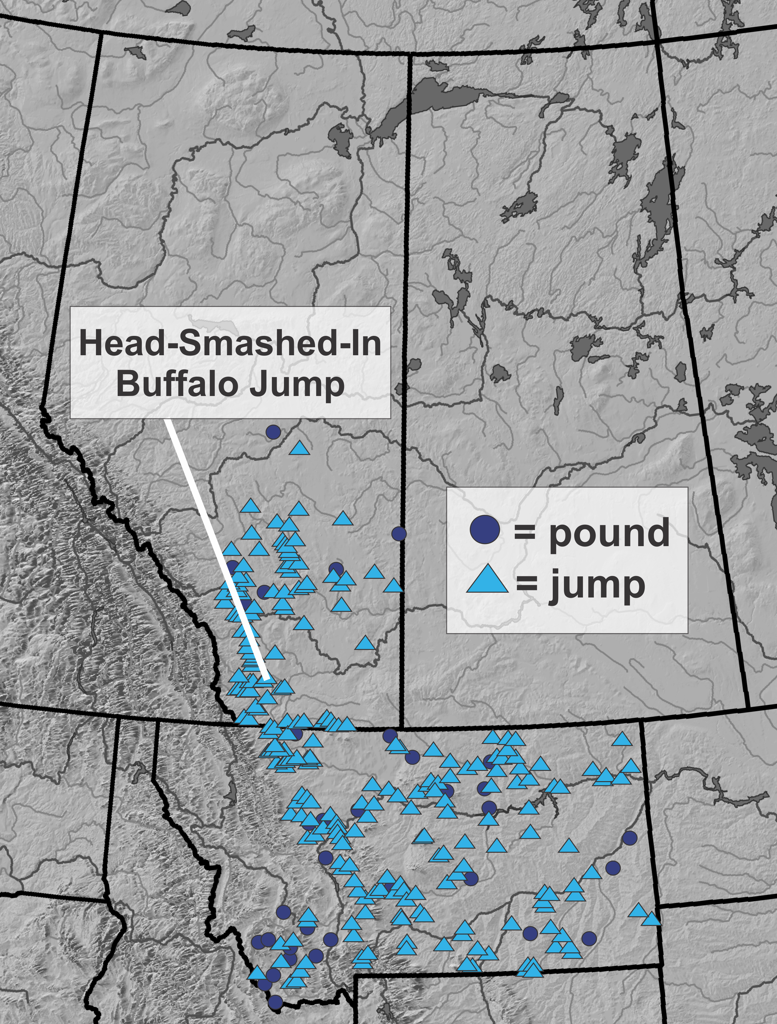
We investigate archaeological sites individually in research, but we also need to understand how sites relate to each other and to broader cultural and natural landscapes. GIS helps archaeologists understand these broader questions. The images below show how we use GIS to understand the broader context of archaeological sites Head-Smashed-In Buffalo Jump and Calderwood Buffalo Jump, courtesy of Todd Kristensen. Archaeologists have investigated the sites through methods such as survey, excavation and artifact analysis. Through GIS, we can then begin to understand the context of the sites within their local topography and see the gathering area, drive lanes and kill areas. We can also see how the sites fit into the broader tradition of bison jumps, pounds, and kill sites on the Great Plains.