Written by: Ron Kelland, Historic Places Research Officer
Recently, some new Municipal Historic Designations have been added to the Alberta Register of Historic Places. These resources are have been deemed by their municipality to be of significant heritage value to their community. Like Provincial Historic Resources, municipally designated properties are protected under the Historical Resources Act and qualify for conservation grants from the Heritage Preservation Partnership Program.
Of the most recent Municipal Historic resources designations added to the Register, three of them are located in the Town of Okotoks.
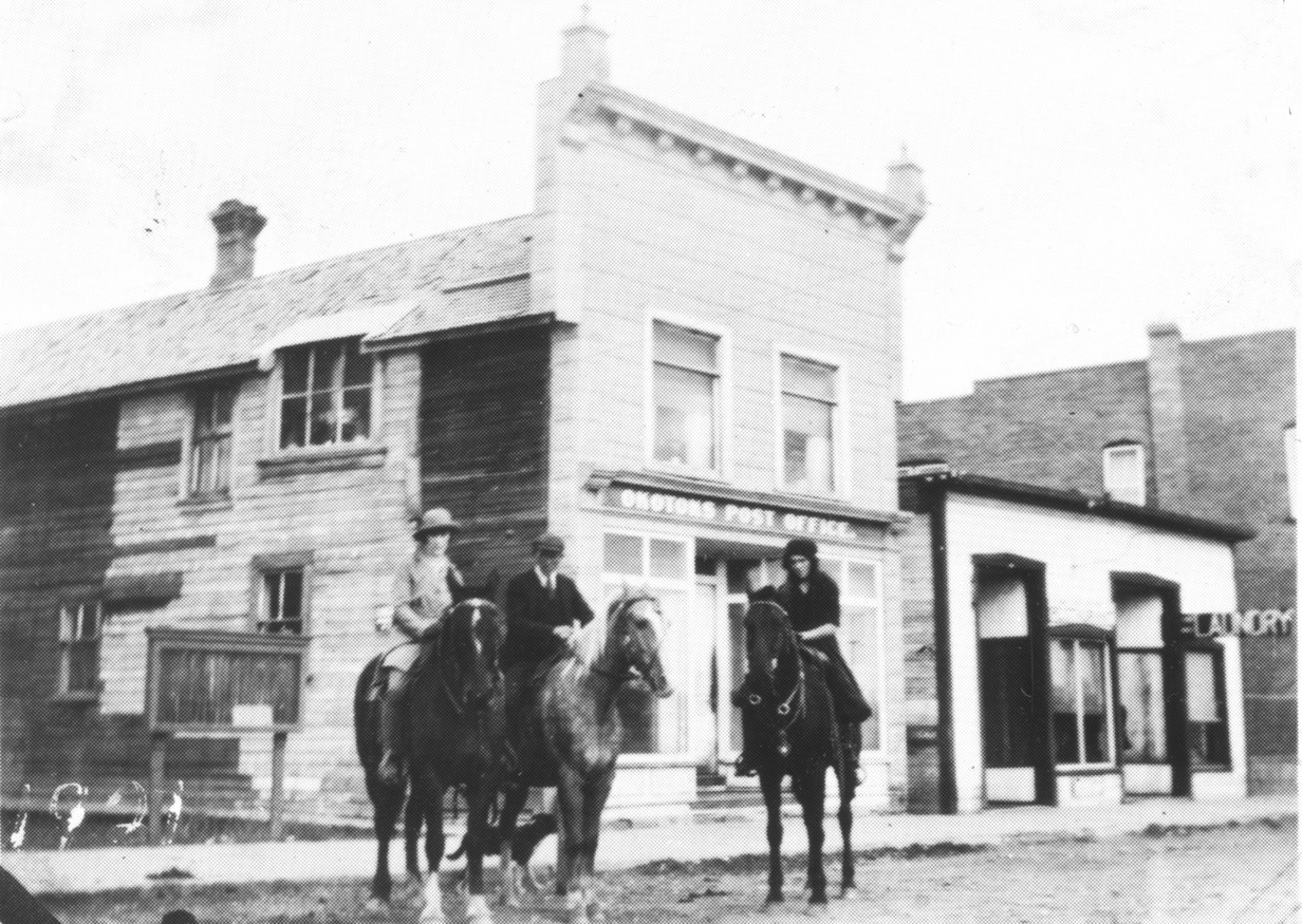
Okotoks Post Office
The Okotoks Post Office is a two-storey wood frame building with a boom town façade and is clad in pressed metal siding resembling a stone pattern. It is centrally located in Okotoks on North Railway Street (formerly Macleod Trail). The post office building is amongst the town’s earliest buildings and was a focal point of the community, being located across from the Canadian pacific Railway station. The building was constructed in 1890 by Herbert Bowen, a local general merchant and post master for the community. When John Paterson bought the store in 1892, he also became the postmaster. The building was the site of the post office from 1891 to 1900, and again from 1907 to 1937. The heritage value of the Okotoks Post Office is due to its association with the town’s early development, being an anchor business and service that the community would grow around. It is also significant for its association with George Paterson, son of John Paterson, who continued in his father’s role of merchant and postmaster and was a noted community member, serving as school board trustee and mayor and belonged to numerous community organizations. The building is also architecturally significant as a representation of an early-twentieth century commercial establishment.

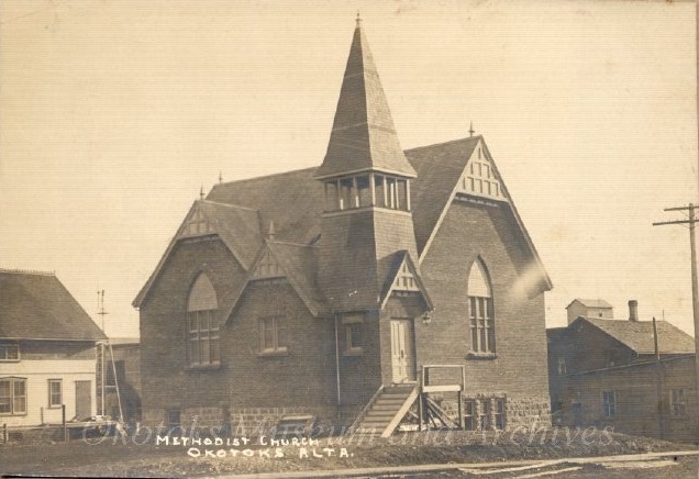
Okotoks United Church
Located Elma Street East in Okotoks, the Okotoks United Church, built in 1906 during a noted boom period in the community. It is a brick and sandstone building with faux wattle and daub details on the bell tower and gable ends. It has heritage value for its association with a significant event in the ecclesiastical history of the Town of Okotoks. In 1917, Okotoks’s Methodist and Presbyterian communities united to form a single congregation. As his church was the newest and largest of the two, it became the home of the new, united congregation. This union of churches in Okotoks was a significant development as it occurred eight years before Methodist, Presbyterian and Congregationalist parishes across Canada joined to form the United Church of Canada.

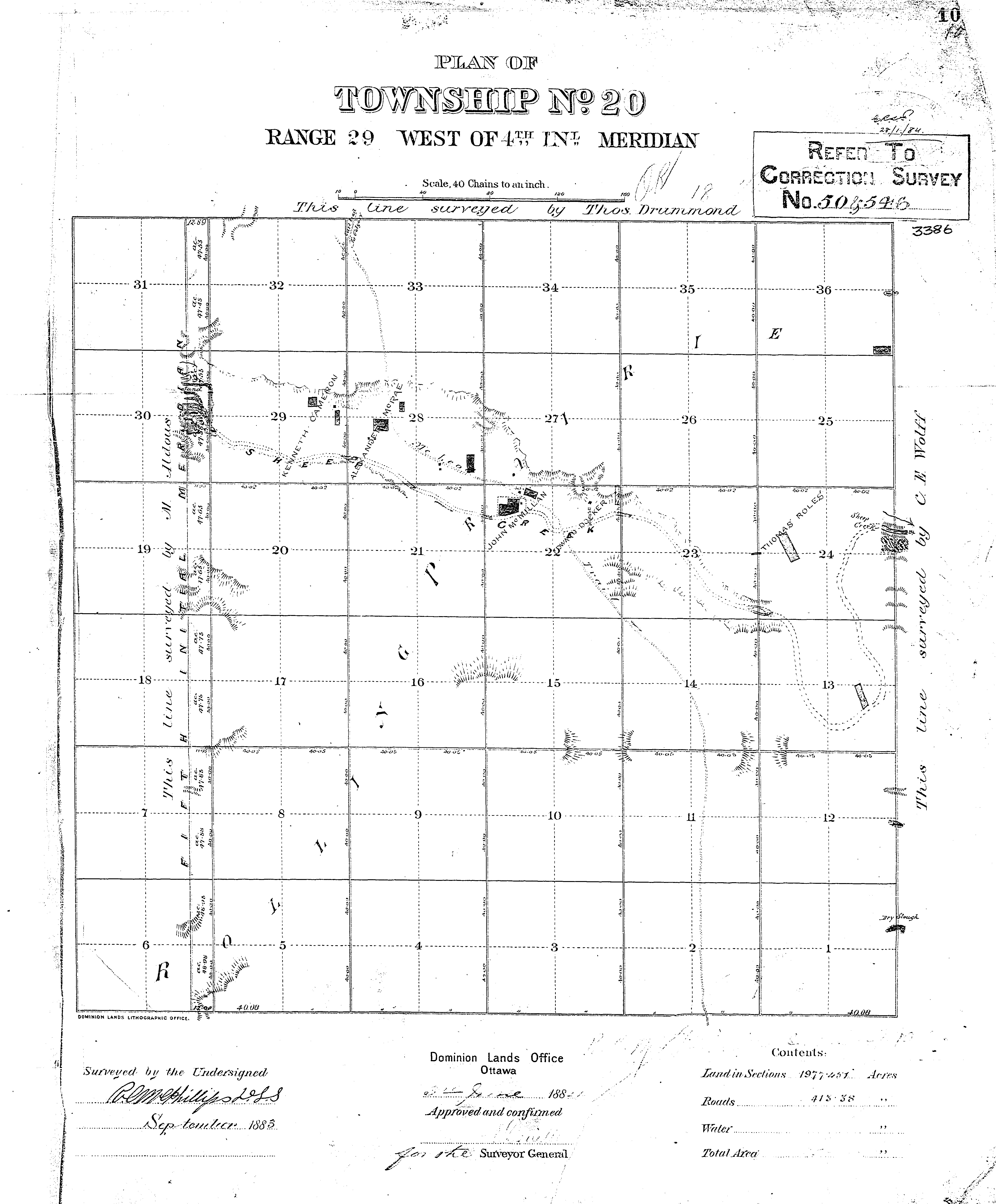
Macleod Trail Cultural Landscape
The Macleod Trail Cultural Landscape is an undeveloped piece of land located just north of Downtown Okotoks, generally bounded by Crescent Road and Mountain Street to the south and north. Previously known as Lineham Park, the area consist of hills covered in natural vegetation and a well-trodden pathway that runs through a prominent gully, crossing the area from the southeast to the northwest. The trail is believed to be a surviving remnant of the Macleod-Calgary Trail, a historically significant trail and wagon route that connected Fort Benton in the Montana Territory to Fort Macleod, Fort Calgary and Fort Edmonton. At certain points along the trail, camps and stopping houses were established where travelers could spend the night. Of these, the stopping houses run by John MacMillan and Kenneth Cameron developed into the Okotoks townsite. Traditional knowledge and documented history indicates that the route followed by the Macleod-Calgary trail was a crucial transportation corridor from ancient times, through to the contact and settlement period before falling out of use following the relocation of western Canada’s Indigenous people to reserves and the construction of the railway. The area is significant as a rare remaining portion of the Macleod-Calgary Trail and as a site with a strong likelihood of possessing archaeological resources.