Preserving the Past at Writing-on-Stone

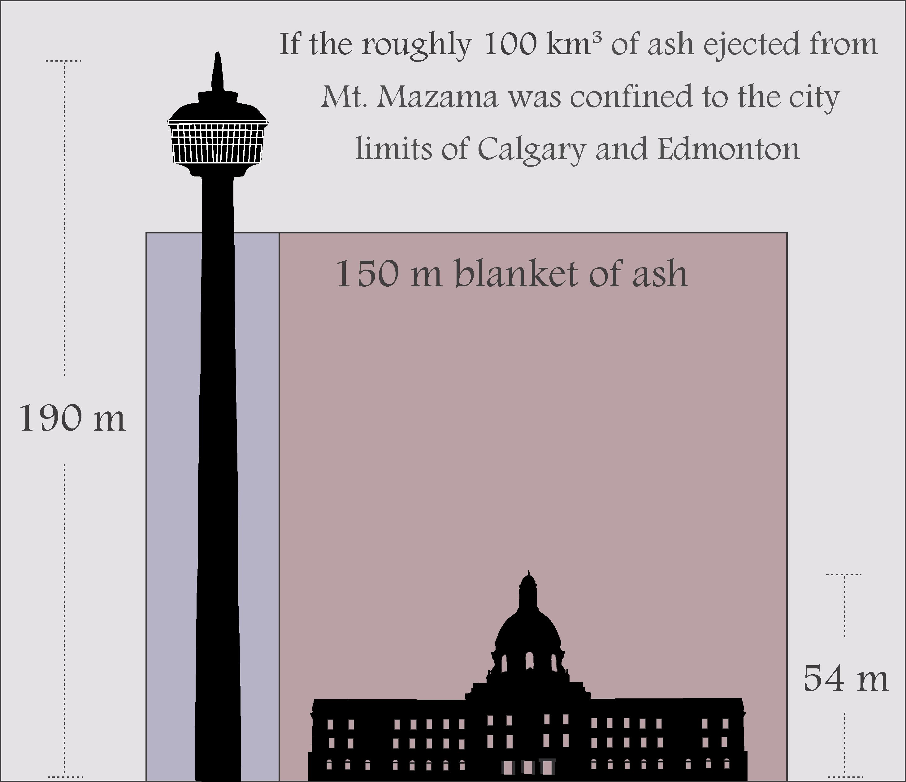
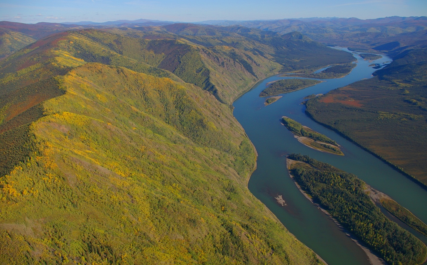
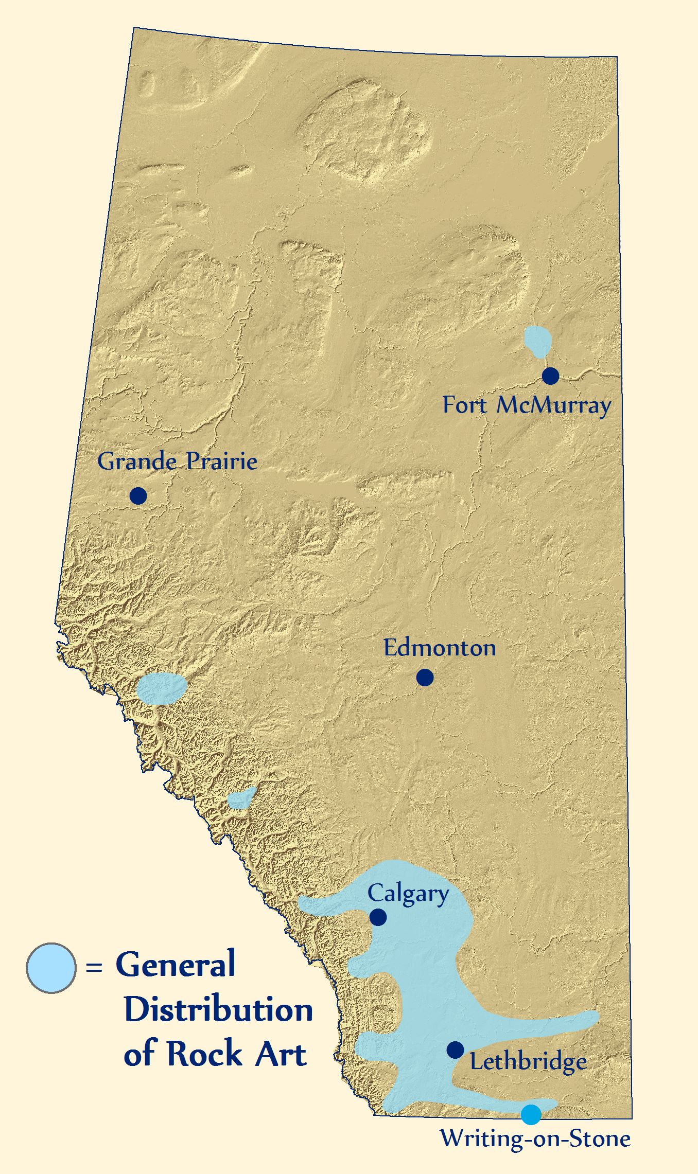
Writing-on-Stone Provincial Park is nestled into the winding valleys and coulees along Milk River in Southern Alberta. Painted and carved on its fragile sandstone walls are one of the largest collections of rock art in North America. Appropriately named, Writing-on-Stone is a rocky canvas of ancient and historic art that spans many centuries.

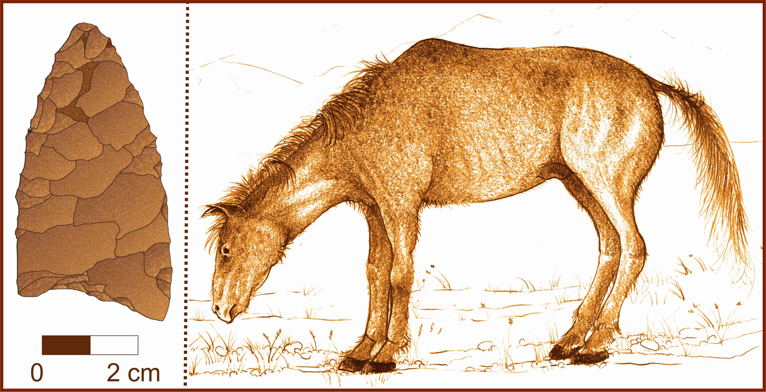
To increase awareness of this unique piece of the past and to encourage the preservation of sensitive historic resources, a collaborative team of the Historic Resources Management Branch, the Royal Alberta Museum, and the University of Alberta initiated the Heritage Art Series project. The goal is to create artwork, like the piece depicted above, that captivates the public in order to encourage the appreciation and protection of Alberta’s past.

Rock Art in Alberta

Alberta’s rock art includes pictographs (paintings), petroglyphs (engravings), carved boulders, and effigies (rocks arranged to form shapes). Art that was applied to rock walls has a variety of functions and there are six major types in Alberta.

Rock Art Map
This map depicts the general extent of recorded First Nations rock art in Alberta.


‘En Toto Pecked’ involves figures that were entirely pecked out of the rock wall and this tradition of art appears in Alberta from 2500-1500 years ago. It is thought to have originated in Wyoming.

‘Vertical Series’ may be a type of rock art that acted as a communication system that related events and actors. It may be ideographic (like Egyptian hieroglyphs) with name glyphs like the Mayans of Central America.

‘Columbia Plateau’ refers to vision quest or hunting ritual art thought to be made by people originally from interior B.C. This style of rock art ranges from a few hundred to several thousand years old.

‘Foothills Abstract’ is a rock art style that consists of enigmatic shapes and motifs that may be the work of religious figures. Subjects include handprints, animals (and their tracks), and stylized humans.

‘Plains Biographical’ refers to rock art that documents events, important figures, or tallies of things acquired/exchanged by the Blackfoot and their ancestors.

Lastly, ‘Plains Ceremonial’ refers to spiritually important rock art that is still of great significance to modern Blackfoot Nations. Out of respect for the power of these and other rock art images to modern First Nations, photographs of the various styles of rock art are not included here.

The Milk River Valley Through Time

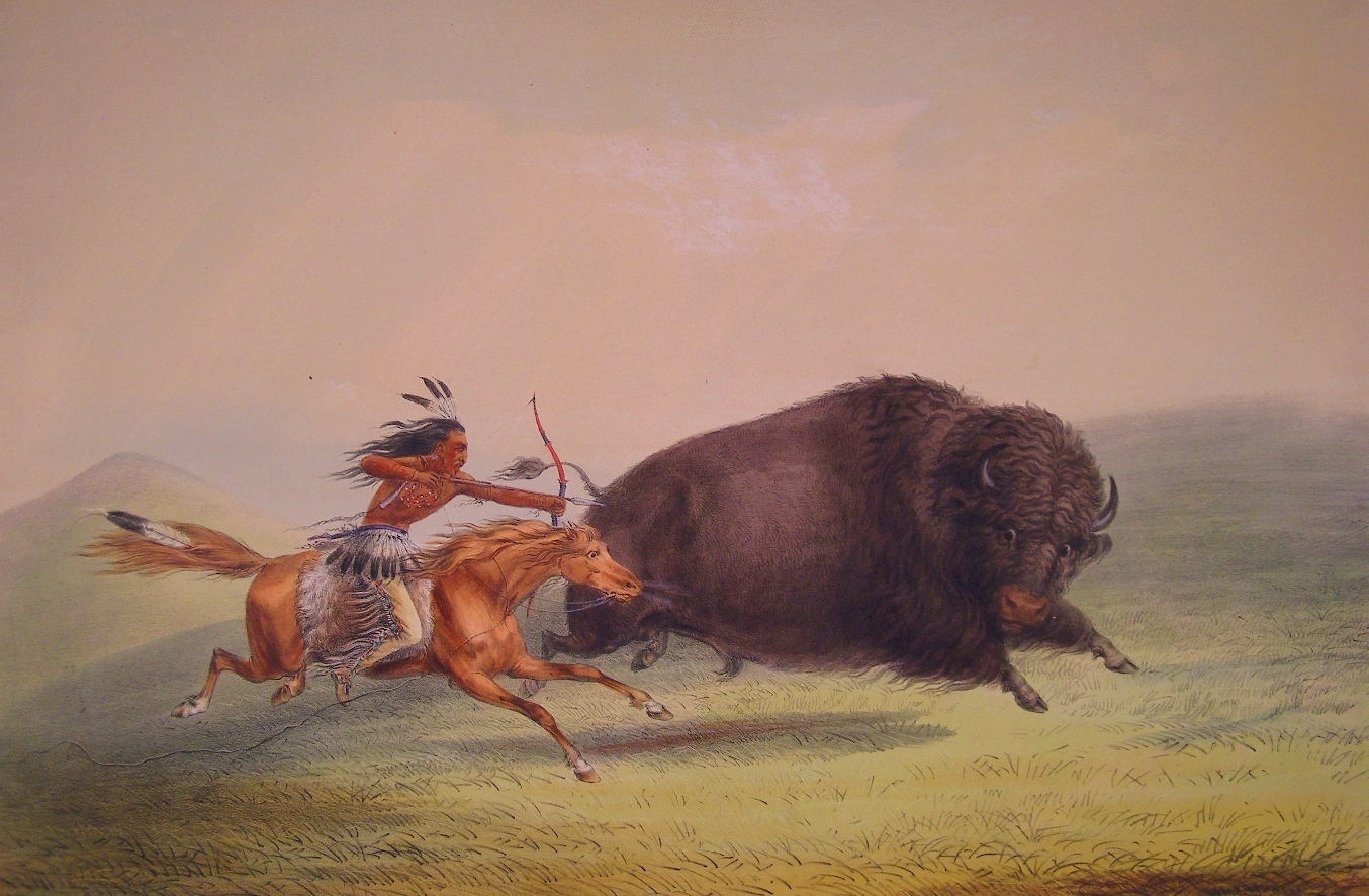
First Nations pursued buffalo herds in the Milk River region and view the valley as a sacred place where stories and dreams were recorded on the rock walls. The earliest Europeans included a mix of traders, coal miners, and Northwest Mounted Police, the early history of which is still recorded in modern place names.

Milk River valley map


Milk River Valley photograph

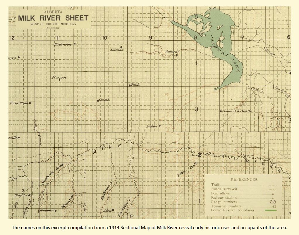
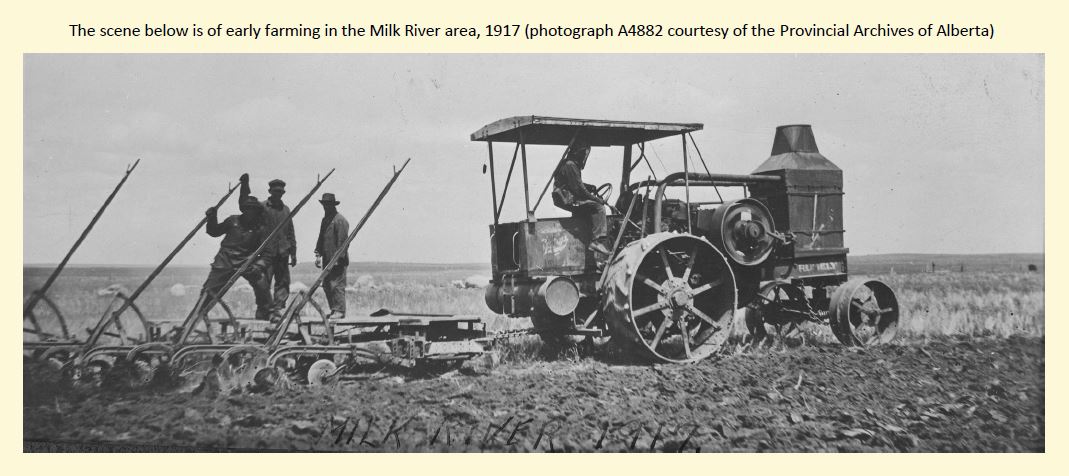
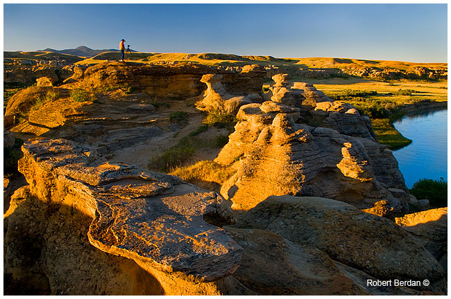
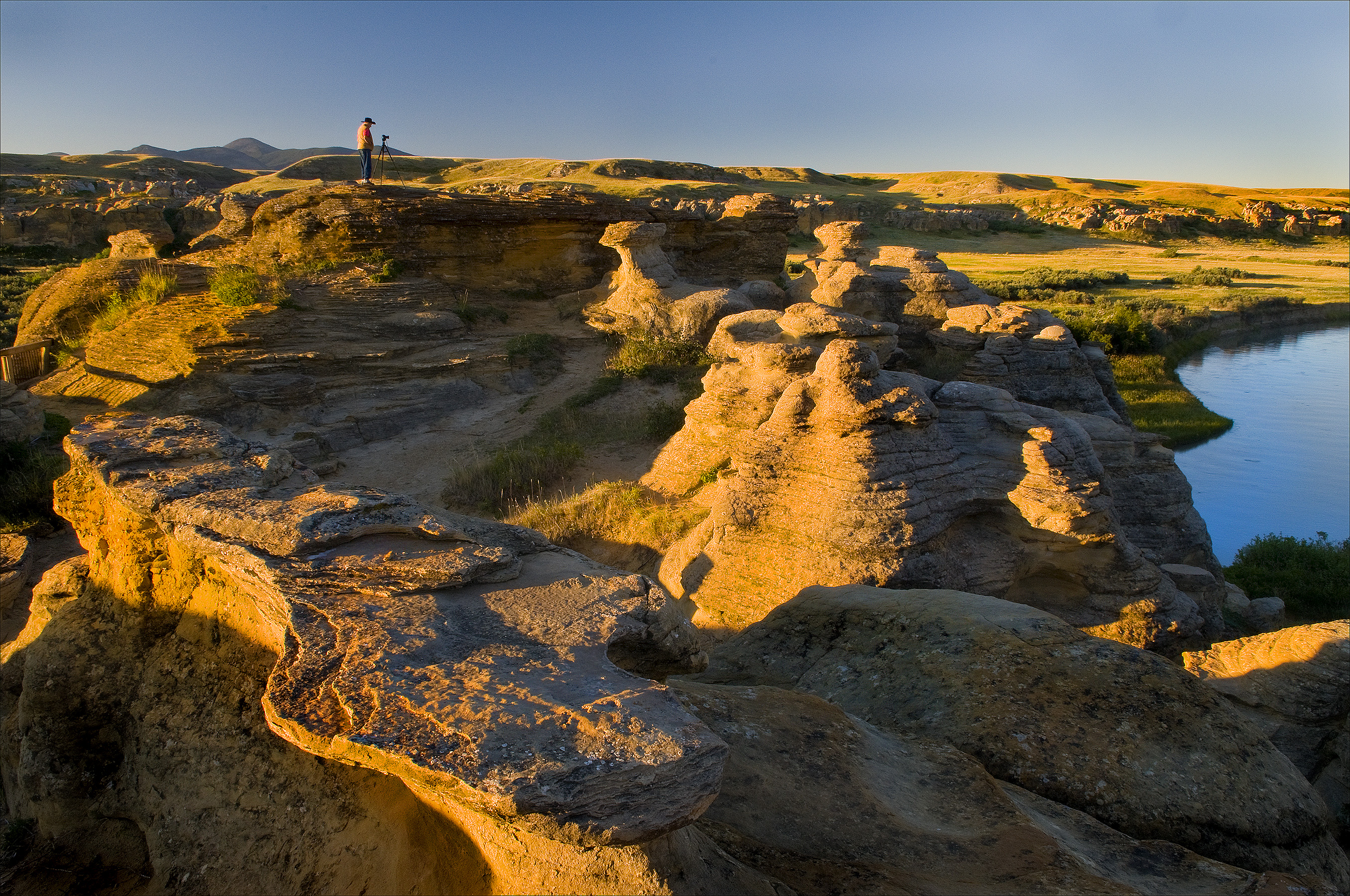
Cattle quickly replaced a vacancy left when buffalo were eliminated in the late 1800s. In addition to ranchers, new irrigation techniques and canals opened up the area to more intensive cultivation. Modern users of the Milk River landscape include farmers, Kainai First Nations, oil and gas operators, ranchers, and people in the tourism industry associated with Writing-on-Stone Provincial Park and National Historic Site (the photograph below is of the morning light on the park’s sandstone hoodoos, courtesy of Robert Berdan). Just as the uses of the Milk River region have changed in the past, they will continue to evolve in the future.

Writing-on-Stone photograph

The above painting by Anne McCartney is a textured narrative of landscape change in the Milk River Valley. The background is from an aerial photograph showing irrigated fields creeping to the valley’s edge. At lower right is a looming sandstone cliff that has witnessed a steady flow of First Nations, traders, miners, explorers, and farmers passing through the valley. In the upper left is a rock art panel depicting a battle scene from the deep past. Recent vandalism of that very panel highlights the need to protect and appreciate the landscape of Writing-on-Stone.

Protecting Rock Art Landscapes

The evocative and significant collection of art at Writing-on-Stone is under constant threat. Sadly, vandalism and graffiti have defaced some of the park’s art but through education and restricted access, much of the vandalism has now been curtailed. Instilling visitors with a healthy respect for the spiritual importance of the area to the modern Blackfoot will help ensure that the landscape is protected. Natural erosion, however, is unstoppable.

Much rock art has disappeared over the centuries from weathering of soft sandstone. New technologies are helping to better document the art and may lead to long term methods that slow rates of erosion. The park has been a key site in North America for experimentation with techniques to protect rock art.

Laser scanner
Archaeologists use laser scanners to accurately record rock art panels.

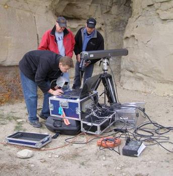
Portable laser scanners have been used to record high-quality images and to produce near-perfect replicas. Artificial drip-lines and plastic caps are diverting water from some exposed panels and a consolidant has been applied in experimental non-rock art locations to test the ability to strengthen rock and prolong the life of rock art images. Note that none of the preservation measures will be applied directly to ancient images without thorough review and cooperation with the Blackfoot people. Rock art left in its natural setting will eventually be lost, but there is much that can be done to enable a prolonged period of appreciation and enjoyment from viewing the hopes and dreams of early artists.

Written by: Todd Kristensen, Northern Archaeologist, and Jack Brink, Royal Alberta Museum

Early Cabins in the West

Cabins performed a variety of functions in Alberta’s past from homesteading to hunting and post offices to ranger cabins. Many events and daily challenges that defined our province unfolded on the wooden floors of early cabins. Just like the characters they housed, each cabin’s architecture and associated artifacts are unique.

Cabin and tobacco tin

To encourage an appreciation of cabins and the surviving record of them, as well as other historic resources in the province, a collaborative team from the Historic Resources Management Branch, the University of Alberta, and the Royal Alberta Museum initiated the Heritage Art Series. The goal is to create artworks that depict scenes from Alberta’s past that captivate public audiences. We hope that these artworks, like the cabin painting above, stimulate an interest in learning about our province’s heritage, which will in turn instill a greater respect for the past.

Cabins were typically made of raw timbers with a variety of corner joints, roofs, sawn floorboards, and chimneys. Associated features include outhouses, garbage pits, ice houses (for storing food), cellars, and drying racks. What can the archaeological record tell us about cabins and their occupants? Maps of cabins and associated structures reveal how people utilized landscapes and interacted with each other within cabins. Our modern homes are often relatively large with multiple rooms and levels, which is drastically different from the single-room cabins that many Albertans spent their lives in. An historical perspective informs us that changes in domestic architecture have had a real impact on the way Alberta’s families interact with each other and with their neighbours.

Cabin map

Cabins are often associated with historic trails that influenced how regions were settled and how goods were transported across the country. Cabin modifications over time tell stories of trial-and-error adaptations to new landscapes while artifacts can indicate the types of activities conducted around cabins, cultural affinities, number of occupants, and the season of occupation. Outhouses and garbage pits can reveal past diets, wealth, access to luxury goods, hygiene, medical conditions, and entertainment.

Cabin and bottle

Aside from cabins’ phsycial make-up and artifact assemblages, they are significant heritage resources because they were often the first permanent structures to appear on many of Alberta’s landscapes. They represent a new adaptation and a new way of life for the people who first built them. There are over 550 recorded archaeological sites in Alberta with cabin components. Over 115 of these sites also have a pre-contact First Nations component, which suggests that many of the good spots for cabins have always been good places to make a living on the land.

Homestead photograph

The painting at the top of this article by Gregg Johnson is of a trapper’s cabin in the autumn foothills. It captures the solitude of the trapper’s life. Autumn was a busy time as trapper’s geared up for winter. Supplies were brought in, trap lines were re-established, and wood was cut for the long winter ahead. Like many of Alberta’s industries, modern trapping has an interesting past and an informative historic record. Archaeology offers a unique opportunity to learn about the past lives of people who may not be represented in historical accounts. In this sense, the study of historic resources gives a voice to people who have not been given the chance to speak for hundreds of years.

Miners cabin

An example of a current research project about cabins that will illuminate the past record of a poorly understood group of people is that by Dr. Kisha Supernant at Buffalo Lake. Dr. Supernant and her research team from the University of Alberta are studying the adaptations of Metis and First Nations people who occupied Buffalo Lake in the 1800s in order to acquire meat that supplied neighbouring trade posts like Fort Edmonton. Her excavations and mapping program will uncover an important way of life that helped shape our province.

Mapping crew
Dr. Supernant and a graduate student use GPS equipment to map archaeological features.

The next blog of the Heritage Art Series will be about the changing landscape and rock art of Writing-on-Stone Provincial Park.

Written by: Todd Kristensen, Northern Archaeologist, and Dr. Kisha Supernant, University of Alberta

Ancient and Early Historic Fishing in the North

In the boreal forest, where big game animals were often hard to find, fish were a life-saving staple for thousands of years. Archaeological and historical records reveal a wide variety of fascinating angling techniques used by Alberta’s First Nations.

Figure 9. Fishing techniques edit


To increase awareness of these practices and other elements of Alberta’s past, a collaborative team of the Historic Resources Management Branch, the Royal Alberta Museum, and the University of Alberta initiated the Heritage Art Series project. The goal is to create artwork that captivates the public in order to encourage the appreciation and protection of Alberta’s past.

The second painting in the series is a symbolic depiction of a mother teaching her daughter about the relationship between people and fish. First Nations survived in Alberta by passing down immense amounts of knowledge, which this image by Jenny Keith illustrates. The artwork also celebrates the role that women make to traditional diets. Fishng was primarily a women’s task in Northern Alberta. Women needed to know where to catch fish, how to make nets, how often to check them, and when to repair them.

The largest catch of fish was traditionally by gill net during fall spawning runs of whitefish. Whitefish were particularly important because they are high in fat, which becomes scarce in the north during long winters. Gill nets are long rows of interconnected squares that capture fish by the gills. What were nets made of before twine? Amazingly, women spent hundreds of hours weaving twisted willow bark or animal sinew into long nets.

Figure 10. Net IMG_1047
This is an example of a willow bark net from the Royal Alberta Museum.

Gill nets were set across rivers or narrow channels during warmer months or were strung through holes under the ice in winter. Large fish were also shot with bow and arrow or were speared by canoe. Some First Nations made fishing arrowheads out of pike jaw bones: nothing catches fish better than fish! Jigging with hooks made of bone and wood was also done, primarily in winter. Hooks were baited with meat scraps, hair, feathers, and beaver oil.

Fishing increased in importance when Europeans arrived. Fur traders in Northern Alberta made a living on pelts but they lived on fish. At Fort Chipewyan in Northeast Alberta, traders caught 33 000 fish from October to January in 1822. The ration was four fish a day (and a potatoe if they were lucky). Some northern trade posts even had to be relocated because they lacked good access to fisheries.

The archaeological record of fishing is sparse because fishing tools are often organic while fish bones tend to be fragile: very little of this survives in Alberta’s acidic soils. Some interesting fish-related fnds include possible stone fish hooks, bone prongs used on fish spears, sinkers (weights) that weighed down nets, and fish vertebrae that were drilled to make beads.


Artifact compilation
This is a collection of pre-contact fish-related artifacts from Alberta that span several thousand years.

Recently developed scientific techniques have also enabled the recovery of fish blood from the edges of stone tools like arrowheads and knives. Even though fish bones don’t survive, archaeologists studying blood residue have been able to determine that fish like pike, walleye, and whitefish were caught thousands of years ago. Lastly, fur trade forts have yielded an interesting array of early hooks. Some are entirely metal while others, like the example below, are a combination of bone and iron.

Figure 4. Fish hook
This fur trade fish hook was found by Jack McIntosh at Dunvegan near Grande Prairie.

When asked to imagine ancient life and food harvesting practices, people often think of men stalking mammoths or stampeding buffalo over cliffs. In reality, for much of Alberta’s human history, women have made just as important if not more important contributions to traditional diets. The painting above is intended to broaden perspectives of hunting and fishing practices while emphasizing the social dimension of food harvesting. People didn’t just survive by capturing food; they persisted for thousands of years by acquiring generations of knowledge that was passed down from parent to child year after year after year.

Stay tuned for the next installation of the Heritage Art Series, which will present the physical record of cabins and their significance in Alberta’s early history.

Written by: Todd Kristensen, Northern Archaeologist, and Dr. Jack Ives.

Ecological Catastrophes in Alberta’s Past: The Mazama Volcanic Eruption

Did you know that one of the largest ecological catastrophes in Alberta’s human history was a volcanic ash fall? Around 7600 years ago the skies were blackened for many days and the prairies of Alberta were blanketed with roughly 15 cm of ash ejected during the Mazama eruption.

To create awareness of this event and other important moments in Alberta’s past, a team from the Historic Resources Management Branch, the University of Alberta, and the Royal Alberta Museum initiated a project called the Heritage Art Series.  The goal is to captivate public audiences with artwork that creatively explores ancient landscapes, relationships between people and their surroundings, and the enduring physical record of human activities. We hope the series inspires a desire to learn more about our province’s heritage and that a greater awareness of the past will instill a deeper respect for it. We’ll release the first four paintings in the series over the coming weeks with explanations about the significant events and figures that each scene depicts.

The first painting (above) by Karen Bishop captures a surreal landscape of Southern Alberta as it would have looked 7600 years ago during the Mazama volcanic eruption. While the volcano that erupted was in Oregon (at modern day Crater Lake), it only took about 12 hours for some of the estimated 100 km³ of ash to reach Alberta. The ash smothered plants, contaminated fresh water, and would have filled animals’ lungs. Airborne particles would have caused intense lightning storms. Huge swaths of dead vegetation combined with frequent lightning led to widespread fires.

Mazama ash distribution and depth diagram
This map shows the spread of Mazama ash into Alberta. The inset depicts the depth of Mazama ash relative to people and dogs.
Ash depth comparison
This figure depicts how deeply Edmonton and Calgary would be buried if all of the ash from the Mazama eruption were confined to the city limits.

By studying micro-organisms and microscopic silica particles in soils and lake beds, scientists, including a team of ‘tephrochronologists’ led by Dr. Duane Froese from the University of Alberta, are learning more about the ecological impact and timing of volcanic eruptions in Western Canada. Climatic systems were altered by the relatively dense ash ejected into the atmosphere, the pH of soils and water bodies changed, and mobile animals like bison likely abandoned their territories for lack of fodder and/or drinking water. However, while the impact was widespread, preserved pollen suggests that plant communities rebounded rapidly. Overall, landscapes may have recovered fairly quickly from volcanic eruptions (on the scale of 2-10 years), but the effect on human populations was likely more pronounced.

Diatoms

Silica particles for blog

The archaeological record reveals that portions of the province were abandoned for several decades and possibly much longer. Notable changes in weapons and raw materials that were used for stone tools around the time of the Mazama eruption may be linked to this ecological catastrophe; the people that returned to once-vacated landscapes were either different from their predecessors or they arrived with new ideas acquired from their neighbours. This, and other large-scale eruptions in North America over the past 10 000 years, changed the direction of local human histories. New cultures, technologies, and social networks emerged after volcanic events.

Projectile points in Alberta

Despite the dramatic nature of volcanic eruptions, few people realize that Alberta has experienced them in the past and that other ecological catastrophes have influenced the development of Alberta’s past cultures. Palaeoenvironmental scientists and archaeologists have learned a great deal about past ecological events that, while educational, have more profound implications for the way we manage ecosystems and respond to the world around us. By studying the past, we can learn how to brace for the future.

To learn more about the Mazama eruption and other palaeoenvironmental studies in Alberta, visit some of Dr. Alwynne Beaudoin’s research at the Royal Alberta Museum.

Stay tuned for the next installation of the Heritage Art Series, which will discuss the archaeological and historical records of First Nations fishing in Northern Alberta.

Written by: Todd Kristensen, Northern Archaeologist & Alwynne Beaudoin, Royal Alberta Museum.

Plane Wrecks, Aviation Archaeology and Northern Heritage

This post continues our look at the work of Alberta’s Archaeological Survey. An expanded version of this article can be found in the Fall 2013 issue of the Canadian Aviation Historical Society Journal.

Plane wrecks are unique and dramatic physical records of human movement. We document here the archaeology and history of a 1952 B-17 plane crash to help illustrate the deep and fascinating roots of northern aviation. We reconstructed mission details from accident reports and discovered interesting connections to the famous Northwest Staging Route, which was a significant transportation network that spanned Alberta.

Scale of the SB-17G and the 8 crew members on the ill-fated 1952 flight (diagram T. Kristensen).

On July 11, 1952, a modified B-17 (an SB-17G) set out from Alaska on a search mission in the Yukon to locate a crashed Royal Canadian Air Force plane that had disappeared in June. The B-17 was originally a Second World War era high altitude bomber, legendary for the damage it could endure in combat. Its durability, combined with the availability of surplus aircraft after the war, meant that B-17s were used for many post-war activities including weather survey, forest firefighting, and search and rescue.

Mountainous terrain in which the SB-17G met its untimely fate (photo T. Kristensen).

Eight crew members of the United States Air Force 10th Air Rescue Squadron were aboard the SB-17G as it entered a small mountain valley. The navigator was unfamiliar with local topography and 15 seconds into the valley, the crew began adjusting power in an attempt to avoid a fast approaching valley wall. Because of its original purpose in high altitude flight, the SB-17G was not particularly maneuverable and couldn’t recover from its predicament. Stalling within meters of the ground, the left wing struck an alpine slope sending the aircraft into an arching skid path that tore through birch trees and bedrock cobbles for several hundred meters before coming to rest. The wreck was quickly consumed by flames. Five men evacuated immediately but the remaining three caught fire in their frantic attempts to depart. An heroic lieutenant escaped the wreck and pulled one man to safety while another emerged from the wreck engulfed in flames. Although he was immediately doused, the airman couldn’t recover from severe burns and died six hours later. The crew spent a somber night in the cold mountains before being rescued the next day.

Northwest Staging Route in Canada and Alaska. Yukon Archives. Department of Defence Collection, 91/37 #51, PHO 419.

The story of the SB-17G crash represents a small but significant piece of aviation history. Northern aviation assumed an international importance with the growth of the Northwest Staging Route in the 1930s. The Canadian portion began in Edmonton and linked a series of northern airstrips up to Alaska and Russia. Like Edmonton, most towns along the route were initially First Nations gathering spots that developed into fur trade posts when traders arrived. They eventually grew into agricultural, mining, forestry, or oil and gas centres. The Alaska Highway was built to connect these centres to help protect North America from a potential Pacific attack. After the war, the Northwest Staging Route remained important for military exercises (which drew the SB-17G to the Yukon) and as a transportation route to other international conflicts.

Reconstructed flight path of the SB-17G to its final resting spot (photo T. Kristensen).

Given their experience on the land, First Nations people were hired as guides to help survey the Alaska Highway before construction. Consequently, much of the highway followed First Nations trails that existed for millennia. Other portions followed Gold Rush trails that started to criss-cross the north in the late 1800s. This synopsis illustrates how modern transportation systems in the north have deep histories. The interconnected travel network that now links northern towns has witnessed birchbark canoe paddlers, moccasins, Gold Rush wagons, tank treads, and jet streams.

SB-17G (S/N 44-83722) used in the US Military Air Rescue Service (photo credit 060526-F-1234S-009.jpg, National Museum of the US Air Force).
B-17G-50-VE (S/N 44-8167) during in-flight high altitude bomb drop in WWII (photo credit 050610-F-1234P-011.jpg, National Museum of the US Air Force).
B-17F flying fortress formation in WWII (photo credit 050615-F-1234P-006.jpg, National Museum of the US Air Force).
SB-17G propeller and engine (photo T. Kristensen).
SB-17G gear wheel (photo T. Kristensen).
Charred measurement tags from SB-17G (photo T. Kristensen).
Canister from SB-17G (photo T. Kristensen).
Wreckage of the SB-17G overlooking the valley it was unable to climb (photo T. Kristensen).

Territorial and provincial heritage legislation exists to preserve the remains of historic events like the SB-17G plane crash. A research permit is required to excavate any historic resource be it a 2 million year old fossil, a 2000 year old fishing camp, or a Second World War era aircraft. Historic objects are not permitted to leave the territories or provinces unless authorized by respective governments, which means artifacts can’t be re-located without permission. This legislation has created some conflicts in the past between heritage managers and people interested in salvaging plane wrecks but positive relationships and advance communication can help ensure that aviation historians and archaeologists work together to share their passion for the past. The story of the SB-17G crash highlights the military importance of the north and the historical depth of human movement.

Written by: Todd Kristensen, Northern Archaeologist & Mike Donnelly, Archaeologist.

On the Deep Roots of Beaver and Human Relationships in Alberta

This post continues our look at the work of Alberta’s Archaeological Survey. Previously, we explored “10, 000 years of hunting in Alberta”, as shown in the archaeological record and how the horse changed the west. Today we look at that Canadian icon: the Beaver.

There are few animals in the north whose history is so intricately interwoven with people than the beaver. From the early fur trade to modern environmentalism, the beaver has chewed its way into numerous facets of life in Alberta. Paleontology, archaeology, history, and modern politics combine to tell an amazing story of human-beaver relationships in the province.

The earliest beavers lumbered into the province over five million years ago. By two million years ago, the modern beaver (Castor canadensis) was living alongside a colossal cousin that was five to six times larger (Figure 1). The giant beaver (C. ohioensis) weighed up to 160 kilogram and was just under 3 metres long. It went extinct around 10 000 years ago. First Nations’ stories tell of the beaver’s role in creating the world by molding the primordial mud into an island fit for humans. To Alberta’s first people, beavers also furnished important materials for tools, clothing, and food. Archaeology sites across the province have yielded beaver bones where very few other animal remains were found. This indicates that beavers were crucial to human diet, particularly during winter. Beavers were captured with willow bark nets, stone-tipped spears, and sinew snares set along beaver trails and canals.

Figure 1: Beaver scale comparison (by Todd Kristensen).

Three major anatomical traits made the beaver important to various cultures in Alberta through history. Beavers stay warm with large fat deposits and very dense, barbed hair. The former trait explained why beavers were important winter foods while the latter trait fueled the fur trade that shaped our nation. The third important trait is durable teeth that enable beaver’s incessant chewing. When it came time to design wood working tools, prehistoric people enlisted the beaver’s dental assistance. Ancient engravers and chisels were made of beaver teeth lashed to a wooden handle. Beaver tooth engravers were common in the toolbox of early northern people and provide a unique glimpse in to the ingenuity of First Nations.

Figure 4: Beaver hat fashions during the fur trade (by Terry Pamplin and Todd Kristensen).

The strong, oily, and barbed under-hairs of beaver were ideal for making superb quality felt hats that were popular from the late 1500s-1800s (Figure 4). Prior to European contact there were likely over 10 million beaver in Canada. These vast numbers were an economic ‘boon’ for Europeans, but the abundance was short-lived. Beaver populations were reduced by as much as 95% in two centuries. As each new fur trade post was established on Alberta’s lakes and rivers, a zone of beaver depletion rapidly radiated outwards until local numbers dwindled and the traders moved on. Fur trade competition decreased in the 1820s and areas of the Canadian northwest were managed more judiciously so that beaver populations recovered and future crashes were prevented. Despite lower populations, hundreds of thousands of beaver pelts and over 10 tons of castoreum (a highly fragrant secretion produced in beaver castor sacs) were shipped out of the Athabasca and Saskatchewan River Districts in the early 1800s.

Biologists like Dr. Glynnis Hood of the University of Alberta, are researching the ecological impact of the fur trade and modern beaver dams. They’ve found that beavers drastically alter local water levels as well as wetland biodiversity, fire regimes, floods, carbon sequestering, and the filtering of local toxins. Dr. Hood’s research explores how knowledge of the beavers’ aquatic engineering can inform land management decisions. The esteemed human-like propensity for industrious labour earned the beaver the honour of our national animal and it may become a tool to mitigate future climatic oscillations (e.g., droughts and floods). Beaver teeth, winter fat, and dense fur represent biological adaptations that early Albertans exploited to suit their needs; dam building may be the latest trait that Albertans utilize in their ever evolving relationship with beavers.

Written by: Todd Kristensen, Northern Archaeologist & Heinz Pyszczyk, Archaeologist.

UPDATE:  Nature Alberta will publish an expanded version of this article in their quarterly magazine. In fact, “On the Deep Roots of Beaver and Human Relationships in Alberta” is the feature article in the Winter 2014 edition of Nature Alberta Magazine. Congratulations Todd and Heiz.  –Michael Thome, editor.

Here are a few more images that illustrate ideas from the article:

This slideshow requires JavaScript.

Hooves in History: How the Horse Changed the West

This post continues our look at the work of Alberta’s Archaeological Survey. Previously, we explored “10, 000 years of hunting in Alberta“, as shown in the archaeological record. While RETROactive will continue to be your source for news and information about Alberta’s historic places, we are branching out to provide insights into other aspects of our work to understand, protect and conserve historic resources.

The chronological spread of the domestic horse into Alberta over the last 500 years.

When horses galloped across what would become the US border onto Alberta’s rolling prairies in the 1720s, it was a bit of an overdue homecoming. It had been roughly 10,000 years since the province’s expansive grasslands shuddered under hard equestrian hooves. Fossils indicate that North America is the original home of the horse where it first appeared millions of years ago.

Ancient spear from Alberta that was coated in blood of the now-extinct Mexican horse.

The now-extinct Mexican horse (Equus conversidens) ventured well north into Alberta’s tundra meadows and onto the menu of Alberta’s first humans. Ancient residues of horse blood were found on stone spear tips used over 10,000 years ago in southern Alberta. Fossil horse bones have also been found near Grande Prairie, Taber, Cochrane, and in the Edmonton area. Around 10 millennia ago, the horse mysteriously disappeared. When the horse returned with the Spanish 500 years ago it assumed a central role among Indigenous and European cultures in the West. The story of the horse in Alberta is a fascinating ride through the province’s heritage.

Once groups like the Blackfoot and Assiniboine mastered horseback riding, the horse occupied just about every dimension of life on the Plains. The new hooved pets created new hunting strategies, they changed the way people moved across the prairies, and they altered the dynamics of Plains warfare but reconstructing when and how the domestic horse spread into Alberta has been tricky. Historic records offer only a handful of references to horse adoption by Indigenous people but a unique piece of heritage offers fleeting and beautiful glimpses of how the horse changed the West. Writing-on-Stone Provincial Park in southern Alberta houses one of the largest collections of rock art in North America. For over a thousand years Indigenous people carved and painted their stories on the sandstone hoodoos and canyon walls and the horse looms large in those depictions.

This carving (‘petroglyph’) from Writing-on-Stone depicts a domestic horse in a buffalo hunt.

Horse carvings depict a wide variety of events and beliefs including battle scenes, hunting expeditions, and tallies of horses acquired through trading or raiding. In everyday life, some horses replaced the dog as beasts of burden while other horses were highly revered as ‘buffalo runners’, prized for being long-winded and intelligent while overcoming an 800 pound buffalo. For buffalo hunters who needed both hands free for their weapons, a well trained horse was a matter of survival.

A painting by George Catlin from the 1800s of life on the Canadian Plains (reproduced with permission from the Bruce Peel Special Collections Library, University of Alberta).

The horse also quickly galloped into peoples’ social lives. Families that acquired many horses gained prestige and respect. Horse raiding became a mark of courage for many groups and horses were traded for a multitude of things including European goods, food, membership into societies, and spiritual power. During the fur trade while slick beaver furs were motivating European economic interests in northern Alberta, horses, guns, and buffalo meat were becoming entwined in complex trade networks that would shape the history of the prairies. When the buffalo eventually vanished, the hooves of the horse pounded on.

This combat scene from Writing-on-Stone shows an early horse draped with body armour (photograph reproduced with permission from Michal Klassen).

The unique collection of rock art at Writing-on-Stone is a provincial treasure that captures pivotal centuries of modern Plains cultures. For this reason, the area is both a Provincial Historic Resource and a National Historic Site. Writing-on-Stone is still a sacred place to the Blackfoot people; a place where spirits dwell among the sculpted bedrock. Visitors are encouraged to learn the story of this powerful place. One of the many benefits of the stony archive of art on the Milk River is that it can be enjoyed and appreciated under blue skies.

Morning light on the beautiful hoodoos at Writing-on-Stone (photograph reproduced with permission from Robert Berdan).

What better way to learn how the horse changed the west than from reading the walls of Writing-on-Stone while cool breezes blow in hints of sage and a red-tailed hawk reads over your shoulder? Site protection combined with a healthy respect for Blackfoot traditions and the archaeological record will ensure that the history of the old West will endure and the story of the horse will ride on.

Written by: Todd Kristensen, Northern Archaeologist & Jack Brink, Curator of Archaeology, Royal Alberta Museum.

Big Game in Deep Time: 10,000 years of Hunting in Alberta

RETROactive has been publishing for almost three years now. We will continue to be your source for news and information about Alberta’s historic places.

At the same time, we’re going to start bringing you articles providing insight into other aspects of Alberta Culture’s work to understand, protect and conserve historic resources. This post is the first showcasing the work of Alberta’s Archaeological Survey.

By the time Europeans and their guns arrived, 250 years ago, in the place that would become Alberta, the area had already witnessed 10,000 years of big game hunting. Alberta’s prehistoric hunters killed mammoth, an extinct horse, an over-sized species of extinct bison, and even camels that roamed the plains millennia ago (Figure 1). Analyses of stone tools have revealed traces of mammoth and horse blood on spear tips in northeast Alberta and southwest of Lethbridge, respectively. Other evidence of prehistoric big game hunting includes human-made cut marks on animal bones found with stone tools.

A selection of wildlife that greeted Alberta’s hunters 10,000 years ago.
Figure 1:  A selection of wildlife that greeted Alberta’s hunters 10,000 years ago.

At eight tons and over three meters tall, the woolly mammoth towered over human hunters. So how did people with thrusting spears bag this massive grazer without being gored? Most likely with ingenuity and teamwork. Mammoths, as well as horses and large bison are herd animals that were probably corralled into situations that gave people the upper hand like bogs, canyons, and cliffs where lumbering prey would get trapped or stuck in the mud. In addition to the dangers of hunting big animals, people also had to contend with big predators like the now-extinct American lion, which has been found in Calgary and Edmonton. It was taller than a polar bear (but much faster) and likely kept people on fearful watch.

By 8,000 years ago, Alberta hunters acquired a new weapon that put some distance between themselves and future food: the atlatl (spear thrower) and dart (a short spear). The atlatl enabled people to throw weapons with much greater force (Figure 2).

Hunting technologies in Alberta.
Figure 2:  Hunting technologies in Alberta.

Around 2,500 years ago, stone tips on ancient weapons become much smaller which indicates the arrival of bow and arrow technology. The bow and arrow was effective at about 30 m away (Figure 3) so why adopt a new hunting system that required people to get closer to big game than the older atlatl?

Hunting ranges of Alberta’s ancient weapon systems.
Figure 3:  Hunting ranges of Alberta’s ancient weapon systems.

Imagine wearing a blind-fold on an autumn day and listening to the difference between a stationary archer and a javelin thrower lunging across the dry leaf litter. The bow and arrow was quieter because it required much less movement and it was also more accurate.

Several other hunting technologies existed in addition to spears, darts, and arrows. Bison and pronghorn antelope were stampeded over cliffs and canyons (Figure 4);

Ancient pronghorn hunting trap. The map is of stone drive lanes in Southeast Alberta and the photograph at right is of archaeologists mapping a pronghorn drive lane north of the Red Deer River.
Figure 4:  Ancient pronghorn hunting trap. The map is of stone drive lanes in Southeast Alberta and the photograph at right is of archaeologists mapping a pronghorn drive lane north of the Red Deer River.

Head-Smashed-In Buffalo Jump near Fort Macleod is a world famous example that was used for over 5,000 years. Small piles of stone were built in converging lines creating drive lanes that extended several kilometres. These piles stabilized branches and leather strips that waved in the wind and frightened bison, which were funnelled down the drive lanes and over steep cliffs. Up to 200 animals could be killed in one day. Buffalo jumps are one of the largest prehistoric meat-capturing events on the planet and it happened thousands of times over thousands of years on the rolling prairies of Alberta.

Moose, elk, deer, and caribou were snared, stalked in deep snow, and speared from boats while swimming. In the winter, beaver and bears were speared in dens and lodges. Alberta’s early hunters called game with birchbark horns, rubbed scapulas on trees to imitate antler raking, dressed in coyote skins to more easily approach bison, and regularly burned small areas to stimulate plant growth that attracted big game. Archaeology tells a story of thousands of years of successful big game hunting strategies. While archaeologists have learned a great deal about ancient hunting, much remains to be discovered.

Alberta Culture’s Archaeological Survey maintains records of new archaeological discoveries across the province to enable their protection. If you come across an arrow head or other stone tools, please take a few photographs or jot down some notes to share with us so we can continue to learn about the province’s rich hunting history. You can contact the Archaeological Survey at  780-431-2300.

Written by: Todd Kristensen, Northern Archaeologist & Darryl Bereziuk, Director, Archaeological Survey.