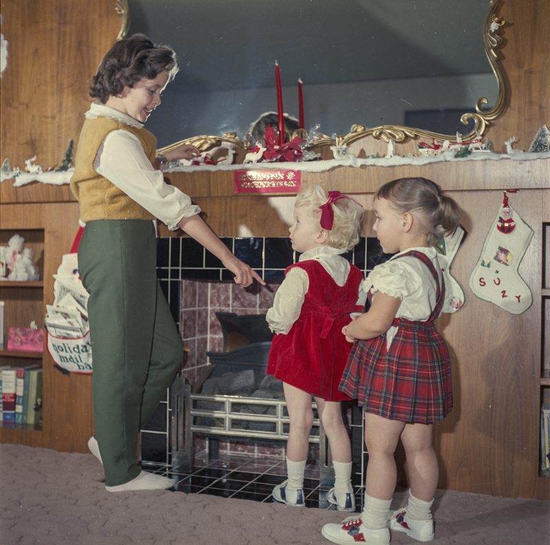
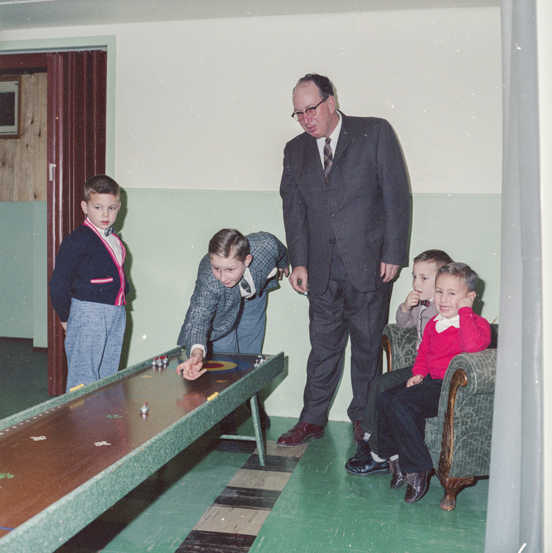
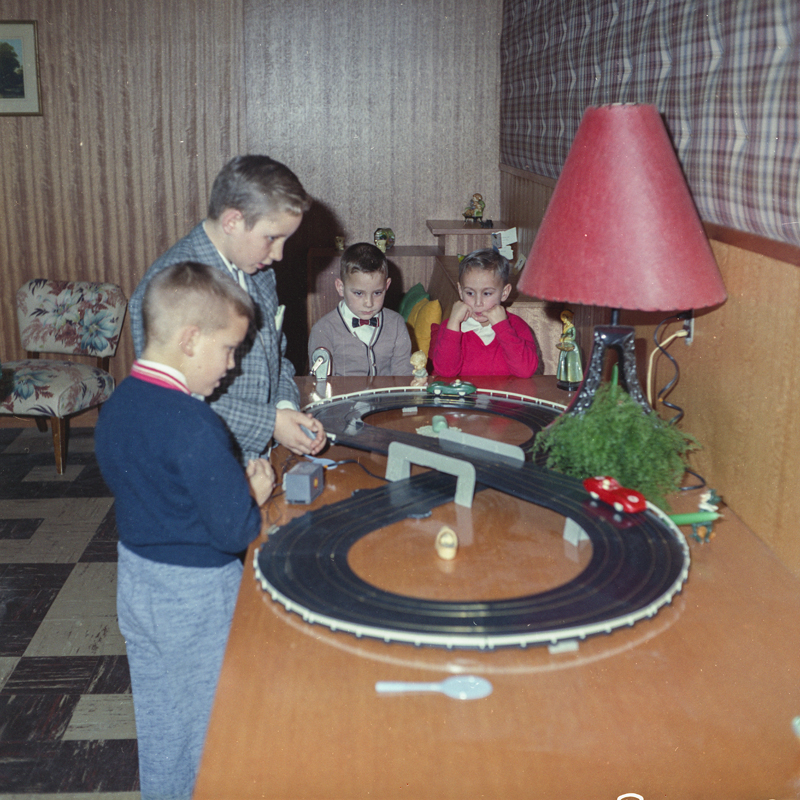
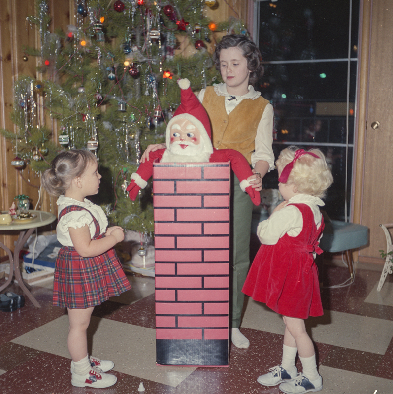
Wishing everyone a safe and enjoyable holiday season! The images below, courtesy of the Provincial Archives of Alberta, were taken from the John Glascow Family Christmas, Edmonton, 1963.
Exploring Alberta's Past

Wishing everyone a safe and enjoyable holiday season! The images below, courtesy of the Provincial Archives of Alberta, were taken from the John Glascow Family Christmas, Edmonton, 1963.

Editor’s note: All images in this post were taken by Suzanna Wagner. The image above is of a view across the Stromness Harbour, Orkney.
Written by: Suzanna Wagner, Program Coordinator, Victoria Settlement and Fort George & Buckingham House
Have you ever travelled vast distances only to find pieces of home?
Intent on exploring new vistas, seeing the ocean, and walking through Neolithic sites, this Canadian historian jetted off to Orkney, Scotland for a vacation. Orkney and Canada share a strong historic connection since the Hudson’s Bay Company hired a great many of their labourers from Orkney. Working with fur trade history made me aware of this, but the only concession my trip plan made to the Orkney-Canada connection was an as-of-yet unread copy of Patricia McCormack’s paper, “Lost Women: Native Wives in Orkney and Lewis” tucked into my suitcase.
After three flights, I arrived bleary-eyed on the largest island of this archipelago north of the Scottish mainland, feeling as though I had travelled to a rather remote part of the world. I couldn’t have been more wrong. Orkney may feel isolated today, but when the Atlantic was bridged with boats instead of planes flying out of densely populated southern urban centres, Orkney was much more central.
Maps of the world on display in Orkney did not have the equator as the centre of the image. Rather, they tilted the globe northward, bringing into focus areas of the northern Atlantic which usually shrink into obscurity- including Orkney itself. By changing the angle from which I considered the globe, I was able to see connections that had never before been made clear to me. One of those connections bridged the wide watery expanse between Orkney and western Canada.
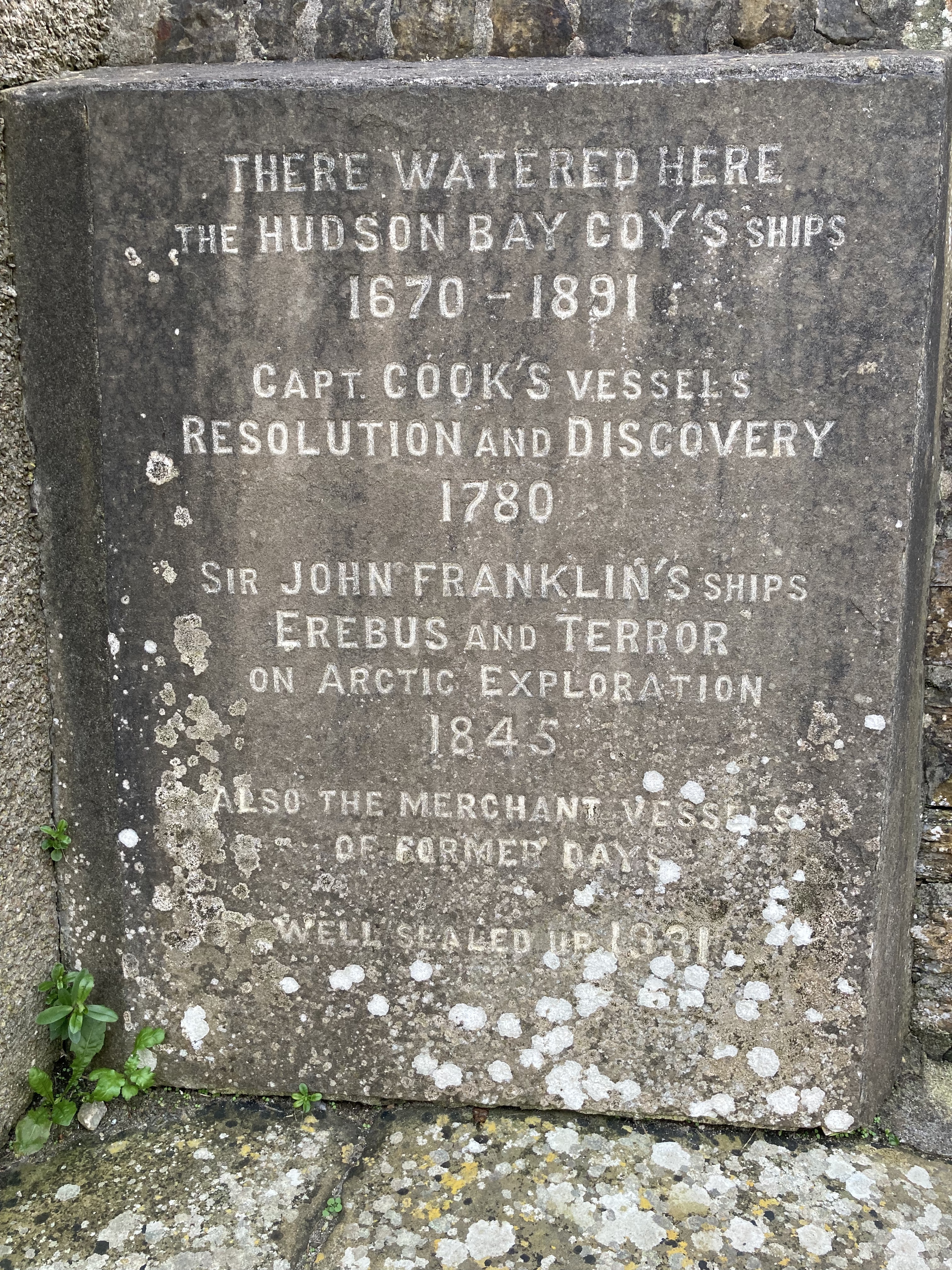
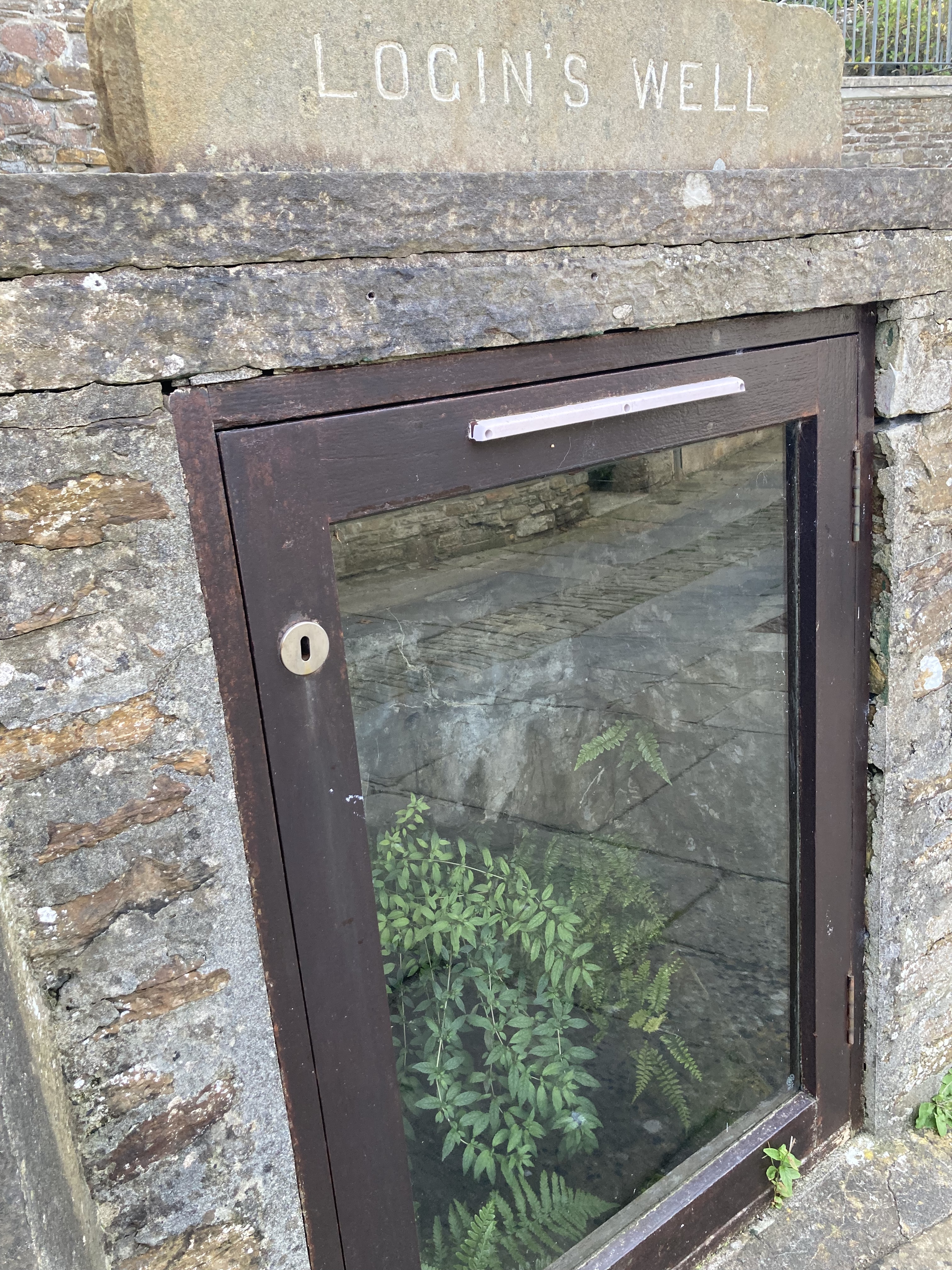
Orkney’s northerly latitude made it a geographically convenient place for the Hudson’s Bay Company (HBC). The oceanic entrance to the Hudson Bay is substantially further north than the mouth of the St. Lawrence seaway, which means that starting the journey from Orkney makes far more sense than leaving from a “more central” port in southern England. Hudson Bay-bound ships “called in” (made a stop at) at the Stromness harbour on the western edge of Orkney as their last landing place before braving the Atlantic crossing. Once in this harbour, they visited Login’s Well (pronounced “Logan’s”) to fill their all-important supplies of drinking water.
But it wasn’t just Orkney’s fresh water the HBC wanted. Orkney’s men were also in high demand.
Read more
Editor’s note: The following interview has been lightly edited for length and clarity. The banner image above is of the Carleton University School of Architecture, Ottawa, 1970. Source: University of Calgary, Canadian Architectural Archives, Carmen and Elin Corneil fonds, CA ACU CAA F0007.
Written by: Robb Gilbert, Archivist, Canadian Architectural Archives and Dorothy Field, Heritage Survey Program Coordinator
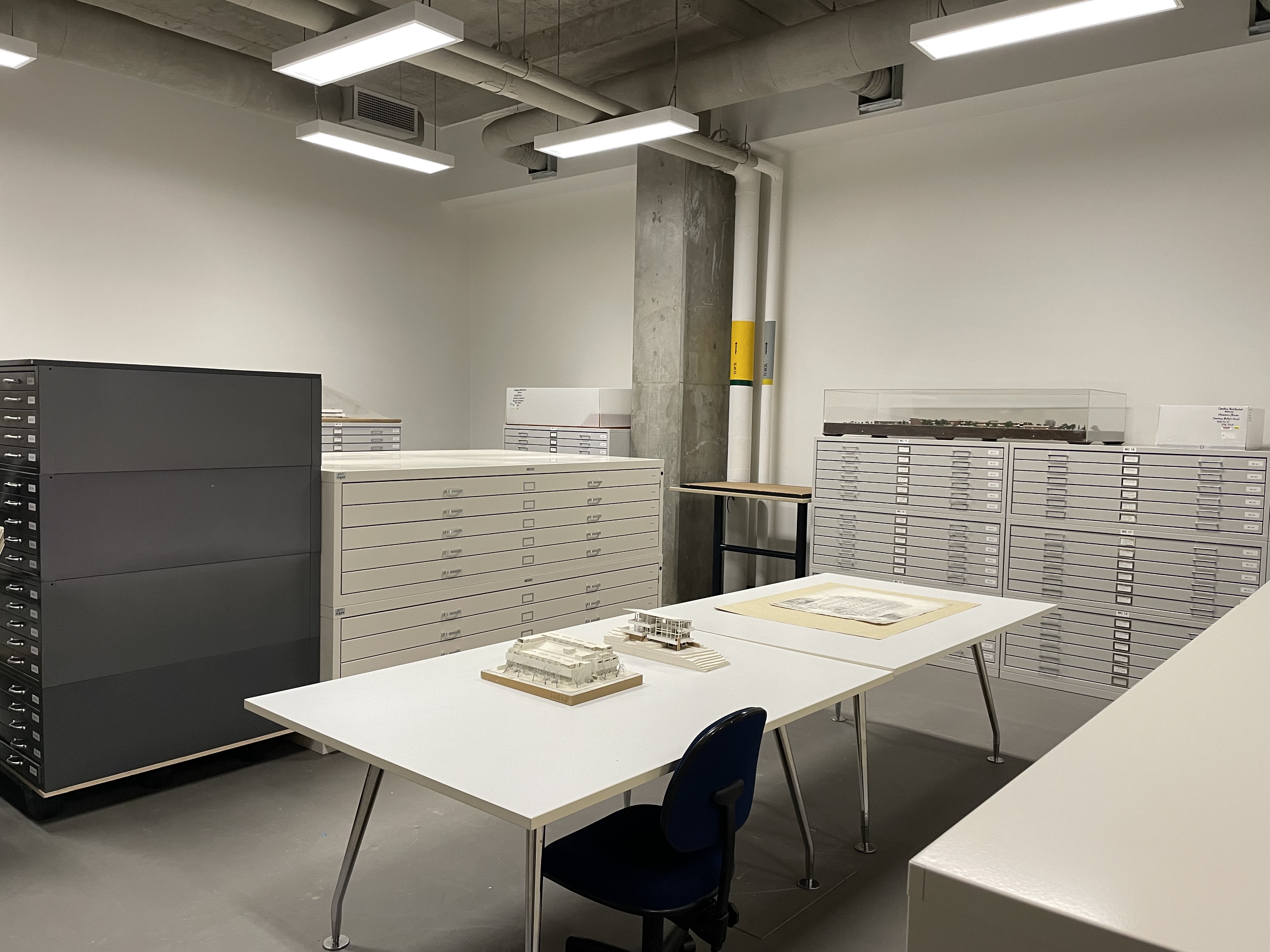
In my work with the Alberta Heritage Survey, I’m always on the lookout for sources of reliable information about Alberta’s architectural history. One such resource that people may not generally be aware of is the Canadian Architectural Archives (CAA), which is a veritable Aladdin’s Cave full of material donated by architects from Alberta and across Canada. But just what, exactly is the CAA? Recently, I had the opportunity to ask Robb Gilbert, Archivist at the Canadian Architectural Archives, about the history, holdings and services of the CAA.
(Dorothy) Hi Robb! Can you tell me about yourself and what you do at the CAA?
(Robb) I’ve been at the CAA for five years. My role is to manage the CAA’s extensive collection, improve access to the holdings, acquire new collections and additions to existing collections, teach students about the archives, assist visiting researchers, and generally raise awareness and engagement with the archives. I previously worked at the Kamloops Museum and Archives before joining Archives and Special Collections at the University of Calgary. My educational background before becoming an archivist was in religious studies and art history. Courses in art and architectural history at Carleton University in Ottawa fueled my ongoing passion for the history of Canadian architecture.
When was the CAA established, by whom, and what was its original mission?
The CAA was established at the University of Calgary 50 years ago in 1974. The idea to start an archive originated with the Dean of the Faculty of Environmental Design (now called School of Architecture, Planning and Landscape) William T. Perks (1934-2023) who proposed an archive to Ken Glazier (1912-1989), the Chief Librarian. The archive was established and developed by Perks, as well as the professors of architecture Michael McMordie and R.D. Gillmor (1930-2019), and the rare books librarian Ernie Ingles (1948-2020). McMordie built the holdings from his connections and through outreach to architects across Canada. And Ingles and the staff in the library provided the administration and operations for the archive. The original mission was to serve as a teaching and research resource for students and researchers, to collect and preserve historical records on Canadian architecture, and to promote public education and awareness about the built environment.

Written by: Patrick Carroll, Cultural Resource Management Advisor, Southwest NWT Field Unit, Parks Canada
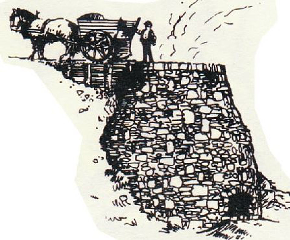
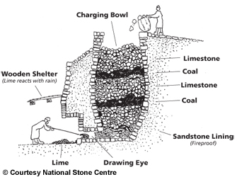
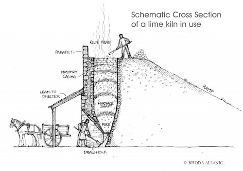
About 50 km upriver on the Slave River from Fitzgerald, Alberta, among a small cluster of islands named Stony Islands, you will find the remains of a stone lime kiln. Archaeologist Marc Stevenson documented the kiln (IjOu-5) and a nearby quarry (IjOu-6) during a survey of the Slave River in 1980. He described the kiln as a, “large semicircular limestone feature 4m in height.” The quarry is an exposed face of limestone just upriver from the kiln. All that we know about the history of the kiln is based on notes from a conversation Stevenson had with a Brother Seaurault. According to Stevenson, “The feature, according to an elderly informant, is the limestone furnace used by residents of Fort Chipewyan in the 1910’s and 1920’s to make whitewash for their log homes in the latter settlement.” It appears, therefore, to have been here for at least a century and is now showing the degradations of time, seasonal flooding and ice scouring.
The kiln is built into a natural alcove in the limestone exposure, set on a rocky shelf at a height to protect it from the impacts of seasonal high water and ice scouring on the Slave River. It consists of a semi-circular convex stone wall extending from the bedrock which, together, create the chimney. The height of the wall extends to the height of the top of the bedrock. A stoke hole on the bottom of the wall faces toward the river. An interesting feature of this kiln is that one side of the wall of the kiln does not abut directly against the limestone outcrop. The collapsing wall on the down-river side appears to have been built mostly flush to the bedrock face. The wall on the up-river side, though, remains in its original condition showing it was built with a 30-60 cm gap between the edge of the stone wall and the bedrock face. It is not known what purpose this gap might have provided for the operation of the kiln, although, it is easily wide enough to allow for a person to enter the cavity of the chimney.

Written by: Ronald Kelland, Historic Places Research and Designation Program
Remembrance Day, November 11, is the day Canadians honour our military personnel and memorialize those who gave their lives while in military service. While honouring all Canadian service personnel this Remembrance Day, RETROactive is drawing particular attention to a geographical feature named to commemorate two cousins who were casualties of the First World War.
Near the Alberta/British Columbia boundary, 55 kilometres ENE of Grande Cache is a mountain known as Mount May; its two peaks are named George Peak and Francis Peak. The mountain and its peaks are named for two cousins, George and Francis May of Ottawa, both of whom were casualties of the First World War.
Francis May
Francis Loren May (frequently misspelled Francis Lorne May) was born on August 14, 1894, at Ottawa to William Chaney May and Susan Margaret May (née Story). William May was a partner in the family firm George May and Sons, a leather goods and saddlery store on Rideau Street. In 1915, Francis was living with his parents at 155 Gilmour Street in Ottawa. Described as being nearly six feet in height and with hazel eyes, a ruddy complexion and light brown hair, he was a member of the Ottawa Ski Club and the Ottawa Canoe Club and, during his school years, he spent two years with the Ottawa Collegiate Institute Cadets. He tried to enlist for service with the Canadian Expeditionary Force in 1914 but was not accepted due to an attack of appendicitis. He did enlist for service at Ottawa on February 22, 1915. His attestation papers list his employment as clerk, and he may have been employed in the family firm or with the Dominion Government. Francis had worked with the Dominion Land Survey, notably in northeastern Alberta in 1912 as an axeman in the surveying party of George McMillan, DLS. It is possible that the May River, which was partially surveyed and named by McMillan in that year, may have been named for Francis.
Read moreWritten by: Sara King, Government Records Archivist, Provincial Archives of Alberta
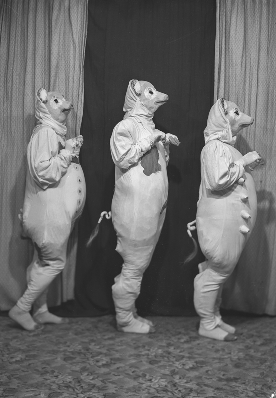
With Halloween once again upon us it’s time for some spooky fun from the Provincial Archives of Alberta. Nicholas Gavinchuk operated a photography studio in Smoky Lake from the early 1920s into the 1960s documenting all manner of aspects of community life there, including Halloween. One of the more interesting aspects of doing archival research is seeing a brief description of a file or photograph and finding out it’s not quite what you expected. This is often the case in archives as archivists try and use the titles given to photographs and files by the creator of the records as opposed to assigning their own.
For example, the image below was labelled as “Halloween Hags”. But as you can see, they’re clearly Halloween hogs! In the Archives’ defense, an “a” and an “o” are awfully similar in cursive.

Written by: Sam Judson and Lindsay Amundsen-Meyer, Department of Anthropology and Archaeology, University of Calgary.
Alberta’s cowboy culture is embraced by many and celebrated through events and conventions like the Calgary Stampede, K-Days or Calgary’s ‘White Hat’ tradition. This culture is largely represented in the history books by white, European settlers, although Alberta’s past is much more multiethnic and multicultural than many realize.
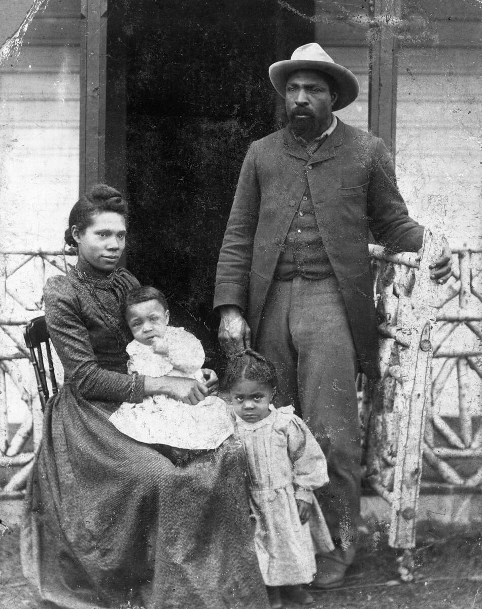
John Ware was one of Alberta’s early Black setters. Ware’s name is recognizable today to many Albertans, who refer to him as Alberta’s first Black cowboy, and the longevity of his legend is fascinating. Despite this, few know his story and very little is known about the true nature of his life.

Editor’s note: September 30 is National Day for Truth and Reconciliation and Orange Shirt Day. Reading residential school histories can be a painful process. If reading this is causing pain or bringing back distressing memories, please call the Indian Residential Schools Crisis Line at 1-866-925-4419. The Crisis Line is available 24 hours a day and can also provide information on other health supports provided by the Health Canada Indian Residential Schools Resolution Health Support Program.
An earlier version of this article appeared in the December/January 2024 issue of Nisichawayasi Achimowina.
Written by: Laura Golebiowski (Indigenous Consultation Adviser), in collaboration with Nisichawayasihk Cree Nation.
“Eight children, an equal number of boys and girls, were going with us to enter a Residential School… I applied, but without success, to the Principal of the Brandon Residential School, for the admittance of the Indian children. That they were “non-treaty” was the alleged objection. As, however, the Red Deer school was willing to receive them, we decided to take them there…In the course of two or three years, five of those apparently healthy children had died from Tuberculosis.”
– Samuel Gaudin, in Forty-Four Years with the Northern Crees
Nisichawayasihk Cree Nation are the Nisichawayasi Nehethowuk: the people whose ancestors lived near where the three rivers meet and who speak Nehetho, the language of the four winds. Their territory includes the rich lands of the Canadian Shield and boreal forest in what is now northern Manitoba. Their central community hub is located at Nelson House, a long-time place of Indigenous occupation where the Hudson’s Bay Company established a trading post in the late 1700s.

Written by: Sam Judson and Lindsay Amundsen-Meyer, Department of Anthropology and Archaeology, University of Calgary.
Calgary was incorporated as a Canadian city in 1884 and, since then, has grown to be a city of more than 1.5 million people. Although the City of Calgary is less than 150 years old, people have lived in this area, called this place home, and taken care of these lands for thousands of years. This long history is told through the numerous archaeological sites within and beyond Calgary’s city limits. Examples such as the Hawkwood site, Everblue Springs site and Mona Lisa Site demonstrate that this part of Alberta has been inhabited for approximately 8,000 years.
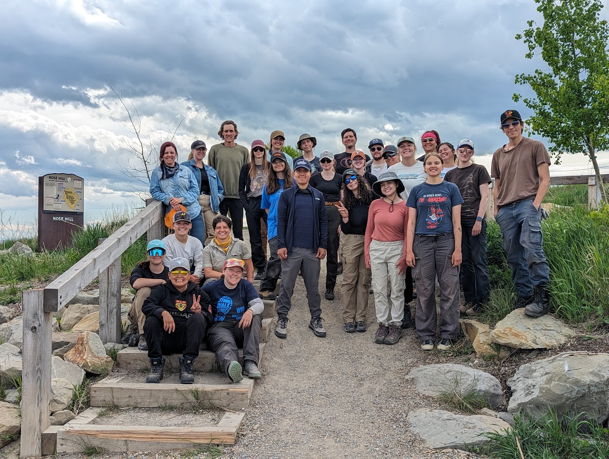
Nose Hill is a testament to Alberta’s long-standing Indigenous history. More than 40 recorded Precontact Indigenous archaeological sites are known within this City of Calgary park space, most first recorded by archaeologists in 1978 ahead of the creation of the park. The majority of these are camp sites made up of one or many stone circles, but kill sites and lithic scatters are also present. Not only was Nose Hill utilized frequently by Indigenous groups before contact, but it was also extensively used by citizens in the early days of Calgary’s existence as a settler municipality. Animals grazed on Nose Hill, northern areas of the hill were cultivated for crops, and a gravel pit was active on Nose Hill for several years. Despite these modern activities, Nose Hill Park remains one of the largest undisturbed grasslands in the Calgary area. As a result, the archaeological sites of Nose Hill are remarkably well preserved and tell a story of thousands of years of human occupation and connection with this prominent landform.

Editor’s note: This article was originally published on the RAM Blog, the official blog of the Royal Alberta Museum.
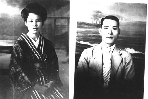
Written by: Chihiro Iwamoto, Administrative Assistant, Royal Alberta Museum
When Canada declared war on Japan in 1941, people of Japanese ancestry were met with intense discrimination. The Canadian government ordered the removal of Japanese Canadians from the West Coast of British Columbia in 1942, and within two months, approximately 22,000 Japanese Canadians, about three-quarters of whom were born in Canada, were forced to leave their homes and their properties were confiscated.
Most male Japanese Canadians were sent to labour camps to work on road construction, while their families were sent to internment camps in interior British Columbia.
Around this time, Alberta’s sugar beet industry struggled to secure labour due to the heavy, harsh, labour-intensive nature of sugar beet cultivation. A group of 560 Japanese families agreed to move to Southern Alberta by 1943, where they signed a labour contract to work in the sugar beet fields because it allowed the families to stay together. One of the communities they were relocated to was the small town of Picture Butte, about 27 km north of Lethbridge.