

Farming in Alberta has been shaped by a deep and layered history of geological, biological, and human forces. This article takes us back to the beginning.
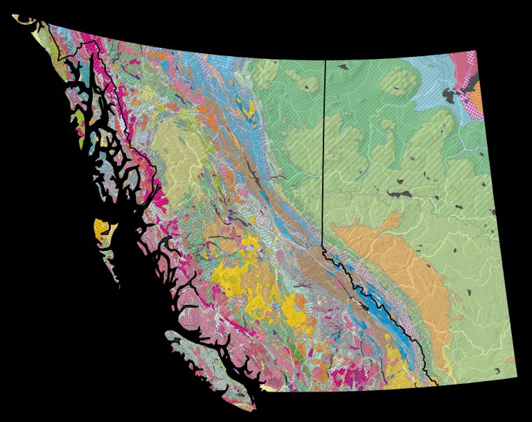
Farming is based on a sliver of soil that caps kilometers of sediment and bedrock. To understand how our fields first formed, we need to read an ancient geological story of how Alberta has been raised and tilted then scoured and capped over time. Alberta has sat inside a continental plate (or ‘craton’) for over 300 million years. Around 180 million years ago, the western edge of this plate began crunching to form the up-and-down terrain of the Coast Mountains of British Columbia (B.C.) and the Rocky Mountains between B.C. and Alberta (Figure 1). Mountain building finished about 50 million years ago.
For almost 200 million years, Alberta has been tilted: our bedrock is formed largely of shales and sandstones that built up when sediment either poured off the mountains and solidified into rock or settled down in ancient waters that once filled a basin over Alberta. From about 50 to 5 million years ago, huge sheets of gravel and sand continued to shed off the Rockies (carried by rivers and streams) before settling into our basement. Read more
