

Editor’s note: Abawashded! June is National Indigenous History Month, an invitation to honour the history, diversity, strength and contemporary achievements of Indigenous peoples.
Written by: Barry Mustus (Alexis Nakota Sioux Nation) and Laura Golebiowski (Aboriginal Consultation Adviser)
Like many Albertans, I have spent a considerable portion of the last year outdoors. I have become better acquainted with my neighbourhood and city parks, and have spent most weekends hiking, camping or cross-country skiing in the mountains. I am grateful to be in a position (both in terms of privilege and location) to access the diverse and beautiful outdoor spaces that our province provides.
When you recreate outdoors, do you consider whose traditional territory you are on? Do you think about those who walked these trails and enjoyed these landscapes before you?
Barry Mustus does. An Alexis Nakota Sioux Nation member currently based in Whitecourt, Barry has dedicated numerous years to the research and reidentification of a historic Indigenous trail network which extended from Lac Ste. Anne north to Whitecourt and beyond. To date, Barry’s work has focused on a 30 km stretch of trail from the Hamlet of Blue Ridge, southeast of the Town of Whitecourt, to Carson-Pegasus Provincial Park. Referring to the trail as, “The Nakota Trail of 1877” (the year Alexis Nakota Sioux Nation signed an adhesion to Treaty 6), Barry’s efforts strive to demonstrate how Nakota peoples have shaped, and continue to shape, this region of what is now Alberta.
The Stoney people, also referred to as the Assiniboine, have long occupied this area. In 1859, James Hector, a companion of Captain John Palliser, noted a group of Stoney camping at the confluence of the McLeod and Athabasca Rivers, where present-day Whitecourt is located. Earlier still, fur trader Alexander Henry makes mention of a Stoney presence in the Upper Athabasca in 1808. Today, Alexis Nakota Sioux Nation is the most northwestern representative of the Siouan language family and has four reserves: the largest at Glenevis near Wakamne (Lac Ste. Anne) with three satellite reserves at Cardinal River, Elk River and Whitecourt.
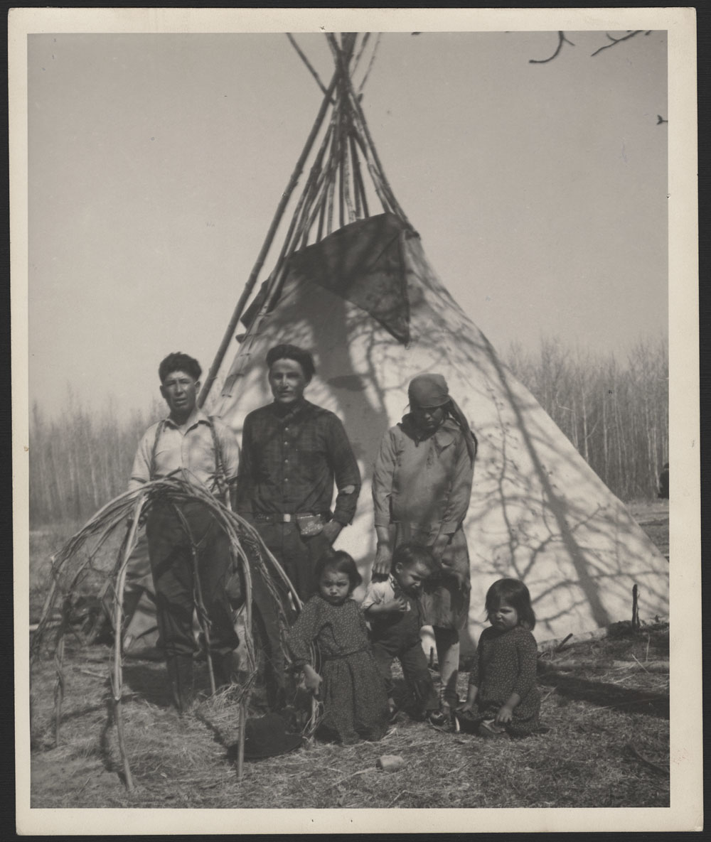
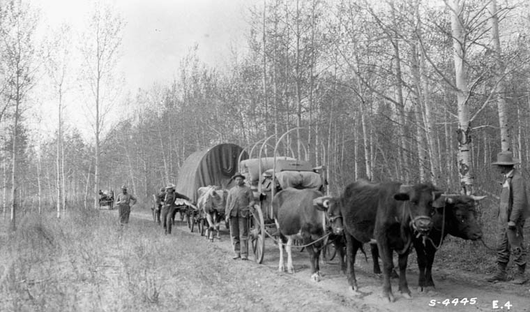
Europeans began to arrive in the region in the 1820s, spurred by the fur trade, gold rush and later, the lumber industry. Many of these settlers benefitted from Indigenous occupation in and knowledge of the area. The, “well-worked Indian path between Lac Ste. Anne and Whitecourt” was used by some keen prospectors traveling north to the Yukon, in advance of the construction of the renowned Klondike Trail. An archaeological report from the 1980s notes that another pre-contact trail ran from Whitecourt to McLeod Lake before branching in two directions: one northwest to Iosegeun Lake, and the second eastward to Lesser Slave Lake. This trail was later used by the Canadian Forest Service. Early Whitecourt homesteaders recall a group of Indigenous peoples who still lived at McLeod Lake, known locally as the “McLeod Lake Indians.” “Names such as Evan Cardinal, Ben Bisma, Pete Pennystone, Eli and Mitchell Paul, and Louis Moostas will be remembered by many early settlers. The Desjarlais family was also part of the McLeod Lake band, descendants now live in Mayerthorpe.”
In addition to his research interest, Barry is also intimately connected with this landscape. The Louis Moostas named above is his paternal great-grandfather. In the 1940s, Barry’s grandparents Sam and Alice Mustooch raised their children on the long spit of land that nearly bisects the lake. The winters were spent trapping and the summers were spent hunting. Twice a year, the family would travel the old trail by wagon to visit relatives and friends at the reserve at Lac Ste. Anne.
Snippets of stories about the historic trails, and the Indigenous peoples who created and maintained them, exist in local history books. Rarely were the stories shared in these books told by Indigenous peoples themselves. Although the language is dated and often problematic, these written recollections corroborate oral tradition and provide a compelling snapshot of early relations between Indigenous and non-Indigenous peoples in the region:
“…A band of Indians used to go back and forth between McLeod Lake and Lac Ste. Anne several times a year. This band had a stopping place on the flat of the Baxter homestead, leaving their tent poles there year round. Steam baths were apparently part of the ritual of their spring stopover… Circles of stones were heated and a bower created over the stones with willow branches and skins. Water was thrown over the heated stones to create steam, exactly like todays sauna, and when the heat and steam became too overpowering, the Indians simply ran and jumped into the cold waters of Beaver Creek!”
The above text, written in the 1976 Sagitwah Saga: The Story of Whitecourt, describes the sweat lodge: a ceremony to cleanse, clarify and seek guidance that is still conducted in many communities today. In a continuation of tradition, ceremony and protocol have been the cornerstone of Barry’s work identifying the trail. Prior to commencing Elder interviews or fieldwork, Barry sought the support of Knowledge-Keeper Jordan Cardinal, a pipe holder and descendent of the Cardinals who lived at McLeod Lake. Per Nakota custom, Barry provided Jordan broadcloth, tobacco, soup and berries as offerings. In the sweatlodge, Barry and Jordan asked for spiritual support for the successful relocation of the historic trail. As Barry puts it: “The Nakota heritage speaks for itself. We put prayers ahead of actions.”
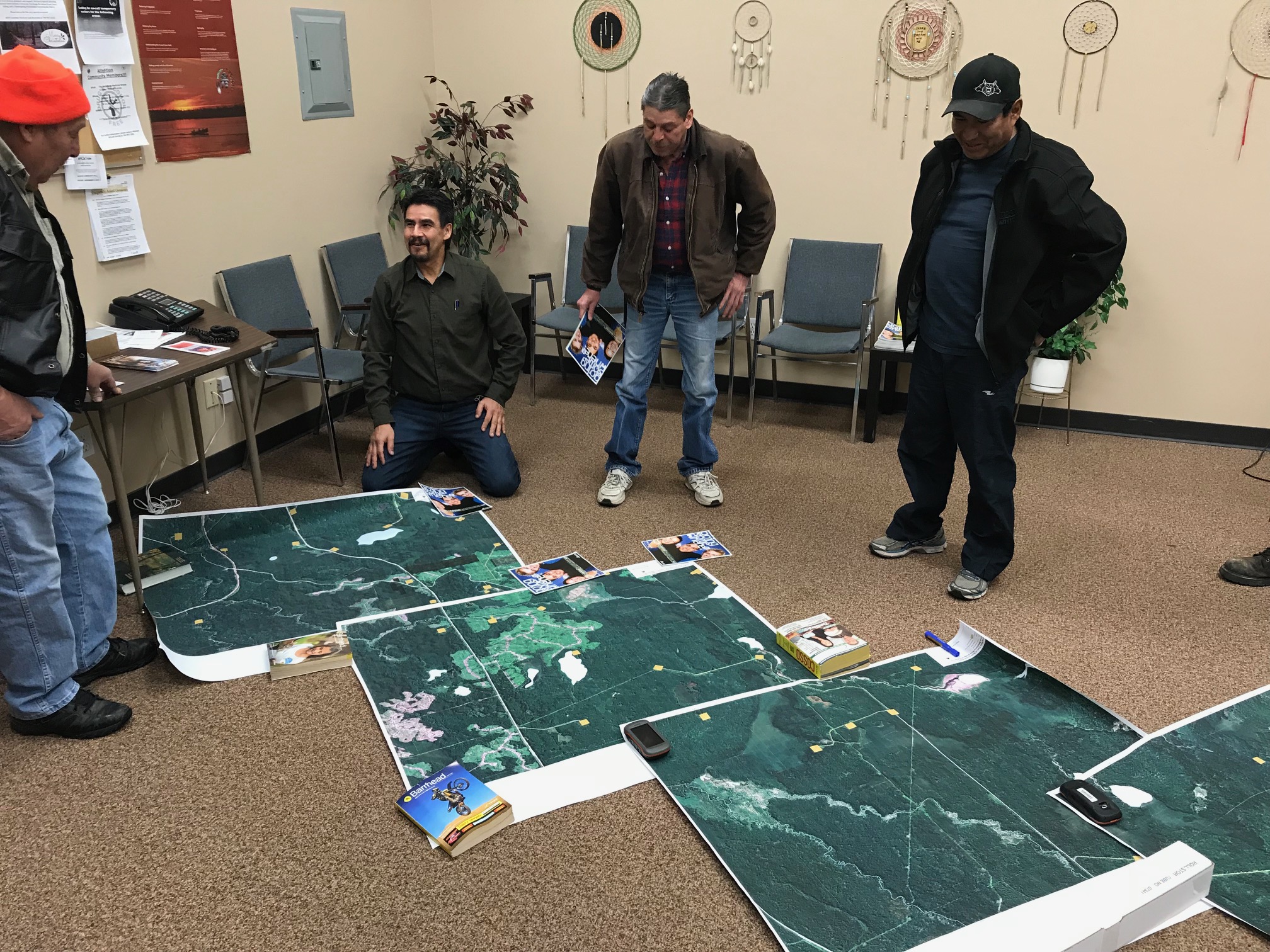
Barry’s efforts combine desktop mapping exercises, field investigations and Elder interviews. For Barry, the involvement of Nakota Elders is critical to both the research and in the consideration of his future goals. “Clarifying their natural connections to the land base is vital to the development [of these lands] for future generations.” Recording more than 70 hours of Elder interviews has been the most rewarding part of the research process. Barry notes that the stories shared in the interviews often made him emotional. “The biggest surprise for me as researcher was the emotions shared by the Elders who were interviewed. I was truly overwhelmed: in every interview the Elders all shed tears when reflecting on the past use and occupations of the land and trails in their territories.”
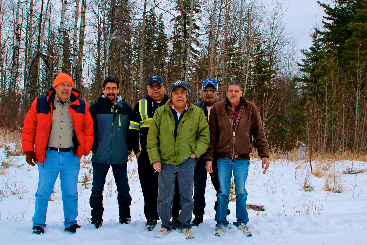
Barry has accessed, largely by foot, much of the landscape southeast of Carson-Pegasus Provincial Park, searching for the historic Nakota trail. On a wintery day in January of 2018, Barry and Alexis Nakota Sioux Nation knowledge-keepers embarked on a site visit to identify the trail.
Near the Hamlet of Blue Ridge, on the north banks of the Athabasca River, stands the Duncan homestead, a long-time stopping place for travelers. People rested and traded here, exchanging whitefish caught at McLeod Lake for fresh meat, vegetables and hay. Behind the homestead on a hill is a single grave, fenced and marked with a cross and red prints. Keri Kidd, the eldest Duncan family sister, has researched who was laid to rest in the cemetery. The individuals include: Ben Louisana (1877 – March 8, 1937), Lenice Jones/Duncan (December 23, 1936 – April 6, 1937) Armand Peters (June 17,1929 – March 3, 1945), Fred Letendre (June 11, 1942 – June 28, 1948), Henry Duncan (born premature on February 28, 1952 and only lived two hours), Wayne Duncan (May 1, 1954 – September 1, 1954), Baby Cardinal (May 17, 1952 – October 30, 1952) and two stillborn children. Alexis Nakota Sioux Nation members have worked with the Historic Resources Management Branch for more than a decade to ensure the resting place is protected from development.
Beyond the homestead, a break in the trees; a faint trail extends to the northwest. The participants return to their vehicles and drive several kilometres along the existing oil and gas roads in the general direction of the trail. On an access road to a wellsite, they stop again: the trail can be seen here too. The Elders are pleased but not surprised. Back in the office, aerial imagery of the area will show approximately two kilometres of intact trail located here.
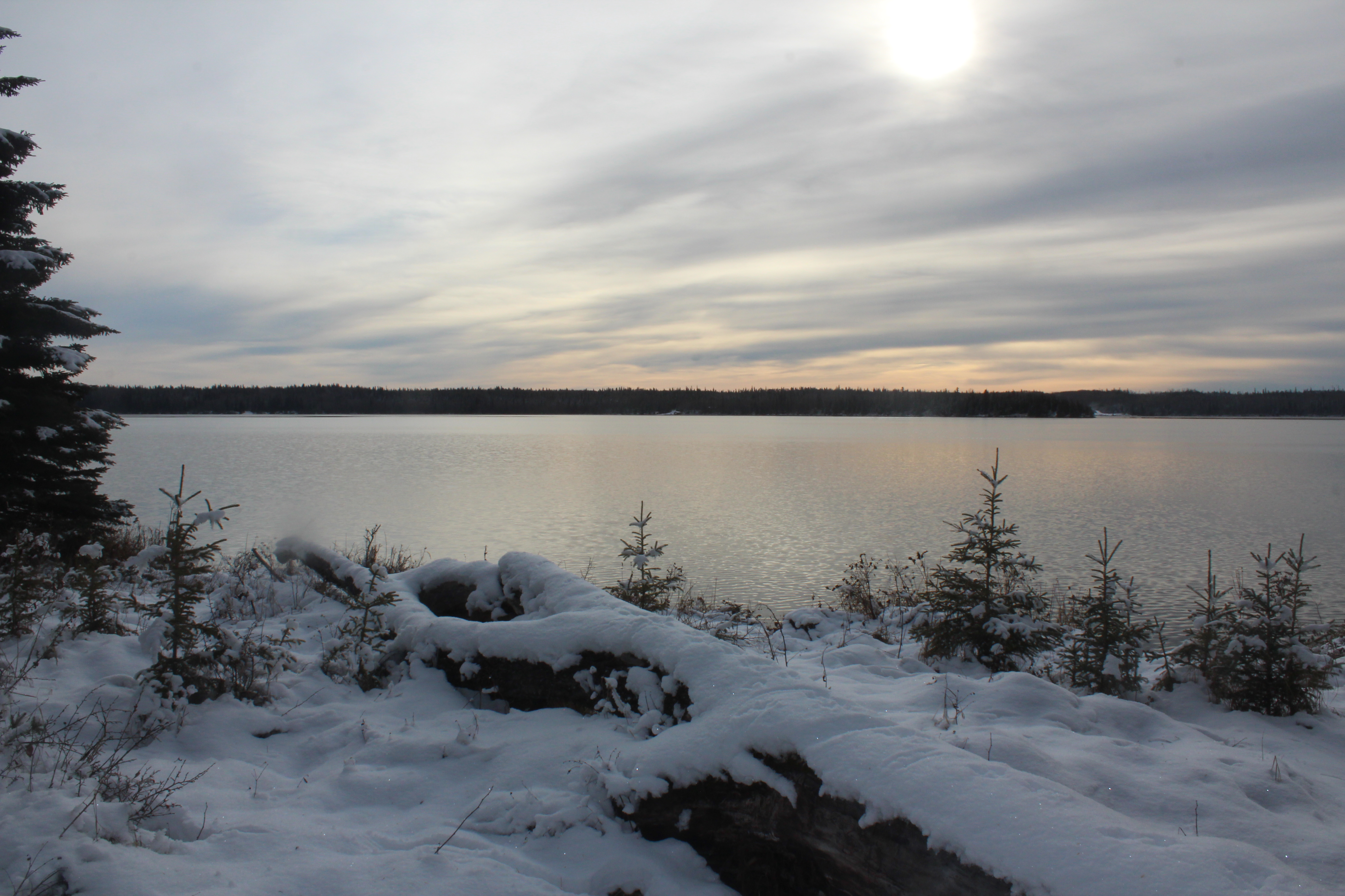
For now, the trail ends along the northern shores of McLeod Lake, in what is now Carson-Pegasus Provincial Park. The Stoney name for this landscape translate to, “Good Fish Lake” or “Where the Fish are Good.” Elders remember when the lakes were filled with whitefish—blue and silver in colour with stout bodies, and their flavour was “like no other.”
Replaced with trout from fish-stocking initiatives, whitefish are now hard to come by here, the Elders say. With the identification of natural gas in the region in the 1950s, a Mobil Oil pump station brought water from the Athabasca River to the McLeod Lake bed. In interviews conducted more than two decades ago, Barry recalls the Elders frustration that the Mobil Oil pump station killed the lake’s whitefish. “Naturally, the province had to attempt to recreate a vital source of livelihood that Indigenous peoples had relied on for generations,” he says about the fish-stocking initiatives. Barry also stresses that the creation of Carson-Pegasus Provincial Park in 1982 was done without obtaining the free, prior and informed consent of Alexis Nakota Sioux Nation, and that this action was in contravention of the spirit and intent of the Treaties.
Oral histories, archival documentation and archaeology indicate that Nakota peoples occupied McLeod Lake prior to signing Treaty, as well as after. From the 1930s to the 1950s, cabins used to dot the shoreline, and structure foundations and historic remnants can still be found if one has a keen eye. These were seasonal trapping cabins, where community members would spend the winter. This was a gathering place for multiple communities, including the Nakota, Saulteaux and Chipewyan. Families would travel by dog sled to visit and participate in round dances in the wintertime. The women would maintain the cabins while the men trapped in the Swan Hills, then the families would return south on the trails for the summer.
Barry works hard to foster relationships with industry, provincial and municipal governments and other partners to raise awareness of Alexis Nakota Sioux Nation history in the region. His goal is to establish a tourism venture, via the Nakota Trail Foundation, to facilitate cultural reclamation and rekindle the sense of Indigenous community spirit. With tipi camping and immersive programming, Barry hopes to break down cross-cultural barriers by sharing the richness of Nakota food, language, stories and song. The video below, by SGWE Productions, highlight’s the research and field work efforts taken to date, and what Barry hopes the future brings for the Nakota Trail of 1877.
Ishnish Barry for sharing your knowledge and research, and for the reminder that the landscapes and spaces we enjoy today have been sites of Indigenous occupation in the past, and will continue to be sites of Indigenous occupation for future generations to come. To learn more about the Nakota Trail of 1877, please email Barry at bear.mustus29@gmail.com.
The Historic Resources Management Branch’s Aboriginal Heritage Section works with Indigenous communities to preserve and protect the cultural heritage sites that are an important part of Alberta’s heritage. To connect with the section, please email aboriginal.heritage@gov.ab.ca.
Editor’s note: The Heritage Division mourns with the Tk’emlúps te Secwépemc after the discovery of 215 lost children at the Kamloops Indian Residential School site. The Government of Alberta is committing funding to find unmarked Indigenous graves associated with residential schools. The Heritage Division has developed a resource guide to assist researchers, former students, Survivors, Survivor groups and communities research and recognize residential school sites and stories.
Sources:
Olekco, Doreen. (1976). Sagitawah Saga: The Story of Whitecourt. Whitecourt, AB: Town of Whitecourt.
Ronaghan, B. (1981). Final report: Historical Resources Impact Assessment at Carson-Pegasus Provincial Park (ASA Permit 80-169). Prepared for Alberta Culture.
Banner image: Excerpt of Sectional Sheet No. 364, Fort Assiniboine. Department of Mines and Resources, 1948. From 1940 until 1986, the lake was known as Carson Lake, as it is the source of Carson Creek. In the 1980s, local residents requested that the name be returned to its historical and local usage. The name was officially changed to McLeod Lake in 1986.
