The Historic Resources Management Branch of Alberta Culture is pleased to announce the launch of the Alberta Energy Resources Heritage website. The site was developed with the aim of promoting an understanding and appreciation of the Province’s abundant energy resources, the rich history of resource extraction and production, and the important role that this sector has played and continues to play in Alberta’s social, political and economic history.
Turner Valley Discovery Well Blowing, 1914. (Provincial Archives of Alberta, P1883.)
As the homepage of the website points out:
“Ancient forces shaped Alberta’s geology, creating a land rich in energy resources. Yet, the story of energy in this province goes well beyond geological formations or petroleum chemistry. It is also the story of individuals, of people driven to reveal the province’s energy secrets and unlock the power of its resources. The quest to locate and unlock Alberta’s energy potential began with them—with their persistence, their innovative thinking and even their passion. It was their energy as much as any other that transformed Alberta, economically, socially and politically.”
Five areas of Alberta’s resource development are explored in detail: coal, conventional oil, natural gas, electricity and alternative energy and the oil sands. Also profiled is Bitumount, north of Fort McMurray where the earliest scientific research on industrial oil sands extraction took place. This pioneering work would later transform Alberta into a major player in the global energy market.
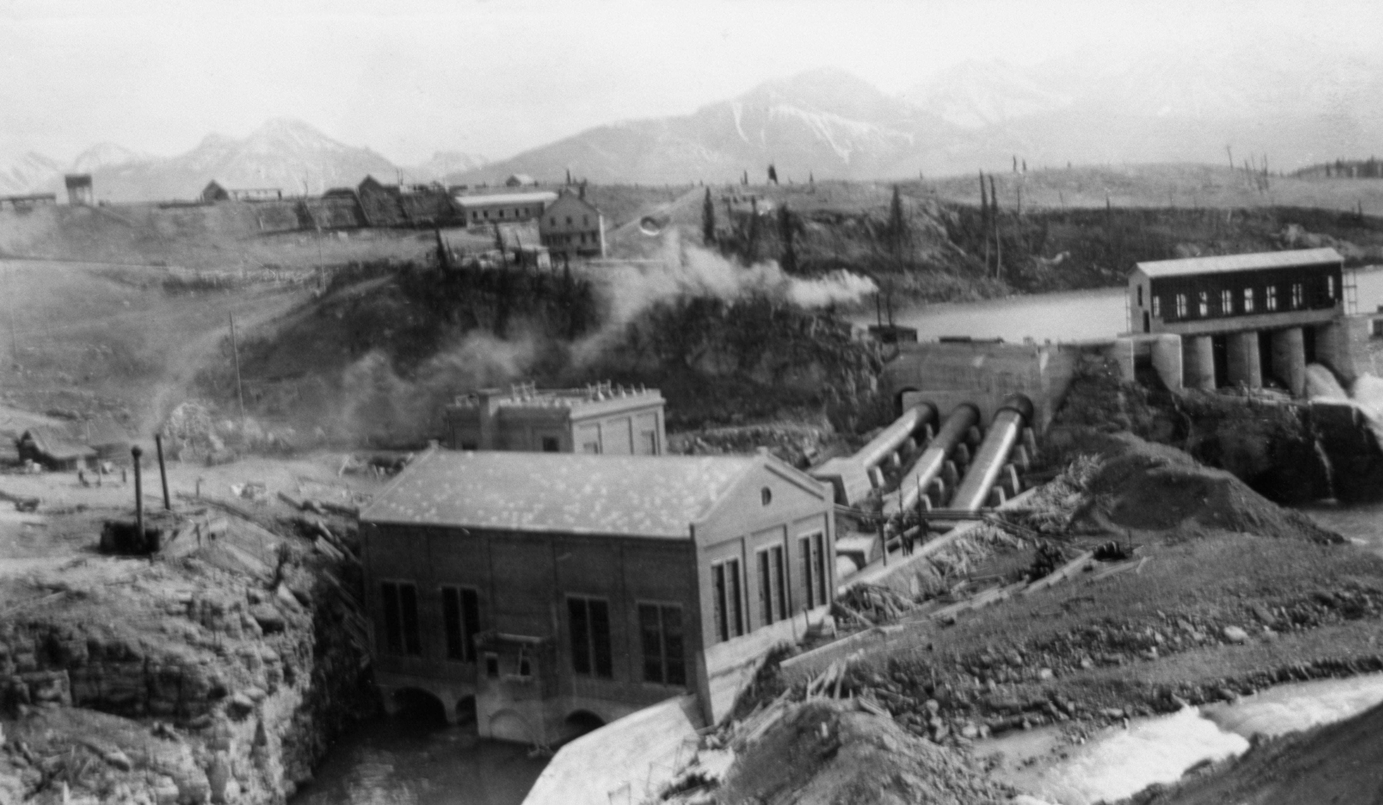
Calgary Power’s power house at Horseshoe Falls on the Bow River, ca. 1912 (Glenbow Archives, NA-3544-28.)
The website is intended to be informative and comprehensive, offering insights into the geological formation of resources, the ancient uses of various energy resources and exploration and industrialization within Alberta. Energy resources are examined through over 300 thematic entries, covered in more than 600 pages of text. Hundreds of archival images, charts, maps, and documents as well as dozens of videos augment the text as do extensive technical glossaries and lists of documentary sources. In addition to exploring the earliest and evolving histories of these sectors the site offers special insights into Alberta’s social history ranging from the miners of the Crowsnest Pass through to the rough necks of the Oil Patch, to pioneering proponents of alternative solutions for the province’s ongoing energy requirements.
Educators, students and the general public are invited to visit the website and explore its various components.
May 14, 2014 was the one-hundredth anniversary of the discovery of oil and gas at Turner Valley. In recognition of this milestone, we are offering a short series highlighting some of the place names associated with the oil and gas heritage of the Turner Valley area.
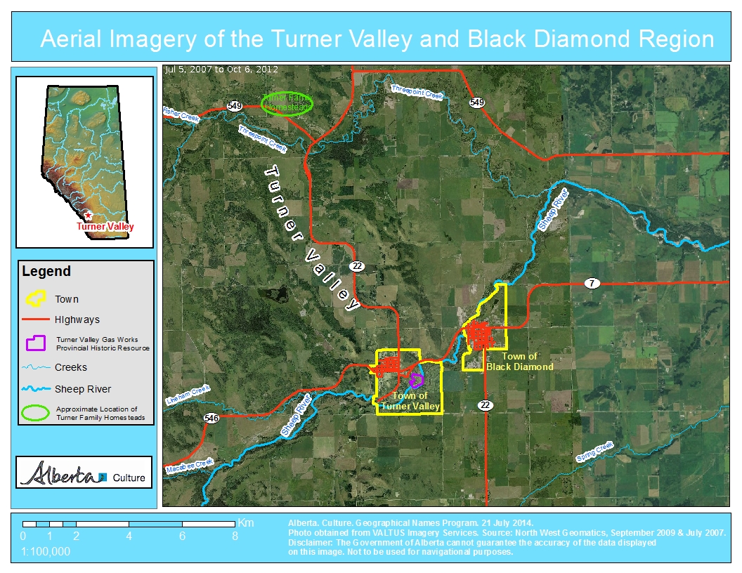
Turner Valley
In 1886, two brothers from Scotland, Robert and James Turner, filed for homestead on neighbouring quarter sections (the S.E. and S.W. quarters of Section 10, Township 21, Range 3, West of the Fifth Meridian) at the northern end of a large valley near the north fork of “Sheep Creek.” (To add a heaping helping of confusion to this story, what was then called Sheep Creek is now the Sheep River and its north fork, or tributary, is now named Threepoint Creek. Isn’t naming fun!) The Turner brothers, soon joined by a cousin, John Turner, acquired more land for their ranch and became noted breeders of purebred Clydesdale horses.
Due to the early arrival and prominence of the Turner family, the valley containing their original homesteads soon became known as Turner Valley. At the time, responsibility for naming geographical features lay with the federal government and the name Turner Valley was adopted by the Geographic Board of Canada as the valley’s official name in December 1943, although it was being used on government maps since at least 1926.
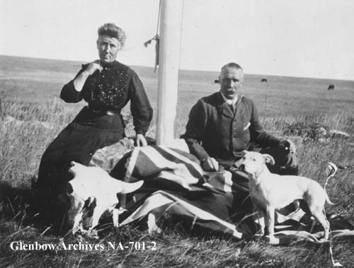
Photo of Catherine (née Dawson) and Robert Turner, ca. 1905, taken on the Turner ranch at the northern end of Turner Valley. (Glenbow Archives, NA-701-2.)
On May 14, 1914, towards the other end of the valley, an oil well known as Dingman No. 1, owned by Calgary Petroleum Products struck gas. Although DIngman No. 1 was not the first productive well in Alberta—that distinction goes to a well in Waterton Lakes National Park (See Cameron Creek) it was our province’s the first significant discovery.
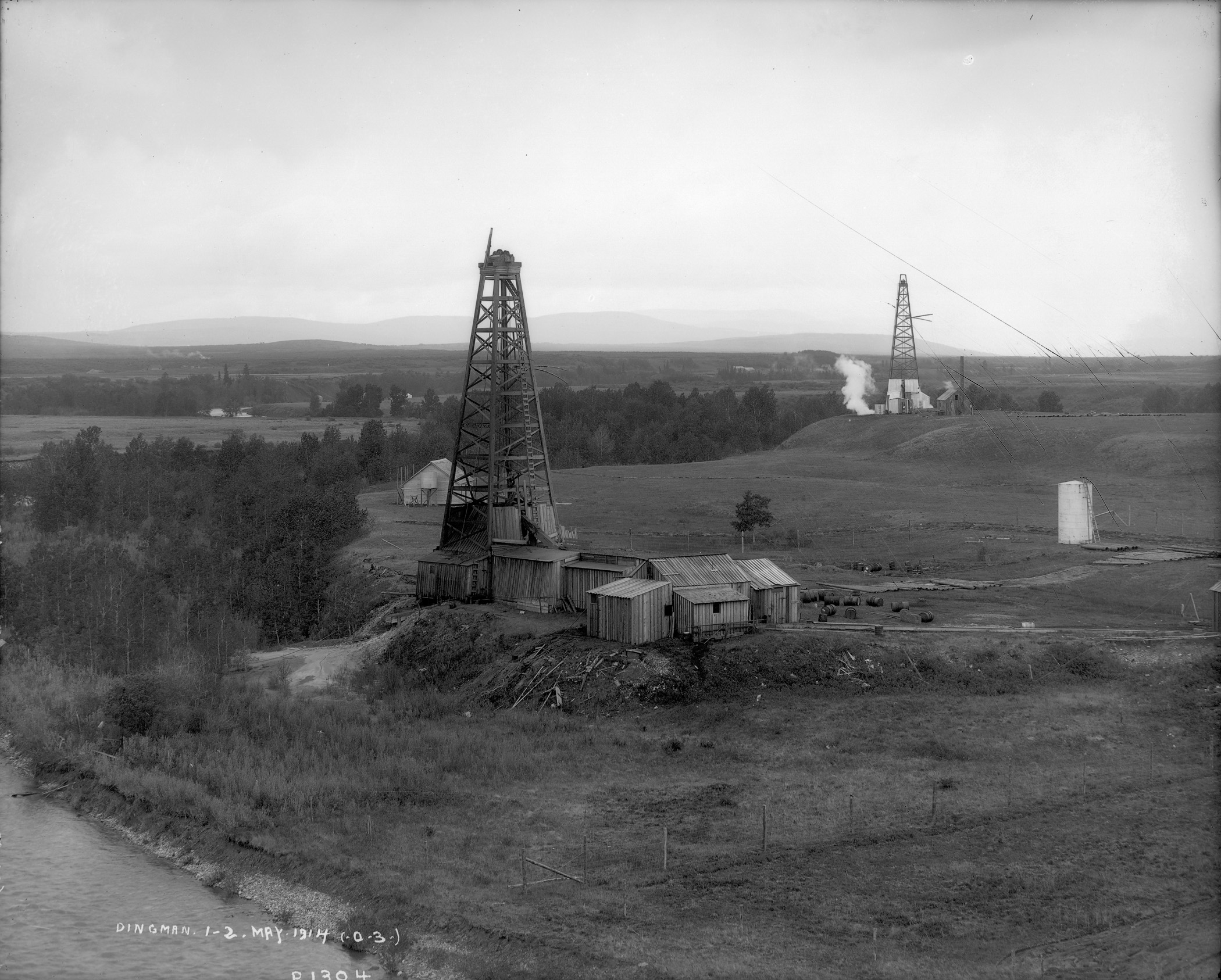
The Dingman No. 1 and Dingman No. 2 wells on the banks of the Sheep River, Turner Valley, 1914. These two wells ushered in Alberta’s first major oil boom, which saw the drilling of hundreds of wells and the establishment of numerous communities in the Turner Valley region. (Provincial Archives of Alberta, P1304.)
Over the ensuing decades the name Turner Valley became one of the best known locales in the province and the name became synonymous with Alberta’s oil and gas sector. A town site, also named Turner Valley was established. A post office opened here in 1926 and, in 1930, with a population of about 700 people, Turner Valley was incorporated as a village. It became a town in 1977.
Black Diamond
Just to the east of the Town of Turner Valley, is the Town of Black Diamond. The name is inspired by the coal deposits found in the area. A coal mine opened in 1899 and a small community serving the mine and the area’s ranchers and homesteaders began to develop.
According to local lore, in 1907, when it came time to choose a name for the newly established post office, two contenders arose: “Arnoldville” was championed by the Arnold brothers who owned the general store that would house the post office, and “Black Diamond” was put forward by Addison McPherson, the owner and operator of the Black Diamond Coal Mine a short distance to the southwest. Allegedly, both were written on scraps of paper and put into a hat. You can guess which name was drawn.
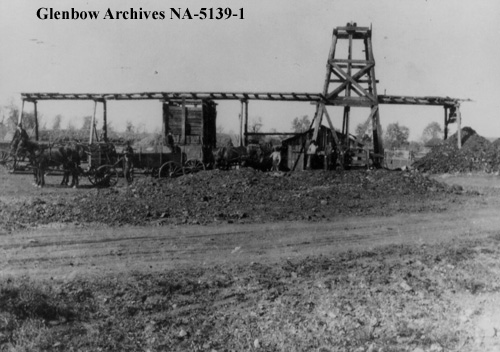
Addison McPherson’s “Black Diamond” coal mine, ca. 1913-1916. The local post office and the community it served were named for this coal mine. (Glenbow Archives, NA-5139-1.)
Following the Dingman No. 1 discovery, Black Diamond boomed, reaching a reported population of 800 by 1930. A local history tells of round-the-clock construction and single lots containing up to seven homes. Black Diamond became a village in 1929. It suffered during the Great Depression, loosing up to a quarter of its official population before rebounding in 1937 following a major oil discovery in 1936. Black Diamond was the largest population centre in the immediate area, reaching a population of 1,380 in 1947 before falling again through the late-1940s and 1950s. Regardless, in 1956, with a population of 991, Black Diamond was incorporated as a town.
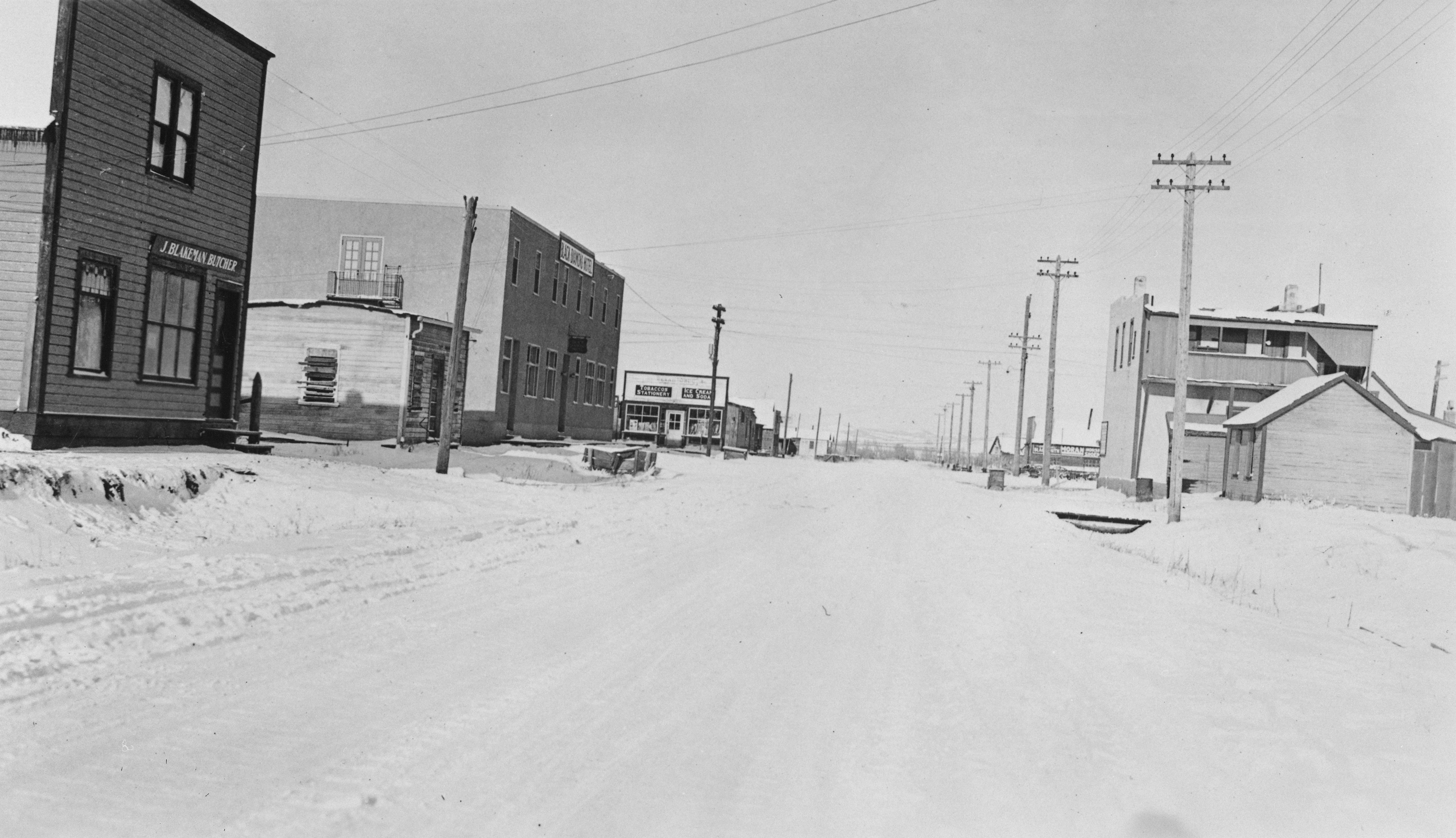
Commercial district of Black Diamond, January 1932. Although it Pre-existed the Turner Valley oil and gas discovery, Black Diamond grew rapidly to serve the burgeoning industry. (Provincial Archives of Alberta , A6999.)
To be continued … More Turner Valley oil and gas names to come!
Written by: Ron Kelland, Historic Places Research Officer and Geographical Names Program Coordinator.
Location
Turner Valley (valley)
National Topographic System Map Sheet: 82 J/09 – Turner Valley
Latitude/Longitude: 50°42’33”N / 114°18’11”W (approximate mid-point)
Alberta Township System: 23-20-3-W5 (approximate mid-point)
Description: Large valley with a northwest to southeast orientation, located approximately 40 kilometres southwest of downtown Calgary
Turner Valley (town)
National Topographic System Map Sheet: 82 J/09 – Turner Valley
Latitude/Longitude: 50°44’31”N / 114°16’49”W
Alberta Township System: 12-20-3-W5
Description: Near the southeastern edge of the valley, approximately 45 kilometres SSW of downtown Calgary
Black Diamond (town)
National Topographic System Map Sheet: 82 J/09 – Turner Valley
Latitude/Longitude: 50°41’17”N / 114°14’04”W
Alberta Township System: 8-20-2-W5
Description: Approximately 40 kilometres SSW of downtown Calgary and three kilometres northeast of Turner Valley (town)
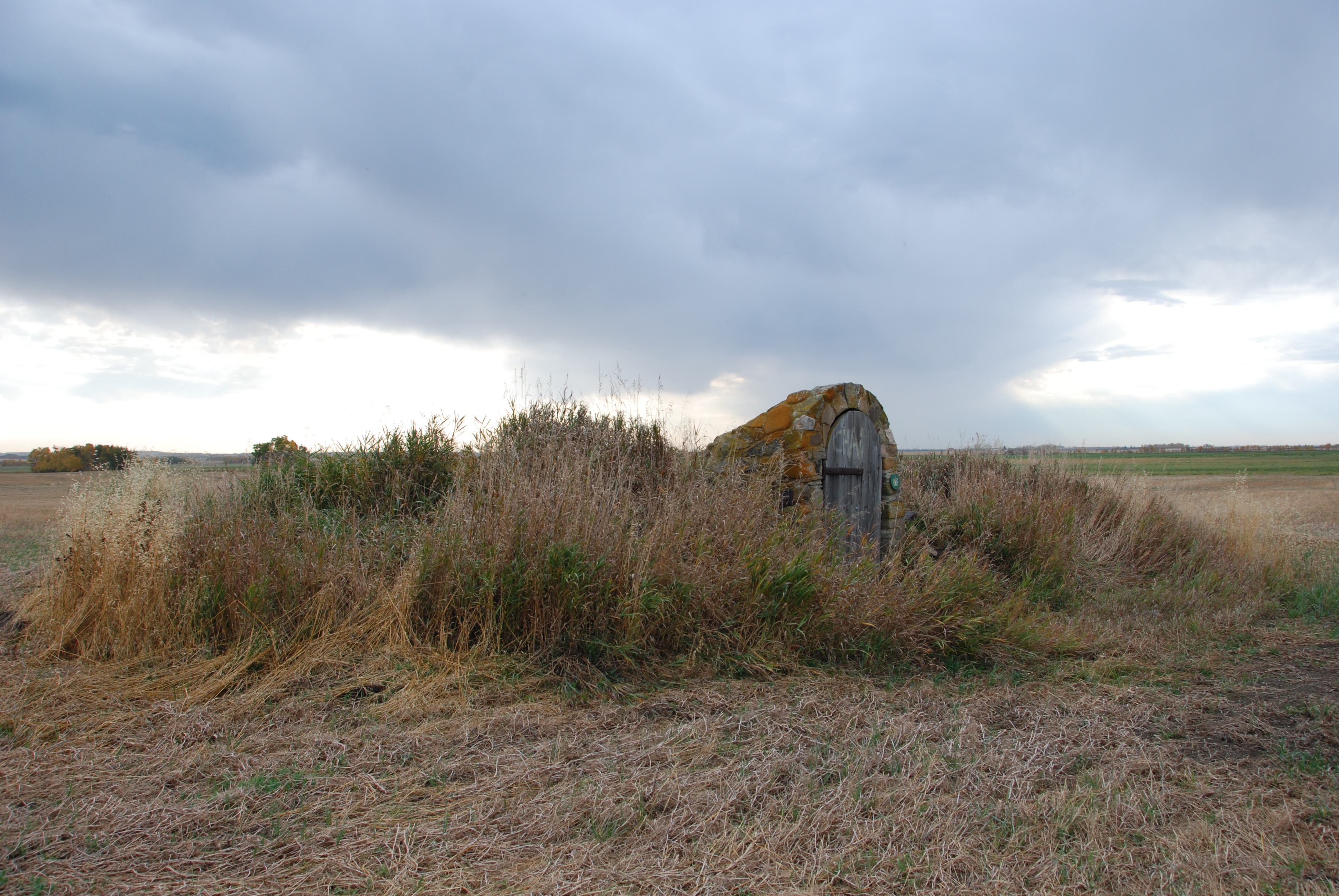
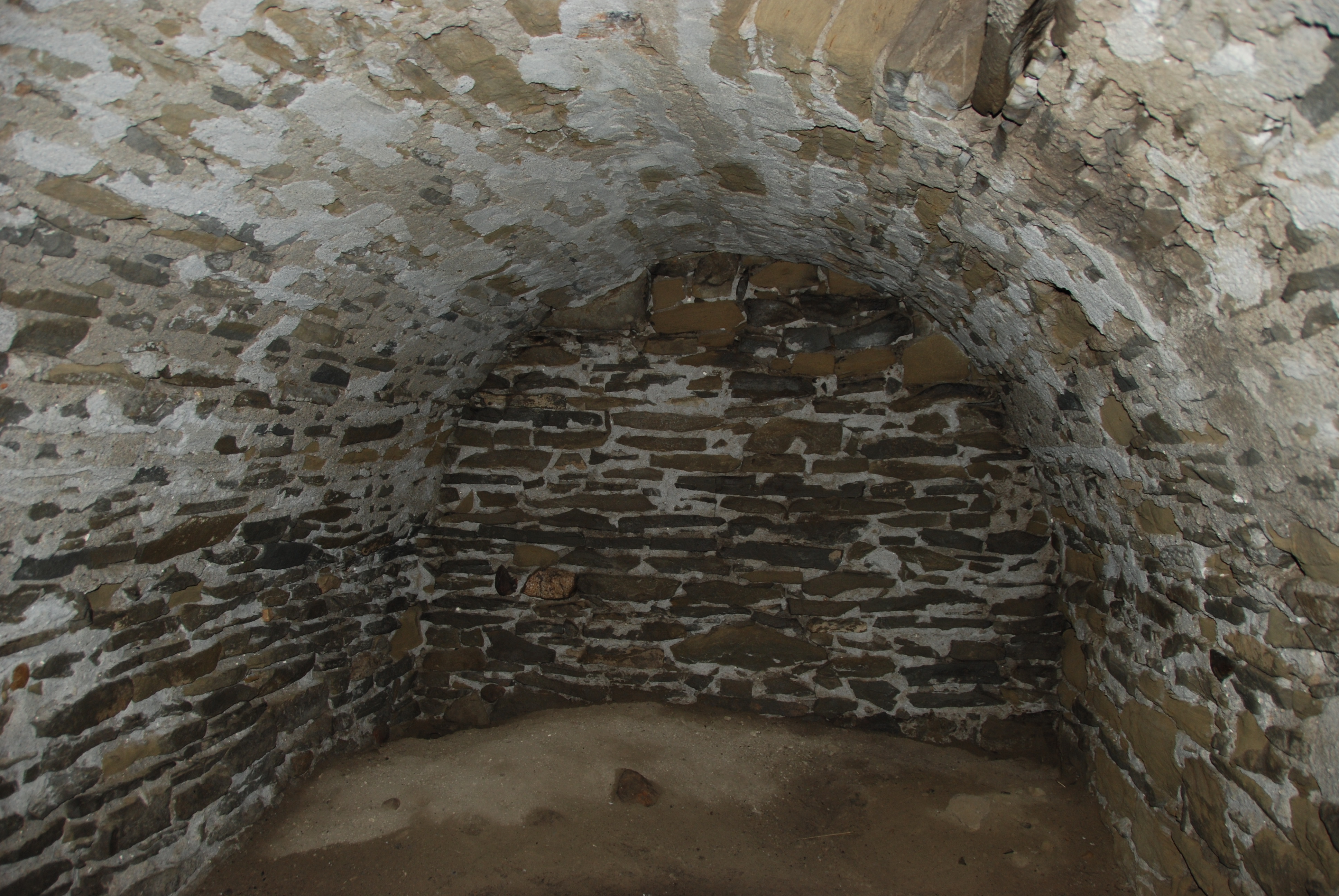
There is a peculiar overgrown mound in a farmer’s field in Kneehill County, near the town of Three Hills. A weathered wooden door hung within a stone-frame sits against the embankment. The door opens onto a sandstone staircase leading downward into a vaulted, stone chamber. Welcome to the Sunnyslope Sandstone Shelter—what must be Alberta’s strangest starter home. We know that the builder must have been a skilled stonemason, but unfortunately we know little else about the craftsman or how the shelter was built. The one-of-a-kind shelter was designated a Provincial Historic Resource in January of 2011. This post will look at some of the theories we have developed in trying to solve the mystery of the origins of the Sunnyslope Sandstone Shelter and its current condition.
The entrance to the Sunnyslope Sandstone Shelter (Alberta Culture, Historic Resources Management Branch, 2011).
The Sunnyslope Sandstone Shelter is significant for how sandstone was used to build its walls, ceiling and archway door. We estimate the shelter to have been built between 1900 and 1905. This makes the structure distinct when compared with other early homes that would have been built in Alberta around the same time.
A few theories have emerged over the years. Initial investigation of homestead records and local stories led many to believe that a George Schech built the shelter. Schech was reputedly a German immigrant and stonemason who came to Alberta in 1903 or 1904 after living in Wisconsin, Montana or Washington for a time. He apparently lived in the shelter while a frame house was being built on the same quarter section of land. Afterwards, it became a root cellar. Little else is known about Schech, as he apparently abandoned the farm and returned to the United States after only a few years of living on the homestead.
The chamber with barrel-vaulted roof made from mortared sandstone (Alberta Culture, Historic Resources Management Branch, 2011).
Another plausible theory emerged from our research and later on from additional oral history in the Three Hills area. The other theory is that the shelter was built in 1902 by a Mr. Stein who, like Schech, was also a stonemason from Germany. However, there is no existing record of a Stein homesteading in the area. There is evidence that Erick C. Stendahl or Erich Steendahl settled on the land that contains the Sunnyslope Shelter. It may be that “Stein” is an adaptation of Stendhal. However, Canadian census records state that Stendahl was originally from Norway, not Germany, and lists 1905 as his year of immigration to Canada. Additionally, a Declaration of Abandonment issued by the Dominion Lands Office for this quarter section was signed by Erich C. Steendahl in 1903. George Schech applied for a homestead on this land shortly thereafter. This further complicates the issue by not having definitive evidence to reference and verify. The information that has been compiled for both Schech and Stein or Stendahl is based on correspondence with residents from the area, census and homestead records.
Homesteaders who came to Alberta would construct a small temporary shelter, such as a tent, dugout or shack, before building a larger and more modern house. In that respect, Sunnyslope is no different. Early dugout houses in Alberta were shallow pits, often built into an embankment, with roofs made from poles, mud plaster and sod. Sod houses were usually the first “permanent” home built by a homesteader during the end of the nineteenth and early twentieth century in areas without trees. Later on, a more solid structure, usually a wooden, frame house, was constructed for permanent habitation. A variety of building techniques were used throughout Alberta during this period, but stone construction is unique and Sunnyslope has load-bearing sandstone walls and a vaulted, sandstone ceiling.
This design is more fitting to the Great Plains of the United States, where dugouts were used as storm shelters. Stone became a popular option in areas of the American West and Midwest because there were fewer trees, and stone better shielded the little room inside from extreme weather, such as tornadoes. Structures like this were also used as temporary homes and storage cellars for supplies, fruit and vegetables.
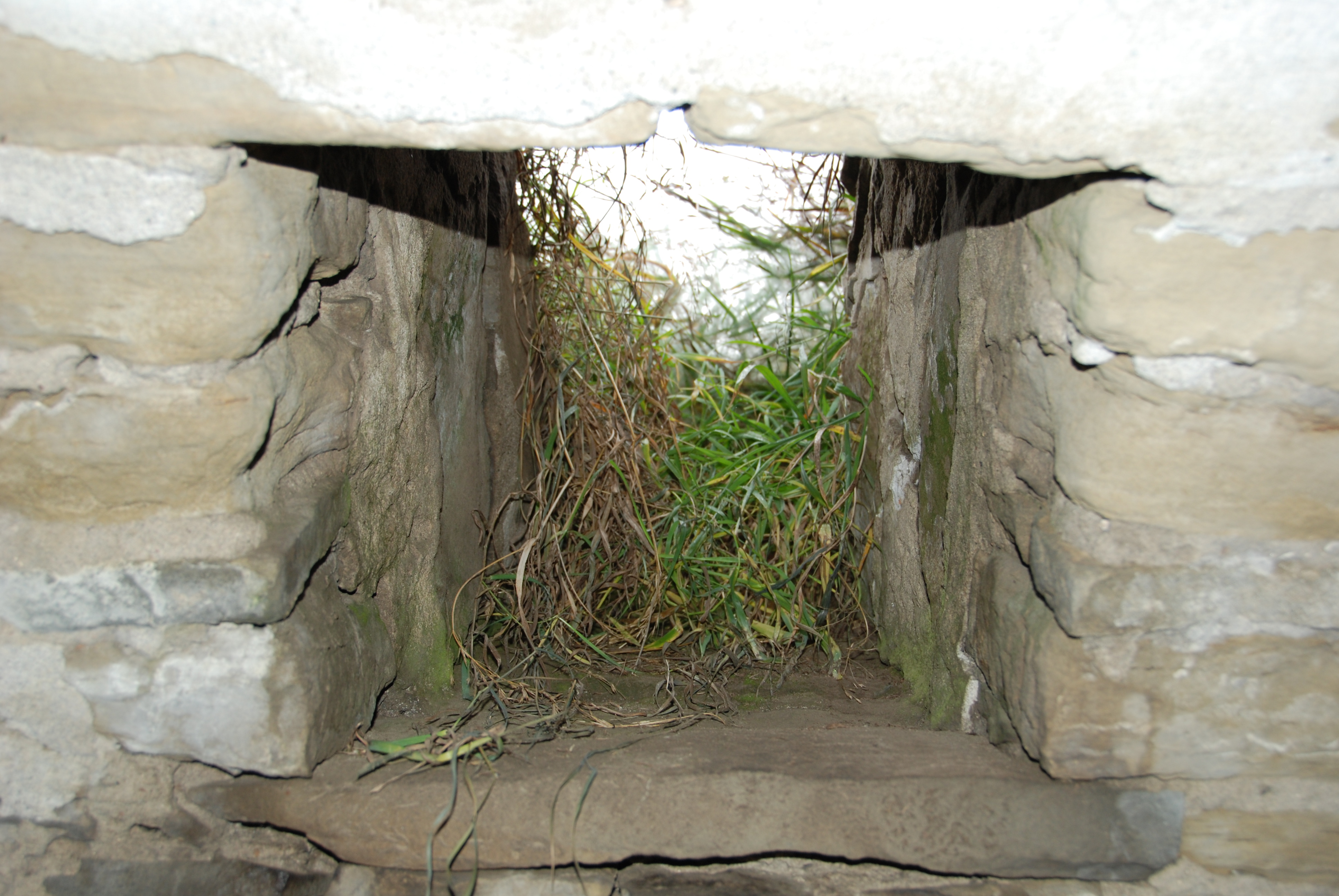
Small opening in the chamber, for light and ventilation (Alberta Culture, Historic Resources Management Branch, 2011).
Stonemasonry was much less common for simple buildings in Alberta, which makes the architecture of the shelter unique, but raises the question: why sandstone? A possible explanation is that the builder was influenced by the techniques used by homesteaders on the Great Plains of the United States, after residing there for some time. Since it appears that the builder of Sunnyslope was a stonemason, it is likely that he would have used the skills he was most familiar with to construct a first home.
The Sunnyslope Sandstone Shelter is stable and the interior has remained intact for more than a century—all of which is a testament to the skill of the builder. The stone archway itself was rebuilt in 1978, when a new wooden door was also added. The use of mortared sandstone and distinct stone stairway remain the most significant elements of the structure. The site shows the innovations that were made by early homesteaders and their need for a quickly constructed living shelter, while revealing the realities of a temporary habitat for early settlers to the area.
The mystery of the site’s origins highlight Alberta’s exciting heritage and show the fascinating stories that have contributed to our history. While there are conflicting reports over who was responsible for the shelter’s construction, this tale shows the fun of reconstructing a 100 year old story. There is evidence to suggest that Schech or Stendahl (Stein?) could have built the shelter, but how can we know for sure?
The entrance viewed from the back; the mortared sandstone is clearly visible (Alberta Culture, Historic Resources Management Branch, 2011).
Can you help us solve this whodunit? We invite all you history sleuths to leave your comments and perhaps help us piece together the puzzle. Any information, tips or stories can assist with creating a clearer picture of the past.
For additional details on the Sunnyslope Sandstone Shelter, refer to the Alberta Register of Historic Places. Homes in Alberta: Building, Trends, and Design 1870-1967, by Donald Wetherell and Irene Kmet provides more information on early homestead construction in the province.
Written by: Erin Hoar, Historic Resources Management Branch Officer.
Wetherell, Donald G., and Irene R. Kmet. Homes in Alberta: Building, Trends, and Design 1870-1967. Edmonton, Alberta: University of Alberta Press, 1991.
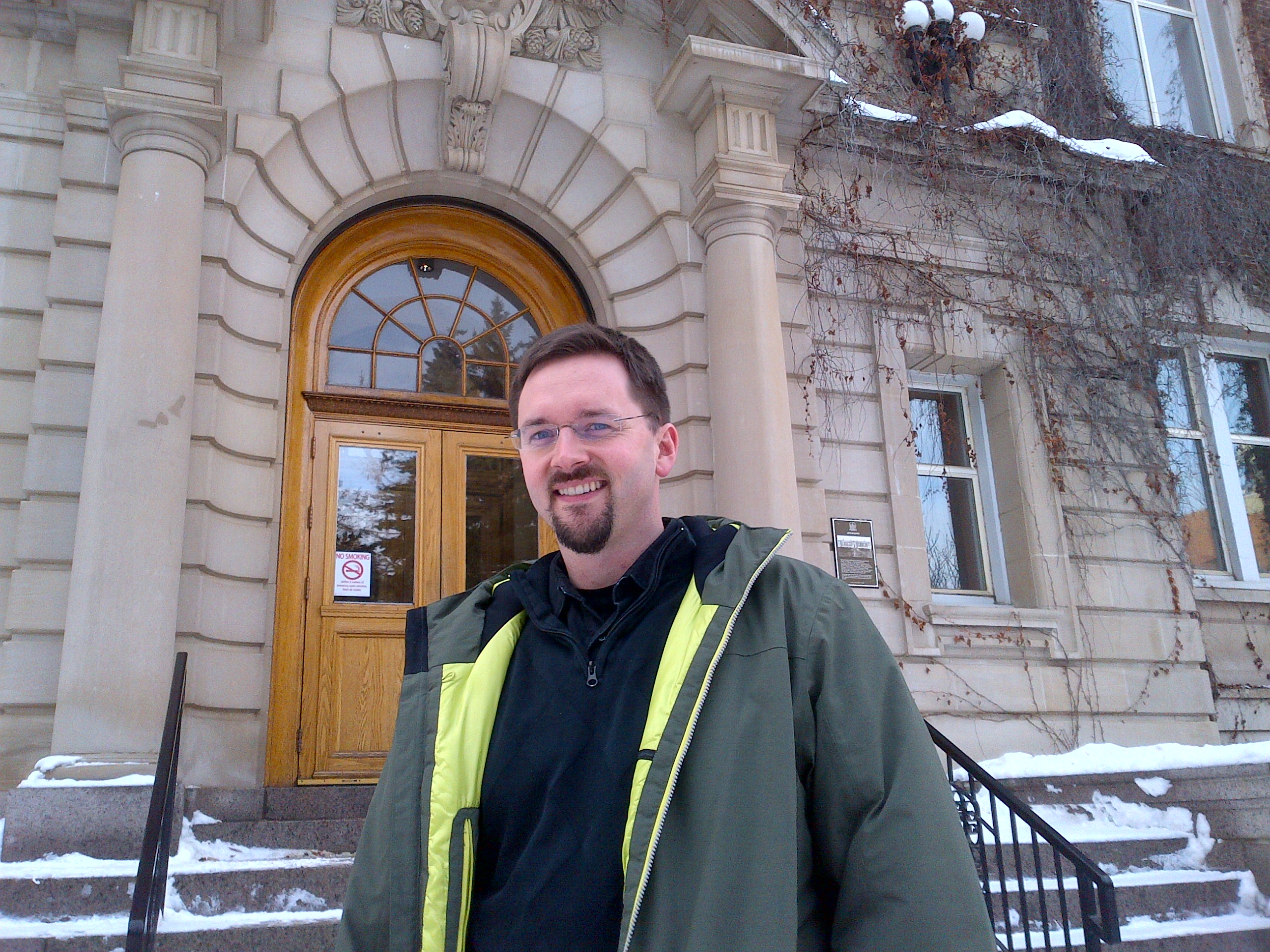
Matthew Francis, Manager of Municipal Heritage Services, describes his role this way: “I manage all of the Government of Alberta’s work with municipalities to protect their historic places.” One focus of his job is running the Alberta Main Street Program. The other is leading the Municipal Heritage Partnership Program (MHPP). Both are done with the help of two Municipal Heritage Services Officers.
Matthew Francis, Manager, Municipal Heritage Services.
The Municipal Heritage Partnership Program was established in 2006 to give municipalities across Alberta the training and tools to start up and run their own heritage conservation programs in a way that “represents the best practice of what the Historical Resources Act requires.”
Matthew, who joined the branch the year before, has worked with this program from its start. He explains: “Municipalities in Alberta had been empowered since 1978 to designate their own historic places, but most of them didn’t know about that. Only a handful of communities—Calgary, Edmonton, Banff, Red Deer—had ever designated something at the local level. [The others thought,] ‘This is something we have to go to the Province [to do]’.”
“So the first several years were really about building awareness. I spent almost 100 days on the road in 2006 going all over Alberta—small towns and cities, and everywhere. We were able to tell them, this can be done locally around the council table, and through a bylaw, and we gave them the background on that, and the training, the tools.”
MHPP staff members lead workshops for local government staff, volunteers, and sometimes elected officials as well, to train them in how to protect locally significant historic places by using recognized tools. The main identification tools are surveys: research projects that gather basic historical and architectural information on possible historic resources. Conducting a survey can be a first step toward developing a comprehensive heritage conservation program. MHPP also offers workshops on heritage inventories: projects that helps a community identify places of outstanding local significance and develop a deep understanding of each place that will help the municipality determine how to protect and conserve it.
The Alberta Historical Resources Foundation offers matching grants to municipalities in Alberta that are undertaking surveys or heritage inventories or that are developing heritage management plans. MHPP staff often help municipalities craft viable survey or inventory projects that are likely to be funded by the Foundation. The MHPP also helps to evaluate grant applications, making funding recommendations to the Foundation’s Board of Directors.
Sometimes staff must overcome scepticism or even hostility of those who think heritage conservation is anti-progress. Matthew responds: “A lot of people when they think about their historic buildings, they think about the past, and we’re more concerned about saying, does that place have a future? That’s the conversation that we’re trying to have.”
Ideally, each municipality will first establish what the MHPP calls a Heritage Advisory Board (HAB), although it may have a different name locally. If the local government decides to seriously pursue the conservation of its historic resources, MHPP staff will meet with the board and others to explain that process and make sure they understand the three key aspects of evaluation: eligibility, significance, and integrity. Heritage consultants—historians, planners, or others with a conservation-related background—typically do the survey or inventory work under the direction of the advisory board.
As a central part of this work, the consultant will produce a document called a Statement of Significance for each historic place, which describes why the community values the place and what about it needs protection to preserve its significance. The HAB must be able to assess the quality of each Statement of Significance, making sure that each document accurately describes the significance and integrity of the historic resource(s) discussed. The HAB will make a recommendation on designation to the municipal council.
“Our place is not to intervene in [designation decisions],” Matthew says. “Municipalities in Alberta can designate whatever they want. They’re empowered to do that. It’s the community that has the local knowledge, and that’s what we’re trying to draw out.” But, ideally, the local government will learn how to make good decisions about heritage designation—decisions that are consistent across the community and also consistent with the best practices that are in use throughout Alberta. Municipalities may also establish their own regulations for the protection of their designated historic places.
“I really love working with the Heritage Advisory Boards.” Matthew reflects. “They’re volunteers for the most part, and they’re there for a reason—it’s usually because they have some sort of personal connection to these historic places that are meaningful to them in their community. A really enjoyable part of the work is getting to hear some of those stories.”
Today, MHPP staff members usually work with a municipality by invitation, although sometimes they’ll contact a local government proactively. This may be initiated by inquiries from private citizens concerned about protecting a specific historic place. When that happens, the MHPP staff member will urge them to contact their local government, but then will follow up with government staff to discuss the option of historic resource designation to protect the resource. “And from there we’ll say, ‘Have you thought more comprehensively about taking a look at all your historic places?’”
The annual Municipal Heritage Forum, a project of Municipal Heritage Services, supports these efforts. “Before 2007 people doing heritage conservation locally in different communities had very little connection with each other,” Matthew recalls. The first forum in 2007, called a Summit for Stakeholders, had about 40 participants. “It was basically just bringing the people together and giving them some information,” Matthew says. “But [we saw that] it’s the sharing of information [that’s important]. It’s really great to see the local knowledge increase and for that information to be shared peer-to-peer.” The forum now attracts about 125 attendees each year, and has become an eagerly anticipated event for heritage professionals and advocates across Alberta.
The Municipal Heritage Partnership Program has now worked with more than 100 municipalities, and it continues to help “repeat customers” as well as communities that are new to heritage conservation. The MHPP keeps evolving, along with the communities it serves. “We’ve worked with communities now that have been through the awareness cycle, so they know how to do [heritage designation], and they’re taking a high degree of ownership for this, which is what we always intended,” Matthew explains. The next step, he says, is helping them integrate heritage conservation into other urban planning initiatives—“not [treating it] like an appendage or an afterthought. Two of the flood-impacted communities we work with—High River and Medicine Hat—are working on major initiatives with their downtown planning, and I think they are leading the way on some of this.”
Municipalities have evaluated well over 1,000 historic places across Alberta since the program’s beginnings, “and that’s the number we keep an eye on,” Matthew says. “Not all of those places have been or will be designated or be protected,” he adds, “but at least they’re known. We know about them, and the communities know about them—and that’s really what matters most.”
The Edmonton and District Historical Society is holding their 18th annual Historic Festival & Doors Open event series! The festival runs from July 6th to 13th and includes museums, archives, historic sites as well as many bus and walking tours. This is an excellent opportunity to take part in the Edmonton region’s diverse heritage. More information and a full schedule of events can be found here.
Below are a few of the places operated by Alberta Culture that are participating in this week-long event.
The Provincial Archives of Alberta will be giving behind the scenes tours of areas that are not usually open to the public, including the vaults and conservation lab. Tours will take place on July 12th at 10am, 11am, 1pm and 2pm.
Interpreters at the Father Lacombe Chapel are offering guided tours of the site and will have historic stories, photos and artifacts to complete the experience. Tours are available all week between 10am and 5pm.
The Ukrainian Cultural Heritage Village is inviting visitors to learn about the restoration process while conservators work on Morecambe School. The tour will be given by our own Jim Nakonechny, a Conservation Technologist with the Historic Resources Management Branch, from 2pm to 4pm, July 8th-10th.
The Rutherford House Provincial Historic Site will be hosting ‘hear the voices of the domestic help’ with different activities planned for each day, including gardening Wednesday and bake day Saturday. The events will show the daily life of the help who served at Rutherford house during the early 1900s. This series runs July 7th-13th and is open 10am to 5pm.
Written by: Erin Hoar, Historic Resources Management Branch Officer.
Back in the 1970s and 80s, the Archaeological Survey of Alberta published a highly-regarded series of occasional papers, known affectionately in archaeological circles as the “Blue Series,” for its characteristic cover colour.
Occasional Paper No. 1, published in 1976.
Robin Woywitka, Cultural Land Use Analyst with the Historic Resources Management Branch commented on how this rich collection of literature has become a coveted resource, with well-worn copies sought after by professional archaeologists and others interested in the field.
Woywitka observed, “The two series were established in the 1970s and 1980s to help disseminate the results of archaeological work conducted in the Province. Thirty five Occasional Paper volumes and 17 Manuscript Series volumes were issued from 1976-1994. These volumes cover the entire breadth of human history in Alberta, from the late glacial to the recent past, and from the Great Plains to the Rocky Mountains into the Parkland and Boreal Forest.”
It’s now online!
As it turns out, the series is not just a relic of the past, but has stood the test of time. Now, by popular demand, the whole series is available online free for download! Jared Majeski, Heritage Division Web Assistant, collaborated with Woywitka to see the project through to completion. Many avid archaeologists have requested this, and those requests have been heard.
Robin Woywitka, Cultural Land Use Analyst, and Jared Majeski, Heritage Division Web Assistant, proudly display a copy of one of the Occasional Paper series, now online.
In addition, the series is being revived! New contributions to the Occasional Paper series are welcome. The new series will focus on the annual review style volumes that were a hallmark of the original Occasional Papers. Please consider submitting a manuscript on topics of Alberta archaeology (submission guidelines are here). The deadline for submissions for the 2014 annual review volume is January 31, 2015. Ideas for edited thematic volumes that stretch beyond the confines of Alberta are also welcome.
Written by: Matthew Francis, Manager, Municipal Heritage Services.
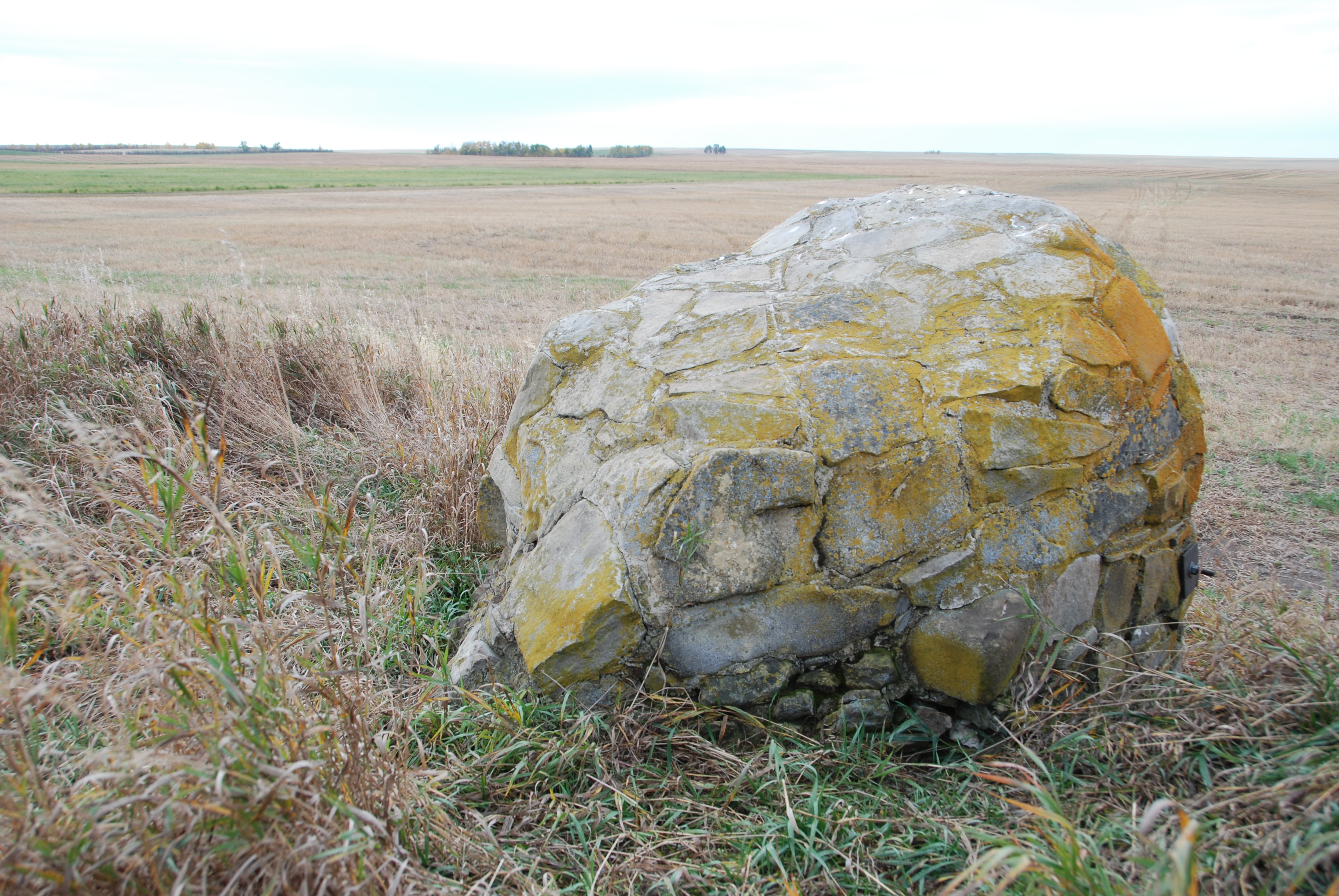
The word ‘Okotoks’ translates from the Blackfoot language as ‘Big Rock.’ The name was given by the resident indigenous people to a very large boulder that is known as a glacial erratic – boulders that have been moved from their original location by glacial ice. Okotoks is by far the largest erratic in Alberta; it is about the size of a two-story house and is estimated to weigh nearly seven million kilograms. The Big Rock is a well-known landmark in southern Alberta. It is a designated provincial historic resource owned by the Government of Alberta, and is accessible to the public by means of a hiking trail, signage and a parking lot. What is not well-known is that the Okotoks Big Rock has a great deal of Aboriginal rock art painted on its surfaces.
Okotoks Big Rock Erratic
Rock art includes pictographs (paintings) made with a red paint composed of iron-rich hematite (red ochre). The existence of a few red ochre images on the Big Rock has been known for decades, but the revolution in digital photography and image enhancement has brought to light a whole lot more art on the Okotoks erratic than previously known. Specifically, we now know that some areas of the rocks were extensively rubbed with red ochre. Since these red areas lack definable rock art figures like humans and animals, it was long believed that the red blotches were simply part of the rocks’ natural colour. Through enhancement we can now pick out hand prints and finger swipes, telling us these red blotches were indeed made by human beings.
Rock art at Okotoks Big RockPhoto-enhanced areas of red ochre smeared on Okotoks Erratic. Note hand prints at top.
All rock art sites are sacred to Native people; rock art represents communication between human beings and the spirit world. Blackfoot people still visit the Okotoks site, conduct ceremonies, and hold the site in great reverence. Thus, it is all the more sad and frustrating that the Okotoks erratic has been subjected to extensive and increasingly frequent bouts of vandalism. As the site is operated by the province and is open to the public, there comes a point where some action needs to be taken. It is an eyesore, an embarrassment and severely disrespectful to the Blackfoot beliefs about the sacred character of the rock. But what can be done with a massive rock surface covered with graffiti that underneath lies fragile, precious painted pictures that tell stories of ancient Aboriginal people?
In the past few years, serious incidences of graffiti were washed off the rock face using a high pressure water sprayer. More recently, an environmentally friendly paint stripper had been used with good success. But critical to any graffiti removal has been potential impact to underlying rock art. We realized that we could never properly manage the site until we had a high-quality “map” of the rocks that plots the complex rock structure and the locations of all the rock art images. We realized that the best way to make a physical record of the Big Rock was to record it in 3D using a portable laser scanner. While documentation won’t stop vandalism at Okotoks, it will make us much better prepared to deal with future instances in a way that protects significant historical resources.
This slideshow requires JavaScript.
A partnership with the internationally respected organization CyArk was formed. CyArk is a nonprofit organization dedicated to digital recording and preservation of the world’s most significant sites. Among their credits are 3D recordings of the statues of Easter Island, Pompeii, ancient Thebes, and Mt. Rushmore. CyArk also digitally stores the 3D information for each site, serving as a world archive of heritage data. CyArk retained a local service provider to assist with the equipment and expertise to conduct the laser scanning. In early October 2013 the entire external surface of the Okotoks Big Rock, including the tops of the rocks and some internal crevices, was scanned during two days of field work. The result is a strikingly accurate rendering of the Okotoks erratic in both its geometric shape and the plotting of all known rock art images. The project also resulted in production of an accurate 1:200 scale model of the Rock that will be useful for planning and educational purposes.
3D rendering of point cloud data from laser scan at Okotoks with enhanced photography overlaid. Red areas are red ochre paint; note square-bodied human figure at upper left.
In addition to the rendering and scale model, the project also raised awareness about negative impacts associated with graffiti and heightening understanding of the value and importance of historic resources to the community. Further Alberta Culture now has a sophisticated tool to use for site management.
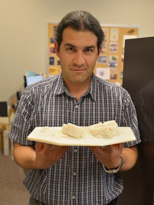
Alireza Farrokhi holding 1:200 scale model of the Big Rock
Sadly, the rocks have already been subjected to more graffiti in the months since our project ended; however, we now have accurate information on the type and location of rock art that will assist in graffiti removal efforts. There are other threats to the cultural and natural significance of the Okotoks erratic. It has long been a favoured place for climbers, subdivisions are rapidly encroaching on the site, and public visitation is increasing. There are many challenges ahead in the long-term management of the Big Rock, but thanks to the careful recording conducted through Innovation Program funding we have a solid baseline of information about this very special place that will guide future management.
Written by: Jack Brink, Curator, Royal Alberta Museum and Alireza Farrokhi, Head of Conservation and Construction Services, Historic Places Stewardship
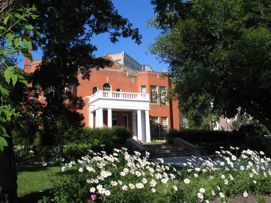
The Bow On Tong Building and the Manie Opera Society Building are two well-known places in downtown Lethbridge that contribute to the distinctive cluster of buildings that make up Lethbridge’s Chinatown district. Recognizing their remarkable history and exceptional significance, the City of Lethbridge’s council recently designated each as a Municipal Historic Resource. The buildings are now undergoing comprehensive rehabilitation, including extensive structural repairs and the careful retention of historic elements found nowhere else in Alberta. I had the opportunity to visit these fascinating places just before Easter, gaining a glimpse into Lethbridge’s Chinese community during the first half of the last century.
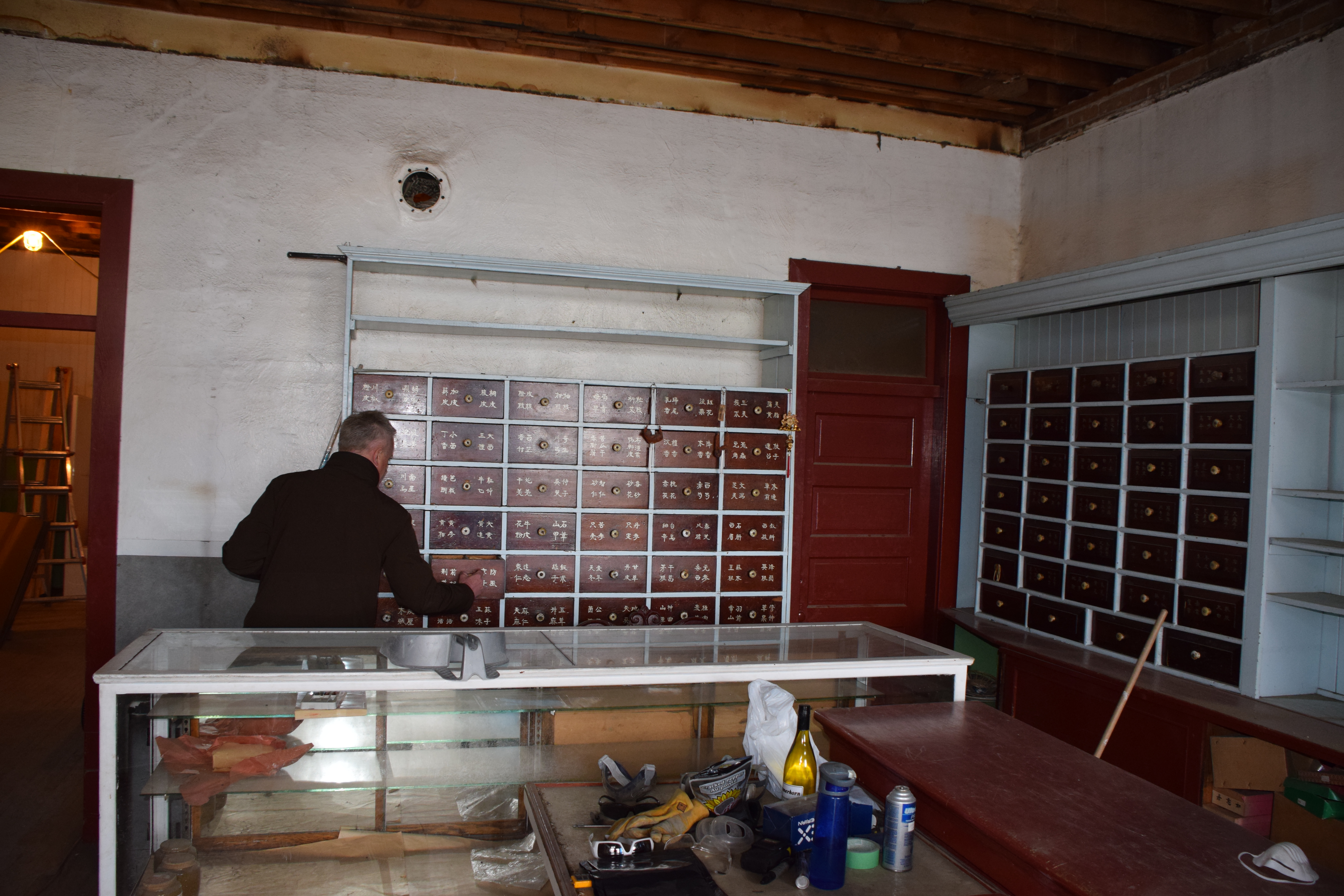
Ted Stilson showing me Apothecary’s showroom and work area. (April 17, 2014)
We peek inside the cabinets to find, well, I’m not sure.
Boxes full of remedies, including “kidney pills”.
A 1907 City bylaw restricting all laundries to this area was enforced only if the laundry was Chinese-owned. Other Chinese-owned businesses followed the laundries into the neighbourhood west of Galt Gardens. The Bow On Tong was constructed in 1916 in the middle of the city block known as Chinatown, on 2nd Avenue South. Beside it stood the Manie Opera House Building (not its original name), built about a decade previously. Lethbridge’s Chinatown had begun.
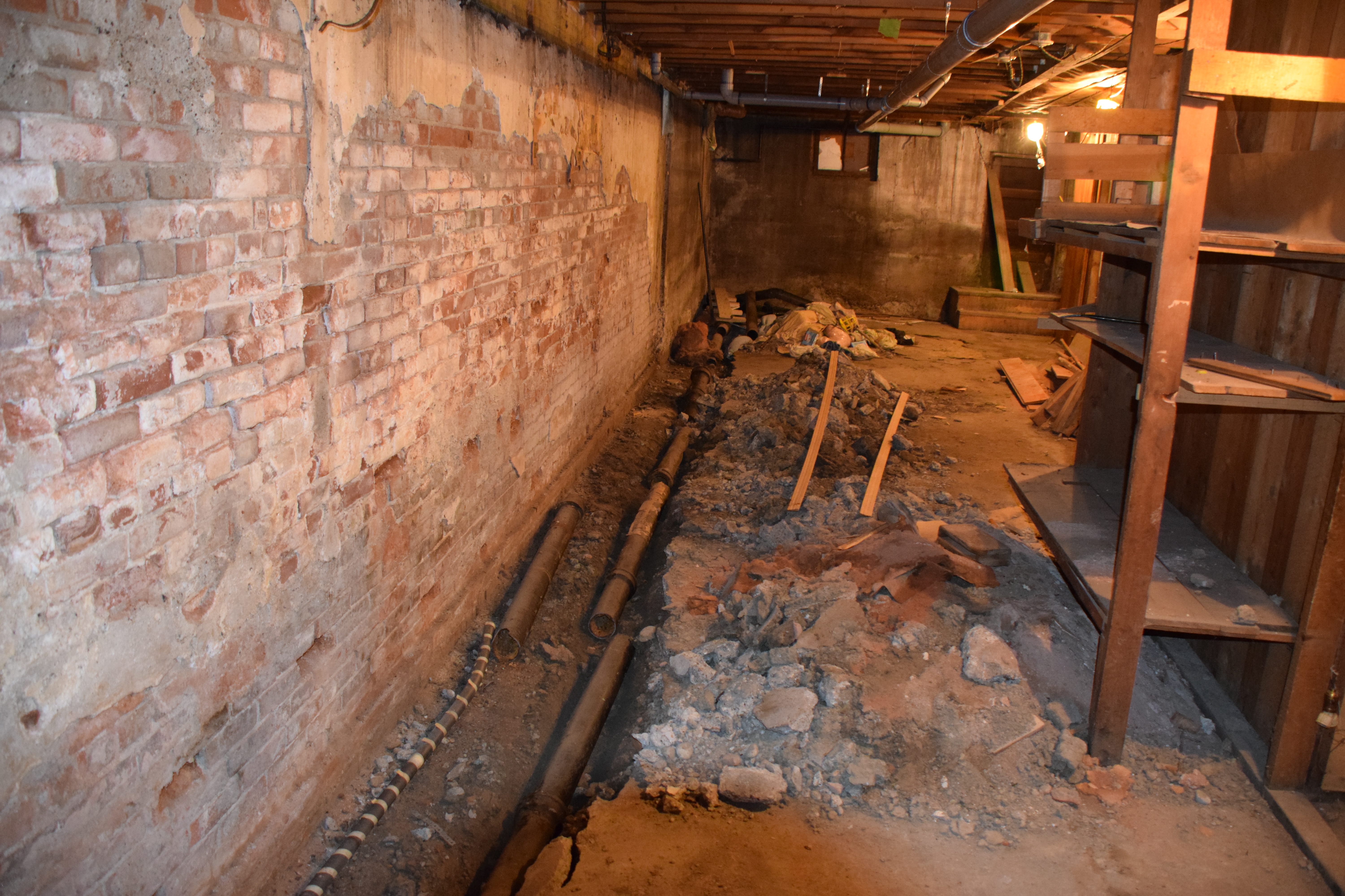
The basement of the Bow On Tong Building in the middle of rehabilitation (April 17, 2014)
My tour of the buildings started on the main floor of the Bow On Tong and was led by Ted Stilson, coordinator of Lethbridge’s Main Street Program, and Kevin Peterson, general contractor for the rehabilitation project. I learned that Way Leong, a Chinese apothecary, opened the Bow On Tong Co. in the 1920s, from where he dispensed traditional remedies to the Chinese community. Shelves and cupboards, labeled with Chinese characters, line the walls of the small shop and tell of Mr. Leong’s practice which operated here into the 1950s. Several of the varnished wood drawers still contain the apothecary’s supplies and equipment. (Unfortunately, while I was there, I did not have the pleasure of meeting Way’s son, Albert Leong, who lived in the building up until rehabilitation work started.)
The basement of the Manie Opera Society is just as interesting. Even with all the construction work going on, I could make out traces of the frail partitions dividing the basement into little rooms. Immigrant coal miners from China once lived down here; their tiny, cramped quarters wallpapered in newspaper still clinging to the walls. A few rooms seem to have been decorated with pictures of American celebrities clipped from magazines—icons of the popular culture of their new homeland.
Kevin Peterson shows us a portion of one of the makeshift walls. Pictures of american celebrities cut out of magazines are everywhere. (April 17, 2014)
Rehabilitation began last year when cracks appeared in the upper wall of the Bow On Tong, leading to the discovery of structural problems throughout both buildings that was slowly causing them to collapse. Major parts of the work are now in progress include the shoring up of a crucial load-bearing wall shared by both buildings and upgrades to meet the current fire code. Even with the urgency of the structural repairs, the work is being done with painstaking care to avoid destroying historic materials. The pressed metal ceiling of the apothecary, for example, has been carefully removed piece by piece. Each piece is numbered and its location mapped before careful cleaning and repainting. After structural reinforcement of the ceiling and the installation of new fire-resistant drywall (required by the building code), the ceiling will be reassembled, with each piece installed in the sequence in which it was removed.
The basement in the Maine Opera Society Building was once wallpapered in newspaper.
Some of the pages are still visible.
The ambitious and painstaking work I saw is a testament to the dedication of the community of Lethbridge, which has supported the project through local fundraising activities and the donated time of many volunteers. Kevin Petersen, the general contractor, has himself contributed much of his own time. When the rehabilitation work is complete, Albert Leong will return to his lifelong home in the Bow On Tong Building. It, and the neighbouring Manie Opera Society Building, will continue the legacy of Lethbridge’s Chinatown.
Written by: Michael Thome, Municipal Heritage Services Officer.
This is the second in a series of posts on our experience attending the National Main Street Conference in Detroit.
I had the pleasure of attending the 2014 National Main Street Conference recently, in Detroit, Michigan. Several Albertans were there with me, including four people representing two of our main street communities: the Town of Olds and the City of Camrose. The (U.S.) Main Street Program has been operating in the United States for over 35 years now. As Alberta continues to revitalizes our its Main Street program, we continue to learn from the American counterpart.
The Canadians after the opening plenary session. Each american state formed a delegation, so we formed one of our own.
In the late 1970s, the (U.S.) National Trust for Historic Preservation was exploring ways to facilitate the preservation of historic downtowns. All over North America, businesses and residents had been leaving downtown and moving to new suburban neighbourhoods and consequently many historic places were neglected and being abandoned. The National Trust realized that solving the problem would not be as simple as restoring dilapidated buildings; restoring historic commercial areas meant bringing people back down town. It launched a three-year Main Street Project in 1977 to study ways to revitalise declining downtowns. The main street pilot project was so successful that it was made a permanent program in 1980 and was soon helping hundreds of communities throughout the United States revitalise their historic commercial areas.
A Main Street project works by pursuing four equally important activities: organizing business owners and residents around a common purpose; economic restructuring or strengthening the existing businesses while also diversifying the mixture of business types; designing a functional and pleasant streetscape that highlights the authentic historic places; and promotion, or rekindling a sense of pride in the downtown. Economic restructuring ensures that businesses are successful and the Main Street is able to pay its own way. Design ensures that Main Street has a functional and pleasant streetscape—built around authentic historic buildings—and creates an inviting place that people want to work, live and play in. Promotion ensures that the community (and visitors from away) know what the area has to offer and feel welcome. Organization ensures that business owners, residents and other stakeholders take shared responsibility for the success of their downtown.
The keynote by Donovan Rypkema presented a straightforward and compelling explanation of how the program works and why it works so well. (Mr. Rypkema is an internationally regarded specialist in the economics of historic preservation.) He argued that Main Street is the most effective, sustainable and “cheapest” economic development strategy he’s come across, for historic areas or otherwise. This is because the four pillars of a Main Street align with the four factors that set the value of real estate.
Mr. Rypkema compared the four pillars of Main Street (design, organization, economic restructuring and promotion) with the four forces of value: economic, physical, social, and political. Mr. Rypkema talked about how Main Street works because each of the four points is aimed at increasing a corresponding area of value. When an area restructures economically by ensuring a mixture of complementary businesses, it increases the number of visitors and therefore the profitability of each business and consequently the value of the real estate.
A Main Street Program adds to the physical value of property when it restores dilapidated historic places and otherwise upgrades the streetscape. It adds to the social value of property by improving how the community feels about the area, by increasing local pride in a historic area. Finally, it adds to the political value of property when the range of possible, profitable and acceptable uses increases. He calls it the most successful economic restructuring programs ever tried in the United States. (On a somewhat related note, Mr. Rypkema joked that Main Street was working on smart growth and new urbanism before these planning philosophies were proposed.)
The best part about the conference was the opportunity to learn from peers in the Main Street movement. There were excellent sessions around all the four points. I attended lots of sessions on using social media effectively (big surprise) and community organization. I highly suggest that anyone interested in these ideas look into the National Main Street Center. I look forward to perhaps attending next year’s in Atlanta, Georgia.
Written by: Michael Thome, Municipal Heritage Services Officer.
The tall silhouette of a wooden grain elevator on the horizon once symbolized rural landscape across the prairies. “Against open space,” in the words of distinguished American photographer Frank Gohlke, “grain elevators were the presence against which that emptiness could be measured.”
A long row of eight elevators had been built at Vulcan by 1924 and provided a backdrop for this harvest scene at Vulcan. (Glenbow Archives, ND-8-218).
Early Elevator Row
In 1891, the Calgary and Edmonton Railway built Siding 19, soon to be named Leduc, on the west side of its mainline. The length of the siding—long enough to build a row of six elevators—showed the railway’s faith in the district’s grain growing potential. By 1905 a row of three elevators lent a vertical silhouette across the tracks from the station. The first grain company to build at a new siding tried to choose the best position for attracting customers, and for loading cars with the greatest ease. Each elevator had sufficient space on the siding to load two grain cars. Elevator construction along the Calgary and Edmonton railway set a pattern followed across Alberta as main lines and branch lines slowly spread their reach.
As elevator rows developed they created a varied sky line: there was considerable difference in size and shape of elevators built from the 1890s to the 1920s. After 1920 many of the early variants were replaced and grain companies built traditional elevators with a gable roof and a gable roofed cupola on top. Wood clad elevators were almost always painted CPR red, and what differentiated each company’s elevator was its name (and its logo, if it had one) painted high up on the walls, emblazoned in white along with the name of the town. In contrast, metal clad elevators were galvanized or painted white.
Elevators Everywhere
Competition between the grain companies resulted in the rapid emergence of rows of elevators at the most significant grain delivery points. By 1911 there were 142 sidings with grain elevators, and 43 of them had three or more elevators. Carstairs, High River and Nanton, along with Edmonton and Calgary, had five elevators, while Westaskiwin had six. Eight years later, in 1919, the total number of elevator delivery points in the province totalled 334, of which 150 had three or more elevators. Barons had emerged as the point with the longest row of elevators, with eight, followed by Nanton with seven. A number of towns had six: Blackie, Bow Island, Carmangay, Chinook, Claresholm, Cluny, Gleichen, Granum, Magrath, Oyen, Provost, Vulcan, and Youngstown. Edmonton and Calgary also had six. The points with the largest elevator capacities were mainly in the wheat-growing area of the southern part of the province, but by the 1940s as farming thrived in the Peace River country, impressive rows evolved at Sexsmith and Grimshaw. Vulcan in southern Alberta however, holds the record for the longest row—12 elevators in 1956.
The elevator row became a towering beacon for Alberta’s growing hamlets, villages, and towns with bustling commercial main streets and residential areas. Through the 1950s into the 1960s a long unbroken row symbolized prosperity. A town with five elevators rather than three had a more lucrative tax base and better services, all of which could be traced back to its life line—the railway.
Barons, 1913. (Glenbow Archives, NA-2059-27)
Elevator Consolidation Begins
From the 1960s, as paved highways increasingly linked Alberta’s major towns with hamlets and rural districts, and one railway station after another closed in smaller centres and on branch lines that were being abandoned, farmers chose to take their business to larger centres. Farmers benefitted from the competition between elevators at larger centres, and grain companies closed more isolated grain buying points due to loss of business, the threat of further branch line closure and changes in car allocation rules. Grain companies consolidated their elevators making for longer rows at fewer points. Towns that had secured multiple elevators flourished; the more elevators in a town, the greater its prestige and the better its prospects for business and further development seemed to be.
All the Colours of the Rainbow
It was in the 1960s that elevator row began to take on the appearance that many of us remember. The grain companies repainted their elevators when the CPR red began to fade. First came white, adopted by the United Grain Growers. A splash of colour marked the beginning of modern company branding. First came white, adopted by the United Grain Growers. Pioneer Grain Company first painted the shingled roofs of their elevators yellow, and then in 1962 went for bright orange on the elevator walls, complemented by yellow roofs. The story goes that on the Victoria Day weekend in 1962 as a Pioneer engineer and his wife toured the countryside, she suggested orange (the colour of her pants that day) would cheer up the appearance of the elevators on the landscape. The company agreed to the experiment and the first dazzling orange elevators on prairie rows surprised everyone. Federal Grain adopted white by the time it took over Alberta Pacific Grain (1943) Ltd. in 1968. The Alberta Wheat Pool adopted a turquoise green colour, which slowly dominated the rows after 1972 as AWP took over Federal Grain in 1972, painting all the white Federal elevators turquoise-green as well. Parrish and Heimbecker adopted a mustard colour in 1976.
The Fall of the Sentinel
More change came to elevator row as the grain companies began to replace ageing elevators with larger single and double composite elevator designs in the 1970s. The sky line began to transform as holes began to appear in the great Alberta rows. By the 1980s elevator row was gap-toothed. Grain companies rapidly consolidated business on sidings where there was enough room to fill more grain cars at one time. Then in 1995 the federal government ended the Crow Rate that subsidized freight rates to the port terminals, and deregulated the railways in 1996. The economy of scale changed. In 1997 there were still major rows of elevator complexes that sometimes included an older elevator as an annex: six at Hussar, six at McGrath, six at Sexsmith, five at Standard, four at Arrowood, and four at Champion and finally seven at Warner. The same year, scores of unwanted elevators, many remnants of once proud rows began to fall. Finally, at the turn of the 21st century, operating grain elevator rows were completely replaced by large inland concrete terminal silo-style structures. Warner is an aberration: with six of its original traditional elevators (forming four elevator complex facilities) still standing and used to handle the local mustard crop, it is a significant legacy of a vanished skyline.
Written by: Judy Larmour.
Barons, 1913. (Glenbow Archives, NA-2059-27)
A long row of eight elevators had been built at Vulcan by 1924 and provided a backdrop for this harvest scene at Vulcan. (Glenbow Archives, ND-8-218).
Elevator row at Vegreville in 1926 illustrates the variety of heights and shapes that defined Alberta’s skyline. (Provincial Archives of Alberta, B.2749.)
Elevator row at Consort, 1950s. (Provincial Archives of Alberta, PA116.2.).
Warner elevator row as it appeared in 1997. Today the six elevator row at Warner, albeit with modifications, is the longest elevator row standing in Alberta. (Alberta Heritage Survey, 97-R0297-09a).

 The Historic Resources Management Branch of Alberta Culture is pleased to announce the launch of the Alberta Energy Resources Heritage website. The site was developed with the aim of promoting an understanding and appreciation of the Province’s abundant energy resources, the rich history of resource extraction and production, and the important role that this sector has played and continues to play in Alberta’s social, political and economic history.
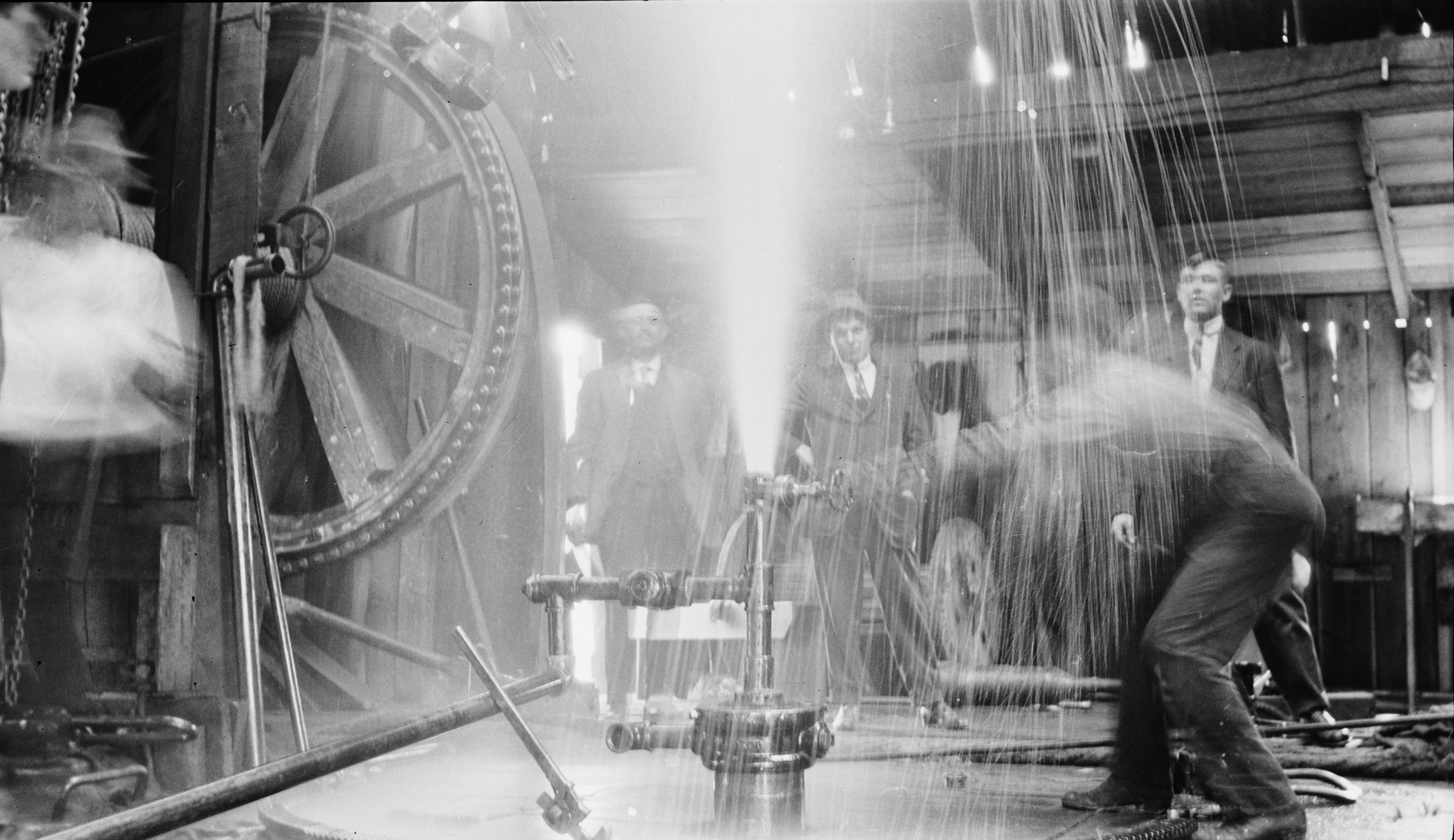


")
")

")
")