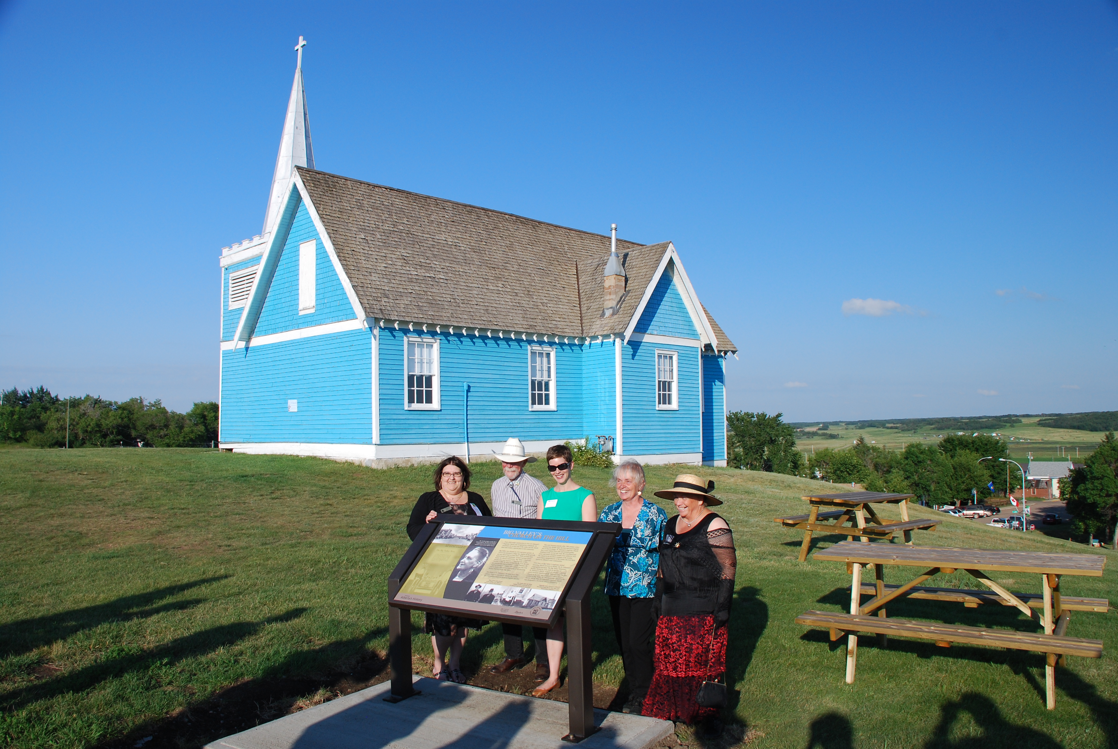
On Friday, August 1, 2014 another heritage maker was unveiled to join the family of over 70 provincial markers located throughout Alberta. Situated in Big Valley, the heritage marker profiles the early history and architectural significance of a prominent local landmark – the St. Edmund’s Anglican Church.
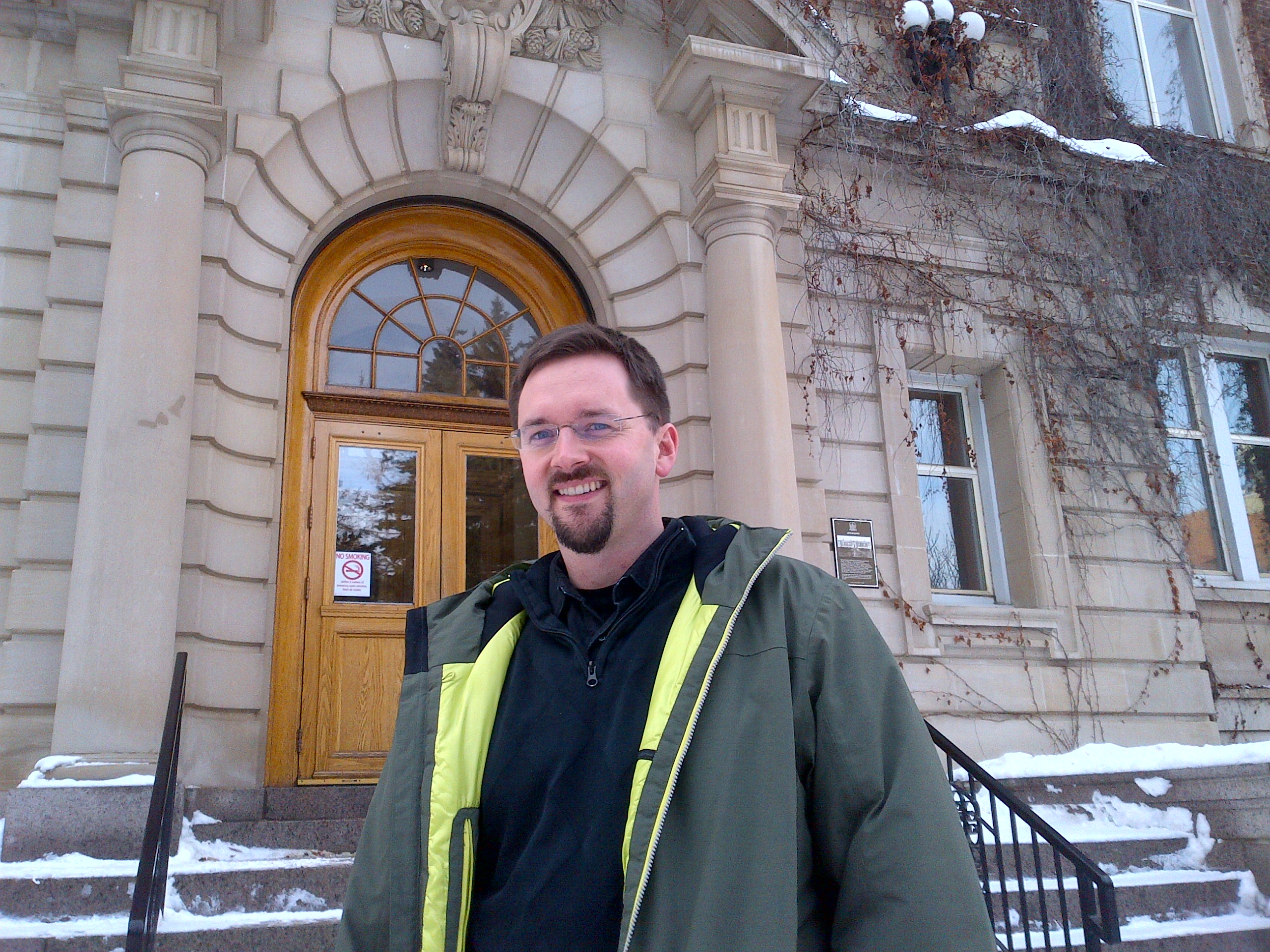
The unveiling of the St. Edmund’s heritage marker coincided with the Big Valley centennial and homecoming celebrations that took place August 1 – 3, 2014. L to R: Gail Knudson, Mayor of Big Valley; Asaph Johnson, Village Councillor; Brenda Manweiler, Historic Places Research and Designation; Lois Miller, Village Councillor and Director, Big Valley Historical Society; Trudy Spence, Secretary, Big Valley Historical Society
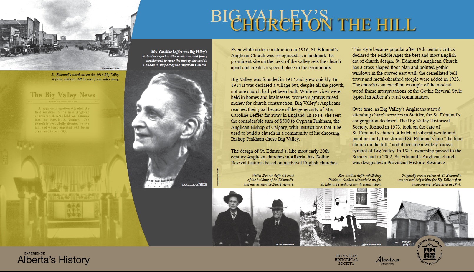
St. Edmund’s, valued by residents of Big Valley as an important part of their heritage, was constructed in 1916 through local donations and a $500 contribution from English citizen Caroline Leffler. Leffler offered the donation to the Bishop of the Anglican Diocese of Calgary to establish a church in an area of his choice. Big Valley was selected and the church was constructed on the crest of the valley, visible from miles away. Still today, St. Edmund’s Anglican Church stands as a significant community landmark.
In 2002 St. Edmund’s was designated a Provincial Historic Resource for its associations with the town’s history as a railway boomtown and as a very good example of modest Gothic Revival architecture. St. Edmund’s was first painted blue in 1974 for Big Valley’s initial homecoming – 40 years ago!
The Big Valley Historical Society applied for the development of the heritage marker through the Alberta Heritage Markers Program, which is funded by the Alberta Historical Resources Foundation. Historical society members and local residents are excited about the heritage marker as it will help to celebrate the provincial significance of the church and increase awareness for this important historic place.
The Alberta Heritage Markers Program promotes greater awareness of the historic people, places, events, and themes that have defined the character of our province. The program brings Alberta’s dynamic history alive through heritage markers placed at roadside pullouts, within parks, and in other community locales.
The August long weekend is fast approaching. Before we know it Heritage Day – Monday, August 4 – will be upon us. If you are wondering what to do with your day off, why not consider a heritage-themed outing? This is the perfect time of year to explore Alberta’s rural historic resources.
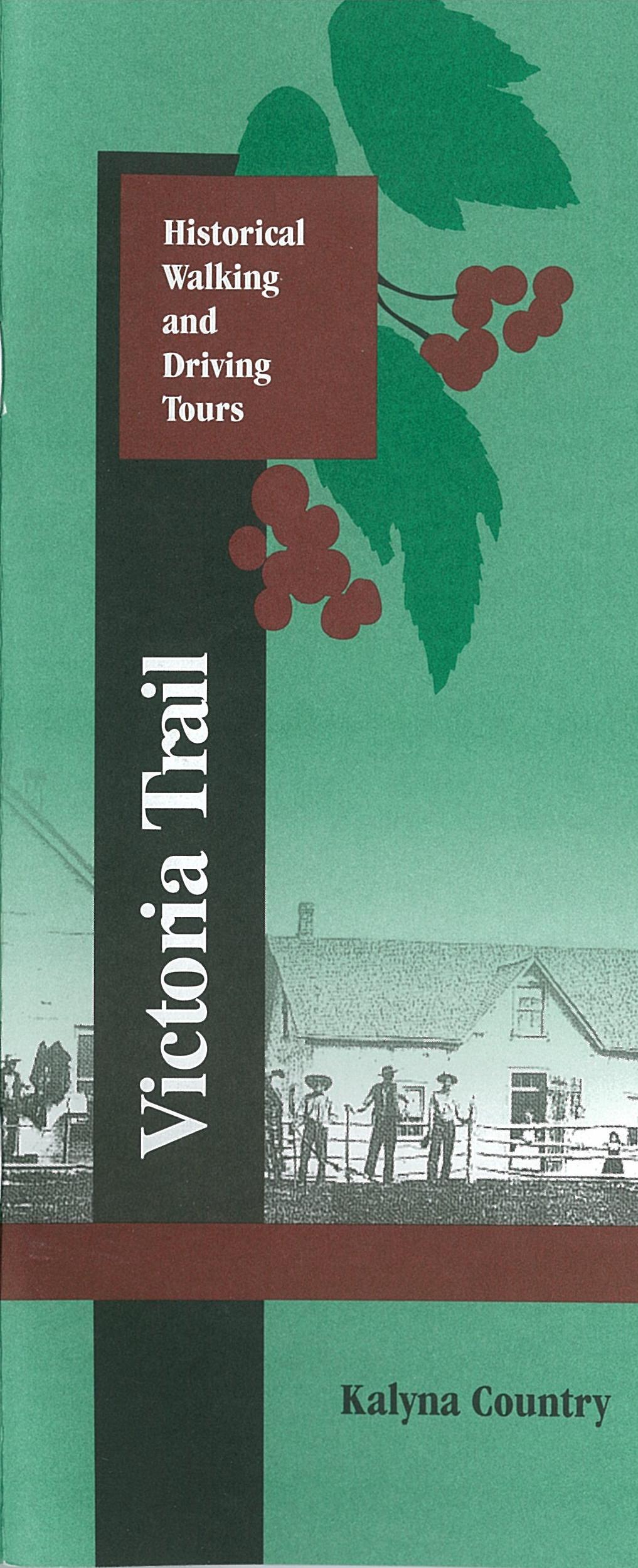
The cover of the Victoria Trail Historical Walking and Driving Tours booklet.
If you are in the Edmonton area, an ideal destination for a heritage day trip is the Victoria Settlement Provincial Historic Site, located one hour and forty minutes northeast of the city. It is a perfect location for a picnic, and there’s plenty to see there. Before you head out of town, make sure you download or print out the Victoria Trail Historical Walking and Driving Tours booklet that is available on the Alberta Culture website. It contains information about the buildings at the settlement, and, once you’ve finished exploring the historic site, you can follow the tour back towards Edmonton along the historic Victoria Trail.
There are two Provincial Historic Resources at the Victoria Settlement Historic Site: Fort Victoria, a Hudson’s Bay Company building dating from the 1860s, and the 1882 Free Trader’s Cabin on River Lot #3. In addition, you can see the Reverend McDougall Graves, where four of the missionary’s family members – victims of an epidemic of smallpox in the 1870s – are buried. A 1906 Methodist Church on the site recalls the important role of the church in the settlement of the area.
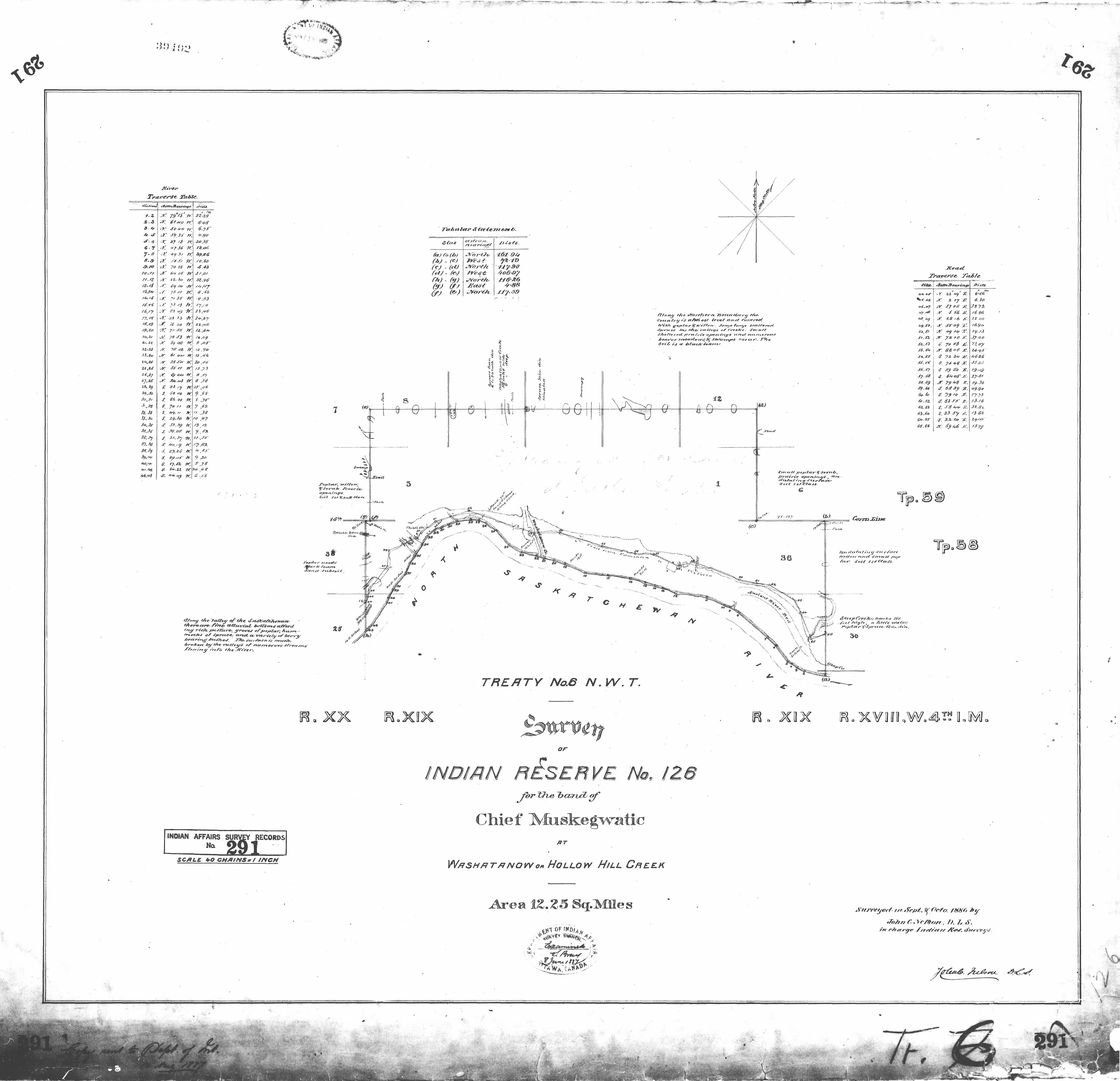
This plan of Indian Reserve No. 126 shows the Victoria Trail as it follows a curve in the North Saskatchewan River. (NCR 291)
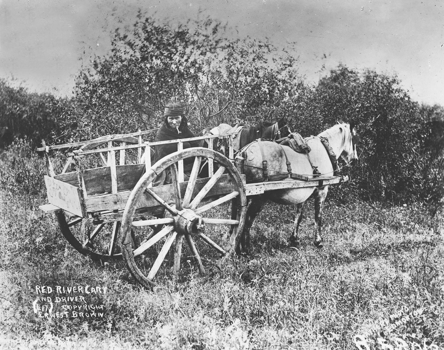
The Victoria Trail is a scenic drive that winds along the bank of the North Saskatchewan River. Unlike many other historic routes, it has remained largely undeveloped and evocative of days gone by. As you traverse the Victoria Trail, it is easy to imagine yourself in the company of those who came before. After 1860, convoys of Red River carts carrying supplies to Edmonton wore ruts into the sod. In 1874, the first North-West Mounted Police contingent famously trekked west along the trail. After the turn of the century, traffic flowed the other way, with Ukrainian settlers coming east from Edmonton to settle on the land. Until the coming of the railway in 1918, the Victoria Trail remained the most important overland route linking Edmonton the Victoria Settlement.
Red River carts like this one were a common sight on the Victoria Trail in the 1860s. (PAA B5806)
This Heritage Day, treat yourself to a journey back in time, along the Victoria Trail.
Written by: Dorothy Field, Coordinator, Heritage Survey Program
The Historic Resources Management Branch of Alberta Culture is pleased to announce the launch of the Alberta Energy Resources Heritage website. The site was developed with the aim of promoting an understanding and appreciation of the Province’s abundant energy resources, the rich history of resource extraction and production, and the important role that this sector has played and continues to play in Alberta’s social, political and economic history.
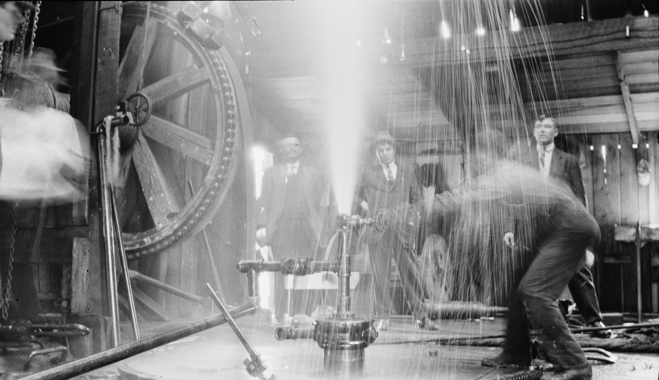
Turner Valley Discovery Well Blowing, 1914. (Provincial Archives of Alberta, P1883.)
As the homepage of the website points out:
“Ancient forces shaped Alberta’s geology, creating a land rich in energy resources. Yet, the story of energy in this province goes well beyond geological formations or petroleum chemistry. It is also the story of individuals, of people driven to reveal the province’s energy secrets and unlock the power of its resources. The quest to locate and unlock Alberta’s energy potential began with them—with their persistence, their innovative thinking and even their passion. It was their energy as much as any other that transformed Alberta, economically, socially and politically.”
Five areas of Alberta’s resource development are explored in detail: coal, conventional oil, natural gas, electricity and alternative energy and the oil sands. Also profiled is Bitumount, north of Fort McMurray where the earliest scientific research on industrial oil sands extraction took place. This pioneering work would later transform Alberta into a major player in the global energy market.
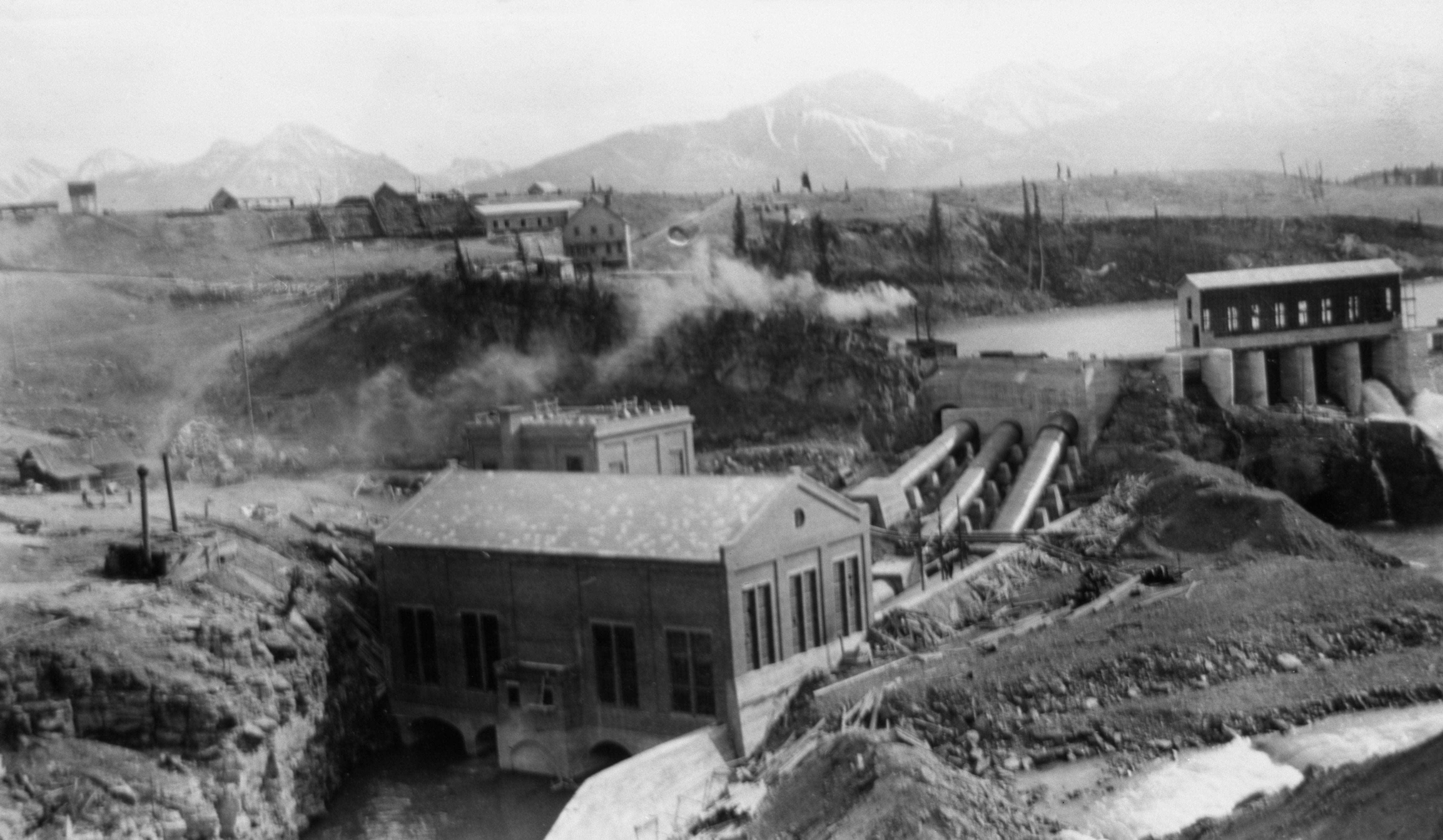
Calgary Power’s power house at Horseshoe Falls on the Bow River, ca. 1912 (Glenbow Archives, NA-3544-28.)
The website is intended to be informative and comprehensive, offering insights into the geological formation of resources, the ancient uses of various energy resources and exploration and industrialization within Alberta. Energy resources are examined through over 300 thematic entries, covered in more than 600 pages of text. Hundreds of archival images, charts, maps, and documents as well as dozens of videos augment the text as do extensive technical glossaries and lists of documentary sources. In addition to exploring the earliest and evolving histories of these sectors the site offers special insights into Alberta’s social history ranging from the miners of the Crowsnest Pass through to the rough necks of the Oil Patch, to pioneering proponents of alternative solutions for the province’s ongoing energy requirements.
Educators, students and the general public are invited to visit the website and explore its various components.
May 14, 2014 was the one-hundredth anniversary of the discovery of oil and gas at Turner Valley. In recognition of this milestone, we are offering a short series highlighting some of the place names associated with the oil and gas heritage of the Turner Valley area.
Turner Valley
In 1886, two brothers from Scotland, Robert and James Turner, filed for homestead on neighbouring quarter sections (the S.E. and S.W. quarters of Section 10, Township 21, Range 3, West of the Fifth Meridian) at the northern end of a large valley near the north fork of “Sheep Creek.” (To add a heaping helping of confusion to this story, what was then called Sheep Creek is now the Sheep River and its north fork, or tributary, is now named Threepoint Creek. Isn’t naming fun!) The Turner brothers, soon joined by a cousin, John Turner, acquired more land for their ranch and became noted breeders of purebred Clydesdale horses.
Due to the early arrival and prominence of the Turner family, the valley containing their original homesteads soon became known as Turner Valley. At the time, responsibility for naming geographical features lay with the federal government and the name Turner Valley was adopted by the Geographic Board of Canada as the valley’s official name in December 1943, although it was being used on government maps since at least 1926.
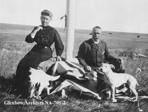
Photo of Catherine (née Dawson) and Robert Turner, ca. 1905, taken on the Turner ranch at the northern end of Turner Valley. (Glenbow Archives, NA-701-2.)
On May 14, 1914, towards the other end of the valley, an oil well known as Dingman No. 1, owned by Calgary Petroleum Products struck gas. Although DIngman No. 1 was not the first productive well in Alberta—that distinction goes to a well in Waterton Lakes National Park (See Cameron Creek) it was our province’s the first significant discovery.
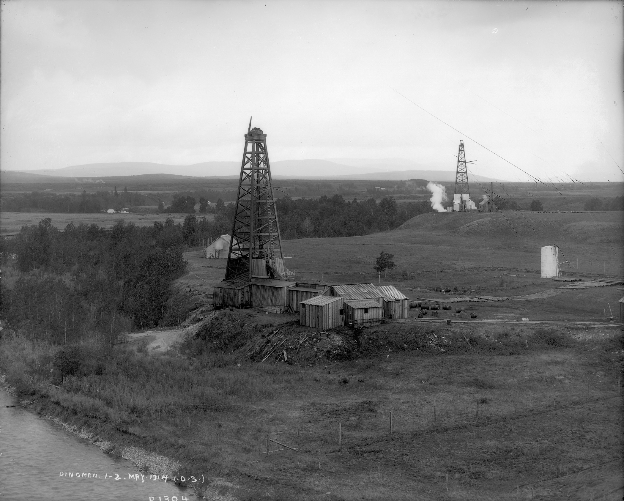
The Dingman No. 1 and Dingman No. 2 wells on the banks of the Sheep River, Turner Valley, 1914. These two wells ushered in Alberta’s first major oil boom, which saw the drilling of hundreds of wells and the establishment of numerous communities in the Turner Valley region. (Provincial Archives of Alberta, P1304.)
Over the ensuing decades the name Turner Valley became one of the best known locales in the province and the name became synonymous with Alberta’s oil and gas sector. A town site, also named Turner Valley was established. A post office opened here in 1926 and, in 1930, with a population of about 700 people, Turner Valley was incorporated as a village. It became a town in 1977.
Black Diamond
Just to the east of the Town of Turner Valley, is the Town of Black Diamond. The name is inspired by the coal deposits found in the area. A coal mine opened in 1899 and a small community serving the mine and the area’s ranchers and homesteaders began to develop.
According to local lore, in 1907, when it came time to choose a name for the newly established post office, two contenders arose: “Arnoldville” was championed by the Arnold brothers who owned the general store that would house the post office, and “Black Diamond” was put forward by Addison McPherson, the owner and operator of the Black Diamond Coal Mine a short distance to the southwest. Allegedly, both were written on scraps of paper and put into a hat. You can guess which name was drawn.
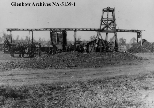
Addison McPherson’s “Black Diamond” coal mine, ca. 1913-1916. The local post office and the community it served were named for this coal mine. (Glenbow Archives, NA-5139-1.)
Following the Dingman No. 1 discovery, Black Diamond boomed, reaching a reported population of 800 by 1930. A local history tells of round-the-clock construction and single lots containing up to seven homes. Black Diamond became a village in 1929. It suffered during the Great Depression, loosing up to a quarter of its official population before rebounding in 1937 following a major oil discovery in 1936. Black Diamond was the largest population centre in the immediate area, reaching a population of 1,380 in 1947 before falling again through the late-1940s and 1950s. Regardless, in 1956, with a population of 991, Black Diamond was incorporated as a town.
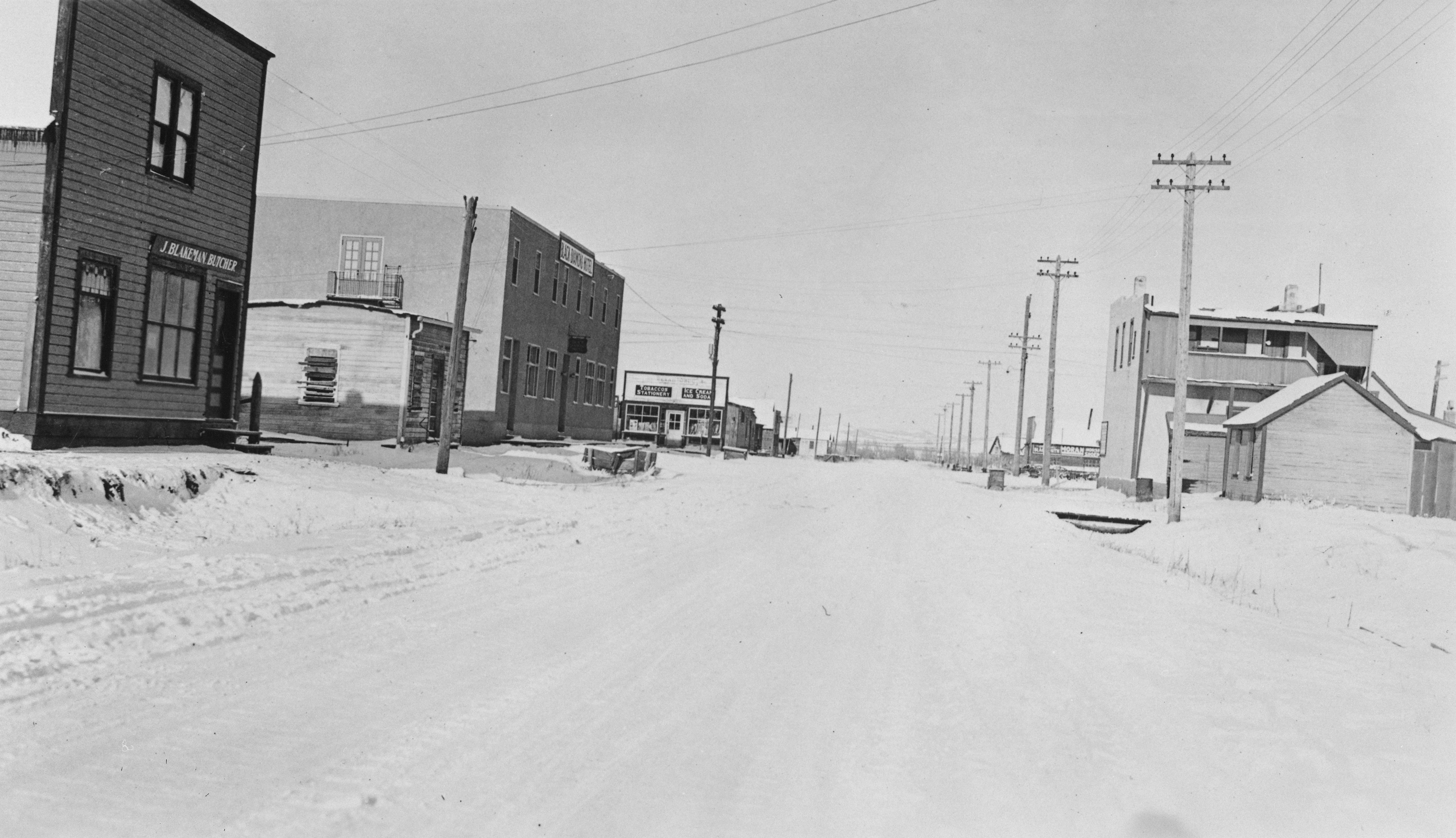
Commercial district of Black Diamond, January 1932. Although it Pre-existed the Turner Valley oil and gas discovery, Black Diamond grew rapidly to serve the burgeoning industry. (Provincial Archives of Alberta , A6999.)
To be continued … More Turner Valley oil and gas names to come!
Written by: Ron Kelland, Historic Places Research Officer and Geographical Names Program Coordinator.
Location
Turner Valley (valley)
National Topographic System Map Sheet: 82 J/09 – Turner Valley
Latitude/Longitude: 50°42’33”N / 114°18’11”W (approximate mid-point)
Alberta Township System: 23-20-3-W5 (approximate mid-point)
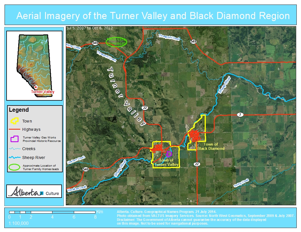
Description: Large valley with a northwest to southeast orientation, located approximately 40 kilometres southwest of downtown Calgary
Turner Valley (town)
National Topographic System Map Sheet: 82 J/09 – Turner Valley
Latitude/Longitude: 50°44’31”N / 114°16’49”W
Alberta Township System: 12-20-3-W5
Description: Near the southeastern edge of the valley, approximately 45 kilometres SSW of downtown Calgary
Black Diamond (town)
National Topographic System Map Sheet: 82 J/09 – Turner Valley
Latitude/Longitude: 50°41’17”N / 114°14’04”W
Alberta Township System: 8-20-2-W5
Description: Approximately 40 kilometres SSW of downtown Calgary and three kilometres northeast of Turner Valley (town)
Kayla Jonas Galvin is deeply involved in creating social media content. She tweets at @jonaskayla and has her own blog Adventures in Heritage. Kayla works as the Heritage Operations Manager at Archaeological Research Associates where she runs the Twitter (@araheritage), Pintrest (ARAHeritage) and LinkedIn Accounts. She sits on the board of the Architectural Conservancy of Ontario, which focus on heritage education and advocacy in Ontario. There she is the social media manager for their Facebook and Twitter (@arconserve) accounts and Editor of their ACORN magazine. Her previous employment at the Heritage Resources Centre at the University of Waterloo involved managing their social media and communication, as well as developing Building Stories, a crowd-sourced survey of historic places across Canada.
Kayla will be speaking about how social media can assist in the conservation of local historic sites. Kayla will explain the power of social media to conserve local heritage places and how you can tap into it. She will give a brief introduction to the social media sites of Facebook and Twitter as well as introduce Building Stories, a crowd-sourcing site. Drawing on her experience managing multiple platforms for businesses and not-for- profit organizations she will share practical lessons on how to use each effectively to engage your community.
Larry Laliberté
Larry Laliberté is a librarian with over ten years’ experience working with GIS and spatial data. Currently he is the GIS Librarian at the University of Alberta where much of his work revolves around analyzing and synthesizing spatial information at many scales, across many disciplines, in various formats. Over the last decade, he has developed and maintained an online collection of historical maps of Manitoba and recently, taken a great interest in developing best practices for the long term preservation of digital geospatial data.
Larry’s presentation will focus on how Historical GIS can be used to link collections. Over the past ten years, many historical library collections have been digitized (textual, numerical, photos, maps) and made available online; however, they often exist on standalone platforms isolated from other digital collections. Using the 1913/14 Fire Insurance Plans of Edmonton as an example, Larry’s presentation will highlight how thinking spatially about local digital collections and combining the power of GIS and geovisualization can open up interesting ways of linking collections.
Please join us October 16th and 17th in Lacombe to hear these heritage advocates share their knowledge.
Written by: Rebecca Goodenough, Municipal Heritage Services Officer
Matthew Francis, Manager of Municipal Heritage Services, describes his role this way: “I manage all of the Government of Alberta’s work with municipalities to protect their historic places.” One focus of his job is running the Alberta Main Street Program. The other is leading the Municipal Heritage Partnership Program (MHPP). Both are done with the help of two Municipal Heritage Services Officers.
Matthew Francis, Manager, Municipal Heritage Services.
The Municipal Heritage Partnership Program was established in 2006 to give municipalities across Alberta the training and tools to start up and run their own heritage conservation programs in a way that “represents the best practice of what the Historical Resources Act requires.”
Matthew, who joined the branch the year before, has worked with this program from its start. He explains: “Municipalities in Alberta had been empowered since 1978 to designate their own historic places, but most of them didn’t know about that. Only a handful of communities—Calgary, Edmonton, Banff, Red Deer—had ever designated something at the local level. [The others thought,] ‘This is something we have to go to the Province [to do]’.”
“So the first several years were really about building awareness. I spent almost 100 days on the road in 2006 going all over Alberta—small towns and cities, and everywhere. We were able to tell them, this can be done locally around the council table, and through a bylaw, and we gave them the background on that, and the training, the tools.”
MHPP staff members lead workshops for local government staff, volunteers, and sometimes elected officials as well, to train them in how to protect locally significant historic places by using recognized tools. The main identification tools are surveys: research projects that gather basic historical and architectural information on possible historic resources. Conducting a survey can be a first step toward developing a comprehensive heritage conservation program. MHPP also offers workshops on heritage inventories: projects that helps a community identify places of outstanding local significance and develop a deep understanding of each place that will help the municipality determine how to protect and conserve it.
The Alberta Historical Resources Foundation offers matching grants to municipalities in Alberta that are undertaking surveys or heritage inventories or that are developing heritage management plans. MHPP staff often help municipalities craft viable survey or inventory projects that are likely to be funded by the Foundation. The MHPP also helps to evaluate grant applications, making funding recommendations to the Foundation’s Board of Directors.
Sometimes staff must overcome scepticism or even hostility of those who think heritage conservation is anti-progress. Matthew responds: “A lot of people when they think about their historic buildings, they think about the past, and we’re more concerned about saying, does that place have a future? That’s the conversation that we’re trying to have.”
Ideally, each municipality will first establish what the MHPP calls a Heritage Advisory Board (HAB), although it may have a different name locally. If the local government decides to seriously pursue the conservation of its historic resources, MHPP staff will meet with the board and others to explain that process and make sure they understand the three key aspects of evaluation: eligibility, significance, and integrity. Heritage consultants—historians, planners, or others with a conservation-related background—typically do the survey or inventory work under the direction of the advisory board.
As a central part of this work, the consultant will produce a document called a Statement of Significance for each historic place, which describes why the community values the place and what about it needs protection to preserve its significance. The HAB must be able to assess the quality of each Statement of Significance, making sure that each document accurately describes the significance and integrity of the historic resource(s) discussed. The HAB will make a recommendation on designation to the municipal council.
“Our place is not to intervene in [designation decisions],” Matthew says. “Municipalities in Alberta can designate whatever they want. They’re empowered to do that. It’s the community that has the local knowledge, and that’s what we’re trying to draw out.” But, ideally, the local government will learn how to make good decisions about heritage designation—decisions that are consistent across the community and also consistent with the best practices that are in use throughout Alberta. Municipalities may also establish their own regulations for the protection of their designated historic places.
“I really love working with the Heritage Advisory Boards.” Matthew reflects. “They’re volunteers for the most part, and they’re there for a reason—it’s usually because they have some sort of personal connection to these historic places that are meaningful to them in their community. A really enjoyable part of the work is getting to hear some of those stories.”
Today, MHPP staff members usually work with a municipality by invitation, although sometimes they’ll contact a local government proactively. This may be initiated by inquiries from private citizens concerned about protecting a specific historic place. When that happens, the MHPP staff member will urge them to contact their local government, but then will follow up with government staff to discuss the option of historic resource designation to protect the resource. “And from there we’ll say, ‘Have you thought more comprehensively about taking a look at all your historic places?’”
The annual Municipal Heritage Forum, a project of Municipal Heritage Services, supports these efforts. “Before 2007 people doing heritage conservation locally in different communities had very little connection with each other,” Matthew recalls. The first forum in 2007, called a Summit for Stakeholders, had about 40 participants. “It was basically just bringing the people together and giving them some information,” Matthew says. “But [we saw that] it’s the sharing of information [that’s important]. It’s really great to see the local knowledge increase and for that information to be shared peer-to-peer.” The forum now attracts about 125 attendees each year, and has become an eagerly anticipated event for heritage professionals and advocates across Alberta.
The Municipal Heritage Partnership Program has now worked with more than 100 municipalities, and it continues to help “repeat customers” as well as communities that are new to heritage conservation. The MHPP keeps evolving, along with the communities it serves. “We’ve worked with communities now that have been through the awareness cycle, so they know how to do [heritage designation], and they’re taking a high degree of ownership for this, which is what we always intended,” Matthew explains. The next step, he says, is helping them integrate heritage conservation into other urban planning initiatives—“not [treating it] like an appendage or an afterthought. Two of the flood-impacted communities we work with—High River and Medicine Hat—are working on major initiatives with their downtown planning, and I think they are leading the way on some of this.”
Municipalities have evaluated well over 1,000 historic places across Alberta since the program’s beginnings, “and that’s the number we keep an eye on,” Matthew says. “Not all of those places have been or will be designated or be protected,” he adds, “but at least they’re known. We know about them, and the communities know about them—and that’s really what matters most.”
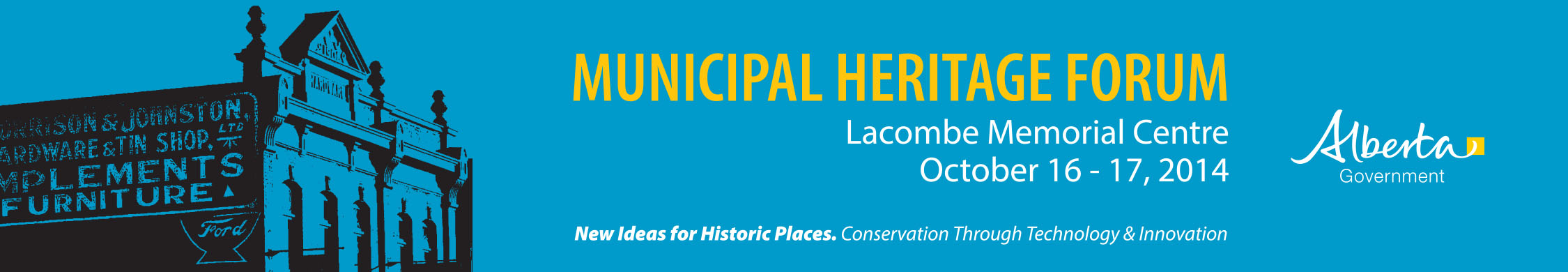
We are pleased to announce that registration for this year’s Municipal Heritage Forum is now open!
The Forum is being held on October 16th and 17th at the Lacombe Memorial Centre in the City of Lacombe. The theme for this year’s Forum is “New Ideas for Historic Places: Conservation through Technology and Innovation”.
Our keynote speakers for this year include Kayla Jonas Galvin of Archaeological Research Associates in Kitchner, Ontario and Larry Laliberté, GIS Librarian at the University of Alberta. Kayla specializes in social media and will be speaking about how you can use social media to conserve local historic places and Larry will be presenting his research on the application of Geographical Information Systems and geovisualization to linking local digital collections.
Kayla Jonas GalvinLarry Laliberté
A preliminary version of the Forum schedule is available here. Registration is available online. Space is limited so please register today.
We look forward to seeing you in beautiful Lacombe!
The word ‘Okotoks’ translates from the Blackfoot language as ‘Big Rock.’ The name was given by the resident indigenous people to a very large boulder that is known as a glacial erratic – boulders that have been moved from their original location by glacial ice. Okotoks is by far the largest erratic in Alberta; it is about the size of a two-story house and is estimated to weigh nearly seven million kilograms. The Big Rock is a well-known landmark in southern Alberta. It is a designated provincial historic resource owned by the Government of Alberta, and is accessible to the public by means of a hiking trail, signage and a parking lot. What is not well-known is that the Okotoks Big Rock has a great deal of Aboriginal rock art painted on its surfaces.
Okotoks Big Rock Erratic
Rock art includes pictographs (paintings) made with a red paint composed of iron-rich hematite (red ochre). The existence of a few red ochre images on the Big Rock has been known for decades, but the revolution in digital photography and image enhancement has brought to light a whole lot more art on the Okotoks erratic than previously known. Specifically, we now know that some areas of the rocks were extensively rubbed with red ochre. Since these red areas lack definable rock art figures like humans and animals, it was long believed that the red blotches were simply part of the rocks’ natural colour. Through enhancement we can now pick out hand prints and finger swipes, telling us these red blotches were indeed made by human beings.
Rock art at Okotoks Big RockPhoto-enhanced areas of red ochre smeared on Okotoks Erratic. Note hand prints at top.
All rock art sites are sacred to Native people; rock art represents communication between human beings and the spirit world. Blackfoot people still visit the Okotoks site, conduct ceremonies, and hold the site in great reverence. Thus, it is all the more sad and frustrating that the Okotoks erratic has been subjected to extensive and increasingly frequent bouts of vandalism. As the site is operated by the province and is open to the public, there comes a point where some action needs to be taken. It is an eyesore, an embarrassment and severely disrespectful to the Blackfoot beliefs about the sacred character of the rock. But what can be done with a massive rock surface covered with graffiti that underneath lies fragile, precious painted pictures that tell stories of ancient Aboriginal people?
In the past few years, serious incidences of graffiti were washed off the rock face using a high pressure water sprayer. More recently, an environmentally friendly paint stripper had been used with good success. But critical to any graffiti removal has been potential impact to underlying rock art. We realized that we could never properly manage the site until we had a high-quality “map” of the rocks that plots the complex rock structure and the locations of all the rock art images. We realized that the best way to make a physical record of the Big Rock was to record it in 3D using a portable laser scanner. While documentation won’t stop vandalism at Okotoks, it will make us much better prepared to deal with future instances in a way that protects significant historical resources.
This slideshow requires JavaScript.
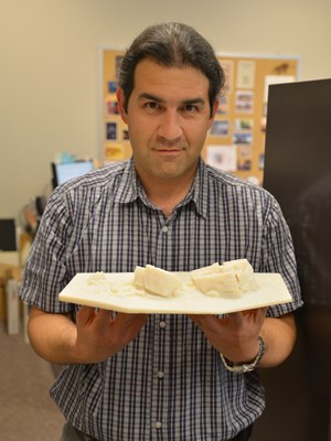
A partnership with the internationally respected organization CyArk was formed. CyArk is a nonprofit organization dedicated to digital recording and preservation of the world’s most significant sites. Among their credits are 3D recordings of the statues of Easter Island, Pompeii, ancient Thebes, and Mt. Rushmore. CyArk also digitally stores the 3D information for each site, serving as a world archive of heritage data. CyArk retained a local service provider to assist with the equipment and expertise to conduct the laser scanning. In early October 2013 the entire external surface of the Okotoks Big Rock, including the tops of the rocks and some internal crevices, was scanned during two days of field work. The result is a strikingly accurate rendering of the Okotoks erratic in both its geometric shape and the plotting of all known rock art images. The project also resulted in production of an accurate 1:200 scale model of the Rock that will be useful for planning and educational purposes.
3D rendering of point cloud data from laser scan at Okotoks with enhanced photography overlaid. Red areas are red ochre paint; note square-bodied human figure at upper left.
In addition to the rendering and scale model, the project also raised awareness about negative impacts associated with graffiti and heightening understanding of the value and importance of historic resources to the community. Further Alberta Culture now has a sophisticated tool to use for site management.
Alireza Farrokhi holding 1:200 scale model of the Big Rock
Sadly, the rocks have already been subjected to more graffiti in the months since our project ended; however, we now have accurate information on the type and location of rock art that will assist in graffiti removal efforts. There are other threats to the cultural and natural significance of the Okotoks erratic. It has long been a favoured place for climbers, subdivisions are rapidly encroaching on the site, and public visitation is increasing. There are many challenges ahead in the long-term management of the Big Rock, but thanks to the careful recording conducted through Innovation Program funding we have a solid baseline of information about this very special place that will guide future management.
Written by: Jack Brink, Curator, Royal Alberta Museum and Alireza Farrokhi, Head of Conservation and Construction Services, Historic Places Stewardship
The National Main Streets Conference is a big event. This year over 1,400 people attended the conference and there were approximately 75 sessions to choose from. Needless to say it was difficult to choose which sessions to attend. Of the sessions that I attended two stood out for me as being really helpful for our Main Street members: “The Naked Truth about Well-Dressed Windows” and “Main Street Makeover – Surviving and Thriving during Construction”.
Storefront Windows
Store owners only have a few seconds to convince a passerby to enter their establishment. The quality and interest of store window displays goes a long way in enticing potential shoppers. “The Naked Truth about Well-Dressed Windows” provided by Seanette Corkill of Frontdoor Back, a retail consultant based out of Vancouver, Washington, included a lot of practical advice on how to plan for and manage your window displays.
Seanette covered planning and investment for window dressings and stressed the importance of budgeting for lighting and props to build a collection that can be used over time. The decision on what type of backdrop to use is important and you can choose from full disclosure (store is visible behind the display), partial disclosure (where the store is partially visible but separated from the display) and closed (display blocked from the rest of the store). Decals are a good addition to storefront but they should be modest in size, not interrupt sightlines and placed to direct the eye to the display itself. Lighting is immensely important and should consist of tracked lighting that will light the top and front of the product on display.
Switching topics from the pretty to the dirty, Kristi Trevarrow’s session on “Surviving and Thriving during Construction” drew on her role with the Rochester Downtown Development Authority in coordinating a main street upgrade project in Rochester, Michigan. The project involved a complete overhaul of the roads, underground services and streetscape and affected their downtown main street for several months. Her responsibility was to minimize the impact of the construction project on local businesses.
According to Kristi, the key to managing business during a successful construction project is pre-planning and communication. In her case, Kristi started holding information meetings two years in advance of the construction and met with everyone she could think of including business owners, residents, local organizations, major employers, property owners and adjacent municipalities. Communications for the project included a project website with regular updates; a brochure with frequently asked questions for businesses to hand out to their patrons; a comprehensive media engagement strategy; social media updates; a field office on the main street for the project (which they built into the project contract); monthly community meetings throughout the duration of the project; and last but not least, a presence on the street every day during construction to field questions and respond to concerns. There were still hiccups that occurred along the way but the high level of planning and engagement by the Development Authority minimized negative experiences.
Both high quality window displays and infrastructure renewal projects can go a long way to ensuring your main street is looking top notch. These sessions were helpful in teaching the ins and outs of how to schedule and manage aesthetic projects from the small to large.
Written by: Rebecca Goodenough, Municipal Heritage Services Officer
This is the second in a series of posts on our experience attending the National Main Street Conference in Detroit.
I had the pleasure of attending the 2014 National Main Street Conference recently, in Detroit, Michigan. Several Albertans were there with me, including four people representing two of our main street communities: the Town of Olds and the City of Camrose. The (U.S.) Main Street Program has been operating in the United States for over 35 years now. As Alberta continues to revitalizes our its Main Street program, we continue to learn from the American counterpart.
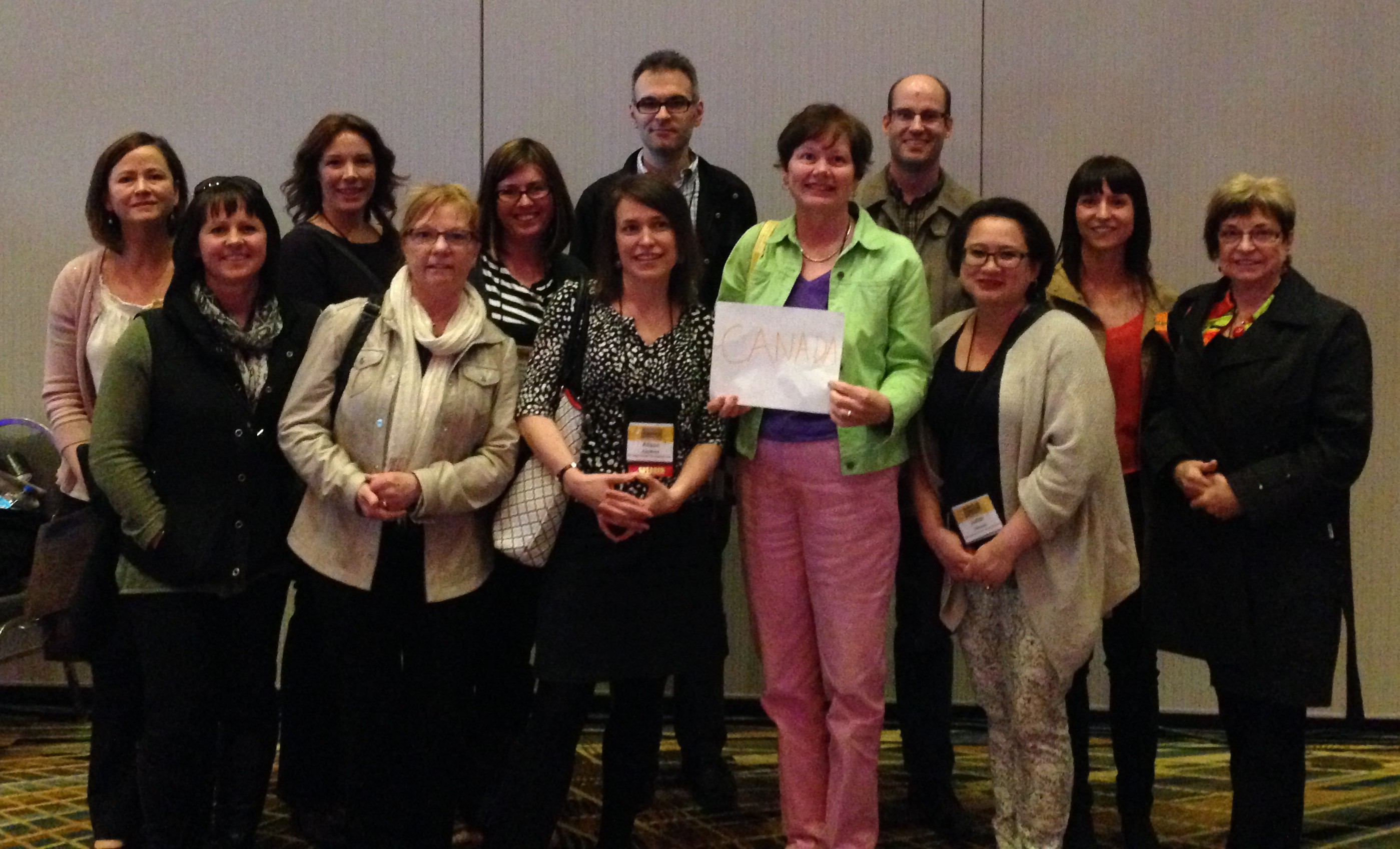
The Canadians after the opening plenary session. Each american state formed a delegation, so we formed one of our own.
In the late 1970s, the (U.S.) National Trust for Historic Preservation was exploring ways to facilitate the preservation of historic downtowns. All over North America, businesses and residents had been leaving downtown and moving to new suburban neighbourhoods and consequently many historic places were neglected and being abandoned. The National Trust realized that solving the problem would not be as simple as restoring dilapidated buildings; restoring historic commercial areas meant bringing people back down town. It launched a three-year Main Street Project in 1977 to study ways to revitalise declining downtowns. The main street pilot project was so successful that it was made a permanent program in 1980 and was soon helping hundreds of communities throughout the United States revitalise their historic commercial areas.
A Main Street project works by pursuing four equally important activities: organizing business owners and residents around a common purpose; economic restructuring or strengthening the existing businesses while also diversifying the mixture of business types; designing a functional and pleasant streetscape that highlights the authentic historic places; and promotion, or rekindling a sense of pride in the downtown. Economic restructuring ensures that businesses are successful and the Main Street is able to pay its own way. Design ensures that Main Street has a functional and pleasant streetscape—built around authentic historic buildings—and creates an inviting place that people want to work, live and play in. Promotion ensures that the community (and visitors from away) know what the area has to offer and feel welcome. Organization ensures that business owners, residents and other stakeholders take shared responsibility for the success of their downtown.
The keynote by Donovan Rypkema presented a straightforward and compelling explanation of how the program works and why it works so well. (Mr. Rypkema is an internationally regarded specialist in the economics of historic preservation.) He argued that Main Street is the most effective, sustainable and “cheapest” economic development strategy he’s come across, for historic areas or otherwise. This is because the four pillars of a Main Street align with the four factors that set the value of real estate.
Mr. Rypkema compared the four pillars of Main Street (design, organization, economic restructuring and promotion) with the four forces of value: economic, physical, social, and political. Mr. Rypkema talked about how Main Street works because each of the four points is aimed at increasing a corresponding area of value. When an area restructures economically by ensuring a mixture of complementary businesses, it increases the number of visitors and therefore the profitability of each business and consequently the value of the real estate.
A Main Street Program adds to the physical value of property when it restores dilapidated historic places and otherwise upgrades the streetscape. It adds to the social value of property by improving how the community feels about the area, by increasing local pride in a historic area. Finally, it adds to the political value of property when the range of possible, profitable and acceptable uses increases. He calls it the most successful economic restructuring programs ever tried in the United States. (On a somewhat related note, Mr. Rypkema joked that Main Street was working on smart growth and new urbanism before these planning philosophies were proposed.)
The best part about the conference was the opportunity to learn from peers in the Main Street movement. There were excellent sessions around all the four points. I attended lots of sessions on using social media effectively (big surprise) and community organization. I highly suggest that anyone interested in these ideas look into the National Main Street Center. I look forward to perhaps attending next year’s in Atlanta, Georgia.
Written by: Michael Thome, Municipal Heritage Services Officer.