Editor’s note: The dwelling Wallbridge and Imrie created remains standing today, bequeathed to the Province of Alberta upon Mary’s death along with several other parcels of land. It is still owned, managed and maintained by the province, with its current tenants being the Land Stewardship Centre. However, its name has since shifted to “Imrie House.”
The author, Devon Moar, recently completed his Master’s thesis on this very topic.
Written by: Devon Owen Moar
First, I want to open with a quote from the poet Muriel Rukeyser:
“The universe is made of stories, not of atoms.”
The hope is that this line sets the tone for how I believe this dwelling exists, shaped both by structure and story. This place is not only a physical, humble shelter but holds a profound account of its inhabitants.
Welcome to Six Acres
Gathering at Six Acres in the Living Room, back inscription: “French Class Finish, 1971”. Source: Private collection of Mary S. E. Wallbridge-Lillis.
Six Acres is a place where architecture, nature, and personal stories blend into one remarkable narrative. The following isn’t just a tour of a building; it’s an adventure through the living history of a place that served as both an everyday sanctuary and a bustling office for two groundbreaking Albertan women, Jean Wallbridge and Mary Imrie. Now, I’m going to share some anecdotes, quirks, and standout moments that make Six Acres far more than just a simple structure.
Editor’s note: All images below courtesy of the Provincial Archives of Alberta.
Written by: Michael Gourlie, Government Records Archivist, Provincial Archives of Alberta
From his start playing hockey on the northside rinks of Edmonton to winning a gold medal the 1980 Winter Olympics, John Utendale had a remarkable career as an athlete and coach, but his achievements during his career as educator were no less distinguished.
Born in Edmonton in 1937, Utendale played rugby, baseball and hockey while attending Victoria Composite High School. He continued to play softball at the provincial level while also playing hockey for the Edmonton Oil Kings. It was his skill as a hockey player that landed him a contract in 1957 with the Detroit Red Wings organization as a member of the Edmonton Flyers of the Western Hockey League. Utendale would become the first Black hockey player to sign a contract with an NHL team.
Utendale with the Edmonton Oil Kings, Oct. 26, 1954.
He later played for the Quebec Aces, joining Willie O’Ree, who broke the National Hockey League’s colour barrier, and Stan Maxwell for an all-Black line. He also played for the Windsor Bulldogs and for teams in Sudbury and Windsor.
Editor’s note: David Murray is an architect in Edmonton and met Arni Fullerton in 1981 while working for him on an alternate, traditional plan for the development of a new town at 58˚ N as required by his contract with the province, led by Montreal architect Ray Affleck. Fullerton and his wife Merle were interviewed on Zoom in April 2024 at their home in Nanaimo.
All images courtesy of the Arni Fullerton Collection at the Provincial Archives of Alberta, unless otherwise noted.
Written by: David Murray, Architect AAA, FRAIC
In the late 1970s, the Alberta Government’s Department of Housing and Public Works, initiated a planning process with the intent to design a new community in northern Alberta, north of Fort McMurray, specifically to house workers and their families at the expanding oil sands extraction developments. It would be a most imaginative and provocative approach to living in the north, the culmination of a lot of precedent research by a team of planning and engineering visionaries.
Illustration prepared by David Murray.
Architect Arni Fullerton was hired by the Alberta government to design the proposed new town. His vision, on which he collaborated with Britain’s Buro Happold Engineers and German structural engineer Frei Otto, was a 35 acre air-supported, weather-controlled, transparent dome, covering a town centre that incorporated housing, recreation fields, a sports complex, commercial properties, a shopping centre, schools, an amphitheatre, parks and a children’s plaza. The town was intended to grow incrementally, outside the town centre dome, over time. All parts of the town would be connected by public transit.
Written by: Suzanna Wagner, Program Coordinator, Victoria Settlement and Fort George & Buckingham House
The Hudson’s Bay Company kept a close eye out for anywhere their business might flourish. So, in 1864, when it came to their attention that large groups of people were gathering at the McDougall Methodist Mission on the banks of the North Saskatchewan River (south of the present-day town of Smoky Lake), setting up a fur trade fort next door was an enticing prospect. Rather than reprise the “Fort White Earth” name of the HBC fort that had operated in the vicinity at the turn of the century, they chose to call the place “Victoria Post.” Victoria was the same name as the mission, and it was a “post” because it wasn’t large enough to merit being called a fort. Despite the technicalities, most people call it Fort Victoria.
By 1874, the fort contained the Clerk’s Quarters (still at Victoria Settlement Provincial Historic Site today), a warehouse, a house for other fort employees, a blacksmith shop, a stable, a dairy, a palisade, and of particular interest, the trade store. The trade store was built by local men Sam Whitford and Joe Turner, likely between 1866 and 1867. The humble post-in-sill builttrade store went through almost as many changes as did the community which surrounded it, and unique within the history of Victoria Settlement, a series of photographs have shed light on many of the changes this building underwent.
Artist’s conception of Fort Victoria, based on Richard Hardisty’s 1874 scale map. Source: Government of Alberta, 1971.
Editor’s note: The banner image above, of Sapaces (seated fifth from left) and family at the Athabasca Bridge opening ceremonies in 1952, is courtesy of the Athabasca Archives.
Written by: Darren DeCoine, Bigstone Cree Nation and Laura Golebiowski, Indigenous Consultation Adviser
Historic trails crisscross much what is now known as Alberta. They serve as reminders of past occupation and travel and, in the case of Bigstone Cree Nation, continue to be used to access sites and landscapes significant to Indigenous Peoples. This is the story of one historic trail, known locally today as Sapaces Gambler Okayas Meskanas: the Jean Baptiste Gambler Historic Trail.
The Matchemuttaw and Gambler families signed Treaty as part of the Peeayseas First Nation near Lac La Biche. They travelled northwest and established themselves in the Kito Sakahikan (Calling Lake) area by 1875, and transferred to the Bigstone Band in 1911. By 1915, patriarch Sapaces (colonial name Jean Baptiste Gambler) had built a house, storehouse and stable along the north shoreline of Kito Sakahikan, and was advocating for reserve lands to government representatives.
In the early 1900s, a trail extended between Kito Sakahikan and Wapaskow (Wabasca), connecting the families and communities contemporarily comprising Bigstone Cree Nation. In 1914, the route was identified as a “pack trail” on the Pelican District sectional map; a parallel trail to the west was the, “sleigh road from Athabaska to Wabiskaw Settlement.” Sapaces and his descendants travelled the region on these trails for generations.
Alberta Section Map No. 454, Pelican Sheet. Second Edition 1st May, 1914.
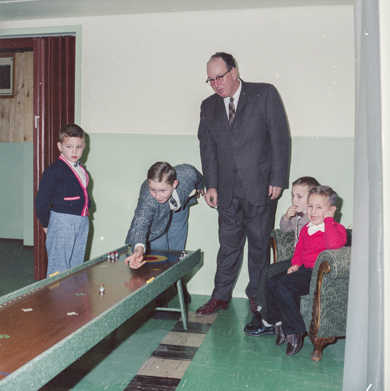
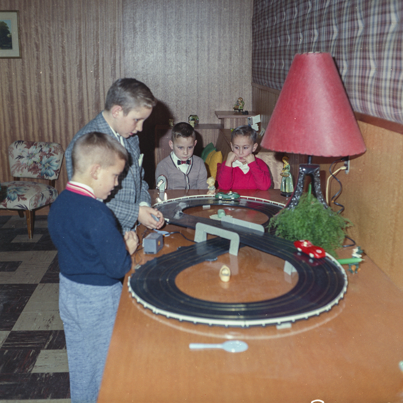
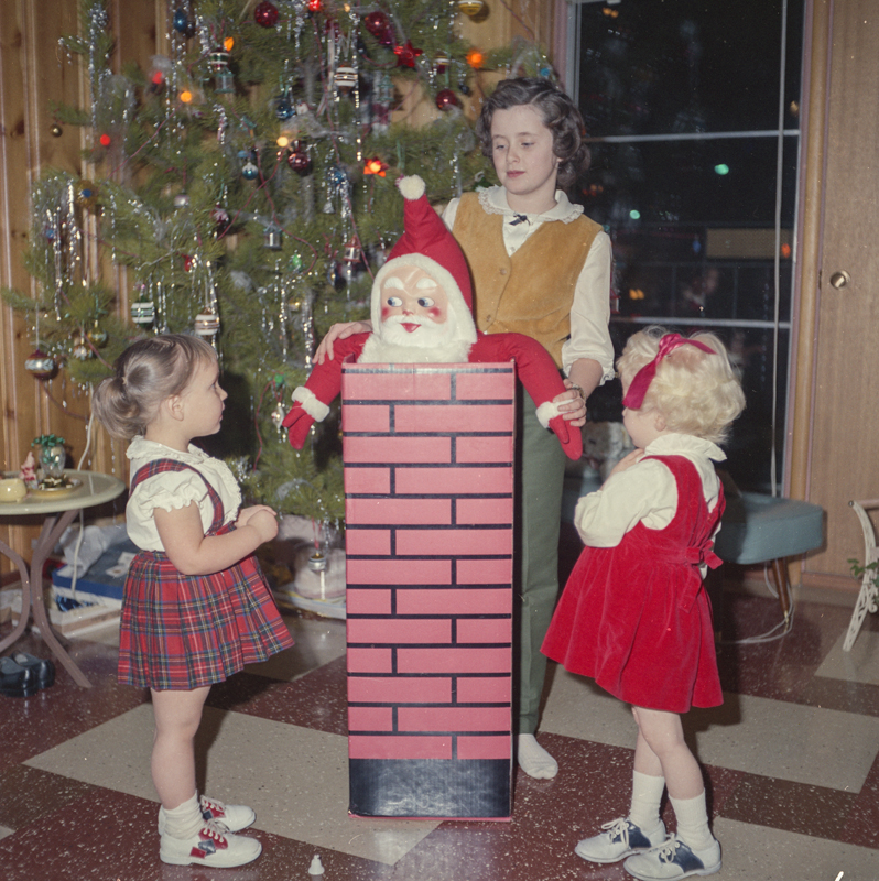
Wishing everyone a safe and enjoyable holiday season! The images below, courtesy of the Provincial Archives of Alberta, were taken from the John Glascow Family Christmas, Edmonton, 1963.
Editor’s note: All images in this post were taken by Suzanna Wagner.The image above is of a view across the Stromness Harbour, Orkney.
Written by: Suzanna Wagner, Program Coordinator, Victoria Settlement and Fort George & Buckingham House
Have you ever travelled vast distances only to find pieces of home?
Intent on exploring new vistas, seeing the ocean, and walking through Neolithic sites, this Canadian historian jetted off to Orkney, Scotland for a vacation. Orkney and Canada share a strong historic connection since the Hudson’s Bay Company hired a great many of their labourers from Orkney. Working with fur trade history made me aware of this, but the only concession my trip plan made to the Orkney-Canada connection was an as-of-yet unread copy of Patricia McCormack’s paper, “Lost Women: Native Wives in Orkney and Lewis” tucked into my suitcase.
After three flights, I arrived bleary-eyed on the largest island of this archipelago north of the Scottish mainland, feeling as though I had travelled to a rather remote part of the world. I couldn’t have been more wrong. Orkney may feel isolated today, but when the Atlantic was bridged with boats instead of planes flying out of densely populated southern urban centres, Orkney was much more central.
Maps of the world on display in Orkney did not have the equator as the centre of the image. Rather, they tilted the globe northward, bringing into focus areas of the northern Atlantic which usually shrink into obscurity- including Orkney itself. By changing the angle from which I considered the globe, I was able to see connections that had never before been made clear to me. One of those connections bridged the wide watery expanse between Orkney and western Canada.
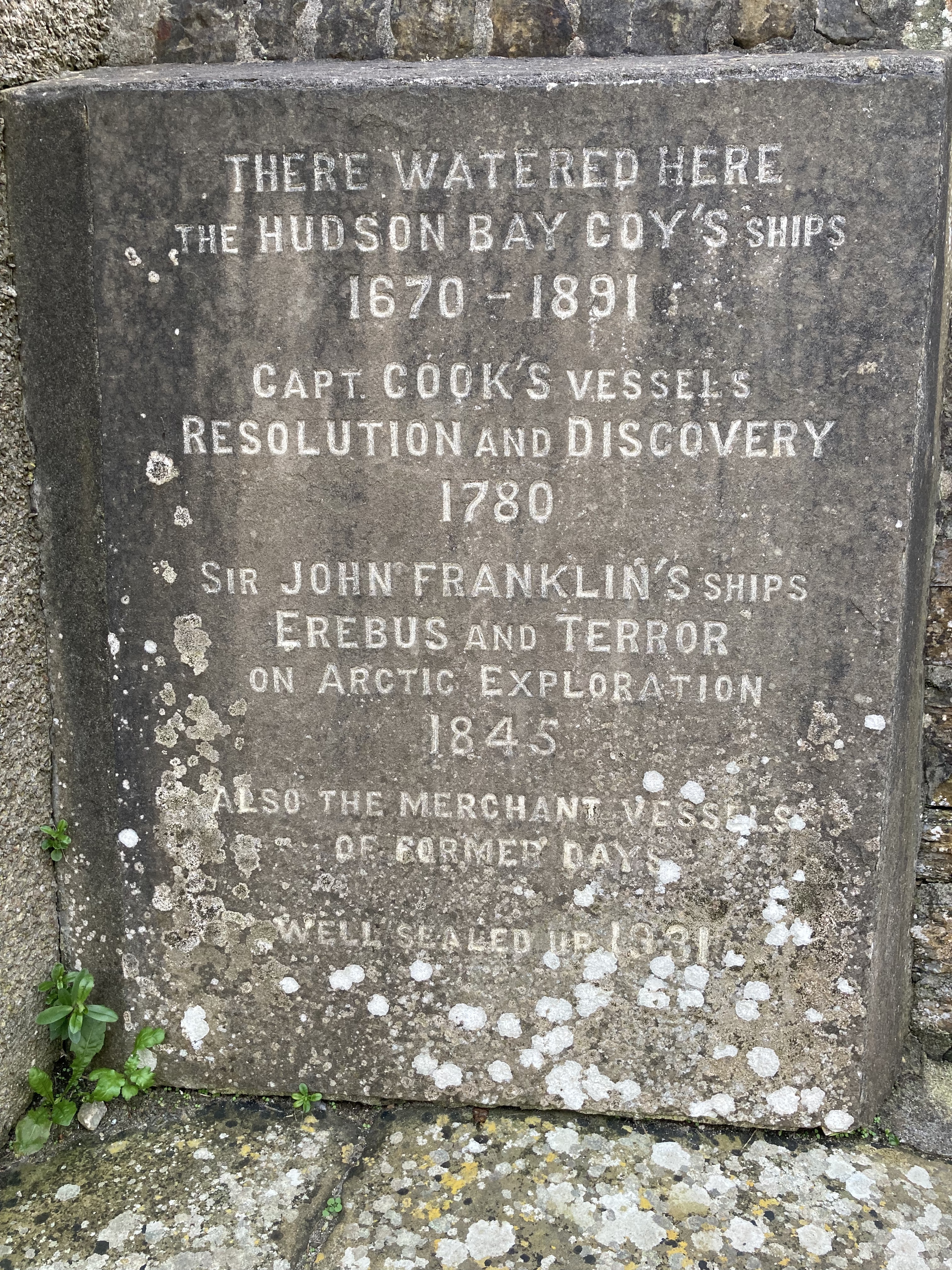
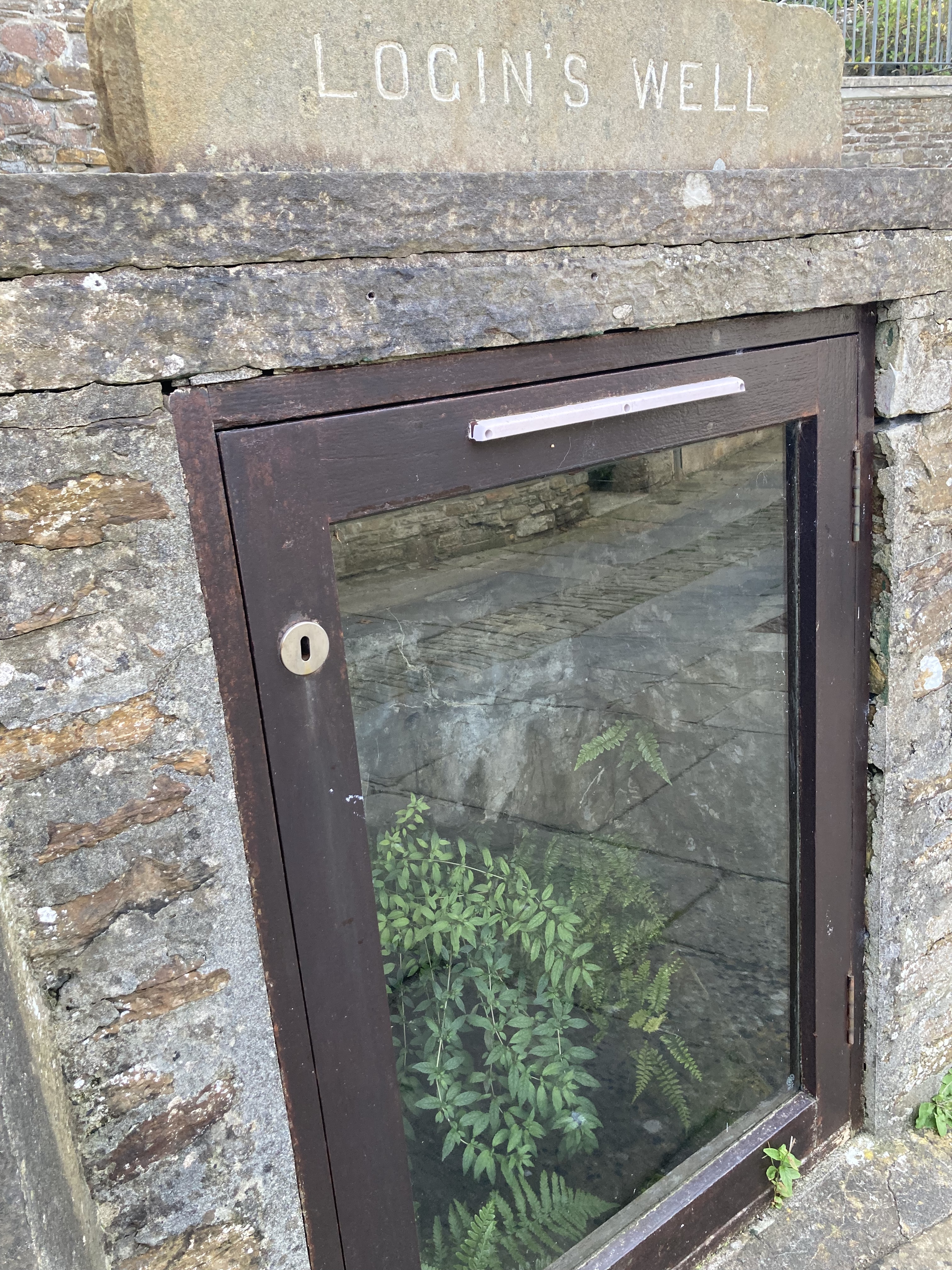
Orkney’s northerly latitude made it a geographically convenient place for the Hudson’s Bay Company (HBC). The oceanic entrance to the Hudson Bay is substantially further north than the mouth of the St. Lawrence seaway, which means that starting the journey from Orkney makes far more sense than leaving from a “more central” port in southern England. Hudson Bay-bound ships “called in” (made a stop at) at the Stromness harbour on the western edge of Orkney as their last landing place before braving the Atlantic crossing. Once in this harbour, they visited Login’s Well (pronounced “Logan’s”) to fill their all-important supplies of drinking water.
Login’s well today: an important part of a Stromness historic walking tour, but if you want to refill your water bottle, you’ll need to look elsewhere.
But it wasn’t just Orkney’s fresh water the HBC wanted. Orkney’s men were also in high demand.
Written by: Patrick Carroll, Cultural Resource Management Advisor, Southwest NWT Field Unit, Parks Canada
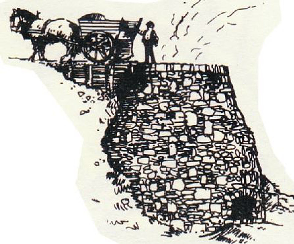
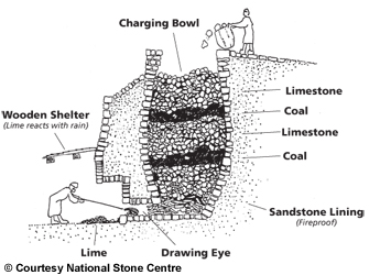
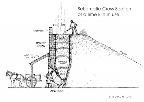
About 50 km upriver on the Slave River from Fitzgerald, Alberta, among a small cluster of islands named Stony Islands, you will find the remains of a stone lime kiln. Archaeologist Marc Stevenson documented the kiln (IjOu-5) and a nearby quarry (IjOu-6) during a survey of the Slave River in 1980. He described the kiln as a, “large semicircular limestone feature 4m in height.” The quarry is an exposed face of limestone just upriver from the kiln. All that we know about the history of the kiln is based on notes from a conversation Stevenson had with a Brother Seaurault. According to Stevenson, “The feature, according to an elderly informant, is the limestone furnace used by residents of Fort Chipewyan in the 1910’s and 1920’s to make whitewash for their log homes in the latter settlement.” It appears, therefore, to have been here for at least a century and is now showing the degradations of time, seasonal flooding and ice scouring.
The kiln is built into a natural alcove in the limestone exposure, set on a rocky shelf at a height to protect it from the impacts of seasonal high water and ice scouring on the Slave River. It consists of a semi-circular convex stone wall extending from the bedrock which, together, create the chimney. The height of the wall extends to the height of the top of the bedrock. A stoke hole on the bottom of the wall faces toward the river. An interesting feature of this kiln is that one side of the wall of the kiln does not abut directly against the limestone outcrop. The collapsing wall on the down-river side appears to have been built mostly flush to the bedrock face. The wall on the up-river side, though, remains in its original condition showing it was built with a 30-60 cm gap between the edge of the stone wall and the bedrock face. It is not known what purpose this gap might have provided for the operation of the kiln, although, it is easily wide enough to allow for a person to enter the cavity of the chimney.
Source: Stoney Middleton Heritage Centre Community Group.Source: National Stone Centre.Source: Rhoda Allanic.Read more →
Written by: Sam Judson and Lindsay Amundsen-Meyer, Department of Anthropology and Archaeology, University of Calgary.
Alberta’s cowboy culture is embraced by many and celebrated through events and conventions like the Calgary Stampede, K-Days or Calgary’s ‘White Hat’ tradition. This culture is largely represented in the history books by white, European settlers, although Alberta’s past is much more multiethnic and multicultural than many realize.
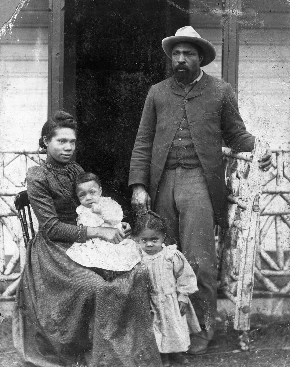
John Ware was one of Alberta’s early Black setters. Ware’s name is recognizable today to many Albertans, who refer to him as Alberta’s first Black cowboy, and the longevity of his legend is fascinating. Despite this, few know his story and very little is known about the true nature of his life.
John Ware, rancher, with wife Mildred and children Robert and Nettie in southern Alberta, [ca. 1896], (CU1107289) by Unknown. Source: Glenbow Library and Archives Collection, Libraries and Cultural Resources Digital Collections, University of Calgary.
Written by: Sam Judson and Lindsay Amundsen-Meyer, Department of Anthropology and Archaeology, University of Calgary.
Calgary was incorporated as a Canadian city in 1884 and, since then, has grown to be a city of more than 1.5 million people. Although the City of Calgary is less than 150 years old, people have lived in this area, called this place home, and taken care of these lands for thousands of years. This long history is told through the numerous archaeological sites within and beyond Calgary’s city limits. Examples such as the Hawkwood site, Everblue Springs site and Mona Lisa Site demonstrate that this part of Alberta has been inhabited for approximately 8,000 years.
Nose Hill is a testament to Alberta’s long-standing Indigenous history. More than 40 recorded Precontact Indigenous archaeological sites are known within this City of Calgary park space, most first recorded by archaeologists in 1978 ahead of the creation of the park. The majority of these are camp sites made up of one or many stone circles, but kill sites and lithic scatters are also present. Not only was Nose Hill utilized frequently by Indigenous groups before contact, but it was also extensively used by citizens in the early days of Calgary’s existence as a settler municipality. Animals grazed on Nose Hill, northern areas of the hill were cultivated for crops, and a gravel pit was active on Nose Hill for several years. Despite these modern activities, Nose Hill Park remains one of the largest undisturbed grasslands in the Calgary area. As a result, the archaeological sites of Nose Hill are remarkably well preserved and tell a story of thousands of years of human occupation and connection with this prominent landform.
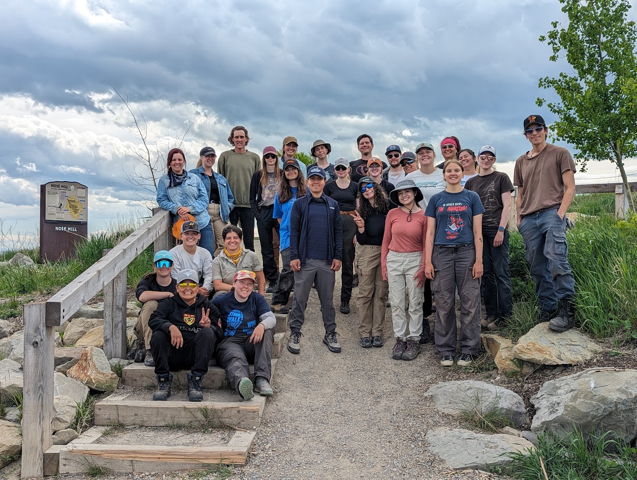
University of Calgary Staff and Students at Nose Hill Park, Calgary. Source: Lindsay Amundsen-Meyer.