

On a cold January day researchers from the University of Alberta and the province’s Archaeological Survey huddled on a frozen lake near Fort McMurray waiting to extract long cores of mud. Layered throughout the cores are environmental indicators, like pollen and microorganisms, that span thousands of years. Geologists have tried to map the boundaries of hydrocarbon reservoirs in the oil sands for over a century but they have only recently focused on the natural forces that exposed bitumen to human eyes. The mystery of this exposure event is what continues to draw researchers to remote frozen lakes in northeast Alberta.
Ice Age Megaflood
The story of Alberta’s oil sands is revealed through studies of sequential layers of sediment and the shape of landforms combined with the use of dating techniques to assign ages to geological events.

The oil sands formed slowly, beginning about 120 million years ago, but the exposure of bitumen happened in the geological blink of an eye. Between 13,000 and 11,000 years ago a thunderous clamour rumbled through northern valleys, followed by a wall of water released from a now-extinct ‘proglacial’ lake that spanned northern Alberta. University of Toledo geologist Tim Fisher estimates that the floodwater had a volume of over 16,000 km³ (the combined volume of Canada’s four Great Lakes is roughly 17,000 km³). Based on mathematical equations and field observations, roughly 8.6 km³ of water are thought to have burst across the Fort McMurray area per hour for 10 weeks.

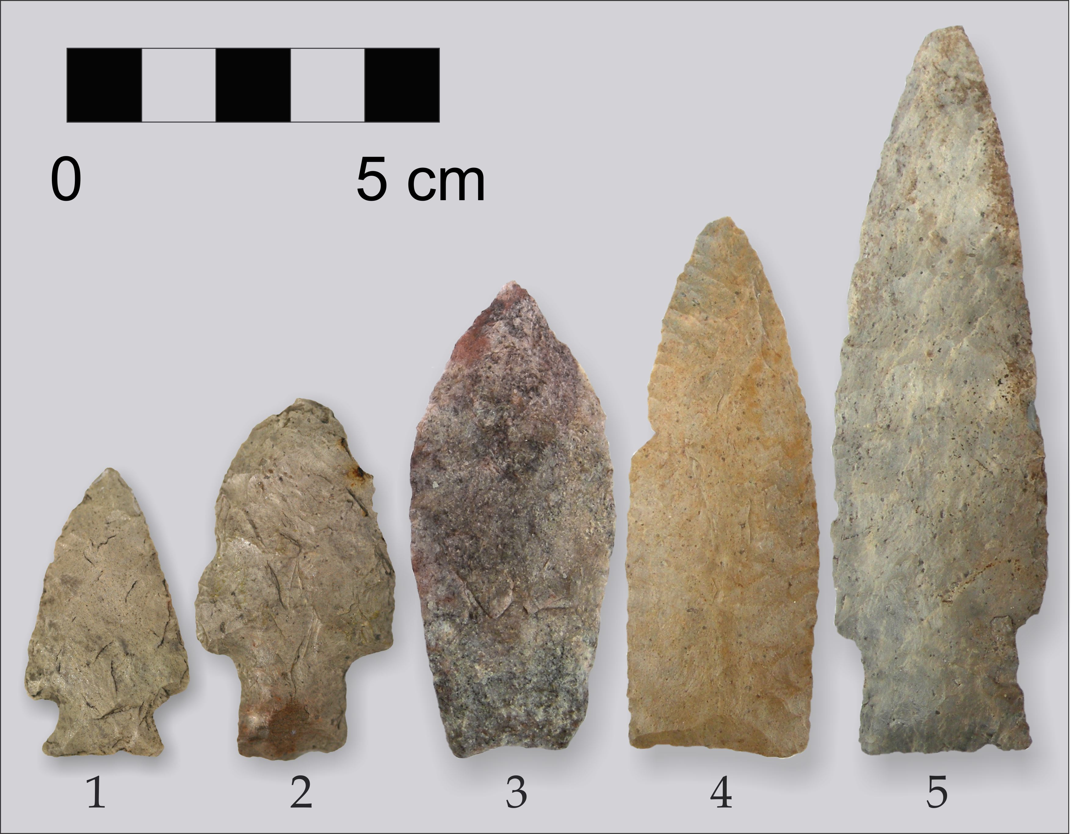
The megaflood bounced boulders 1 meter in diameter across the forest floor like popcorn on a pan and deposited huge gravel loads in some areas while scouring away swaths of sediment in others. For human survivors, the flood exposed two important features. It peeled the lid off a treasure chest of material called Beaver River Sandstone; a rock ideal for making stone tools like spear heads. Archaeologists have recovered over two million artifacts of Beaver River Sandstone from a site complex called Quarry of the Ancestors near Fort McMurray, which people have returned to for over 8000 years.

Bitumen and Boats
The second material exposed was bitumen, which was originally used by First Nations as a boat sealant. Rocky rivers are hard on birch bark canoes; holes, tears, and seams had to be regularly caulked and a ready supply of bitumen sealant lay freshly exposed along river valley walls.
Early European explorers observed the novel sealant and recorded bitumen outcrops on their travels in northern Alberta in the late 1700s. In the 1800s, fur traders based out of Fort Chipewyan on Lake Athabasca (a major canoe-building depot) collected loads of soft tar for boat maintenance.
Reports of raw bitumen were eagerly investigated by surveyors in the mid- to late 1800s. By the 1880s attempts were being made to separate it from sand using hot water, and commercial production began in the 1930s. This short history of the megaflood and its impact reveals that much of Alberta’s energy sector has developed on the basis of a chain of communication about oil sands discoveries that extends deep into the province’s past.
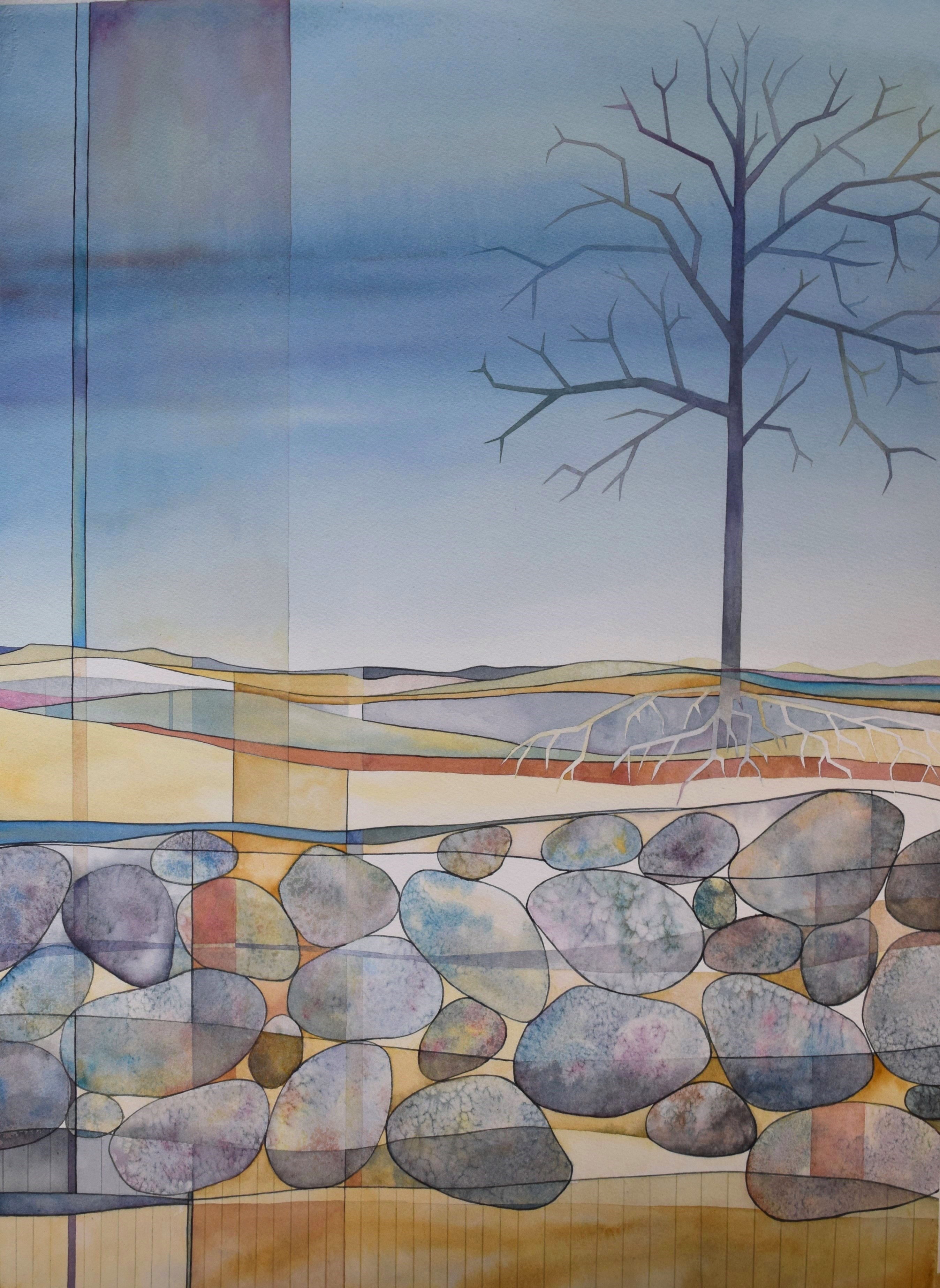
Heritage Art Series
The Heritage Art Series is a collaboration of the Historic Resources Management Branch, the University of Alberta, and the Royal Alberta Museum. Each artwork shares an important story about the people of our province: we hope it fosters a greater awareness of our past and instills a deeper respect for it. The painting above is by Calgary-based artist Conny Jager. It symbolizes the colourful layers of our past and the importance of flood events in our history. Uncovering the story of Alberta requires a blend of science, archaeology, and history.
A full version of this article appears in the October issue of the Canadian Heavy Oil Association Journal.
For a detailed history of oil sands development see Alberta Culture and Tourism’s Energy Resources Heritage website.
Written By: Todd Kristensen and Robin Woywitka (Archaeological Survey)

I was privileged to be at the National Trust conference session in Calgary where Todd Kristensen presented this information. Thank you Todd. Your NT presentation (along with that of your team including Darryl Bereziuk) was wonderful – highly informative and exciting. I am eager to continue learning more and more about these amazing topics!