

Anyone with allergies knows when spring begins, and plants start pollinating, the offensive ‘dust’ can wreak havoc. However, one of the great things with pollen, from an archaeological perspective, is the fact that it gets dispersed annually. This means that each year, the ‘signature’ of the pollen released tells us about the landscape at the time. Plants have evolved to reproduce with pollen in several ways, and one that is highly effective is pollinating via the wind.
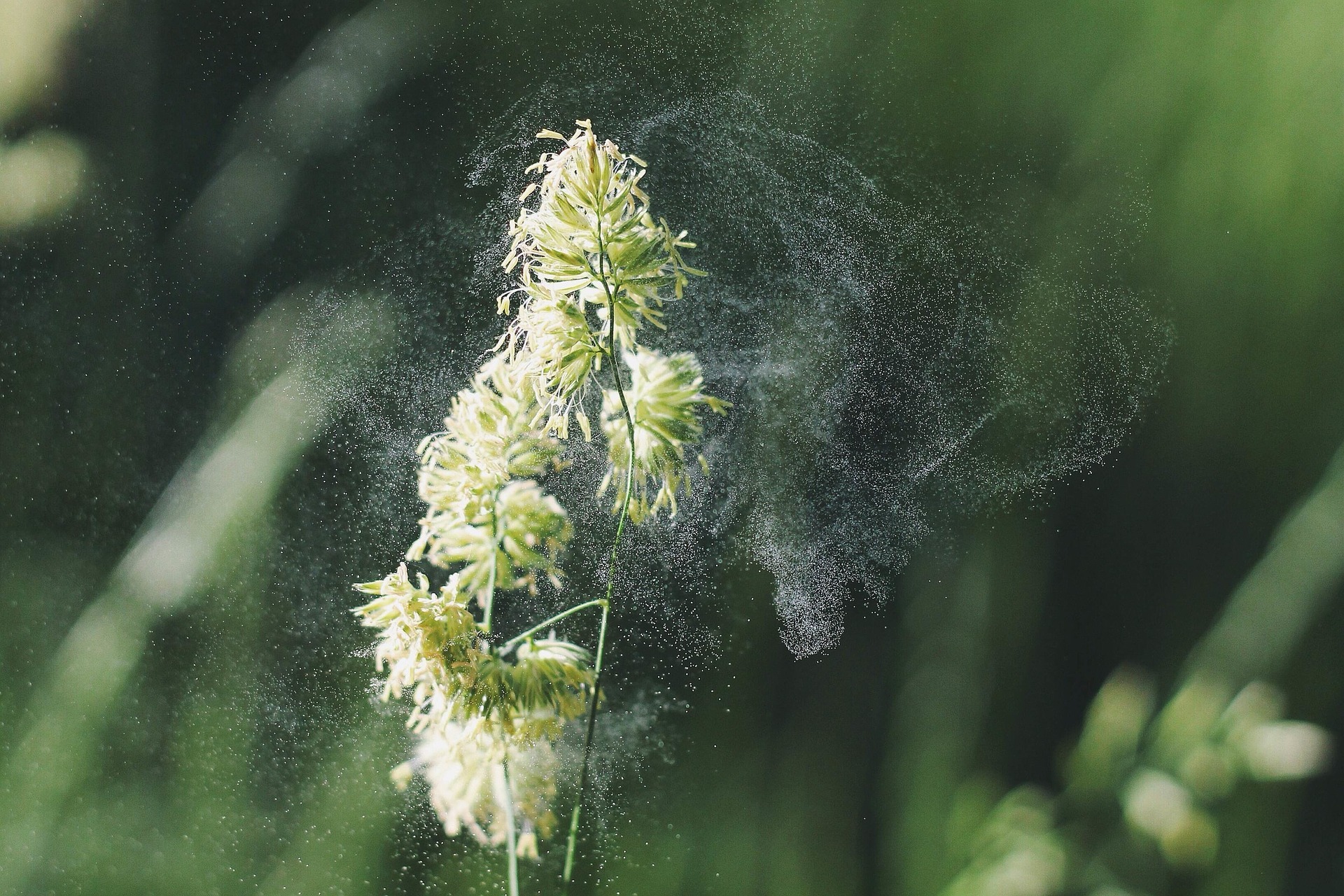
When the wind transports pollen it gets dispersed across the landscape, sometimes even getting caught within puddles. Inevitably, many pollen grains get caught in lakes and accumulate in the sediments. When it settles on the bottom of a lake basin, it stays there and is preserved for researchers to find hundreds, and even thousands, of years later. All this information that is recorded in the sediments is laid down in chronologic order and provide us with information about the past1,2.


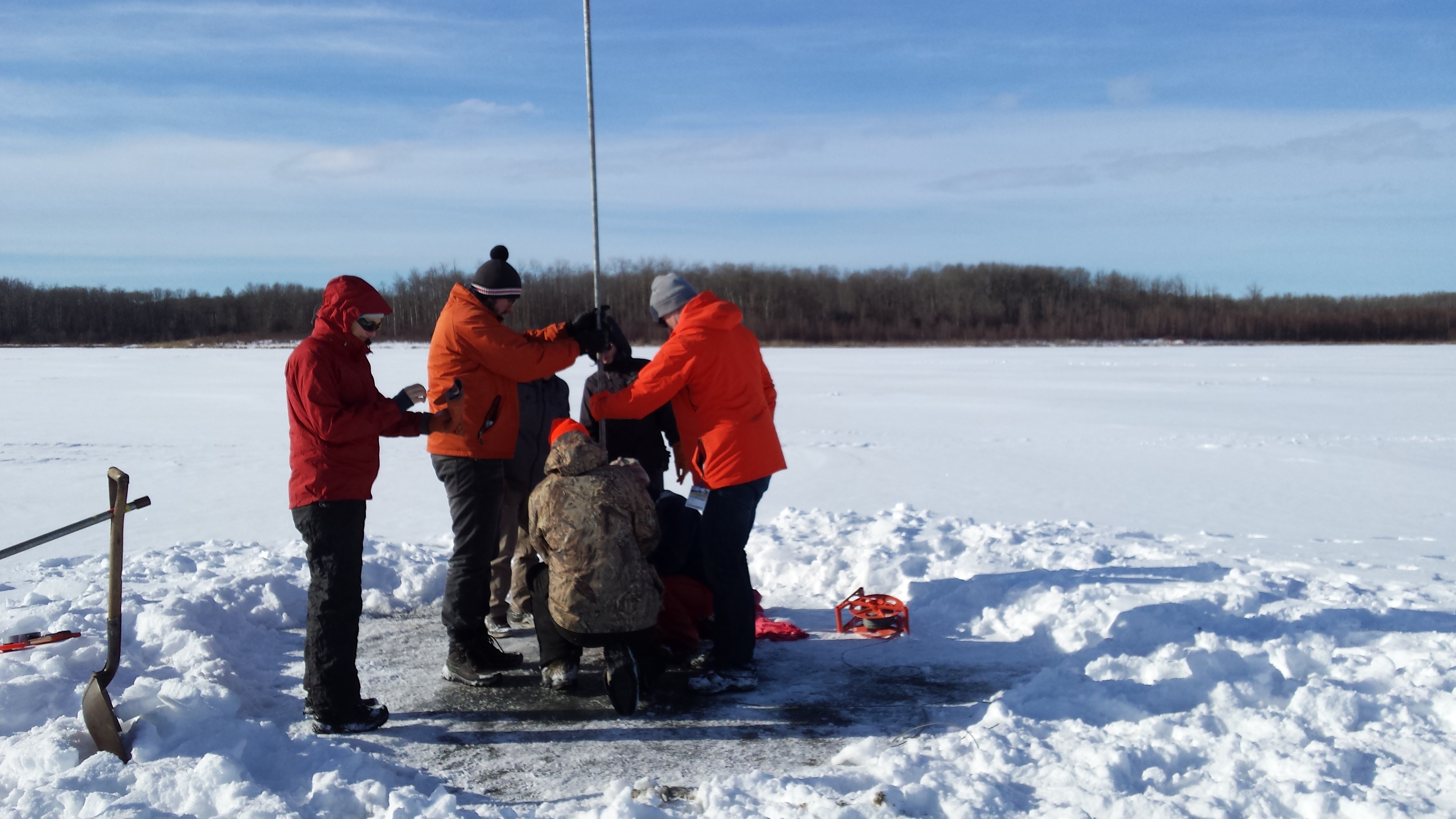
Pollen researchers (or palynologists) are interested in understanding past environments and the way they change. They can access this ‘data bank’ of sorts in a couple of different ways. The most common way is to core a lake of interest. Using coring equipment like a Reasoner corer3, a long barrel of sediment is acquired that contains pollen and other valuable data. Since it is removed all as one piece, it represents the complete record of materials deposited in the lake, including the pollen that was trapped over time. Piece by piece, researchers can begin to reconstruct the past environment and look at changes in the landscape.
But what do these tiny allergy-causing grains mean for archaeological sites? At archaeological sites, we can’t assume that the plants we see today are the plants that were always there. We have to look to other sources, and other records, to understand what the area might have looked like. The use of pollen to understand archaeological sites and human occupation has been used extensively across the world. In the Fertile Crescent and Europe, pollen can tell us when landscapes were being changed to make way for agriculture. In North America, we can see when Europeans arrived and began cultivating their plants because of the signature and change it produced on the landscape. When we have botanical elements preserved, be it pollen, phytoliths, seeds, or charcoal, it tells archaeologists and researchers so much about the surrounding landscape and what plants people were using. When we look at the record from lakes adjacent to archaeological sites, we are able to recreate the past landscapes that people inhabited.
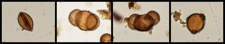
For some of the earliest archaeological sites in Alberta, we know what the landscape looked like because of the records of pollen that lakes have trapped and stored for thousands of years. When we look at the overall composition of pollen in an assemblage, we can infer information about climate and landscape conditions. If we have a high amount of willow or grass pollen represented, we can tell that the landscape was more open. When pine, spruce, and birch dominate, we can reconstruct a mixed boreal forest with shrub species on the ground. Certain species, like spruce, prefer specific soil conditions, so the taxa’s presence in the core tells us a bit of the landscape itself, beyond the species.
Research into past landscapes has proven to be valuable, especially in areas where the archaeological record only gives us small glimpses of past life. In the boreal forest, for example, deposits are often shallow and poorly stratified, and soils are very acidic which tend to destroy organic artifacts (like bone, wood, and seeds) that may have been at a site. These factors leave archaeologists with the challenge of reconstructing the record with limited information.
Current research happening at the University of Alberta (alongside the Royal Alberta Museum) is looking at a core in the boreal forest region that will provide thousands of years of environmental data for researchers to use when interpreting archaeological sites. The core is from Sharkbite Lake, located northeast of Fort Mackay and nestled between hundreds of archaeological sites on both sides of the Athabasca River. Initial analysis of Sharkbite Lake shows us that the base of the sediment collected dates to 3320+/- 15 radiocarbon years before present (rcyBP). The core is a total of 3.8 m long and can tell us a lot about the landscape humans would have been inhabiting over the past 3000 years.
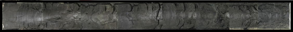
Each centimetre of sediment in the core represents 8.5 years, making it one of the highest resolution records in Alberta’s northeastern boreal forest. Pollen from the core describes and reconstructs changes to the vegetation on a finer scale. Evidence of a local forest fire along the margins of Sharkbite Lake is seen through pollen—a decrease in pine, spruce, and other canopy species, but stable then increased levels of birch, willow, and herbaceous shrubs—and microcharcoal levels. The high-resolution record means we can date this event. Sometime between 2410 and 2377 rcyBP, a stand-clearing fire burned around the lake, destroying the canopy and burning down to the mineral soil. This fire changed vegetation for several years and promoted new shrub communities, like berries, to appear. For the archaeological record, nearby sites like Ronaghan’s Ridge have dated occupations in this post-fire interval that can benefit from interpretations of the artifact assemblage in conjunction with this environmental data. Local vegetation events such as this fire can be associated with archaeological sites, and provide us with an understanding of the landscape at the time. In addition, archaeological sites with dated occupations can look to these detailed pollen records to infer climate and reconstruct the landscape. By understanding the environmental record, we can look at pollen to see how open or closed a forest was, what type of trees would have dominated a site, and even how often fires were occurring. We can even see what types of plant food would have been available for groups in the area. From there, we can infer what types of animals people would have interacted with on the landscape; specific plant types attract certain animals and so, if the plant is present, so might be the animal.
For archaeologists, pollen becomes a valuable tool for reconstructing the daily lives of First Nations ancestors. The interactions between the landscape, animals, plants, and humans can’t always be recorded archaeologically, but by using multiple sources of information, we can better understand these ancient relationships.
Written By: Christina Poletto, Master’s student, University of Alberta
References
1 Faegri, K., and J. Iversen 1989. Textbook of Pollen Analysis. 4th ed. Wiley, New York.
2 Edmonds, Robert L. 1979. Aerobiology. The Ecological Systems Aprroach. Ed. Robert L. Edmonds. US/IBP Syn. Dowden, Huchinson & Ross, Inc., Stroudsburg.
3 Reasoner, Mel A. 1986. An inexpensive, lightweight percussion core sampling system. Géographie physique et Quaternaire 40:217-219.

This type of research has been used before, most notably with the discovery of “Otzi” in the Italian Alps in 1991.
“The Iceman’s final meals have served up a feast of information to scholars. His stomach contained 30 different types of pollen. Analysis of that pollen shows that Ötzi died in spring or early summer, and it has even enabled researchers to trace his movements through different mountain elevations just before he died.”
This type of research has always fascinated me! Thank you for another great article!
Hello! Thank you for your comment and for reading the blog. It really is fascinating what pollen can tell us!