Written by: Todd Kristensen, Regional Archaeologist
Recent archaeological discoveries in Alberta’s Boreal Forest are confirming the antiquity of Indigenous occupation of this place and refining ideas of how pre-contact people adapted to landscapes. Two fresh articles in the most recent issue of the Archaeological Survey of Alberta’s Occasional Paper Series explore ancient sites found in northwest Alberta.
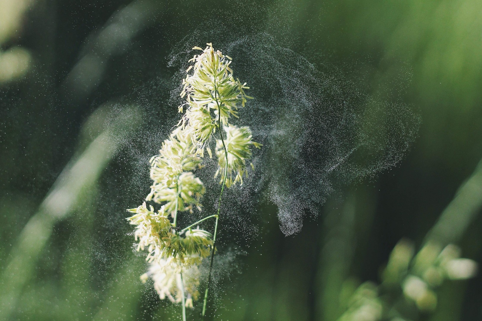
Anyone with allergies knows when spring begins, and plants start pollinating, the offensive ‘dust’ can wreak havoc. However, one of the great things with pollen, from an archaeological perspective, is the fact that it gets dispersed annually. This means that each year, the ‘signature’ of the pollen released tells us about the landscape at the time. Plants have evolved to reproduce with pollen in several ways, and one that is highly effective is pollinating via the wind.
Pollen being released from a flower which will be carried by the wind. Plant Pollen is available through the CC0 Public Domain.
When the wind transports pollen it gets dispersed across the landscape, sometimes even getting caught within puddles. Inevitably, many pollen grains get caught in lakes and accumulate in the sediments. When it settles on the bottom of a lake basin, it stays there and is preserved for researchers to find hundreds, and even thousands, of years later. All this Read more →
Has the boreal forest always been a boreal forest? How do vegetation communities change with age? One thing for certain is that northern boreal forests are young. Compared to the redwood forests of California for example, Alberta’s boreal forest is a ‘baby’. That being said, it’s no baby in size. The boreal forest region in Alberta covers over 55% of the province and is a ‘hot spot’ for ecological diversity.
The forested parts of Alberta figured here are dominated by the boreal forest. The boreal region is renowned for its ecological diversity and is home to hundreds of plants and animals (created by Christina Poletto).
Why is Alberta’s boreal forest so young and how has it changed? Some 12,000 years ago, ice sheets that covered Alberta began to melt and the landscape opened. The Laurentide Ice Sheet retreated to the northeast so that the northwest corner of Alberta was the first region to become free of ice. The newly opened landscape was a productive steppe-tundra environment that lasted for a short period. Species like birch and alder were dominant while smaller shrubs of grasses and willow covered the remaining landscape. Read more →
When people think of archaeology in Alberta they might picture buffalo jumps, rock art, or medicine wheels. These are dramatic types of sites on the prairies but what about the north? Alberta’s boreal forest has a unique record and requires a unique breed of archaeologist to find it. This blog is a small window to archaeological work in the northern half of the province and some of the interesting archaeological sites hiding in our forests.
Boreal Breed
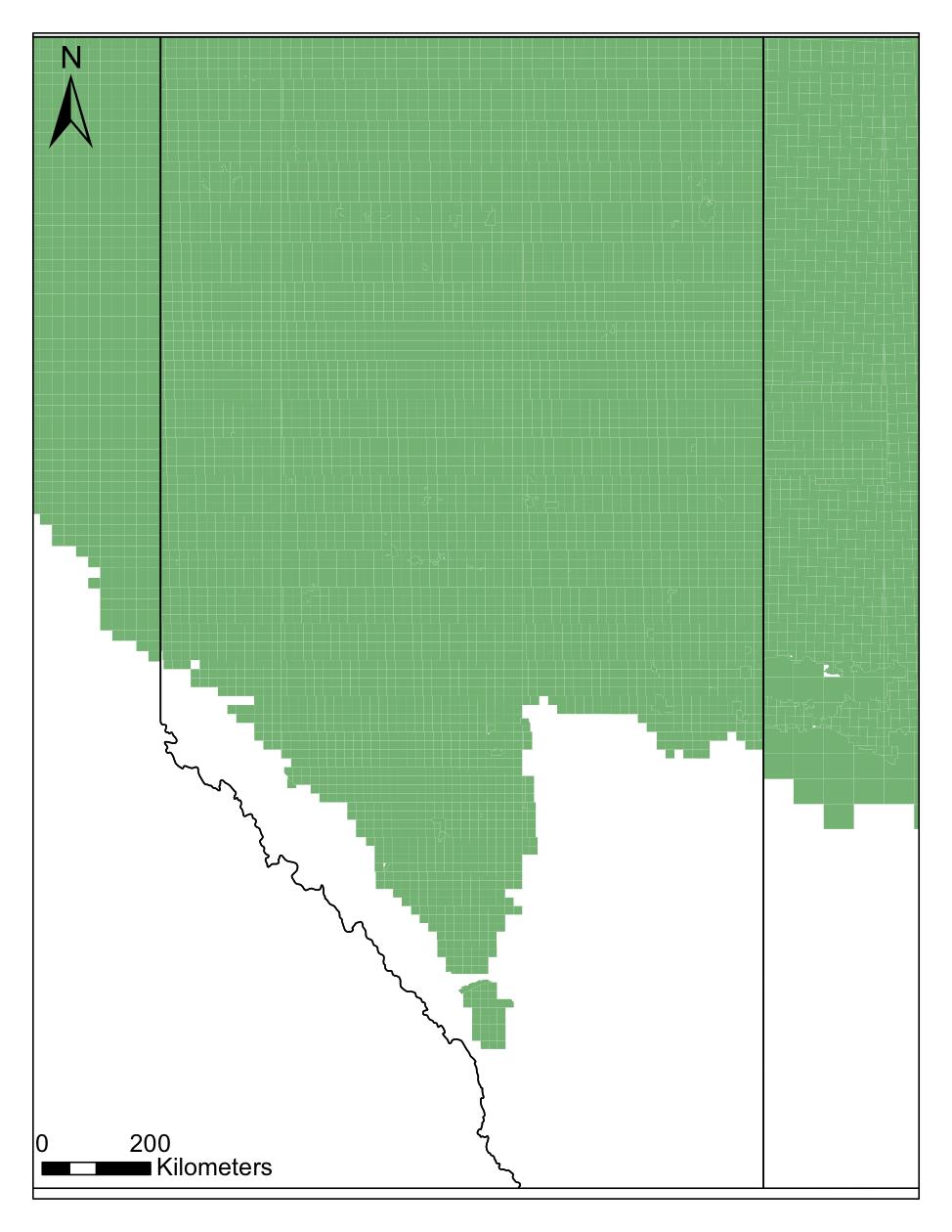
Archaeologists working in northern Alberta brave bugs, blowdown (piles of fallen trees stacked like a cruel game of KerPlunk) and a range of conditions from blistering hot to bitterly cold. Forests are quite good at concealing sites so archaeologists dig hundreds of small shovel tests to find them. Most archaeology in the ‘Green Zone’ (typically forested Crown Land) happens in advance of forestry, oil and gas activity, gravel operations, and construction of transmission or road corridors. The hard work and skill of consulting archaeologists has resulted in over 8000 archaeological sites in the Green Zone.
Roughly 8000 sites have been found in Alberta’s boreal forest (highlighted in green).
The Nature of Northern Sites
Most of the successful shovel tests yield small collections of stone debris from pre-contact human tool making. Sites in the north are typically smaller than on the plains. Why? Pre-contact people in the north were generally more mobile and lived in smaller groups; southern bison herds supported bigger groups that stayed in one spot for longer periods, which produced bigger collections of artifacts. Archaeological visibility is also a factor. Prairie landforms are often easier to locate and interpret while artifacts, bones, or stone features on the surface can help guide archaeologists to productive areas under the ground. Not so in the north. Hot spots for artifacts are often harder to access, are covered in vegetation and dense roots, and are challenging to interpret (e.g., ‘how has this terrace changed over thousands of years’). Read more →