The history and conservation of the Colonel’s Cabin

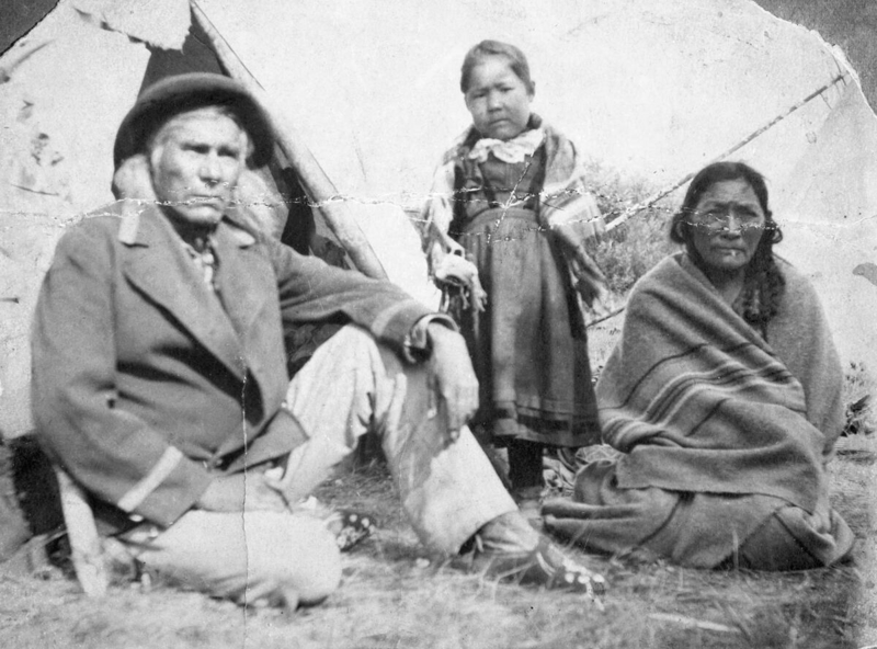
Editor’s note: The banner image above is courtesy of the Glenbow Library and Archives Collection, Libraries and Cultural Resources Digital Collections, University of Calgary.

Cowritten by: Fraser Shaw, Heritage Conservation Advisor and Ronald Kelland, Geographical Names Program Coordinator

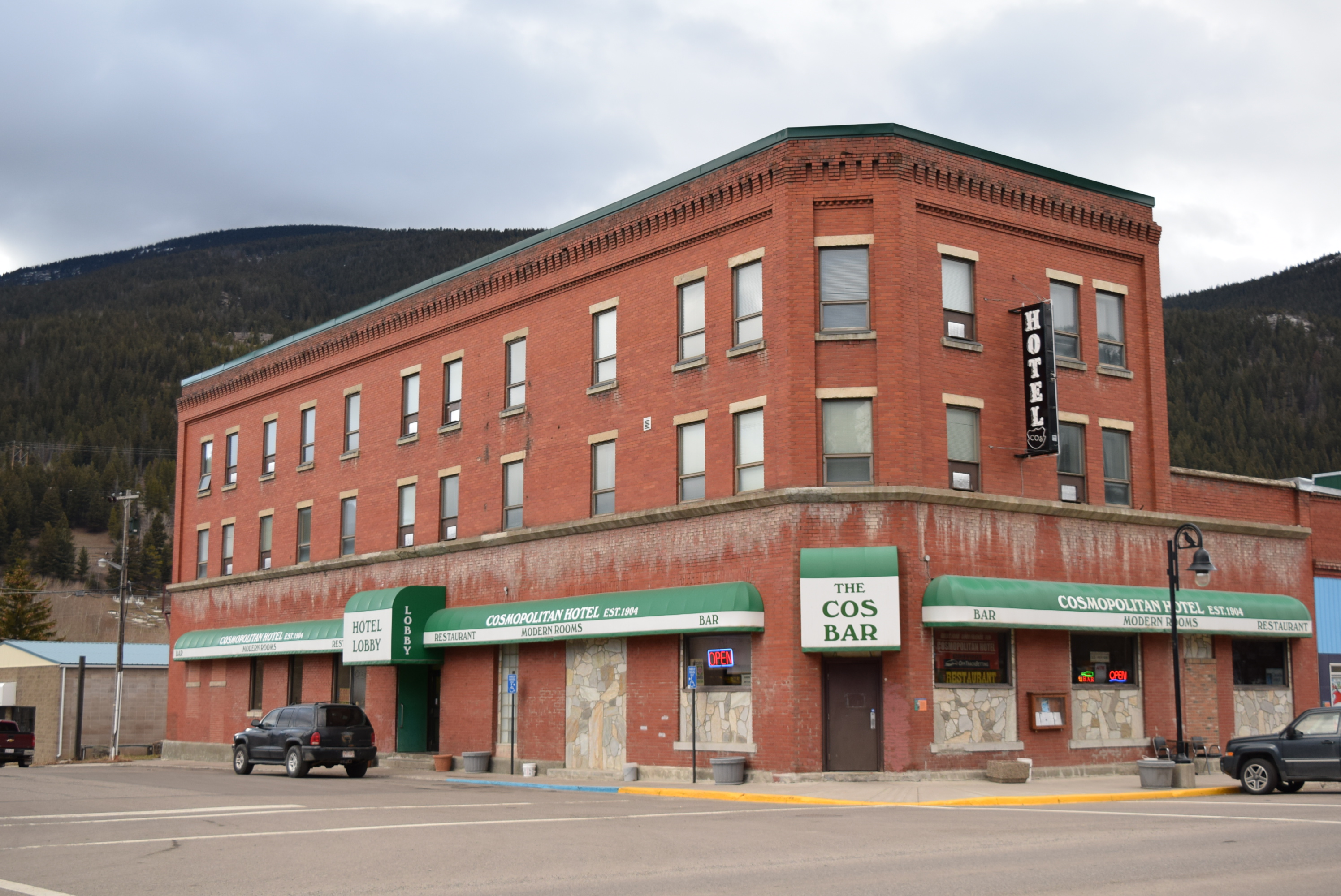
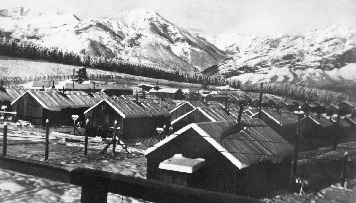
A panoramic 1945 photograph shows a snowbound mountain landscape in the grip of winter. Plumes of smoke rise from rows of tarpaper-covered buildings huddled behind barbed wire fences and guard towers. This is Camp 130, one of a series of Prisoner of War (POW) camps established across Canada during the Second World War. Outside the prisoners’ compound is a small, single-story log cabin occupied by the camp commandant. Built in 1936, the “Colonel’s Cabin” was protected as a Provincial Historic Resource in 1982 as one of few remaining structures in Alberta directly linked to the internment of prisoners of war and to recognize the site’s earlier association with the Kananaskis Forest Experimental Station.

Camp 130 Prisoner of War Camp, winter 1944 or 1945. Source: Glenbow Library and Archives Collection, Libraries and Cultural Resources Digital Collections, University of Calgary, CU1128370 (NA-4824-2os).

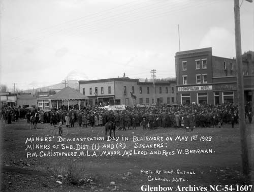
During the Great Depression, Canada’s middle-class, political and economic elites were concerned about the large number of unemployed men roaming the country and how that long-term unemployment might result in moral degradation, petty criminality and the fostering of revolutionary communist ideology. Under pressure from religious organizations and municipal and provincial governments, the Dominion government established a series of temporary work camps for single, unemployed men to be administered by the Department of National Defence. By 1936, camps had been established at Acadia, New Brunswick; Valcartier, Quebec; Petawawa, Ontario; Duck Mountain, Manitoba; and Kananaskis, Alberta. Ostensibly created to engage unemployed and homeless men in work that was seen as being necessary for their physical, psychological and spiritual betterment, the camps also kept these unemployed, transient men out of sight and far from transportation routes and urban centres.

Read more

Blairmore, Trochu and Grande Prairie home to new Municipal Historic Resources

Editor’s note: Read previous RETROactive posts about Historic Resource designation.

Written by: Ronald Kelland, Historic Places Research and Designation Program

Recently, some new Municipal Historic Designations in the Crowsnest Pass, Trochu and Grande Prairie have been added to the Alberta Register of Historic Places. These resources have been deemed by their municipality to be of significant heritage value to their community. Like Provincial Historic Resources, municipally designated properties are protected under the Historical Resources Act and qualify for conservation grants from the Heritage Preservation Partnership Program.

Cosmopolitan Hotel (Crowsnest Pass – Blairmore)

The Cosmopolitan Hotel is a three-story brick building. Its heritage value lies in its: association with the urban and commercial development of the former mining town; for its design; and for its position as a community landmark. Like many communities in their early days, Blairmore’s earliest buildings were simple, wood-frame structures, which were highly susceptible to fire. The original, wood-frame Cosmopolitan Hotel burned down in 1912, along with much of Blairmore’s commercial district. The hotel was rebuilt as a substantial, 50-room brick structure later that same year.

Although still a simple and understated structure, it affects an impressively solid appearance and has some ornamental details, such as the corbelled parapet that were common on commercial buildings of the period. Located on a corner lot on what was Blairmore’s most important intersection, the Cosmopolitan Hotel has long been a significant landmark in the Crowsnest Pass. Being located across the street from the Blairmore Bandstand, which was a favoured location for community events, miners’ union rallies and strikes, the Cosmopolitan Hotel was often the backdrop of those events, making it a significant focal point for the community.

The Cosmopolitan Hotel was designated as a Municipal Historic Resource in 2016 and was listed on the Alberta Register of Historic Places in early 2024.

Cosmopolitan Hotel from the southwest, November 2018. Source: Historic Resources Management, Arts, Culture and Status of Women.
Miners’ Union Rally at the Blairmore Bandstand with the Cosmopolitan Hotel in the background, May 1, 923. Source: Glenbow Archives, NC-54-1607.
Read more

Tipis, Bison and Dogs: Visualizing an Archaeological Feature in Southern Alberta

Written by: Todd Kristensen and Emily Moffat, Archaeological Survey of Alberta

Small rings of rock appear across Alberta’s prairies. These stones once weighed down the bison hide covering of tipis – a type of dwelling used by generations of First Nations. Tipis, and the remnants of them, have drawn the attention of archaeologists and historians in the province for over 70 years. It is estimated that Alberta had a million stone circles before being displaced by farming and other developments. Currently, the province has over 8,000 recorded archaeological sites with tipi rings: some are a single circle (a small camp) while others host over 200 rings in one spot (a large gathering of family and allies). New figures and imagery here highlight decades of archaeological research and help visualize how records of tipi rings can reveal dimensions of pre-contact life.        

Exposed, excavated, and mapped tipi rings in Alberta. Source: permits 08-110, 09-050, 11-048, and 21-046.
Read more

When the Ice Melted: Revisiting the Ice-Free Corridor

Editor’s note: The research presented in this blog is from a published journal paper co-authored by Timothy Allan, John Ives, Robin Woywitka, Gabriel Yanicki, Jeffrey Rasic and Todd Kristensen.

Ice sheet margins derived from: Dalton, A. S., M. Margold, C. R. Stokes, L. Tarasov, A. S. Dyke, R. S. Adams, S. Allard, et al. 2020. An Updated Radiocarbon-Based Ice Margin Chronology for the Last Deglaciation of the North American Ice Sheet Complex. Quaternary Science Reviews 234: 106223–27. https://doi.org/10.1016/j.quascirev.2020.106223.  

Written by: Todd Kristensen, Archaeological Survey of Alberta

Alberta was once covered with glacial ice. Around 22,000 years ago, portions of the ice that sprawled across the province were over 1.5 kms thick. When the ice began to melt, it retreated in two directions (northeast and west) and exposed a pathway dubbed the Ice-Free Corridor that crossed through Alberta and connected previously exposed land masses over the warmer United States and a colder but drier region to the north called Beringia (parts of Northwest Territories, Yukon, Alaska, and Russia). People had settled into the corridor in what is now Alberta by 13,000 years ago. Where did they come from?

The melting of ice sheets over Alberta from roughly 22,000 to 13,000 years ago (based on data from Dalton et al. 2020). The ages are ‘calibrated’ from radiocarbon dates.

New archaeological discoveries are pushing back the ages of when people arrived in Beringia and to the south in the United States. To help understand which of those two areas are the likely source of people who came to Alberta, archaeologists have recently looked at the tools they were carrying, specifically, what kinds of stone the tools were made of. Some of the rock types that people used to craft things like spear points, scrapers and knives, are only found in certain areas in North America: their presence in Alberta’s archaeological record indicates that the stones were transported from far away. In turn, archaeologists look at changes in those ‘toolstone’ materials to track changing relationships; in the absence of other things that don’t preserve in Alberta’s soil, stone tools reveal where people migrated from, who they were interacting with (their ‘kin’) and how that all changed over thousands of years.

Read more

Archaeology on the Brink: The Occasional Paper Series in 2023 (Part 2)

Editor’s note: The Archaeological Survey of Alberta is proud to release the complete volume of Occasional Paper Series No. 42, available for free download. The volume is dedicated to Alberta archaeologist Jack Brink and the initial blog featured the first five articles. This post features the remaining seven articles, which focus on a variety of archaeological topics.

Written by: Todd Kristensen, Archaeological Survey of Alberta

In the sixth paper of the volume, staff of Lifeways of Canada Limited summarize three seasons of excavation at an important archaeological site in southern Alberta. The Junction Site has produced a number of interesting pit features associated with Late Precontact Period bison kills, processing areas and winter camp activities.   

    A boiling pit feature and profile from the Junction Site. Source: Vivian and Blakey, 2023.
    Read more

    Archaeology on the Brink: The Occasional Paper Series in 2023 (Part 1)

    Editor’s note: The Archaeological Survey of Alberta is proud to release the complete volume of Occasional Paper Series No. 42, available for free download.

    Written by: Todd Kristensen, Archaeological Survey of Alberta

    Archaeology on the Brink: Papers in Honour of John W. Brink

    Cover of the 2023 Occasional Paper Series. Artwork by Shannon Ford.

    Unlike previous volumes, in which papers are published and released throughout the year, the current volume is based on an archaeology conference session dedicated to the widely respected Alberta archaeologist Jack Brink, and all articles are here released concurrently. This blog features five articles (out of 12 in the issue) that focus on archaeological work at the famous Head-Smashed-In Buffalo Jump UNESCO World Heritage Site in southern Alberta. The rest of the 12 articles will be published next week.

    Read more

    The Archaeological Survey in Numbers – 2022 Update Part One

    Written By: Colleen Haukaas, Archaeological Survey

    This week’s post is an update on 2022 archaeological permits from the Archaeological Survey of Alberta. All archaeological field research in Alberta must be carried out under a permit issued by the Archaeological Survey by a qualified professional archaeologist. In 2022, the Archaeological Survey issued 209 permits to 53 professional archaeologists at 19 companies.

    As in previous years, the majority of permits were issued for mitigative assessments, or assessments to determine if a proposed development may impact a known of potential archaeological site. The majority of assessments were Historical Resources Impacts Assessments (HRIAs), which are generally preliminary examinations intended to determine whether a development will impact archaeological sites. More detailed site excavations are less common in mitigative archaeology, but do occur when sites cannot be avoided by a development. In 2022, mitigative archaeologists carried out 194 assessments, which included the excavation of more than more than 27,000 shovel tests and 476 square meters of formal site excavation.

    The infographic below includes details about archaeological permits and assessments, based on information provided to the Archaeological Survey in permit applications, reports and other reporting materials.

    Part two of this post will discuss the archaeological sites recorded in 2022.

    You can explore previous Survey in Numbers to compare statistics year over year.

    National Day for Truth and Reconciliation: Remembering Emma Stanley

    Editor’s note: September 30 is National Day for Truth and Reconciliation and Orange Shirt Day. Reading residential school histories can be a painful process. If reading this is causing pain or bringing back distressing memories, please call the Indian Residential Schools Crisis Line at 1-866-925-4419. The Crisis Line is available 24 hours a day and can also provide information on other health supports provided by the Health Canada Indian Residential Schools Resolution Health Support Program.

    Written by: Laura Golebiowski (Indigenous Consultation Adviser) in collaboration with Whitefish Lake First Nation #128.

    Emma Stanley was born in 1886, in the area known today as Whitefish Lake in northeastern Alberta. Her mother was Eliza and her father was Cheepo-Koot, or Charles. She had at least two sisters. The last name Stanley was assigned to Indigenous families upon christening by the Methodist ministers of time. These assigned names are still known and common in the community today.

    Emma and her family were members of James Seenum’s Band, contemporarily known as Whitefish Lake First Nation #128. Their leader was Chief Pakan, or James Seenum: “a very forceful and highly respected figure.” When the Nation signed Treaty Six, Cheepo-Koot was selected as one of three Councillors.  

    In the years and decades prior to Emma’s birth, James Seenum’s Band members lived by the Cree seasonal round, which influenced their hunting, fishing, agricultural and travel practices. “In the spring-time, after the potatoes and turnips were planted, [the people] went south on their buffalo hunt, leaving the missionary and a few of the older people at home to look after the place and anything that had to be done. They would travel till they came to the buffalo range. After a good day’s hunt there was lots to do, such as curing the meat so it would keep. The surprising thing was that there was no such thing as flies to bother the fresh meat.”

    “James Seenum, Pakan, and family at Whitefish Lake reserve, Alberta,” ca early 1900s. (CU194507) by unknown photographer. Source: Glenbow Library and Archives Collection, Libraries and Cultural Resources Digital Collections, University of Calgary.
    Read more

    Rallying Point: Blairmore Bandstand designated a Provincial Historic Resource

    Editor’s note: The banner image above, awarding of a Dominion Day track trophy at the Blairmore Bandstand, is courtesy of the Crowsnest Museum and Archives.

    Written by: Ronald Kelland, Historic Places Research Officer

    A well-known landmark in the Crowsnest Pass has recently been designated as a Provincial Historic resource and is now listed on the Alberta Register of Historic Places.

    View of the Blairmore Bandstand from the east, showing its wooden construction and prominent position along Blairmore’s main commercial roadway, June 2021. Source: Historic Resources Management, Alberta Arts, Culture and Status of Women.

    On your drive through the Crowsnest Pass, if you were to pull off Highway 3 and travel down the streets of the communities that make up the municipality you will see historic buildings that harken back to the boom periods of these coal mining towns. One structure that you may miss is a small bandstand in the community of Blairmore situated in a green space between 20th Avenue and the Canadian Pacific Railway line. It may be an unassuming structure, but the Blairmore Bandstand is one of the most significant sites in the Crowsnest Pass – a community landmark and a symbol of hard-won workers’ rights and the labour movement of the 1920s and 1930s.

    The Blairmore Bandstand is typical of such structures. Built of wood, the bandstand consists of a raised, circular platform with railings and interior benches under an eight-sided, peaked roof with flagpole. Bandstands were once a common and important fixture in many Alberta communities. Associated with Victorian and Edwardian Age beliefs about the healing and restful benefits of urban green spaces, education and wholesome entertainment, bandstands were often the centrepiece of urban parks, where they were used for public events such as concerts and speeches. Being situated in publicly accessible spaces also leant their use as rallying points for social movements and protests.

    Read more

    The Place of Frozen Smoke: Cultural Landscapes of M’behcholia

    Editor’s note: Banner image of Dene Tha’ First Nation drummers at M’behcholia courtesy of Laura Golebiowski.

    Written by: Laura Golebiowski (Indigenous Heritage Section) in collaboration with Dene Tha’ First Nation and Matt Munson (Yves Claus Didzena)

    It was known as The Place of Frozen Smoke. Where, on cold winter days, the smoke from countless campfires could be seen rising high above the lakeshore. A landscape that has sustained Dene Tha’ First Nation since time immemorial. It’s name is M’behcholia, translating to Big Knife, or Bistcho Lake. The name of the lake itself is M’behcho. Multiple English spellings and translation attempts exist for these names.

    For many, it is an ancestral place where all living Dene Tha’ First Nation members have a connection. Elders and knowledge-keepers tell us there are trails all around, extending from the lake. The Dene Tha’ used horses, canoe and dog teams to travel the vast expanse of shoreline, pitching tents and tipis to camp and make dry fish and meat along the way. The lakeshore was dotted with permanent settlements, seasonal camps, fishing spots, gravesites and sacred places. Each place had a Dene name, inspired by the activities that occurred there.

    M’behcholia in the fall. Source: Laura Golebiowski.

    It was the birthplace of several Ndátin—dreamers or prophets—including Gochee (Brother), Mbek’ádhi (He is Recovered) and Nógha (Wolverine). These spiritual leaders were trained by listening to the stories of animals and powerful ancestors, and would relay visions of the future to the Dene Tha’.

    Read more