The St. Mary Reservoir, near Cardston in southern Alberta, was built and filled by the early 1950s. During reservoir draw downs and droughts, lake bottom sediments are exposed and quickly eroded, which has revealed a unique collection of artifacts and even trackways of now extinct megafauna like mammoth and camel.
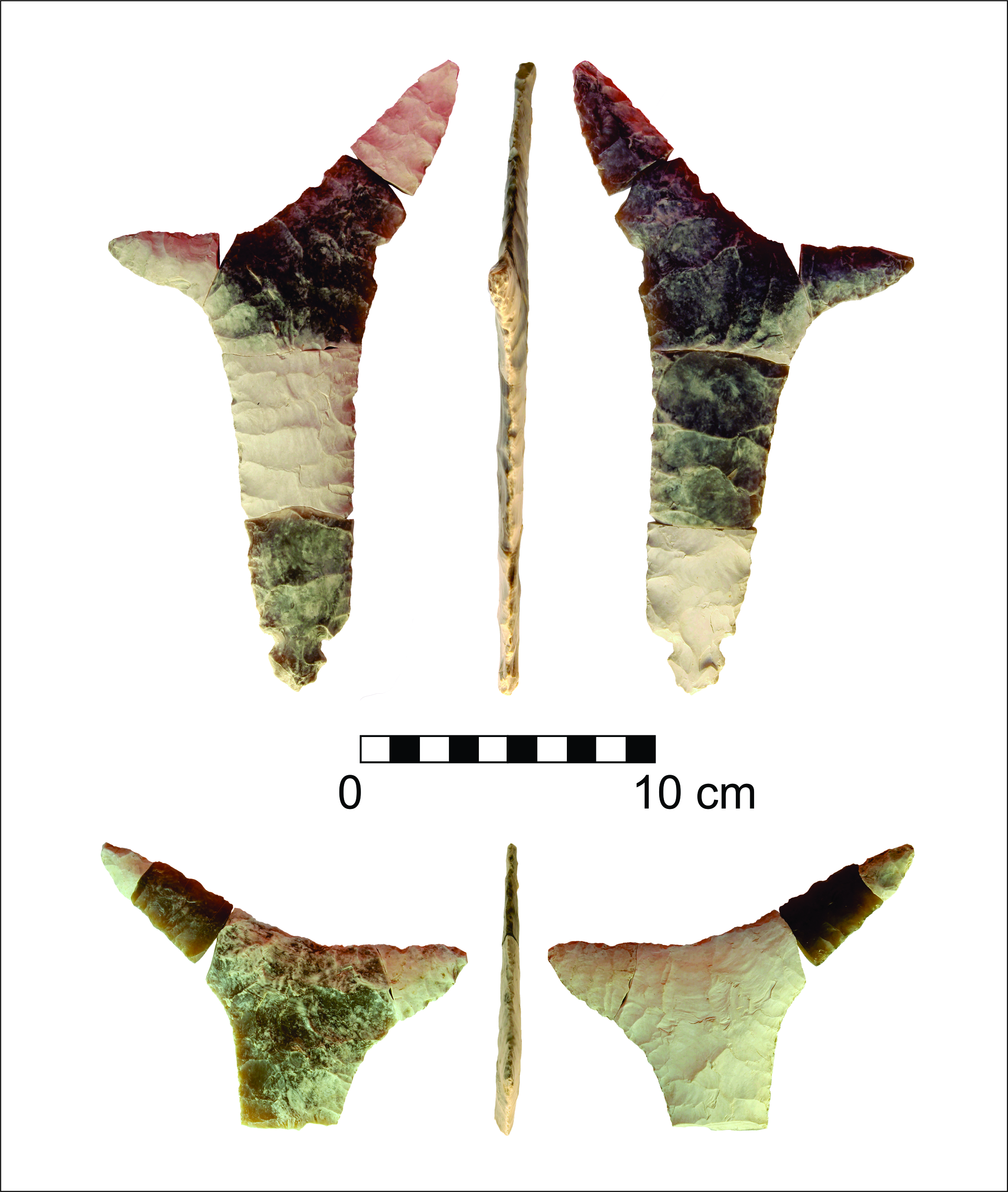
Two particularly interesting artifacts are termed ‘eccentrics’ because their shape and significance are so unusual. Eccentrics are very rare artifacts, the shapes of which are thought to be determined more by aesthetic rather than functional reasons. Some archaeologists think that the large flintknapped stone artifacts from St. Mary Reservoir are symbolic representations of the branched “horns” of pronghorn antelope once common across the Great Plains. Others think they may have been ceremonial knives used on special occasions.
Knife River Flint ‘eccentrics’ from St. Mary Reservoir. The different colourations of these pieces are due to ‘patination’. This is when a chemical rind develops over time around particular edges or faces of artifacts depending on their exposure to different local conditions (courtesy of Shayne Tolman).
You may have recently seen a news story about archaeological finds at McKinnon Flats, approximately 22 km southeast of Calgary (see below for news links). Today, McKinnon Flats is a popular recreational area, used for fishing, hiking and bird watching. But did you know that five centuries ago it may also have been used for bison hunting and camping?
Archaeologists of Lifeways of Canada Limited have been contracted by Alberta Culture and Tourism to find out about early settlement at McKinnon Flats. They’re part of Culture and Tourism’s three-year Post-Flood Investigation Program, which was initiated to record the effects of the June 2013 southern Alberta flood on archaeological and palaeontological sites along rivers such as the Bow, Highwood, Sheep and Kananaskis. As a result of the program, 100 new archaeological sites were identified and additional information was gathered at 87 sites that had been recorded prior to the flood. Many of these sites were found eroding from the riverbanks, with some in need of investigation before they disappeared entirely. Read more →
Pottery traditions have developed independently all over the globe thanks to the versatility of clay as a medium for utilitarian function and the expression of identity. Over 450 sites in Alberta have pre-contact pottery dating from 300 to close to 2000 years old. Fragments or “sherds” of pots at archaeological sites reveal surprising amounts of information about how people lived, how they transmitted knowledge, and why pottery traditions persisted in Indigenous populations for millennia. Ancient pottery production continues to influence modern potters and it can inform how modern society uses material goods to express identity. Read more →
A few weeks ago we featured ice patch archaeology in Willmore Wilderness Park as part of the Rocky Mountain Alpine Project. The trip to Willmore was one of two attempts this summer to find archaeological artifacts and other organics melting out of Alberta’s ice patches. The second attempt took place from August 22-26, this time in Jasper National Park and, as promised, here are the results! For a background on the Rocky Mountain Alpine Project, check out our video.
This year was our second visit to Jasper’s ice patches. The goal of last year’s trip to Jasper was to determine if there was potential for finding organics and archaeological artifacts in Alberta’s alpine ice features. The trip was very successful and we found that many organics, like antlers and wood, were preserved at high altitudes. We also found a cultural piece of leather, with two knots in it, melting out of one of the patches. It was radiocarbon dated to A.D. 1640. The exploratory trip proved to be successful and we were excited to return to Jasper this year, both to re-visit the ice patch that yielded the leather and to explore some new areas.
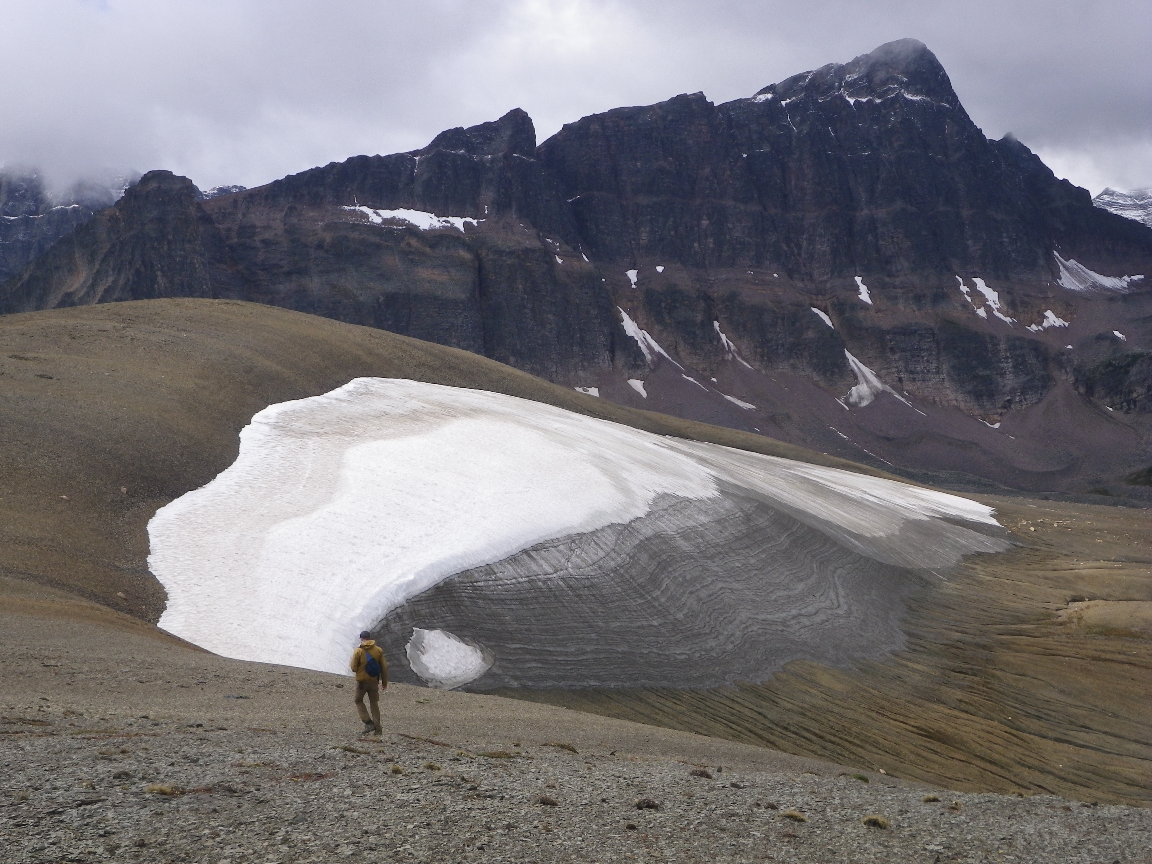
Ice patch in the Maligne Lake Area of Jasper National Park, archaeologists surveyed the patch in August 2016. (Photo Credit: Aaron Osicki)
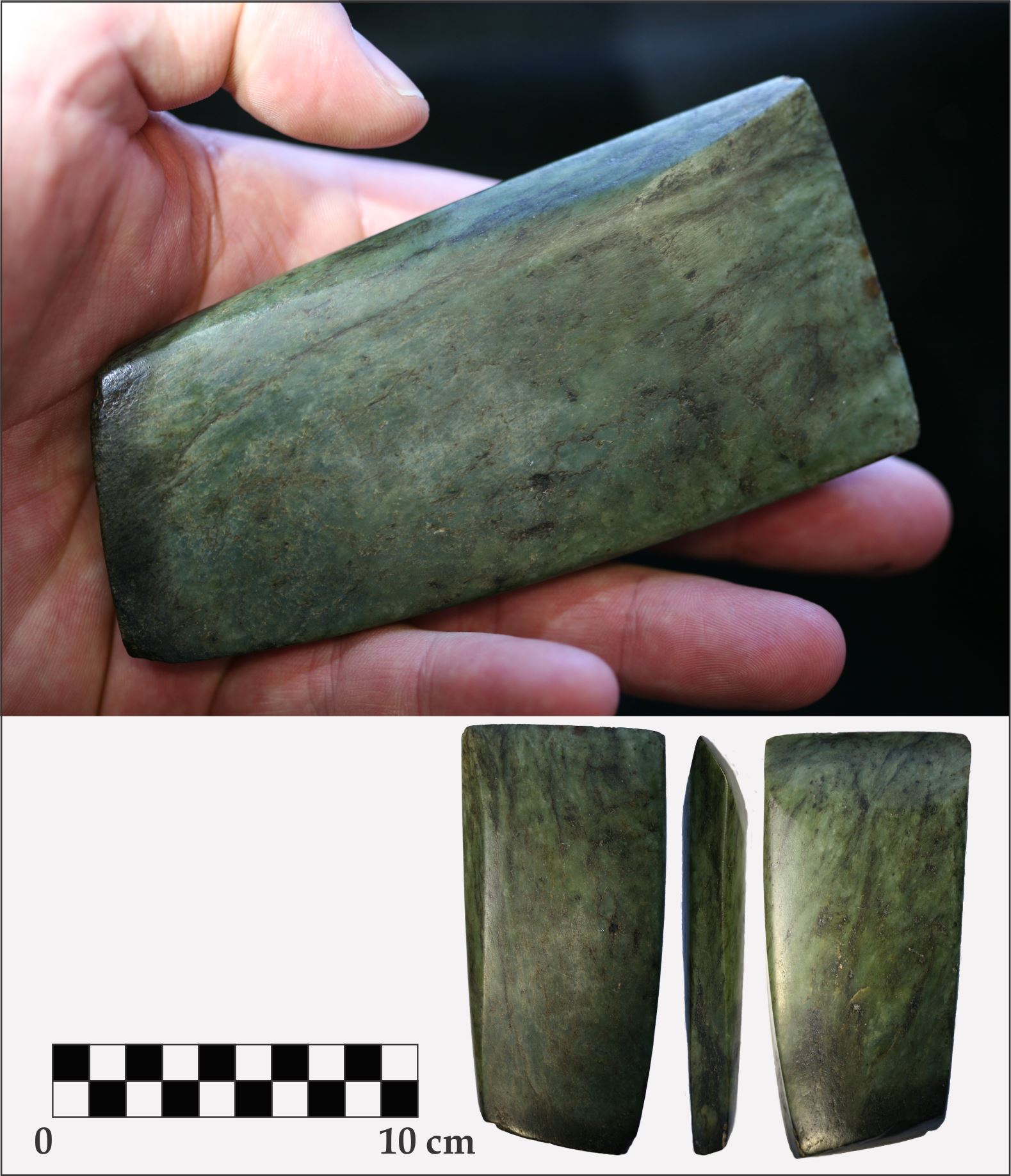
With no jade mines or known quarries in the province, you may be surprised to learn that people used jade in Alberta thousands of years ago. Jade is a common name that refers to two minerals, one of which, nephrite, is found in Canada.
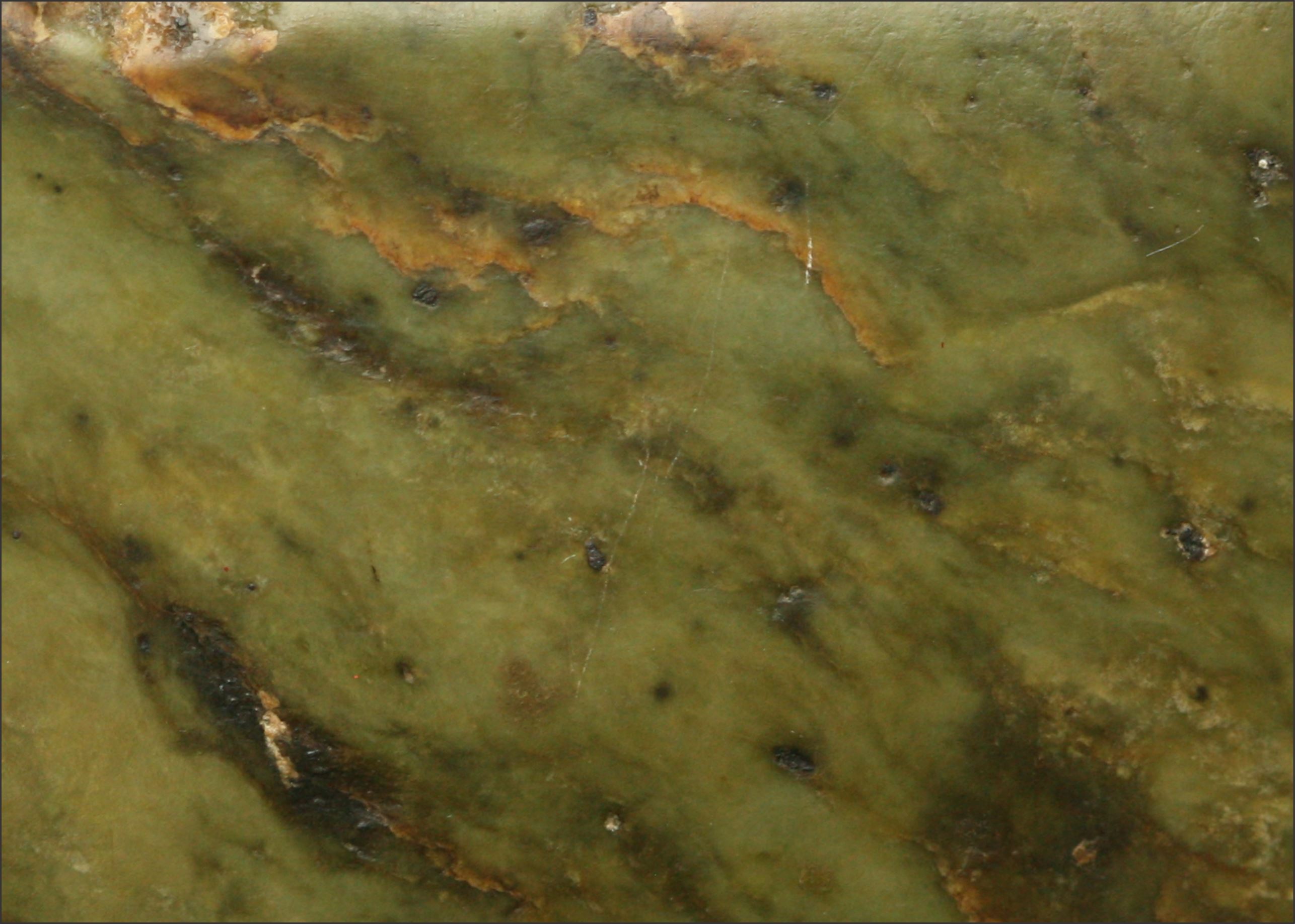
Close-up photograph of a jade (‘nephrite’) artifact from northwest Alberta (by Todd Kristensen).
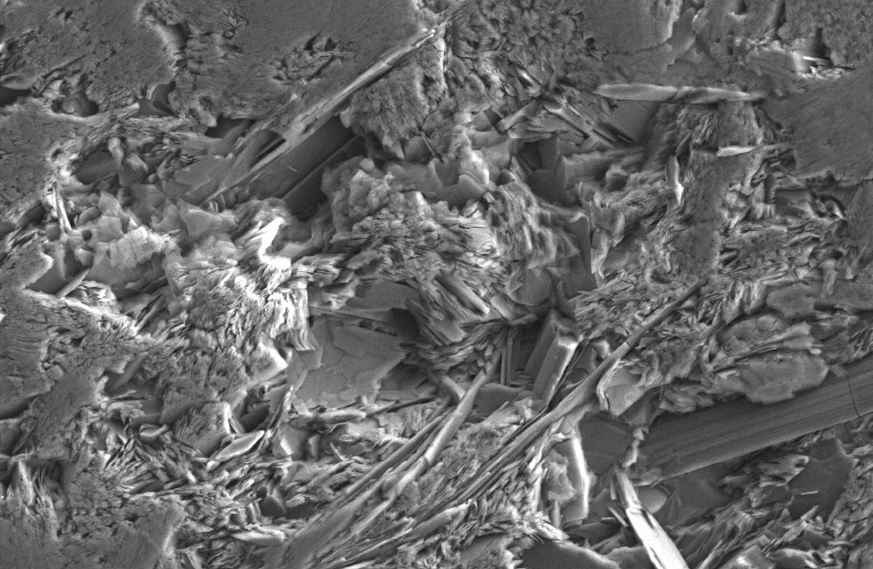
Nephrite is one of the toughest natural materials on earth and for this reason, ancient people used it to make tools called celts. Tightly interlocking bundles of amphibole crystals (actinolite/tremolite) make nephrite incredibly resistant to fracture so the celts retain their sharp edges despite hours of wood-working with them.
Tightly interlocking bundles visible in this Scanning Electron Microscope image give jade (‘nephrite’) its strength (courtesy of Jesse Morin).
How did people make jade or nephrite celts? Slowly! As in modern times, nephrite was too strong to chip with a chisel so it was patiently sawed and ground with materials like sandstone and quartz crystals and polished with a slurry of gritty water. Jade occurs in outcrops across British Columbia where some First Nations had specialized jade workers. Most of the evidence for Aboriginal nephrite working comes from the Fraser River of southern B.C. near Lytton, Lillooet, and Hope. While the celts manufactured by pre-contact people were certainly functional, the rarity of jade and the time it took to make celts would have resulted in a highly revered and prized type of tool.
Nephrite celts are highly polished with a flat and slab-like shape. This specimen was found near Stony Plain outside of Edmonton (by Todd Kristensen).
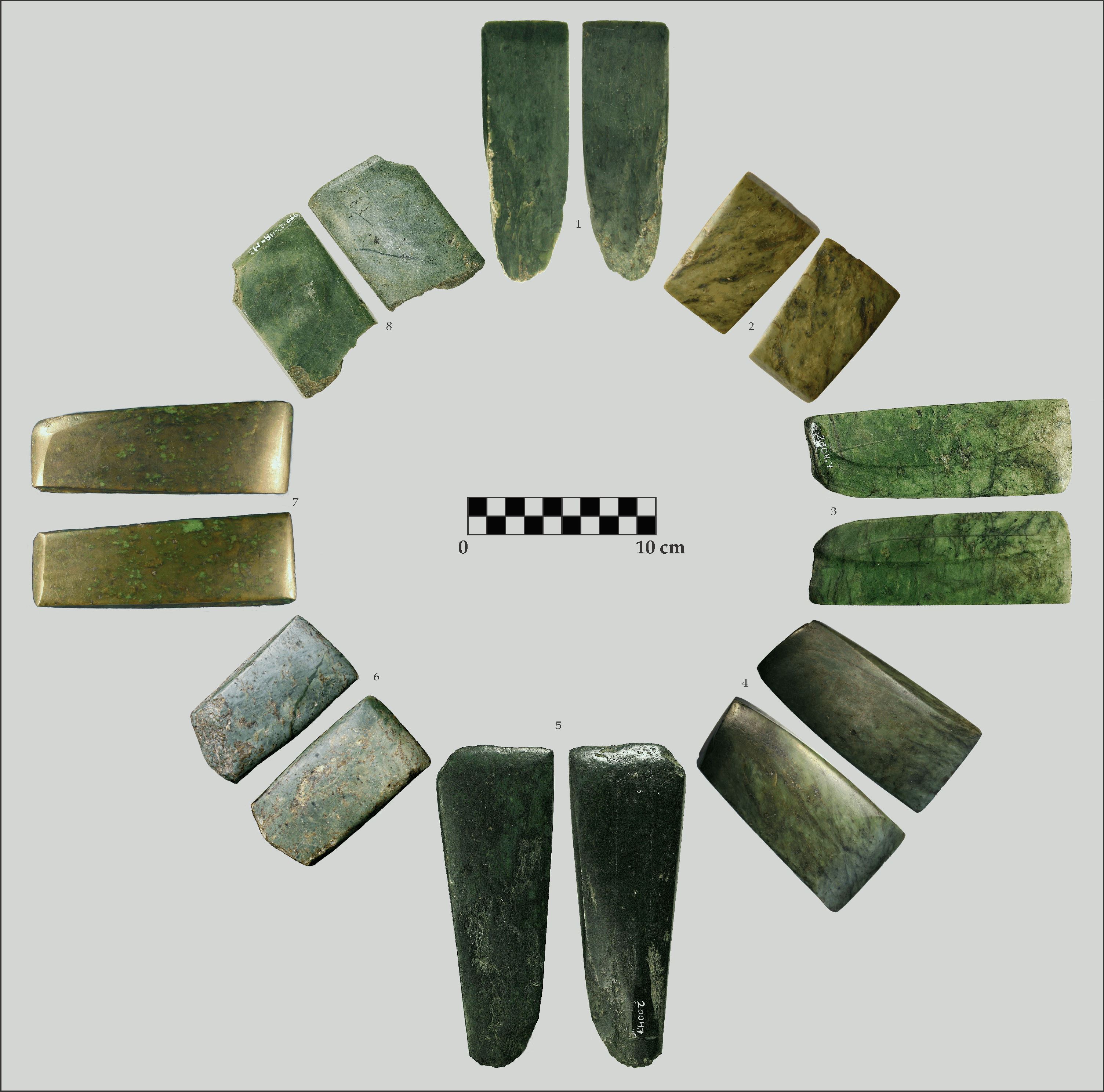
Nephrite celts have been recovered from several farmers’ fields across Alberta but have never been found during an archaeological excavation in the province. They are generally more common in northern Alberta where First Nations likely maintained stronger trading connections to people from B.C. than in the south.
Jade or nephrite celts found in Alberta. Specimens 1, 2, 3, 5, and 8 are from the Grande Prairie area. Specimens 4, 6, and 7 are from the Edmonton area.
Based on historic records and tools used by First Nations shortly after European contact, jade celts were most likely tied onto wood or antler handles to increase the force that people could apply to the tool. The Alberta celts are thought to have been either ceremonial, status-markers, and/or they were used to build boats or prepare wooden poles.
A large spur on the end of a wood or antler handle served as a platform on which to tie or ‘haft’ a flat celt (by Todd Kristensen).
Written By: Todd Kristensen (Regional Archaeologist, Archaeological Survey), Jesse Morin (Heritage Consultant), and Karen Giering (Curatorial Assistant, Royal Alberta Museum)
Acknowledgements
Staff from the Archaeological Survey, Royal Alberta Museum, and University of Alberta collaborated with museums and farmers across Alberta to analyse our rare jade artifacts. Jade expert Jesse Morin from B.C. analysed specimens and lent his knowledge to the project. Full results, including geochemistry, mineralogy, and archaeological significance of Alberta’s jade will appear in an Occasional Paper Series article that will be available to the public shortly. Thanks to all the researchers for their help and thanks to the museums and farmers for kindly loaning artifacts for this study!
From August 8-12th, 2016, Todd Kristensen (Northern Archaeologist), Robin Woywitka (Cultural Land Use Analyst), Courtney Lakevold (Archaeological Information Coordinator) and graduate student Timothy Allan visited Willmore Wilderness Park as part of the Rocky Mountain Alpine Project (RMAP). RMAP is focused on the recovery of archaeological artifacts and other organic remains (e.g., feathers, bones, caribou antlers and dung) from melting ice patches. Amazing artifacts have been found melting out of ice patches in alpine areas in the Yukon, Northwest Territories, United States and Norway. These finds have been very important for understanding how people used alpine areas in the past.
Alberta has vast stretches of alpine environments, many of which are quite fragile. One element of those fragile alpine habitats are ice patches that are currently melting at a rapid pace. The goal of RMAP is to explore Alberta’s ice patches to see how people in the past used alpine environments and see how it compares to that of people in other parts of Canada and the world. Last summer, the first RMAP expedition took place in Jasper National Park where many organics were found, as well as a piece of leather that was radiocarbon dated to A.D. 1670. Read more →
When people think of archaeology in Alberta they might picture buffalo jumps, rock art, or medicine wheels. These are dramatic types of sites on the prairies but what about the north? Alberta’s boreal forest has a unique record and requires a unique breed of archaeologist to find it. This blog is a small window to archaeological work in the northern half of the province and some of the interesting archaeological sites hiding in our forests.
Boreal Breed
Archaeologists working in northern Alberta brave bugs, blowdown (piles of fallen trees stacked like a cruel game of KerPlunk) and a range of conditions from blistering hot to bitterly cold. Forests are quite good at concealing sites so archaeologists dig hundreds of small shovel tests to find them. Most archaeology in the ‘Green Zone’ (typically forested Crown Land) happens in advance of forestry, oil and gas activity, gravel operations, and construction of transmission or road corridors. The hard work and skill of consulting archaeologists has resulted in over 8000 archaeological sites in the Green Zone.
Roughly 8000 sites have been found in Alberta’s boreal forest (highlighted in green).
The Nature of Northern Sites
Most of the successful shovel tests yield small collections of stone debris from pre-contact human tool making. Sites in the north are typically smaller than on the plains. Why? Pre-contact people in the north were generally more mobile and lived in smaller groups; southern bison herds supported bigger groups that stayed in one spot for longer periods, which produced bigger collections of artifacts. Archaeological visibility is also a factor. Prairie landforms are often easier to locate and interpret while artifacts, bones, or stone features on the surface can help guide archaeologists to productive areas under the ground. Not so in the north. Hot spots for artifacts are often harder to access, are covered in vegetation and dense roots, and are challenging to interpret (e.g., ‘how has this terrace changed over thousands of years’). Read more →
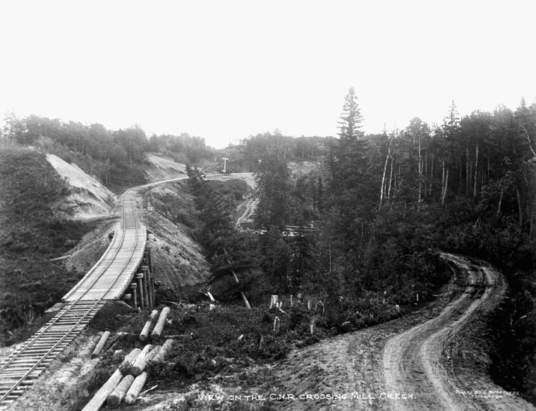
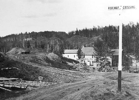
Have you ever wondered about archaeology in your own city? Have you ever wanted to be an archaeologist? This summer an archaeologist from the University of Chicago is leading an archaeological investigation in the Mill Creek Ravine! Haeden Stewart is looking for remains from historic settlements to learn more about daily life in the early 20th century, as the city was industrializing. In the early 1900’s, the Mill Creek Ravine was home to several mills, meat packing plants, a railway line, and homes of the ravine’s workers.
Early industrial Edmonton – View of the C.N.R. crossing Mill Creek, 1900-1925. Library and Archives Canada MIKAN 3335022
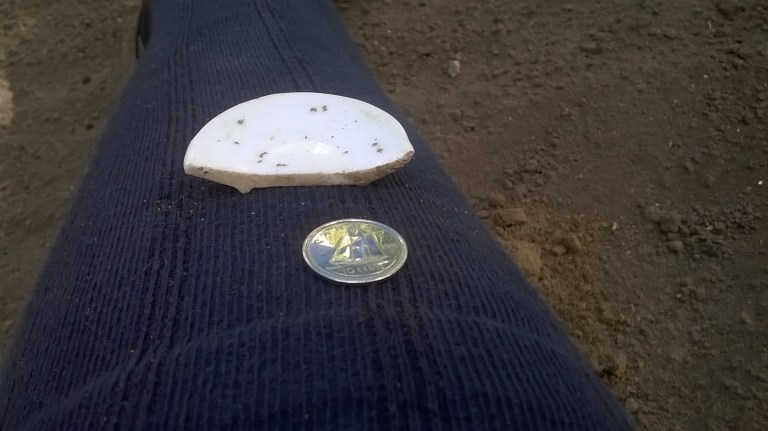
Haeden will be excavating two locations this summer. The first is a shanty town located at the north end of the Mill Creek Ravine. This town was one of many that settlers built in the first few decades of the 20th century. Some shanty towns were more temporary, but some, like the Ross Acreage in Mill Creek, were more substantial and housed settlers for many years. Haeden’s team has already been working at the shanty town for several weeks, where they have unearthed some great finds, including animal bones, glass bottles, and the remains of two chickens buried in a pit!
Glass bottles excavated at a historic shanty town in Mill Creek, Edmonton. Photo credit: Haeden StewartToy saucer from a historic shanty town in the Mill Creek Ravine, Edmonton. Photo Credit: Haeden Stewart.Chicken bones buried in a pit in a Shanty Town in Mill Creek Ravine, Edmonton. Photo credit: Haeden Stewart
Next, Haeden plans to excavate at Vogel’s meatpacking plant in the south end of the ravine. Vogel’s was one of three large meatpacking plants built by 1910 in the Mill Creek Ravine.
Haeden will be excavating every day of the week, from approximately 830am-530pm, except for Tuesday. If anyone is interested in volunteering to help out with the excavation please contact Haeden at haedenstewart@uchicago.edu, or call\text him at 773-827-4004 to make arrangements.
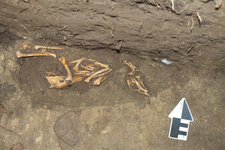
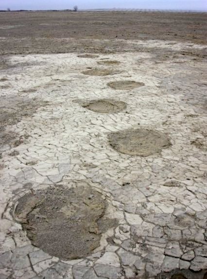
When St. Mary Reservoir in southern Alberta was filled in the 1950s, no one knew that it submerged an incredible record of life from 13,000 years ago. That record, including footprints of mammoth, camel, and horse, was recently exposed – the internationally significant site is now informing opinions about the role humans played in the extinction of Alberta’s ‘megafauna’.
Rare and information-rich trackways from lumbering mammoth were revealed by scouring winds at St. Mary Reservoir (courtesy of Shayne Tolman).
Wally’s Beach
Shayne Tolman, a teacher from Cardston, is responsible for drawing attention to St. Mary Reservoir and Wally’s Beach, a site complex on an ancient island in St. Mary River that is currently being investigated by Dr. Brian Kooyman and a team from the University of Calgary. Archaeologists have discovered that the menu of some of Alberta’s oldest humans included megafauna like camel, horse, and perhaps mammoth. Over six thousand artifacts indicate that people were hunting big game at a time when these animals were likely struggling to cope with climate change. Did human hunting lead to megafauna extinction or are warming temperatures to blame? Many researchers argue that pre-contact human populations were too small to impact big game while others suggest that targeted hunting patterns among small groups could have big consequences.
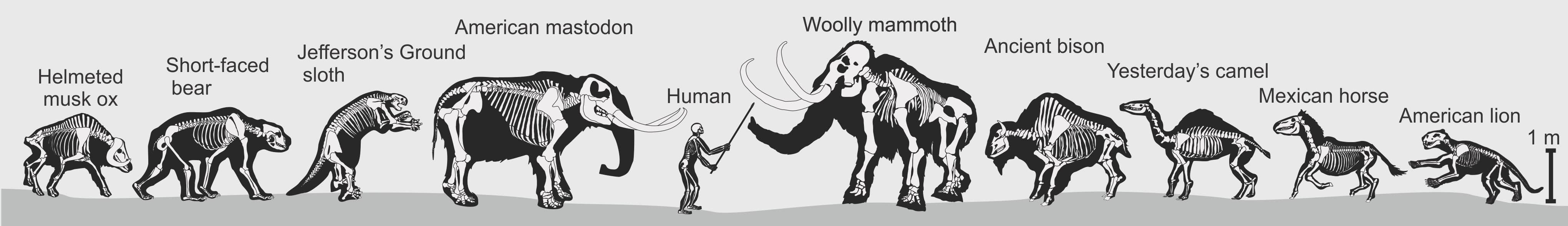
Megafauna of Alberta at the end of the last Ice Age (produced by Todd Kristensen)
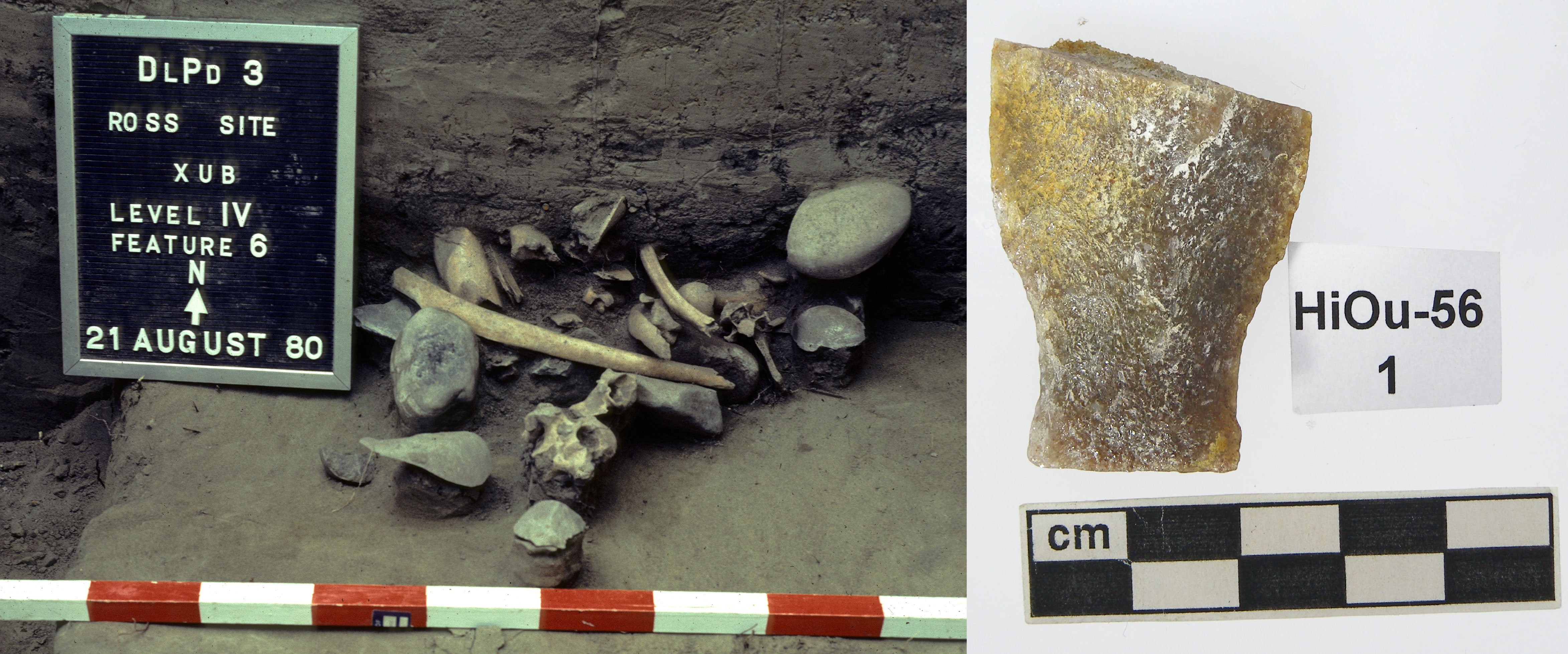
In a previous post we talked about how Alberta has almost 40,000 recorded archaeological sites. Each of these sites has its own record and associated artifacts so, you can imagine, it is a lot to keep track of. One of the most important tools we use to organize site data is a Borden number. You may have heard sites referred to by their Borden number before; for example Head-Smashed-In is also known as DkPj-1. The Borden number is actually more important than the site name as the Borden number is what is used to organize all site records and for cataloguing artifacts. In fact, the majority of sites in Alberta do not have a name at all, they are known solely by their Borden number.
Borden number DlPd-3 (Ross Site) is used as the unique identifier for this archaeological site (left). Borden numbers are also used to catalogue artifacts as a way to identify what site they came from (right). (Photo Credits: Royal Alberta Museum)