The Victoria Cross Mountain Ranges: Commemorating the Heroism of Canadian Veterans

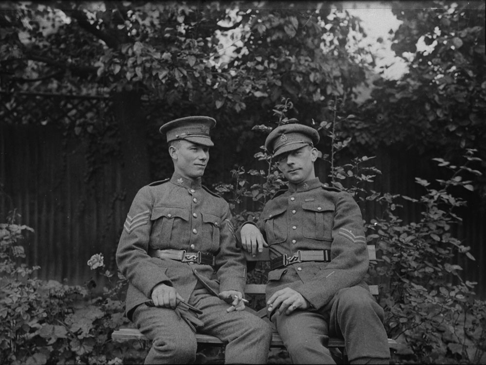
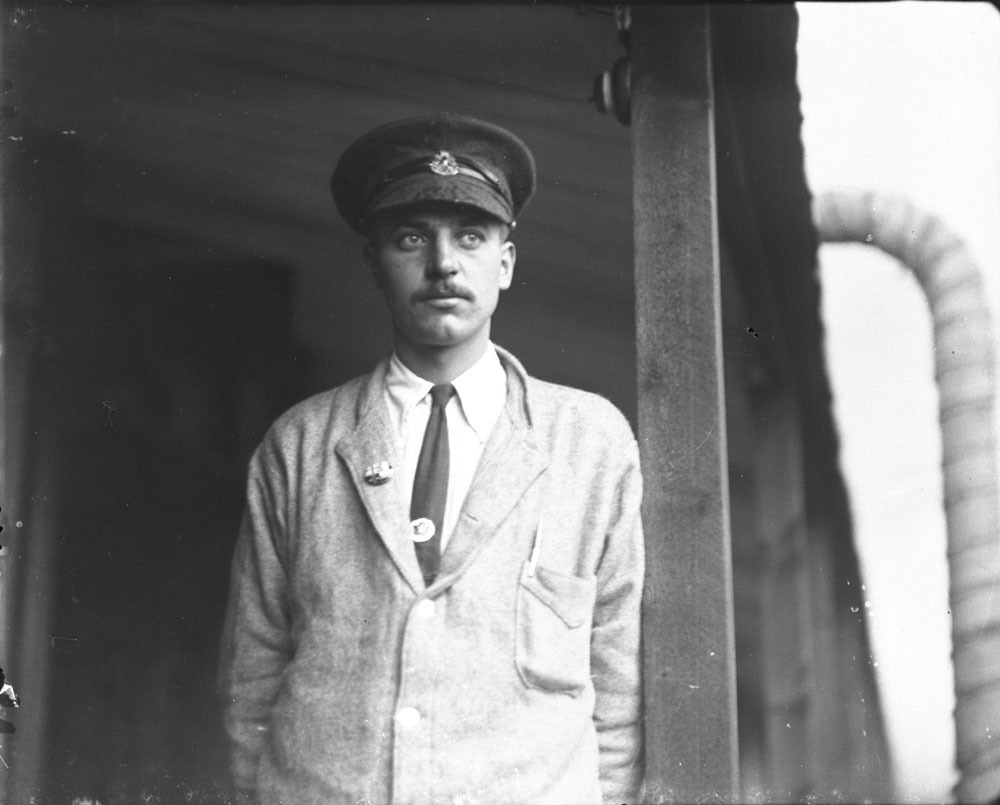
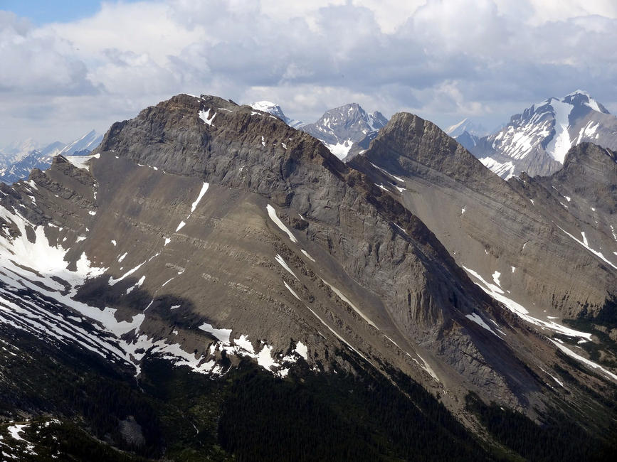
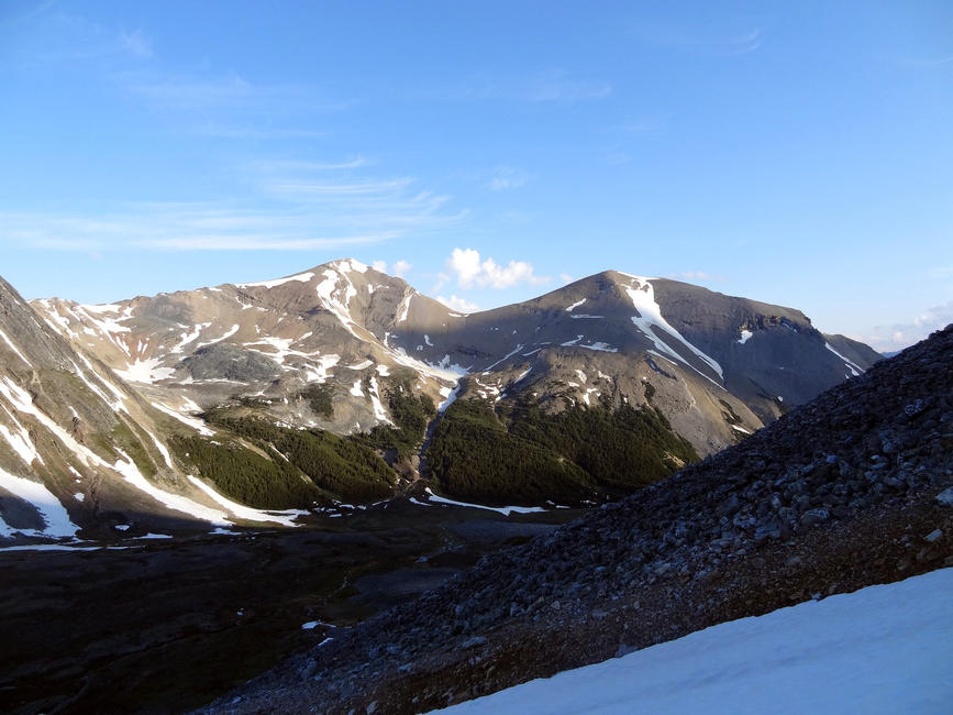
In Jasper National Park there are five mountains named for First World War Victoria Cross recipients with Alberta connections. The peaks are located within a series of mountains known as the Victoria Cross Ranges. The names of these mountains honour Private John Chipman Kerr, Private Cecil John Kinross, Captain George Burdon McKean, Private John George Pattison and Sergeant Raphael Louis Zengel.

The Victoria Cross was established in 1856 by Queen Victoria to recognize military personnel who demonstrated bravery when faced with the opposition during wartime. It is the highest military decoration that can be bestowed upon a soldier in the British Commonwealth. This post will look at the recipients of the Victoria Cross who the mountains in Jasper National Park are dedicated to.

Mount Kerr

Mount Kerr is named in honour of Private John Chipman Kerr, who served in the Alberta raised, 49th Battalion (Edmonton Regiment), Canadian Expeditionary Force. Kerr, originally from Fox River, Nova Scotia, moved to Spirit River, Alberta before enlisting for service in 1915.

J. C. Kerr (right) c. 1914-1919 (Credit: Canada Dept. of National Defence/Library and Archives Canada).

On September 16, 1916, during the Battle of the Somme, Kerr and his unit prepared to ambush German soldiers. As the lead bayonet man, Kerr was 30 metres ahead of his comrades and exchanged fire with enemy troops. The Germans, believing that they had been surrounded, surrendered to Kerr. Sixty-two prisoners were captured and 250 yards of enemy territory was seized. Kerr was injured and lost a finger in the attack, but reported back for active duty before the wound had been fully dressed.

For his actions on that day, Private Kerr was awarded the Victoria Cross.

After the war, Kerr returned to farming, worked in the Turner Valley oil fields and as a forest ranger. He enlisted in the Second World War and transferred to the Royal Canadian Air Force. John Kerr died in Port Moody, British Columbia in February 1963. His Victoria Cross is displayed at the Canadian War Museum in Ottawa.

Mount Kinross

Mount Kinross was named for Private Cecil John Kinross. Originally from England, he had immigrated to a rural Alberta farm with his family at the age of 16. He enlisted in the 51st Battalion, Canadian Expeditionary Force in 1915 and later transferred to the 49th Battalion in France.

C. J. Kinross c. 1914-1919 (Credit: Canada Dept. of National Defence/Library and Archives Canada).

On October 30, 1917, during the Battle of Passchendaele in Belgium, Kinross’s unit was under intense artillery fire. Showing no concern for his own personal safety, he took off alone and charged towards the enemy, killing six soldiers and destroying their machine gun. His action inspired his comrades and their unit to advance 300 yards into enemy territory. Kinross was severely injured in the battle and did not return to the front lines.

Kinross received the Victoria Cross for his act of bravery that day.

His citation announced “he showed marvellous coolness and courage, fighting with the utmost aggressiveness against heavy odds until seriously wounded.” Private Kinross was honourably discharged and he returned to Lougheed, Alberta, where he lived until his death in June of 1957. His Victoria Cross remains with his family and the miniature is on display at the Loyal Edmonton Regiment Museum in Edmonton.

Mount McKean

Mount McKean (Courtesy of Mountain Nerd on Summit Search).

Mount McKean is dedicated to Captain George Burdon McKean, who immigrated to Canada from England in 1902 to join his brother on a farm near Lethbridge. He studied at Robertson College, a theological school in Edmonton, and was an assistant minister at the time of his enlistment in 1915. McKean first enlisted as a Private in the 51st Battalion, Canadian Expeditionary Force and later became a Lieutenant in the 14th battalion (Royal Montreal Regiment).

G. B. McKean, 1918 (Credit: Canada Dept. of National Defence/Library and Archives Canada).

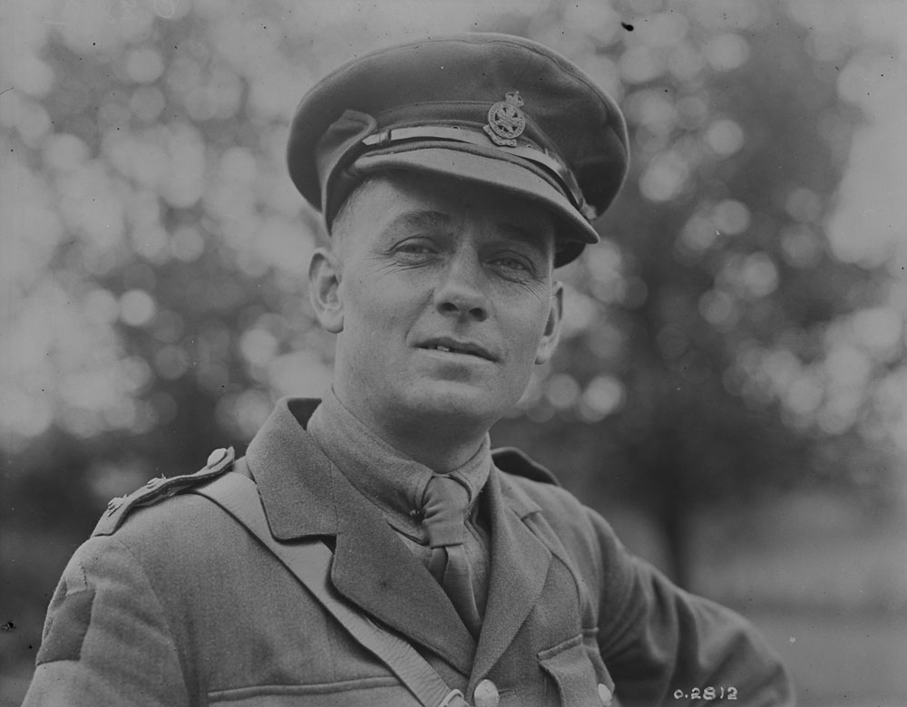
In April of 1918, while stationed near Gavrelle, France, McKean led his troops in a raid against German forces. When his men hesitated, McKean took off alone towards the enemy’s heavily fortified trench, taking out two of their soldiers. This move instilled confidence in his unit, who quickly followed to seize the trench and capture its remaining soldiers. Lieutenant McKean was praised for his actions and was awarded the Victoria Cross. His citation reads “This officer’s splendid bravery and dash undoubtedly saved many lives, for had not this position been captured, the whole of the raiding party would have been exposed to dangerous enfilading fire during the withdrawal.”

In addition to the Victoria Cross, McKean also received the Military Cross and the Military Medal for his service during the war. He was later promoted to Captain. After the war, he returned to England. He was killed in an industrial accident in November 1926. In addition to being commemorated by Mount McKean, in 2003, a public square in Cagnicourt, France was named La Place George Burdon McKean. His Victoria Cross is in the collection of the Canadian War Museum.

Mount Pattison

J. G. Pattison c. 1914-1919 (Credit: Canada Dept. of National Defence/Library and Archives Canada).

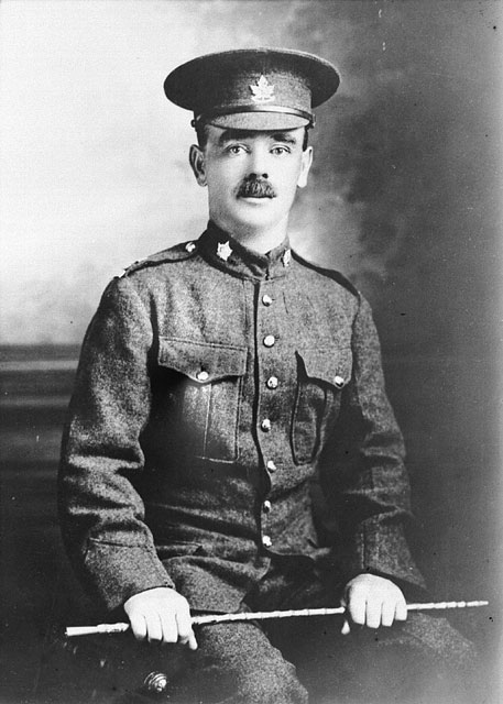
Mount Pattison is dedicated to Private John George Pattison. He was born and raised in England and moved to Canada in 1906 with his wife and four children. He worked for the Calgary Gas Company. In 1916, at 40 years of age, he enlisted in Calgary with the 50th (Calgary) Battalion, Canadian Expeditionary Force.

In April of 1917 at Vimy Ridge, the 50th Battalion was advancing towards German occupied territory when they were confronted with heavy machine gun fire. Pattison charged forward to face the opposition and hurled grenades at the enemy which allowed him to take out the remainder of the German crew. He was awarded the Victoria Cross for his actions and credited with making further advances possible. Pattison was one of four Canadians to receive the Victoria Cross at the Battle of Vimy Ridge.

A few weeks later, Private Pattison was killed in action on June 3, 1917, during an attack on a German occupied power station in Lens, France. In addition to the mountain named in his honour, Pattison Bridge over the Elbow River in Calgary commemorates his service and sacrifice.

Mount Zengel

R. L. Zengel c. 1914 (Credit: Canada Dept. of National Defence/Library and Archives Canada).

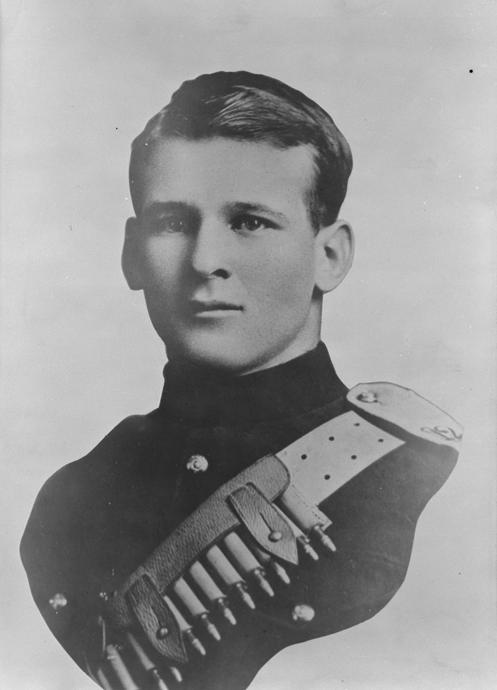
Mount Zengel is named in honour of Sergeant Raphael Louis Zengel, who came to Canada from Minnesota at a young age. The Zengel family initially settled on a homestead in Saskatchewan before Raphael enlisted to the 45th (Manitoba) Battalion, Canadian Expeditionary Force in 1915. He later became a sergeant in the 5th (Western Cavalry) Battalion.

On August 9, 1918 near Amiens, France, on the second day of a massive campaign against German forces, Sergeant Zengel’s platoon came under heavy machine-gun fire. He rushed ahead and met the defensive unit, killing two of their machine gunners and forcing the others to scatter. He was cited for his excellent work through the attack and for showing utter disregard for his own personal safety.

Sergeant Zengel was awarded the Victoria Cross for his contribution at the Battle of Amiens. (He had previously been awarded the Military Medal for his service at the Battle of Passchendaele). After the war he became a long-time resident of Rocky Mountain House, Alberta. He died in February 1977. Branch No. 8 of the Royal Canadian Legion in Rocky Mountain House is named the R.L. Zengel V.C. to commemorate his award distinction. In 1936, the Geographic Board of Canada named Zengle Lake in Saskatchewan in his honour, misspelling his name in the process.

Mount Zengel on the right (Courtesy of Mountain Nerd on Summit Search).

The tribute to these soldiers in 1951 was made possible by the co-operation of federal and provincial governments. However, at the time, the proposal created controversy. The issue’s resolution would bring about the creation of the Victoria Cross Ranges and an agreement between the Governments of Alberta and Canada still governs geographical naming in in Alberta today. That will be the subject of our next place names post.

For more information on soldiers who served in the First World War, Library and Archives Canada provides digital records on the soldiers who enlisted in the Canadian Expeditionary Force.

Written by: Erin Hoar, Historic Resources Management Branch Officer

Sources:

Canadian Great War Project. (Accessed August 21, 2014).

Geographical Names Program Research File #83-D/16, Jasper Park. In custody if the Historical Resources Management Branch.

Geographic Board of Alberta Minutes: March 28, 1946-November 19, 1949.

Geographic Board of Alberta Minutes: January 22, 1950-December 17, 1954.

Library and Archives Canada. “Soldiers of the First World War: 1914-1918.” (Accessed August 22, 2014).

National Defense and the Canadian Forces. “Canada’s Victoria Cross.” (Accessed August 29, 2014).

National Defense and the Canadian Forces. “Victoria Cross – First World War, 1914-1918.” (Accessed August 21, 2014).

Nix, James Ernest. “McKean, George Burdon.” Dictionary of Canadian Biography, vol. 15, University of Toronto/Université Laval, 2005. (Accessed August 29, 2014).

Peak Finder. (Accessed August 21, 2014).

Summit Search: Mountain Community. (Accessed August 29, 2014).


Why I Miss the Local Elevator

The elevator agent in his office was at the heart of the community, 1950s. (Glenbow Archives, Photo: Glenbow Archives, NA-4510-707.)

It’s when the grain is ripe for harvest in late August or early September that I miss going to our local Alberta Wheat Pool elevator the most. Jumping off the combine and going to the elevator to have its friendly agent, Bill, run a moisture test on a grain sample and discuss the state of the crop was one of my jobs on the farm. When I arrived in Alberta in the 1980s, drinking coffee and shooting the breeze with the neighbours while the elevator agent was busy, was part of the culture, but the old-timer grain farmers could smell change the air. How right they were.

Our closest local elevator, a single composite wood crib facility constructed in 1963, at Eckville, closed in 2001. Since then we rarely visit an elevator. Now we have our own moisture tester, analysis market conditions using the internet, and have our grain trucked from the bins in the yard to the inland terminal at Lacombe or further afield—selling grain over the phone and having it trucked to a concrete silo is not much fun!

Alberta Wheat Pool at Eckville, (Photo courtesy of the Alberta Heritage Survey 79-R0240-13.
Alberta Wheat Pool at Eckville (Photo courtesy of the Alberta Heritage Survey, 79-R0240-13.)

In past decades farmers were in and out of the elevator office in a rhythm that reflected the farmer’s seasonal activity. A major reason to go to the elevator was to update the permit book, which kept a record of the type, quantity and grade of grain delivered as well as the number of acres seeded to various grains, and the acreage assigned to each grain for quota purposes. Canadian Wheat Board regulations required that all grain sales, even to local users, be recorded in the permit book.

The permit book had its origins in the quota system on cereal grains introduced during the Second World War. Beginning with the crop year 1941-1942, farmers were only able to deliver limited amounts of grain, based on their acreage, at certain times. The quota system, administered by the Wheat Board, was designed to prevent the clogging of the grain handling system at a time when production exceeded available markets. It continued after the war in an attempt to give each producer an equal opportunity to sell his or her grain at the Wheat Board price for the crop year.

A farmer’s pay check and hence his loyalty to one grain company over another was ultimately determined by whether he could get space in the elevator to deliver his quota of grain. If there was room, some farmers preferred to haul to the Alberta Wheat Pool or United Grain Growers elevator, lured by the promise of patronage dividends on deliveries in relation to the companies’ profits for the year.

Many farmers made a point of being at the elevator office often, not only to find out what was going on but to establish a good relationship with the agent. They sometimes helped out when the agent was especially busy. In years when the harvest was plentiful, railway box cars were often in short supply and elevator storage space was limited, bonds of friendship, along with a reputation for reliable delivery and honesty might ensure one’s grain would be taken in before the neighbour’s.

There were a thousand and one reasons why a farmer might be at the elevator other than when he was delivering grain. He bought coal and flour throughout the year, seed in the spring and from the 1950s, fertilizer. He might be in to check prices, find out if there was space in the elevator for his grain or pick up a cheque for grain previously delivered. Farmers needed the use of the scale at the elevator for inter-farm grain sales, and the elevator agent usually obliged.

UGG promoted a new image of their agents as the dispenser of free advice: “How to get the most from your UGG agent,” Country Guide, August 1961, pag e 41. (Reproduced with the permission of the Glenbow Archives.)

There was no need for a business excuse to go to the elevator. On wet days farmers dropped in to see who else was there, play crib or just to complain about the weather. The elevator office was a good place to catch up on local gossip: who had bought a new tractor, who was selling out, who was renting land from who, and to gauge the relative condition of neighbouring crops, as well as shifting land and machinery auction prices.

Farmers gravitated towards the elevator they dealt with and elevator agents played host to groups of farmer-customers in their cramped offices during visits to town. The elevator agent, urged on by his company to network and increase sales, was part of the community, involved in social and sporting events. At Forshee, a long forgotten elevator siding between Rimbey and Bentley, Harry Proudfoot, a U.G.G. agent from 1946-1968, was a member of several athletic teams, and helped his farmer neighbours during haying season and other times when grain deliveries were slow.

Back in the 1930s when elevator agents often had the only radio in the district, broadcasts were a lure for farmers, who might hope to catch more than the day’s grain prices. In the 1990s farmer went to the elevator to catch the farm weather cast and to watch world-wide commodity trading on cutting-edge computers. The farmers gathered whiled away hours discussing every farming topic under the sun. The agent would go off to receive a load or two of grain, and they would often still be there when he returned from the driveway.

A somewhat idealized artistic perspective on the importance of the grain elevator to the business of the prairie town. Country Guide, March, 1933, page 10, (reproduced with the permission of the Glenbow Archives.)

From the mid-twentieth century, much of the farmer’s economic news, social connections, information about the latest cropping practices, and even family activities and entertainment came through the elevator office as grain companies vied to be foremost in the farmers’ lives and keep their business. All grain companies, especially the farmer-owned Alberta Wheat Pool and United Grain Growers, pushed the image of the grain elevator as the stable symbol of rural life.

It ended for us in 2001. We knew it would happen. We saw elevators topple all over the province after 1995. When Eckville went down in a cloud of dust we did not go to watch. Now in 2014, the Canadian Wheat Board is no more: there are no quotas, no permit book. We market our own grain. Like so many others in the farming community we have lost a connectedness with fellow grain producers and direct involvement with the grain handling system that really was centred in the elevator office.

Written by: Judy Larmour.

Using GIS: the Significance in the Landscape

It’s not an overstatement to say that the final keynote presentation at the 2014 Municipal Heritage Forum in Lacombe blew everybody away. Larry Laliberté, GIS Librarian at the University of Alberta, opened Forum attendees’ horizons with an intriguing presentation entitled, “Historical GIS: Connecting Collections.”

Larry Laliberté presents "Historical GIS: Connection Collections"
Larry Laliberté presents “Historical GIS: Connection Collections”

In his presentation, Larry described how history’s main mode of communication is narrative, while Geography’s distinctive form of expression is visual. If we begin to connect these two methodologies, as can now be done through Geographic Information Systems (GIS) technology, it opens the doors to new perspectives and insights. This is what Laliberté described as a type of “visual narrative, a spatial story, a landscape liturgy.”

This shift in thinking from text to visual has been described as a kind of “spatial turn” in the way people conceptualize the world around them, past, present and future. In 2012, the Editorial Journal of Map and Library Geographies (8:177-180), put it this way. It is “a change in thinking from finding and retrieving information from text-based means to doing so visually, from geography or location-based methods.”

One only has to be aware of such popular social media as Foursquare to see how popular and ubiquitous this so-called “spatial turn” has become.  GIS technology can give us practical and insightful ways to consider and deepen our knowledge of the historic places all around us. Compelling blogs such as #LostYEG: Lost Edmonton explores how the street scape has evolved over time.

The GIS tools now widely available create an opportunity for “Spatial History.” This is an approach to studying or exploring the historic past that “combines and uses a multitude of sources that can be situation in space as well as time.”

Forum attendees attentively taking in the closing keynote presentation by Larry Laliberté on "Historical GIS: Connecting Collections."
Forum attendees attentively taking in the closing keynote presentation by Larry Laliberté on “Historical GIS: Connecting Collections.”

Laliberté used one of his recent projects – which involved historic maps – as a case study to open up the topic for our Forum attendees. He and his team have analyzed 1913-1914 fire insurance plans from the City of Edmonton. These maps were scanned and then geo-referenced with contemporary maps, yielding detailed map layers that could be studied. Additional information gleaned from the 1911 Census allowed researchers to understand in detail the density of the built environment along Jasper Avenue, along with a high degree of demographic detail about the people who lived there at that time. When you mix in archival materials such as historic postcards and other sources, which can be tagged for location, a rich environment of information is created. It was almost something like creating a “Google Streetview,” type of experience for the early 20th century.

As Larry mentioned, this new field of Historical GIS is not an end in itself, but rather a research tool, an approach by which we can access or look at history and historic places. It does not provide the answers to the historical questions we may have, but it certainly does expand the toolkit by which we can begin to construct or unearth those answers.

Be sure to check out Larry’s presentation online.

Written by: Matthew Francis, Manager, Municipal Heritage Services.

Trick or Treat, Halloween in Alberta

Halloween is tomorrow. I wanted to take this opportunity to look back at the different ways Halloween has been celebrated in Alberta since the late nineteenth century. Early newspapers offer a fascinating window into how we celebrated Halloween, ranging from private and public parties, to ‘trick-or-treating’ and pranking.

Halloween at the Wineglass Ranch near Brocket (1907-08). Courtesy of the Glenbow Archives, NA-4035-188.

Like most holidays, Halloween is a fusion of ancient and modern traditions. Halloween traces its origins back thousands of years to the Celtic festival of Samhain (October 31 – November 1), which marked the start of the Celtic New Year. It was believed that the boundary between the physical and supernatural worlds broke down during Samhain, and spirits, ghosts and fairies could cross over and walk the earth. The festival was Christianized in the ninth century becoming ‘All Hallows Day’ (November 1, now generally called ‘All Saints Day’). Though Christianized, many of the customs associated with Samhain endured, particularly among the Celtic peoples of Ireland, Scotland and Wales. These cultural traditions were brought to North America by waves of immigrants and evolved into what we know today as Halloween.

From the start Halloween in Alberta was marked by “general nuisance” and “sundry pranks,” such as soaping windows, unhinging gates, or moving property. Reporting on Halloween in Innisfail in 1897, the Calgary Herald noted that “several small buildings took the usual trot around town during the evening.” Generally speaking, these items were left where they could be found – the goal was to create a nuisance, not to steal. Occasionally, however, people were left searching for their property the next day. In 1925, a farmer posted a notice in the Red Deer News requesting that the “Halloween revellers” who removed his garden gate “kindly return the same forthwith or indicate…where they have taken it.” Carriages and cars were also popular targets for Halloween pranksters, who enjoyed taking them for a joyride. Such tricks occasionally had unforeseen consequences: One prankster in Rockyford, for example, got more than he bargained for in 1919 when he took a car for a joyride, only to find that there was a baby asleep in the backseat. After a frantic half-hour of searching, the car was found abandoned at the town’s bank, and the baby was found “fast asleep as if nothing had happened at all.”

Aftermath of Halloween pranking in Airdrie (1930s). Courtesy of the Glenbow Archives, NA-598-12.

The boundaries of acceptable behaviour on Halloween were quite clear – pranks that could be rectified with minimal expense or effort were considered harmless fun, but any destruction of property was strongly condemned. The Edmonton Bulletin commented in 1912 that Halloween was a “recognized night of immunity from punishment” for pranksters, provided that “no serious depredations were committed.” Similar comments from newspapers across Alberta suggest a broad tolerance for relatively benign pranks, though it is also clear that this tolerance had limits. Halloween in Edmonton in 1917, for example, was marked by significant destruction of property – Chinese laundries were targeted for vandalism, sidewalks were torn up, and many fences and outbuildings were heavily damaged or destroyed. The Edmonton Bulletin expressed indignation at the night’s events, denouncing revellers as “youthful marauders” and commenting that their actions had “quite passed the limits of joking.” The Raymond Recorder struck a similar tone in a 1932 editorial pleading for a “Sane Halloween.” “Why is there any amusement in destroying private property?” asked the clearly frustrated editor, who issued a rather ominous warning to potential troublemakers: “any person who is the victim of meddlesome pranks on Halloween night…is quite within the law in protecting his property, and if anyone is hurt, the trespasser is entirely at fault.”

It is also clear from newspaper coverage that different standards of behaviour were expected from boys and girls. Minor social disorder on Halloween was clearly viewed as a by-product of youthful exuberance and a rite of passage –for boys. Most newspapers were very clear that Halloween pranks had been carried out by “the boys of the town” or “the male portion of the population.” In 1914, the Didsbury Pioneer urged the “boys and girls” to “conduct themselves properly in their fun and not damage other peoples’ property,” but such statements explicitly suggesting that girls participated in pranking are very rare. The extent to which girls actually took part in Halloween disorder is unclear, but such behaviour would clearly have not been socially acceptable.

Trick-or-treating near Little Smokey River (ca. 1950). Courtesy of the Provincial Archives of Alberta, A15910.

For those Albertans who wanted no part in pranking, Halloween offered many other opportunities for celebration. Archival photographs and newspaper stories reveal that private costume parties have been a part of Halloween fun in Alberta since the late nineteenth century. Similarly, a wide range of clubs and societies hosted costume parties for their members. The Edmonton Caledonian Society pointed with satisfaction to the Celtic roots of the holiday, inviting its members in 1908 to “celebrate this old-fashioned Scottish festival” (as late as 1919, the city’s Scots were promoting Halloween as a “peculiarly Scotch night”). During World War One, Halloween balls doubled as fundraisers for causes associated with the war effort, such as the Red Cross and the Returned Soldiers’ Fund. Such events offered people a respectable way to celebrate Halloween, free from any association with pranking or social disorder.

The most famous activity associated with Halloween, of course, is ‘trick-or-treating.’ The practice of going door-to-door in costume asking for food may echo cultural traditions that date back hundreds of years to the British Isles. The use of the term ‘trick-or-treat’ – and the implied promise that giving youth a treat will stop them from taking your carriage for a joyride – appears to be a North American phenomenon. “The kids are expected to be out in full forces on their quest for Halloween treats” remarked the Western Globe in 1938, “and the old cry of ‘Trick or Treat’ will be the password.” The popularity of ‘trick-or-treating’ took off after World War Two, and the annual custom anchored itself as the most characteristic practise associated with Halloween night.

From the ancient customs of Celtic Britain to the practise of dressing up and collecting candy from strangers, Halloween has undergone a significant transformation over the past several thousand years. However you choose to observe the day, have a safe and happy Halloween!

Written by: Allan Rowe, Historic Places Research Officer.

Sources and Further Reading

Peel’s Prairie Provinces, Digitized Newspaper Collection.   http://peel.library.ualberta.ca/newspapers/

Rogers, Nicholas. Halloween: From Pagan Ritual to Party Night. New York: Oxford University Press, 2002.

Santino, Jack. “Halloween in America: Contemporary Customs and Performances.” Western Folklore 42,1 (January 1983), 1-20.

Key Things to Know About Provincial Historic Resource Designation

Canadian National Railways Steam Locomotive 6060 in Stettler (2009)
Canadian National Railways Steam Locomotive 6060 in Stettler (2009). A unique Provincial Historic Resource.

As Manager of the Historic Places Research and Designation Program, one of Brenda Manweiler’s primary responsibilities is the Provincial Historic Resources Designation Program. The goal of the Provincial Historic Resources Designation Program is to identify, evaluate, and designate those historic resources that are most significant to the province as a whole. Currently there are some 360 sites protected as Provincial Historic Resources in Alberta, with several more added every year.

The designation program is almost entirely driven by citizen input. Applications for provincial designation come from the public, usually the property owner but sometimes also from other individuals or groups concerned about the long-term future of a resource.

Once a resource is designated, its owner cannot destroy, disturb, alter, restore, or repair it without written approval from the provincial government. But the owner gains tangible benefits, including access to conservation grants and technical advice, and the intangible benefit of knowing that a valued property will be preserved and protected into the future.

Brenda feels these citizen advocates could take even greater advantage of the Provincial Historic Resources Designation Program if they better understood the designation criteria. Here are some key things she’d like people to know:

A property doesn’t have to be grand or architecturally detailed, nor associated with some famous person to be designated. It doesn’t even have to be a building.

a view of a path in the Reader Rock Garden, 2005.

Brenda notes: “The general public seems to have such a defined idea of what a historic place can be. They’re thinking of homes, commercial buildings, churches, schools.” But the Alberta Register of Historic Places also includes gardens, such as the Reader Rock Garden in Calgary; buried resources such as Balzac Archaeological Site; a radar station located in Cold Lake; a steam locomotive in Settler—even a Meteorite Impact Crater, in Whitecourt.

“I would love to see more of these unique historic places,” she says. “One of the gaps that we have in our family of historic resources is sports and leisure sites,” she continues. “Canada is such a hockey country; Alberta is such a hockey province. Where’s an ice rink? Where’s the baseball field? I’d love to designate some sites that help to celebrate Alberta’s strong history in athletic pursuits.”

Provincial designation isn’t better than municipal designation, just different.

Northern Defence Radar Station, Cold Lake

Brenda explains: “Provincial significance is determined by looking through a pretty big lens. Is this site significant to all Albertans? Has the site helped shape the province into what it is today? Municipal designations have a narrower scope, a local lens to look through to determine significance.” But a municipally designated site can be just as significant as a provincial one—often even more so—within its own community context. Both levels of designation offer the same form of protection: the resources cannot be altered without approval from the designating authority.

She continues: “We have a variety of sites throughout the province that have been designated as both Municipal and Provincial Historic Resources. People might think that’s just duplication, so why bother? But I think it’s important to note the perspective that we come at it from. A provincial point of view is going to be lot different than a local perspective, so a site could end up being designated under both categories for different reasons.”

An example is Calgary City Hall, which is designated by the federal, provincial, and municipal governments. Both the provincial and municipal designations recognize the building’s significance as Calgary’s seat of government, and as an excellent example of Richardsonian Romanesque architecture. But the municipal designation also notes that it is “the earliest known example of steel-frame construction in Calgary” and that it was designed by a prominent Calgary-based architect.

Designation is not just about the sites and structures; it’s also about people and how they’ve used these places.

Looking down into the Whitecourt / Woodlands Meteorite Impact Crater (2007)

The most modest or ordinary place could be where a remarkable person lived or worked, or where some once-crucial, unusual, or game-changing human activity took place—and that’s what makes the site historically significant.

One of Brenda’s favourite examples is the Owen Residence/Dominion Meteorological Station in Edmonton. Inside this ordinary American four-square dwelling was “arguably the most significant meteorological post outside of Toronto” (according to the Statement of Significance). Even more remarkable, it was operated by “Weather Lady” Eda Owen, one of the few female meteorologists in the world working at a major station.

Another very modest but significant place is the Community Rest Room in Ponoka. When farm families came into town to conduct business, men could congregate in their choice of hotels, bars, and pool halls. This facility provided a much-needed retreat for women and children, offering not only toilets and showers but also a safe and social meeting place—and even a venue for political organizing.

“So much of the significance associated with Provincial Historic Resources comes down to the unique stories—the events, people, and places that have helped to make Alberta what it is today,” Brenda says.

Written by: Kerri Rubman.

Alberta Historical Resources Foundation Heritage Awards

The Alberta Historical Resources Foundation gives out Heritage Awards biennially. The Heritage Awards recognise individuals and groups work to conserve, protect and interpret Alberta’s rich and diverse heritage. The 2014 awards ceremony took place in Red Deer on October 16th.

Our colleagues over at the Alberta Culture and Tourism blog just published an article detailing the award winners (see Heritage Award recipients give Albertans a prize). It contains details of the event, including a list of award winners. You should check it out!

The ceremony was a great night where some very worthy Albertans were recognized for their work in conserving and interpreting Alberta’s heritage. Our very own Gary Chen, Heritage Conservation Advisor (and shutter-bug extraordinaire) was on the scene. We have some great pictures from the awards ceremony we’d like to share with you.

The staff of the Historic Resources Management Branch congratulate each and every award winner. The tireless work they do in preserving Alberta’s heritage is welcome and appreciated, by us and many, many other Albertans. We couldn’t do what we do without the support and encouragement of people such as these.

Written by: Michael Thome, Municipal Heritage Services Officer.

2014 Municipal Heritage Forum Was A Huge Success

A big thank you to everyone who helped to make our first Municipal Heritage Forum held outside of Edmonton and Calgary a huge success! We are very grateful for all of you who took the time to attend, contribute presentations or assist with logistics. We hope everyone had an enjoyable time, met some new people and learned about Alberta’s historic places.

Forum attendees in front of Lacombe’s first Municipal Heritage Resource, St. Andrew’s United Church

We look forward to seeing many of you at the 2015 Municipal Heritage Forum that will be held in conjunction with the Heritage Canada The National Trust conference in Calgary from October 22-24. Stay tuned for information on how you can access one of the free registration passes to what is sure to be a fantastic event.

Written by: Rebecca Goodenough, Municipal Heritage Services Officer

Preserving the Past at Writing-on-Stone

Writing-on-Stone Provincial Park is nestled into the winding valleys and coulees along Milk River in Southern Alberta. Painted and carved on its fragile sandstone walls are one of the largest collections of rock art in North America. Appropriately named, Writing-on-Stone is a rocky canvas of ancient and historic art that spans many centuries.

To increase awareness of this unique piece of the past and to encourage the preservation of sensitive historic resources, a collaborative team of the Historic Resources Management Branch, the Royal Alberta Museum, and the University of Alberta initiated the Heritage Art Series project. The goal is to create artwork, like the piece depicted above, that captivates the public in order to encourage the appreciation and protection of Alberta’s past.

Rock Art in Alberta

Alberta’s rock art includes pictographs (paintings), petroglyphs (engravings), carved boulders, and effigies (rocks arranged to form shapes). Art that was applied to rock walls has a variety of functions and there are six major types in Alberta.

Rock Art Map
This map depicts the general extent of recorded First Nations rock art in Alberta.


‘En Toto Pecked’ involves figures that were entirely pecked out of the rock wall and this tradition of art appears in Alberta from 2500-1500 years ago. It is thought to have originated in Wyoming.

‘Vertical Series’ may be a type of rock art that acted as a communication system that related events and actors. It may be ideographic (like Egyptian hieroglyphs) with name glyphs like the Mayans of Central America.

‘Columbia Plateau’ refers to vision quest or hunting ritual art thought to be made by people originally from interior B.C. This style of rock art ranges from a few hundred to several thousand years old.

‘Foothills Abstract’ is a rock art style that consists of enigmatic shapes and motifs that may be the work of religious figures. Subjects include handprints, animals (and their tracks), and stylized humans.

‘Plains Biographical’ refers to rock art that documents events, important figures, or tallies of things acquired/exchanged by the Blackfoot and their ancestors.

Lastly, ‘Plains Ceremonial’ refers to spiritually important rock art that is still of great significance to modern Blackfoot Nations. Out of respect for the power of these and other rock art images to modern First Nations, photographs of the various styles of rock art are not included here.

The Milk River Valley Through Time

First Nations pursued buffalo herds in the Milk River region and view the valley as a sacred place where stories and dreams were recorded on the rock walls. The earliest Europeans included a mix of traders, coal miners, and Northwest Mounted Police, the early history of which is still recorded in modern place names.

Milk River valley map


Milk River Valley photograph

Cattle quickly replaced a vacancy left when buffalo were eliminated in the late 1800s. In addition to ranchers, new irrigation techniques and canals opened up the area to more intensive cultivation. Modern users of the Milk River landscape include farmers, Kainai First Nations, oil and gas operators, ranchers, and people in the tourism industry associated with Writing-on-Stone Provincial Park and National Historic Site (the photograph below is of the morning light on the park’s sandstone hoodoos, courtesy of Robert Berdan). Just as the uses of the Milk River region have changed in the past, they will continue to evolve in the future.

Writing-on-Stone photograph

The above painting by Anne McCartney is a textured narrative of landscape change in the Milk River Valley. The background is from an aerial photograph showing irrigated fields creeping to the valley’s edge. At lower right is a looming sandstone cliff that has witnessed a steady flow of First Nations, traders, miners, explorers, and farmers passing through the valley. In the upper left is a rock art panel depicting a battle scene from the deep past. Recent vandalism of that very panel highlights the need to protect and appreciate the landscape of Writing-on-Stone.

Protecting Rock Art Landscapes

The evocative and significant collection of art at Writing-on-Stone is under constant threat. Sadly, vandalism and graffiti have defaced some of the park’s art but through education and restricted access, much of the vandalism has now been curtailed. Instilling visitors with a healthy respect for the spiritual importance of the area to the modern Blackfoot will help ensure that the landscape is protected. Natural erosion, however, is unstoppable.

Much rock art has disappeared over the centuries from weathering of soft sandstone. New technologies are helping to better document the art and may lead to long term methods that slow rates of erosion. The park has been a key site in North America for experimentation with techniques to protect rock art.

Laser scanner
Archaeologists use laser scanners to accurately record rock art panels.

Portable laser scanners have been used to record high-quality images and to produce near-perfect replicas. Artificial drip-lines and plastic caps are diverting water from some exposed panels and a consolidant has been applied in experimental non-rock art locations to test the ability to strengthen rock and prolong the life of rock art images. Note that none of the preservation measures will be applied directly to ancient images without thorough review and cooperation with the Blackfoot people. Rock art left in its natural setting will eventually be lost, but there is much that can be done to enable a prolonged period of appreciation and enjoyment from viewing the hopes and dreams of early artists.

Written by: Todd Kristensen, Northern Archaeologist, and Jack Brink, Royal Alberta Museum

Happy International Archaeology Day!

IADLogo2014-with dateArchaeology Day began in 2011 as an initiative to recognize the work that archaeologists do and to celebrate archaeological discoveries. This event helps to bring public awareness to the work of professional archaeologists.

The day is commemorated yearly on the third Saturday of October and was initially known as National Archaeology Day, which began in the United States. Archaeology Day has grown into an international movement and has become increasingly popular since its inception. Groups from all over the world participate by holding archaeological activities in their own areas. Tours, site digs and lectures give people the chance to experience the thrill of archaeology. Even Jeopardy! is getting on board – on October 17th there will be a special category in honour of the event.

Alberta will join in on the celebrations and the Strathcona Archaeological Society, as well as the Association of Professional Engineers and Geoscientists of Alberta will be hosting a Rock and Fossil Clinic at the Telus World of Science in Edmonton on October 18. The public is encouraged to bring in artefacts and bones to be identified by professional archaeologists, geologists and palaeontologists who will be on hand for this event. Visit here for more details.

An Obsidian Arrowhead discovered near Worsley, Alberta.

For more information on International Archaeology Day, have a look at the Archaeological Institute of America’s website or blog.

Written by: Erin Hoar, Historic Resources Management Branch Officer.

Radway’s Once Thriving Flour Mill

Radway is home to the 1929 Krause Milling Company Grain Elevator. Beside the elevator are the foundations of a once thriving flour mill: together with the elevator it was part of a grist mill operation located on a spur line from the main C.N. line. The mill exemplified the independent local flour milling industry that accounted for nearly one third of Alberta-milled flour in 1937. It was first licensed to produce 125 barrels (11,136 kg) of No. 1 flour per day.

The Krause Milling Company Elevator and Flour Mill, at Radway. (Photo courtesy of the Radway and Area Historical Archives Association Archives.)

Withold Krause, a second generation Alberta grain buyer and miller, who owned several other elevators and a flour mill in Leduc, built the elevator to his own design, and then began construction of the mill, which opened in 1931.The mill was a sturdily-built rectangular three-storey frame building clad with tin sheeting painted white. A basement addition on the northeast corner housed the diesel engine that ran the machinery and the steam boiler that heated the mill. The main line shaft to drive the roller mills ran beneath the first floor.

Withold Krause designed the flow line (machinery layout) inside the mill to give a flow of about 25 bushels of wheat an hour. The first floor, with solid 3 by 10 plank Douglas fir flooring, housed the tempering bin, the roller mills, and also the bagging chutes where the refinedflour ultimately finished its journey. Bags of flour were stacked for sale or collection on the east side of the first floor. The entrance to the mill and the loading platform were on the south side facing the elevator. On the second floor were the scourer and the centrifugal cloth sifters. The third floor housed a holding bin for wheat, the cylinder where the wheat was washed, and the final sifter.

Roller mills of the type used in the Radway Mill. (Image courtesy of the Radway and Area Historical Archives Association Archives.)

Milling involved a number of steps before flour was produced. Wheat cleaned in the elevator was hauled to the mill to be scoured, washed, tempered and sent to the roller mills. The wheat was run through five roller mills referred to as breaks: each ground the wheat more finely. Each roller mill was connected with a sifter for bolting (refining) the stock (the wheat after the first break). A system of numerous small elevators (cups attached to webbing fabric moving inside wooden chutes), moved the stock between machines and from floor to floor. The flour produced was given a final sifting and bagged. Krause ordered plan white bags without the company’s logo during the height of the depression as so many people wanted to reuse the fabric for clothing.

In the 1930s Krause operated mainly as a grist mill; he took in farmers’ grain at his elevator and they took home its value in flour and by-products such as shorts and bran, picked up at the mill door. Swapping wheat for flour appealed to farmers in a cash-strapped economy. At Radway the farmer did not actually get his own wheat ground. His load of wheat, weighed and graded at the elevator, was given a value in terms of Number 2 Northern Wheat (milling grade) and he was entitled to the flour products from this amount of wheat less a gristing charge of 25 cents per bushel. In his best years, 1932-1933, Krause cleaned about 50,000 bushels of wheat in his elevator and milled it into number one “Kernel” flour and “Creamo,” cream of wheat cereal.

Withold Krause promoted Kernel brand as just as good as the purest of white flours produced by the large milling companies. (Image courtesy of the Radway and Area Historical Archives Association Archives.)

Krause operated the mill during the day time, which was just as well for the village as the mill was powered by a thundering Fairbanks-Morse two-cylinder, two-cycle, 120 horsepower diesel engine. As the engine burst into life, Krause’s son, Vernon recalls  “the whole town would shake.”

During World War II, as flour mills in Europe shut down and flour was urgently needed for the war effort, Krause and other millers had limited access to wheat. The Canadian Wheat Board allowed small millers a subsidy on flour sold domestically to compensate, so Krause concentrated on milling for sale, selling in Edmonton and from the mill door.

After the war Krause sold the mill. From 1949 Fred Weder operated the elevator and flour mill business under the banner of the International Grain Company and Radway Flour Mills, respectively. There was a big change in how the mill was operated. Weder ran the mill 24 hours a day, six days a week, producing 140 pound (64 kg) jute bags of low quality unbleached flour for export to countries in the Far East starving due to the ravages of World War II.. Weder shifted the huge diesel engine aside and installed an electric motor. The mill started up at the flick of a switch, and ran quietly ensuring Radway residents got some sleep!

Three two-man teams—a miller and a helper/bagger—operated the mill in eight hour shifts around the clock. More workers were needed to haul clean wheat from the elevator to the mill and load the bags into railcars. The mill crew, mostly local young men, lived in a bunk house nearby. They pushed out at least three box cars of flour a week, over triple the production of the Krause years.

This new level of production took its toll on the flour mill. By 1953 the milling rollers had been pushed to their limit and all the equipment was in need of overall. Fred Weder closed the operation and put the mill up for sale. There were no buyers, and eventually it was dismantled for salvage. Today, the Krause elevator, the only remaining country elevator in Alberta that is associated with the flour milling industry, stands alone next to the foundations of the mill that it once supplied.

Written by: Judy Larmour.